
(1961-July 1, 2003)
WEST End: City limits of Sioux City, Woodbury County
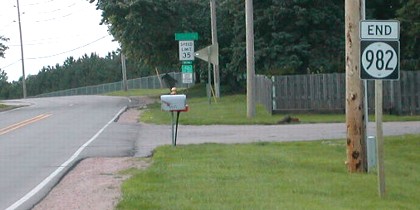
Facing northwest, but heading north, on 982 (6/18/02)
Photo by Neil Bratney
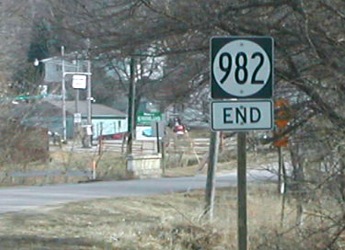
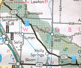
Highway 982 "floated" apart from the route grid, neither beginning nor ending at another highway. One end picked up southeast of an interchange with US 20 at the Sioux City city limits, and then stopped at the city limits of Smithland, within sight of 141 but not actually getting there. Although this route has not been part of IA 141 since the 1950s, it should not have been dropped from the state rolls, because it's a more direct route and would truly connect Sioux City and Des Moines.
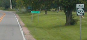
Facing southeast, but heading east, on 982 (6/18/02)
Photos by Neil Bratney
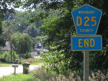
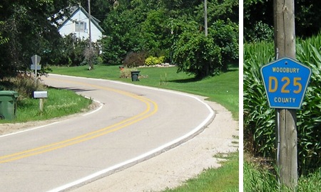
Woodbury County had previously planned to make 982 into D25, a plan put into effect by the decommissioning. Despite the diagonal nature of the route, and that D25 only works for the northern fourth of the road.
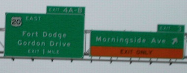
Facing northeast, but heading east on 20 and north on 75 (6/18/02)
Photo by Neil Bratney
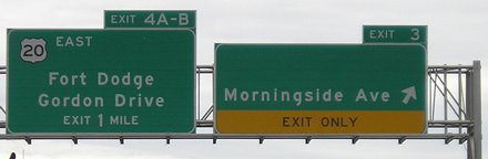
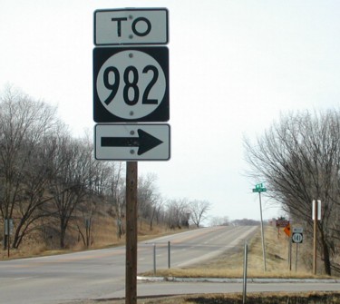
This is the closest signed route to 982's east end, US 20 (now with US 75), half a mile away. The blank on the right side of the left sign used to say "12 North" but 12 has been decommissioned past its junction with I-29 (at least signage-wise). My guess is that the city is placed ahead of the local street because that's the order of the exits. The prudent move would be to add "20 Business" in its place. Instead, though, something unexpected happened...
Facing northeast, but heading east on 20 and north on 75 (6/12/05)
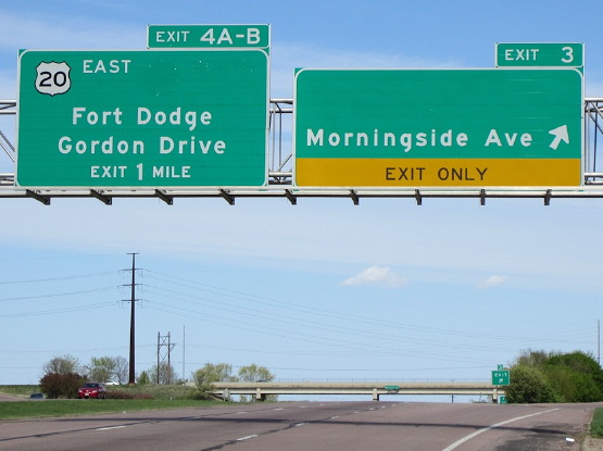
Interesting, very interesting. The only thing that would conceivably go in the space that appears on the right BGS is "(To) 982" - interesting in two factors: 1) 982 doesn't technically make it to this intersection (as seen at top), and 2) This BGS could only have been put up sometime between June 19, 2002 (the day after Neil took his picture) and June 30, 2003 (the day before 982 was decommissioned) - meaning that despite good intentions, the replacement BGS was mostly a waste. (And yet, they can't figure out how to add directions on I-29's state highway exits...)
Facing northeast, but heading east on 20 and north on 75 (4/8/12)
Photo by Jason Hancock
This version of that picture better shows the ghost of IA 12 on the left BGS.
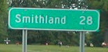
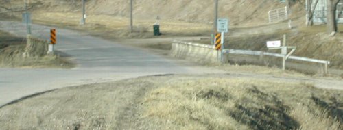
EAST End: City limits of Smithland, Woodbury County
Facing east on 982 (2/23/02 and 7/23/09)
Left photo by Neil Bratney
The yellow sign in the trees is the "Stop Ahead" for 141. See that bridge? Look below.
Facing west on 141 at the intersection (2/23/02)
Photo by Neil Bratney
This is the bridge in the above left picture. Notice that the bridge position implies that the road went straight ahead instead of splitting, which indeed it did when it was 141. (Old bridge, then, isn't it?) But as you can see in the background of the above right picture, the bridge was replaced by a culvert.
Facing west on 141 (2/23/02)
Photo by Neil Bratney
This is near the above picture.
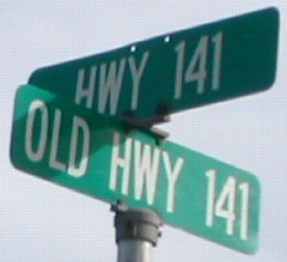
Closeup of sign in above picture (2/23/02)
Photo by Neil Bratney
Old roads never die, they just find their way on to rural street signs. The road has unofficially or officially been "Old Highway 141" for about half a century, much longer than the 35 years it carried the 141 designation.
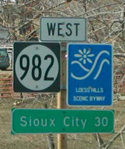
Facing west on 982 (2/23/02 and 7/23/09)
Left photo by Neil Bratney
The first sign for 982 included the Loess Hills Scenic Byway and the leaving-town LGS for Sioux City. You can see the "D25 End" in the center.
Last seen: 2003 (2001 map)
Pictures by Neil Bratney: First-fourth, 6/18/02; sixth and eighth-eleventh, 2/23/02
Pictures by me: Fifth, 6/12/05; seventh and twelfth, 7/23/09
Page created 4/7/02; last updated 2/24/19