(July 1, 1920-present)
- In 1920, they knew it as: Mostly the Cedar Rapids, Ottumwa, and McGregor Trail, registered March 23, 1917, although that trail appears to have gone through Edgewood and Littleport rather than Strawberry Point, and via IA 220 instead of Homestead. It also included the Glacier and Daniel Boone trails (they overlapped) from the Missouri state line to Ottumwa. (8 counties, then 9)
- IA 13 passed by or was two blocks from every county's courthouse except Iowa County, since it doesn't go through Marengo.
- We know it as: Parts of US 63, IA 149, V77, US 6, US 151, Business US 151, IA 13, US 18
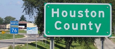
- And all of IA 76, once two 1920s extensions are taken into account (see far below)
- The near-entirety of the modern route (with the exception of south of Indian Creek Way), which is vaguely around half the length of the original, has been pushed to the edge of a lot of towns but still serves them.
- Let's get granular:
- State line to Bloomfield: US 63, 285th Street, Garnet Avenue, 276th Street, Harvest Avenue, US 63
- Future US 63 in Davis County was Federal Aid Project 50.
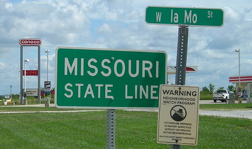
- There was a fraction of a mile on the state line until 1924.
- The bridge on old 63, near the village of Mark, was closed in January 2017.
- Some early maps show Harvest Avenue and 212st Street
- The west intersection with IA 2 changed in 1975 so northbound 63, rather than eastbound 2, stopped. There was an RRX just south.
- Bloomfield: Old IA 2, then Jefferson, Washington, Madison streets
- The Waubonsie Trail map goes on the east side of the railroad and uses Karr Avenue, Railroad Street, South Street, Pine Street, and Jefferson Street, but that was changed by/in 1922.
- The Fox River crossing just north of Bloomfield was straightened in 1947.
- Bloomfield to Ottumwa: US 63, Mink Boulevard, 111th Street/10th Street, Little Soap Road, US 63, 43rd Street (dead end), Madison Avenue
- Mink Boulevard was severed with a bridge closure/removal in 2004.
- "Great detour war is over," Bloomfield Democrat, July 29, 1965, announced the straighter US 63 to Ottumwa was finished. Turns out that drivers were seeking out their own paths instead of following the official detour through Albia.
- Ottumwa: Madison Avenue, Hancock Street, Weller Street, Church Street, Market Street, 2nd Street, Wapello Street, Albany Street, Court Street
- Before 1928, the route changed in the downtown area to use Market, 4th, and Court streets, past the Wapello County Courthouse. (The street is Church south of the Des Moines River, and Market north.)
- Ottumwa to Webster: IA 149, 180th Avenue, G48, 190th Avenue, 260th Street, 200th Avenue, 255th Street, 205th Avenue/207th Avenue with a vacated bridge over the North Skunk River, IA 149, 208th Avenue, 200th Street, 196th Street, IA 149
- The 1918 "Inter-County System" map proposed using the road through Highland Center, as it was part of three named auto trails: Cedar Rapids, Ottumwa, and McGregor Trail; Ottumwa, Sigourney, and Cedar Rapids Route; and St. Paul and St. Louis Short Line. This would have put downtown Hedrick on the route. However, this road, present-day V5H, has 13 turns between Hedrick and IA 149, and half a mile remains dirt today.
- The overlap with IA 2 (later IA 92) was in place around 1924.
- The smooth slopes south of Webster had harder corners before 1925.
- Webster to North English: Main Street, IA 22, 150th Street, southward extension of 232nd Avenue, vacated road ¼ mile south of 140th St, IA 149, 135th Street, 268th Avenue, abandoned angle northwest to about the South English River, IA 149, 110th Street, vacated stairsteps east of the railroad
- Google Maps and Street View say the north-south road on the section 29/30 line is 232nd Avenue; the county PDF map says 230th
- Moved to 150th Street and 250th Avenue between Webster and South English in 1925, and the present route in 1930
- The road between IA 22 and the South English River was adjusted in 1925 and moved to the present with paving in 1932. That's when the big, now-abandoned curve was created.
- North English: From a point just south of the county line, south of where MidWestOne Bank is today, two options:
- Mini-stairsteps to Summit Street, then Main Street, Washington Street, northward extension of Boland Avenue. The IA 149 alignment west of Main following the Chicago, Minneapolis & St. Paul railroad wasn't built until 1930.
- Highland and Clark streets (past the school), then Main, etc. If this was used, it was the earliest version.
- The North English Record on June 26, 1986, said the 1928 concrete and bridges from the town to "Bushman's corner" (the turn to Parnell) were finally going to be replaced. That project also added the present curve on the southeast side of North English bypassing Main Street. It was a big enough event that Gov. Terry Branstad attended a ribbon-cutting on October 24, 1987, although the pavement itself would not be completed until next summer (Cedar Rapids Gazette).
- North English to Homestead: 332nd Street, IA 149, 330th Street, N Avenue, 325th Street, vacated road and bridge over North English River, P Avenue, IA 149, PP Avenue (south of Conroy, now broken into parts), V77, US 6
- The realigned north end of the bypassed segment of 149 closely matches the original alignment requiring two quick turns to 330th Street.
- Bridgehunter says the abandoned NN Avenue bridge, a 1929 replacement of an 1887 span, technically still exists and was part of the Pershing Highway. However, maps are universal in saying that bridge was not part of IA 13, because the highway cut through Section 28 to reach the road straight south from Parnell. This segment was eliminated in favor of the 1928 pavement, but the bridge would remain through the 1970s.
- The road between Williamsburg and Conroy has changed twice: In 1930 to parallel the railroad, and in the 1960s in conjunction with the I-80 interchange. The latter is minuscule except that it means Stone Drive, the frontage road for the outlet mall, is the original roadbed.
- In 1924, the road was adjusted to stay south of the Rock Island Railroad just west of Homestead, and then use a new underpass to go north of the railroad past Homestead.
- Homestead to Amana: V Street, 44th Avenue, extension of 44th to 160th Street that remains a visible line through the trees, US 151, vacated extension of 48th Avenue, 48th Avenue, 47th Avenue, 220th Trail, 45th Avenue, vacated road on section line north for just under a mile, US 151
- In 1924, the IA 13/IA 149/US 151 routing at Homestead (west-to-north) was designed as the mainline curve at the intersection with US 6. Around 1963, the intersection was changed so US 6 was the through road and southbound IA 149 stopped. Then, sometime between 1983 and 1994, the intersection was reverted to the previous configuration, so US 151 is the mainline and westbound US 6 stops at a T intersection. (The Depression-era concrete curve appears to have been left in place until then!) The underpass mentioned above was turned into an at-grade crossing at the same time.
- The Homestead-Fairfax corridor has carried the numbers 13, 150, 149, and 151, in that order.
- Amana to Cedar Rapids: US 151, F12, Y Avenue, Crandic Rd, US 151, 1st Avenue W (Walford), Benton-Linn Road, Southview Road, Williams Boulevard, US 151, Stallman Drive, E66/Cemetery Road, 80th Street SW, 16th Avenue SW
- Three turns west of Walford were condensed into one (present 151) in spring 1921.
- The town of Walford did not incorporate until 1954.
- US 151 through Fairfax was rebuilt in 2020. As you might be able to tell above, the section that runs due north-south is about the only original part remaining, and with the railroad overpass you could say it's changed vertically.
- Cedar Rapids-Marion: As shown on Jason Hancock's Highways of Cedar Rapids, Johnson Avenue NW, A Avenue NW, 9th Street NW, 1st Avenue/Marion Boulevard, 7th Avenue, 10th Street, Indian Creek Road
- With the Lincoln Highway between 80th Street SW and downtown. The part of 16th Avenue SW west of 80th Street SW, at the west end of the US 30 Lincoln Freeway, was torn up in the mid-2010s for the IA 100 project.
- The section between Blairs Ferry Road and 2nd Street was more angular until after World War II. The road went from just north of the present Blairs Ferry intersection across Indian Creek to where 1st Avenue and 6th Street meet, then up the west side of the McDonald's and a still-existing stub at Houdek Auto Center, then under the railroad with a hard right turn.
- A long-term project to extend Tower Terrace Road and create a "lower speed, urban arterial" (oxymoron alert) from I-380 to IA 13 resulted in the elimination of Indian Creek Road in northern Marion from north of 29th Street to Lucore Road in 2018. The old roadbed, outside the city limits as late as the early 2010s, was turned into a trail.
- Marion to Manchester: Indian Creek Way, IA 13, Scotland Road, Rowley Road; Marion Road, Main Street, 4th Street in Central City; Valley Farm Road, Hutchinson Road; 3rd and Linn streets in Coggon; IA 13, Nugents Road, Linn-Delaware Avenue, IA 13, Adams Street in Ryan, IA 13, Burrington Road
- Surprising in its not-straightness, really. Even the road into Manchester had multiple turns until the US 20 freeway was built.
- A four-lane portion that terminates in Central City looks silly, but traffic maps show it's necessary and beneficial!
- Manchester: 5th, Marion, and Franklin streets
- Although the West Delaware school district was formed in 1959, its sports teams remained the Manhawks — but the coincidental sex connotation wasn't an issue until girls' basketball was added in 1971. The renaming of the Manhawks and Hawkettes to Hawks came in 1979. (I didn't have anywhere good to put this, I just found it interesting.)
- Manchester to Strawberry Point: Honey Creek Road, X15, C64, IA 13, Delta Avenue (dead-ends), Dogwood Avenue, Mission Road, Mission Street
- The original intersection with IA 10 (now IA 3) was north of the county line. IA 13 followed the section line to intersect a diagonal that is now 398th Street. The present intersection came with either grading in 1931 or paving in 1936.
- The present alignment between Strawberry Point and the county line was established early.
- Strawberry Point to US 52: IA 13 but a bit more winding version, IA 56, Bridge and High streets in Elkader, IA 13, Falcon Avenue (dead end), Fawn Hollow Road (short piece east of Roberts Creek), IA 13
- There was a particularly sharp pair of curves at the X3C/Grandview Road intersection, and a bit of the old road is a curved driveway on the east side of present 13.
- A few maps call Roberts Creek Pony Creek.
- A construction document from 1922 shows the original road in the vicinity of the IA 128 intersection on the west side of a creek that appears to have completely vanished, probably a few hundred yards west of the present road if that.
- US 52 to US 18: The section line north from near US 52 (at the "Jct 52" sign at the present north end), along the west edge of the cemetery, then the abandoned diagonal northeast
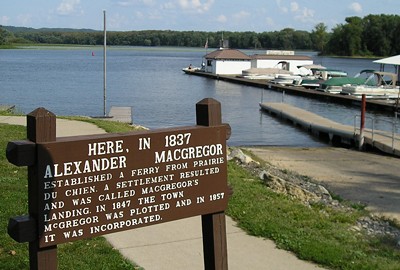
- US 18/52 junction to McGregor: US 18 with Giard Road, 148th Street, the parking lot of Maggie’s Diner, 145th Street; then IA 76/Business US 18
- 1920s extensions: IA 76, Old Rossville Drive, X26, Memorial Drive, IA 76, Evergreen Drive, Jefferson Road, vacated road at section line, IA 76; Main Street, 1st Street, 4th Avenue, 2nd Street, 5th Avenue in Waukon; Prairie Avenue, Mount Olivet Road, IA 76, Lonnings Drive and Riverside Drive (original Upper Iowa River crossing just west of present), IA 76
- Including vacated(?) Coon Valley Lane and long-gone road in Sections 21 and 28 north of Marquette.
- The 1921-23 state maps and the post-1924 state maps have lines different enough to be noticeable for IA 13 and IA 51 in the southern half of Allamakee County. At the same time, all the lines are brought into question by whether or not certain roads in certain directions did and could exist, since we're talking the heart of the Driftless Area and no way is any line along the Yellow River going to look that clean. I'm leaning with what can be best extrapolated from known later routes, perhaps giving the unincorporated village of Rossville the most online attention it's ever had.
- Related routes (all 900s unsigned):
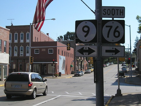
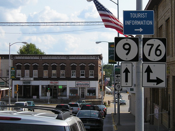
- IA 76 (II): Severed and renumbered from IA 13 in the Great Renumbering
- IA 149: IA 13's route between Ottumwa and Williamsburg (formerly continuing north and northeast)
- The extensions of 149 along former US 63 from US 34 to IA 23 brought more of IA 13's original corridor under that designation, while also cutting 63's share
- IA 150 (I): IA 13's route between Homestead and Cedar Rapids, superseded by 149 in 1930, then superseded again by US 151 in 1985
- IA 180: Spur to Hayesville created when IA 149 was straightened south of Sigourney
- IA 922 (II): Realigned IA 149 curve around downtown North English
- IA 922 (III): Business US 151 in Cedar Rapids (relevant segment: 9th Street NW in Cedar Rapids to 10th Street in downtown Marion)
- IA 931 (I), IA 932, and IA 943 (I): Old segments in Coggon, Ryan, and Central City, respectively
- IA 944 (I): Original route between the US 20 freeway and downtown Manchester
- IA 957 (I): Old US 63 through Mark in southern Davis County
- IA 958: Old US 63 south of Ottumwa (Madison Avenue)