 NORTH
NORTH
| IA 149
endpoint history (all Cedar Rapids info thanks
to Jason Hancock) |
|||
| FROM | TO | SOUTH | NORTH |
| 10/16/26 | March 1930 | US 63 (IA 149 at IA 23) |
US 6 (V77 at US 6) |
| March 1930 | 10/7/34 | US 30 (80th St SW at US 30/218) | |
| 10/7/34 | 12/22/36 | US 30 (1st Ave at 10th St NW) | |
| 12/22/36 | Early 1940s | US 161, later US 218 (1st Ave at 1st St SW) | |
| Early 1940s | 1/27/54 | IA 150 (southeastbound 10th St SE at 1st Ave) (along US 151) | |
| 1/27/54 | ??? | IA 74 (1st Ave at 1st St SW) | |
| ??? | 9/23/81 | US 30/US 151/US 218/IA 64 (Williams Blvd at 16th St SW) |
|
| 9/23/81 | 9/19/85 | US 30/US 151/US 218 freeway | |
| 9/19/85 | 7/16/97 | I-80 exit 220, Williamsburg | |
| 7/16/97 | 11/19/07 | US 63 (Ottumwa bypass) | |
| 11/19/07 | Present |
US 34 |
|
Old NORTH End (?-September 23, 1981): Stoplight, US 30/US 218/16th Ave. SW and US 151/Williams Blvd., Cedar Rapids, Linn County
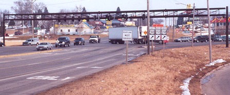
Facing northeast, but heading north, on 149, now Business 151 (January 2002)
Photo by Jason Hancock
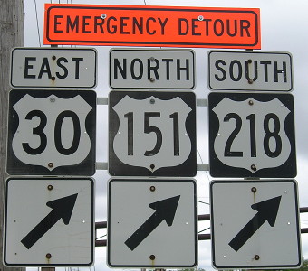
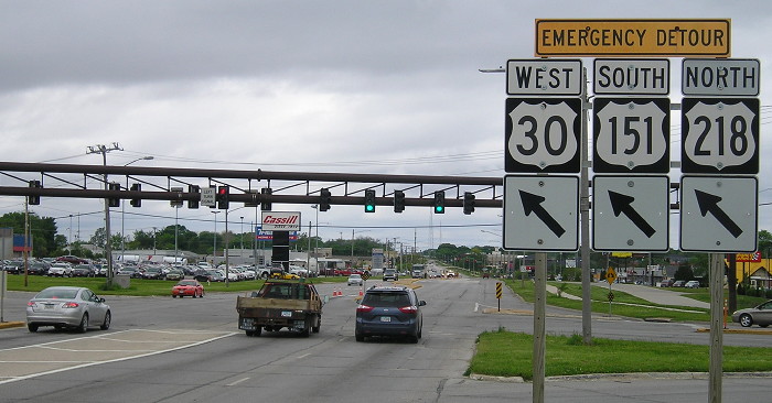
This was the end of 149 before 1981, so it just ducks under the cutoff here. (It's also on the 1981 map.) This was also the south end of US 151 at the time. Today Williams Boulevard (formerly 149 and 151) is all Business 151. Those 30/151/218 signs are for a "Fog Detour" (since changed to an "Emergency Detour") through Cedar Rapids.
Inset maps of the early 1950s don't show 149 northeast of this intersection, but they don't not show it - there are no markers between 16th/Williams and downtown until 1956, and IA 64 was more or less on the modern-day Business 151 route throughout that time. Alignments for both US 30 and IA 150 were changed over the decade and it's possible or likely changes to those routes affected 149. For more information see Jason Hancock's Highways of Cedar Rapids page. The date 149's north end was moved to this intersection is the only Cedar Rapids area-related date Jason has been unable to pin down to at least a year.
Facing northeast, but heading north, on 149, now Business 151 (5/18/17)
In the last iteration of this intersection before the freeway opened, the signs here would have been "End 149", "151 ^", and "30/218 <->". The emergency detour turns onto 16th Avenue.
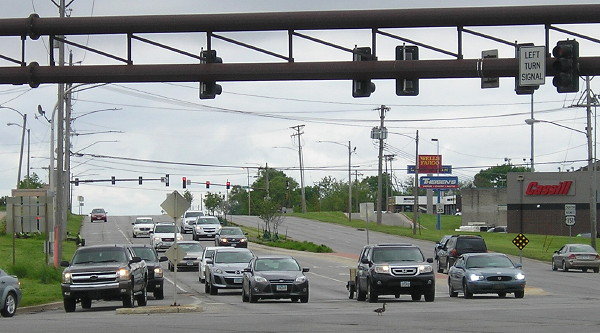
Facing southwest, but heading south, on Williams (NE corner) (5/18/17)
The back of the emergency detour assembly is at left; "South Business 151" that would have been the first "South 149" is at right. At bottom center is a duck walking through the intersection that, at the time, I found hilarious.
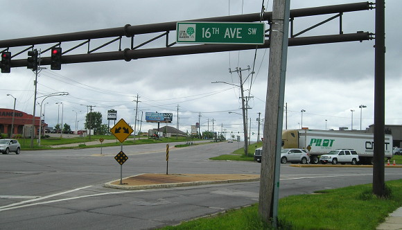
Facing southwest, but heading south, on Williams (NW corner) (5/18/17)
This is looking the same way but I moved to the other side of the street. The skewed street grid requires the nonstandard assembly with overhanging stoplights.
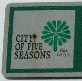
The "City of Five Seasons" slogan was written in 1968 and adopted by the city of Cedar Rapids by 1975, according to this Gazette article. I think these street signs date to the 1980s. Newer signs omit all the text and have a bigger tree logo. (5/18/17)
Facing west on 16th Avenue, formerly 30/218 (5/18/17)
Driving on 16th out of Cedar Rapids, you can tell it was a major highway at one time, based on the buildings that were clearly old hotels and restaurants. On that note...
Let's play "spot the repurposed Kmart"! (5/18/17)
Old NORTH End (September 23, 1981-September 19, 1985): Interchange, US 30/151/218, Cedar Rapids, Linn County
Facing northeast, but heading north, on 149, now 151 (May 2002)
Photo by Jason Hancock
The "End" sign was probably posted between here and the LGS. For those four years this was also the south end of US 151 (again).
...at least according to the Iowa Department of Transportation. The Special Committee on Route Numbering, which is in charge of approving changes to US routes, did not acknowledge the extension of 151 past this point until 1996. The reason for the delay is unknown (though I have a strong urge to make a bureaucracy and/or traffic joke).
For many more, and more recent, pictures, see the IA 922/Business 151 page.
Facing northeast, but heading north, on 149, now 151 (4/18/06)
Facing north on olf 149, now 151 (5/31/17)
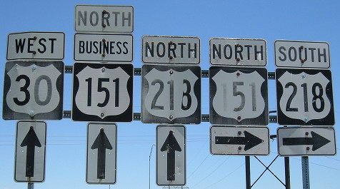
Which direction did you want to go again? Turn right to head east, north and south; turn left across the bridge to head west and north. As fun as this sign is, it's missing an "East 30 ->", and that would've put all four directions on this assembly. These signs were replaced soon after.
Facing southwest, but heading south, on 151, now Business 151 (11/28/03)
Although this sign is approached traveling south, when 149 ended here it could have also substituted for Jason's photo second from top.
Facing southwest, but heading south, on 151, now Business 151 (11/28/03)
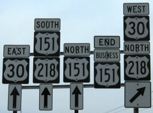
Between fall 1981 and fall 1985, "South 151" would be "South 149" and "End Business 151" would be "End 151."
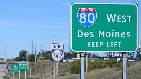
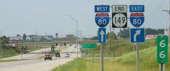
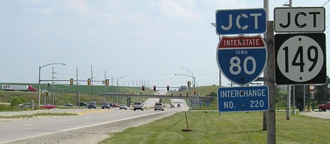
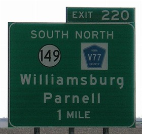
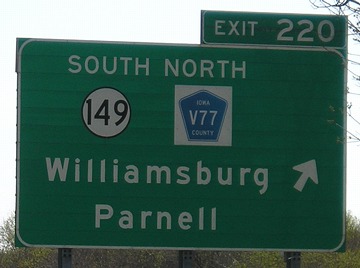
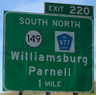
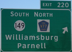
NORTH End: I-80 exit 220 and V77, Williamsburg, Iowa County
Facing north on 149 (7/8/05)
This multicolored LGS is just north of main Williamsburg - that is, the part of town that's not a byproduct of the outlet mall.
Facing north on 149 (10/7/13)
Facing north on 149 (7/8/05)
The Tanger Outlet Mall is visible on the other side of I-80. Before 1985, when 149 went to Cedar Rapids (ending at the new 30/218 interchange from 1981-85), it continued north of here to US 6 east of Marengo, duplexing with 6 south of the Amana Colonies.
Closeup of LGS in above picture (7/8/05)
Replacement for LGS above (10/7/13)
Facing south on V77 (7/8/05)
Facing south on V77 (10/7/13)
This is the replacement for the sign set below.
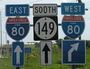
Facing south on V77 (7/8/05)
Facing south on V77 (7/8/05)
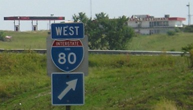
The restaurant seen in the background here and the gas station are closed.
Facing south on V77 becoming 149 (2/1/02)
On this side of the freeway, it's a county road. This small piece of four-lane continues north of the interchange a bit, to serve traffic for the Tanger Outlet Mall. Behind this photograph are two stoplights.
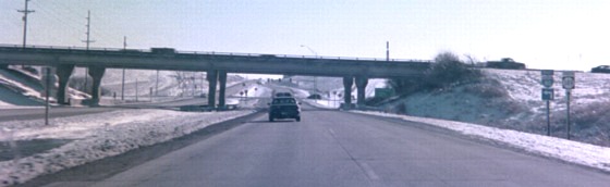
Facing south on 149 (10/7/13)
Facing south on 149 (7/8/05)
Yes, that is a hay baler going down a four-lane road. Don't you just love Iowa?
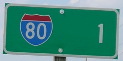
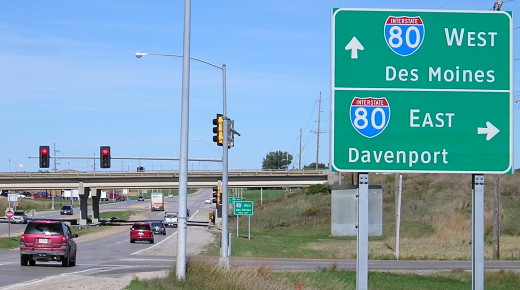
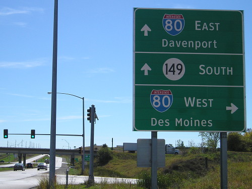
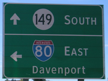
Facing east on 80 (4/18/06)
Facing west on 80 (10/7/13)
Facing east on 80 (11/26/08)
Surrounding area information: Old 149/6 junction
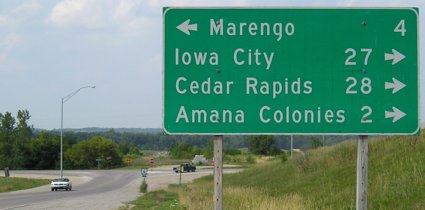
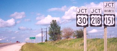
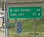
Facing north on V77 (old 149), 6 miles north of interchange (7/8/05)
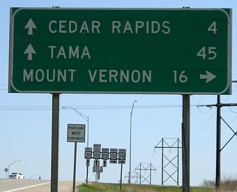
This mileage sign is DOT style, which means it's more than 20 years old; shows four destinations, which is a rare sight and even rarer since there's no "straight ahead" location; and shows how equidistant Iowa City and Cedar Rapids' downtowns are from this location.
Page created 3/3/02; split 11/6/05; last updated 10/4/23