

(December 1920-July 1, 2003)
Technically, the state retained control of 107 inside the city limits of the towns it passed through until 2010 and 2011.
- In 1920, they knew it as: A road from Clear Lake to Thornton. It was NOT around for the 1919 map, but with its addition by the end of 1920, it's close enough. Kind of like if someone gets added to a TV series right after the pilot.
- We know it as: County Road S25
- Let's get granular (1920 alignment): S25, Fir Ave, South Shore Drive, then maybe 12th Ave S (Clear Lake), S 8th St (Clear Lake). The alignment in Clear Lake is, ironically, murky.
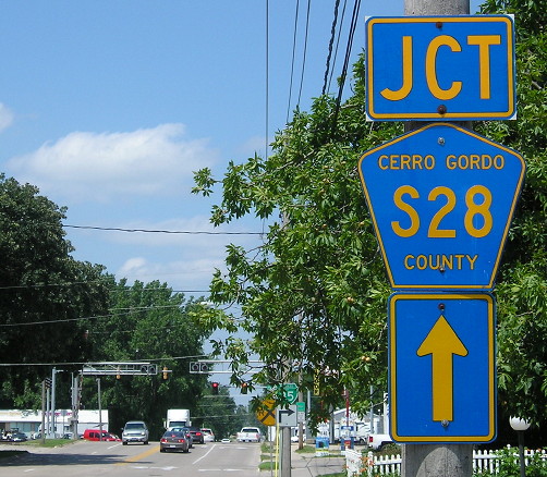
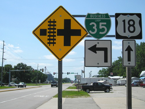
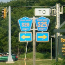
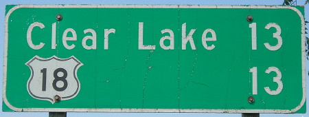
Old NORTH End: Stoplight, US 18 and S28, Clear Lake, Cerro Gordo County
Facing north on 107 (7/9/18)
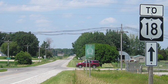
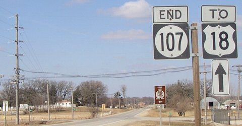
This intersection became the north end of IA 107 in 1952, when US 18 was rerouted between Garner and the Mason City airport.
Facing north on 107 (7/9/18)
Facing north on 107 (3/22/03)
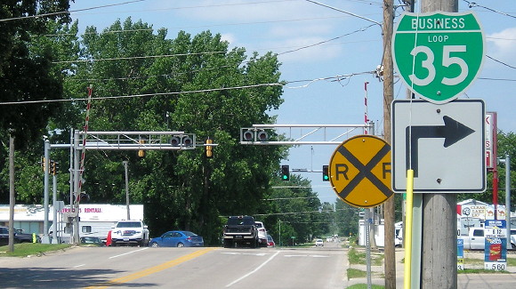
Facing west on 18 (3/22/03)
Although S28 goes north from 107's old north end, on the south side of Clear Lake it is S25.
Facing west on 18 (7/9/18)
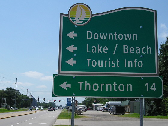
The wayfinding sign is using Clearview, but it's scaled differently. Compare the capital/lowercase T's, the O, and the H.
Clear Lake has a population of 2,500
wide-awake, enterprising people. Is a city of beautiful homes; has good
churches, good schools. Good service of all kinds. Electric lights,
waterworks, gas, new sewer system, electric interurban railroad, local
and long distance telephone, ample hoel, restaurant and garage
acommoodations. Band concerts every afternoon and evening during the
season. Splending boating, bathing, fishing. Fine new pleasure pier,
elegant dancing pavilion, good orchestra. Sail boats, power boats and
picnic grounds. Stop and enjoy the cool shade, the lake breezes and
hear the band concerts.
— Huebinger's Map and Guide for North Iowa Pike (1912)
Facing west on 18 (7/9/18)
Facing west on 18 (3/22/03)
Facing west on 18 (3/13/11)
Photo by Jason Hancock
Facing east on 18, post-decommissioning (7/31/05)
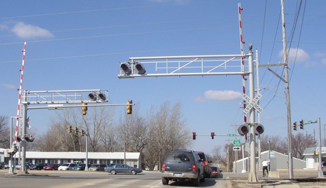
West of this intersection (behind the camera), Clear Lake has recently re-striped part of 18 to be one lane in each direction with a center turn lane, as opposed to two lanes of traffic each way.
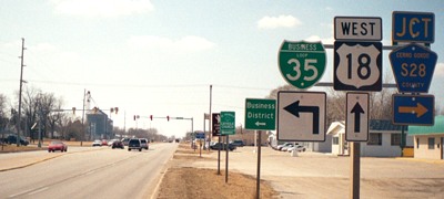
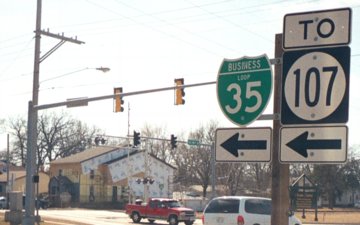
Surrounding area information: Junction old IA 106

Facing west on 106/Bus. Loop I-35 (3/22/03)
The LGS reads "<-State Park 2; <-Thornton 13; Clear Lake->" when Clear Lake, like Cedar Falls at IA 57, is all around us. It's possible the sign — now gone, just like Lincoln Elementary School which was demolished in 2011 — dated back to before 1980 when this road was IA 106. But 107 hasn't been here since 1987; it's still further south.
1920 NORTH End: IA 19, later US 18, Clear Lake
IA 107's first south end depends on the first signed route of IA 19. If IA 19 in 1920 followed the North Iowa Pike route of 1912, the north end was probably northeastbound Main Avenue at 4th Street. If as early as 1920, the pike was moved to bypass the business district, the north end would have been 8th Street at 7th Avenue.
Sometime between 1936 and 1952, Clear Lake renamed its street system.
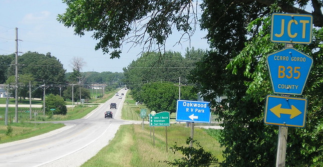
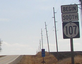
NORTH End: B35/27th Ave. S., Cerro Gordo County
Facing north on 107 (7/9/18)
For five years (1987-92), the end of 107 was half a mile north of here at the then-city limits of Clear Lake.
Facing north on 107 (7/9/18)
Facing north on 107 (3/22/03)
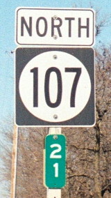
Just to the lower right of the Clear Lake State Park sign is mile marker 30. Once upon a time (1920-1967) IA 106 went west from here along the south side of the lake. When commissioned it was the highest-numbered intersection in the state.
Facing south on 107 (3/22/03)
With the "hanging end" is an Iowa rarity: a "BEGIN" sign. Jason Hancock says the signs here were put up in 2000, meaning they lasted less than three years.
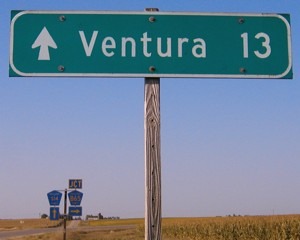
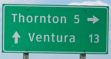
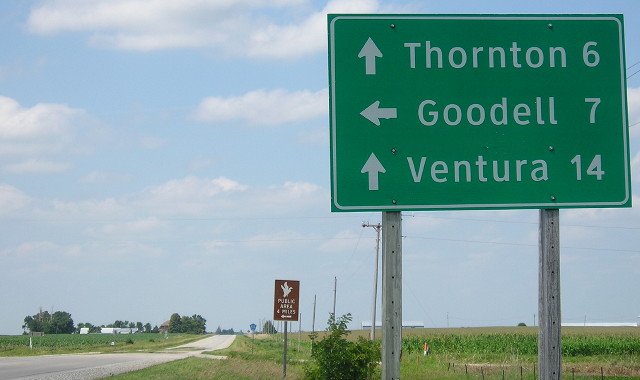
1920 SOUTH END: Thornton, Cerro Gordo County
Facing north on 107 (7/9/18 and 3/22/03)
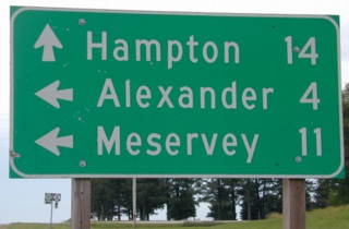
It's strange that both the destination town and highway would both be listed, especially since they're the same distance away!
The right shield is a couple miles north of Thornton, at B60.
I would not have deleted the entire route from the highway system. Instead, I would've sent 107 east of Thornton 1½ miles to I-35, which would involve taking charge of a railroad crossing. That road doesn't directly intersect 107; it ends at the south side of the tracks, and 107 turns on the north side.

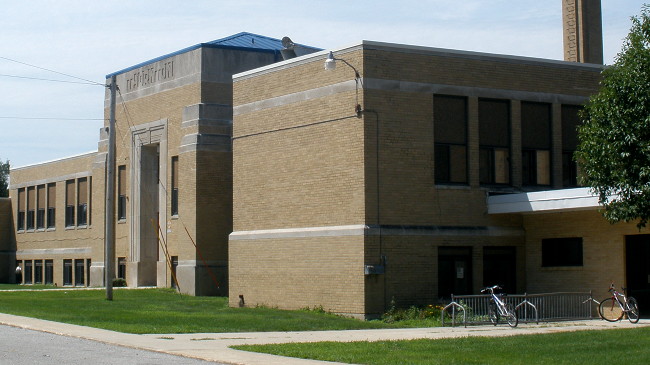
The Thornton school building was demolished in the 2011-12 school year, literally and metaphorically leaving an empty space in the center of town. (7/29/10)
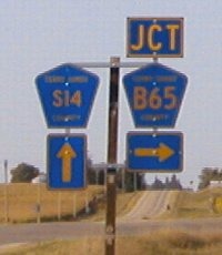
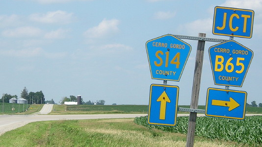
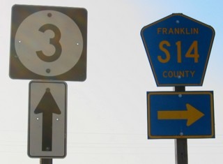
Along the route: Splitting up the numbers
Facing north on 107 (9/5/03)
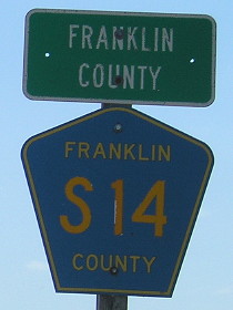
You can see the curve for 107 under the county road shields. The space now occupied by B65 shields held the shields for 107. The county did everything right here, splitting up the route and signing it accordingly, even taking down the "Jct" above the S14 shields here. (I'm not sure what's up with the different sizes, though.)
Facing north on 107 (7/9/18)
Facing north on 107 (7/9/18)
The county LGS (notice Clearview, again) is messy; the straight-ahead destination should be on top and there's too much space around the lines.
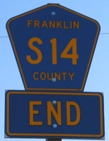
Temporary NORTH End (June 2003): B43/City limits of Meservey, Cerro Gordo/Franklin county line
Facing north on 107 (7/9/18)
Because Meservey's south city limits are at the Cerro Gordo/Franklin line, the very temporary north end would have been at the north city limits instead of the south. In this area was the temporary end of IA 107, as the road was turned over in two segments. All signs north of this point were taken down between May 16 and June 4, 2003; the rest of the route was decommissioned July 1. It is unknown whether any signage was placed for the month this location served as the north end, making the route a very short-term spur to Meservey. The Cerro Gordo County part of the route was turned over before the Second Great Decommissioning.
Facing south on 107 (7/9/18)
At the Cerro Gordo/Franklin line is the south Meservey city limits.
And then there was one
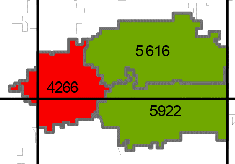
The red school district is Meservey-Thornton, created in 1963. The bottom green is Sheffield-Chapin, one of the few districts to include the name of an unincorporated town. While this 2005-06 map shows them as two separate districts, in reality "SCMT" had been in existence since the 1988-89 school year. By the time SCMT became a legal entity in 2007, though, demographics were demanding another change. Rockwell-Swaledale, the top green district, lost 35 percent of its enrollment between 1999-00 and 2006-07 and, as you can see from the map, SCMT made a logical partner. Rather than contribute to acronym overload, they went with West Fork, named after the branch of the Cedar River running between Thornton and Swaledale. (Sounds downright suburban, doesn't it?) In a quarter-century this area of Cerro Gordo and Franklin counties went from three high schools to one. (Although, sadly, the building in Thornton has come down, there are still a few ghosts in the machine...)
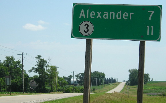
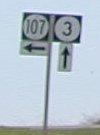
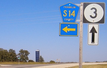
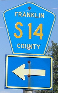
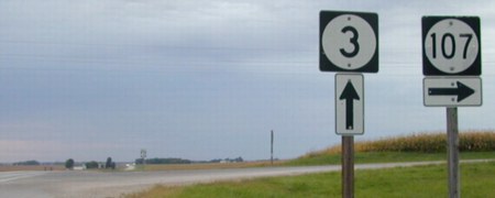
SOUTH End: Stop sign/T intersection, IA 3, Franklin County
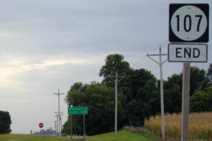
Facing south on 107 (9/13/02 and 9/5/03)

LGS in above picture, with 15 more years of being beaten up (7/9/18)
Facing east on 3, sign assembly at lower left of LGS (9/13/02)
Facing east on 3 (9/5/03)
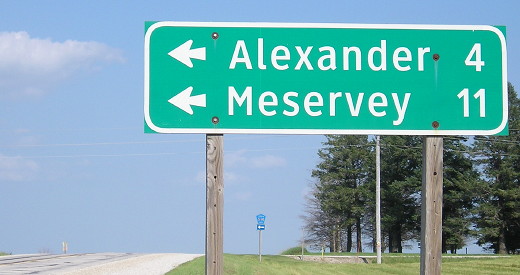
Facing east on 3 (7/9/18)
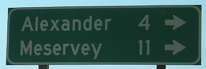
Facing west on 3 (7/9/18)
Facing west on 3 (9/13/02)
Notice the font difference in the 107s compared to the above.
Facing west on 3 (9/5/03)
Last seen: 2003

Sources for school information: "One last visit to M-T"; "Rockwell-Swaledale parents say keep high school there," Mason City Globe-Gazette, Dec. 6, 2007
Page created 12/15/01; last updated 4/21/10 3/24/20