 WEST
WEST
(June 14, 1986-present)
Detailed maps of the historic routes of IA 57 and 58 are here. Detailed maps of the historic routes of IA 57 and 58 in the Waterloo/Cedar Falls area are on this page.
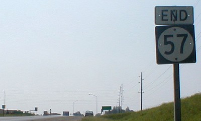
WEST End: Intersection, US 65 and S45, Hardin/Franklin county line
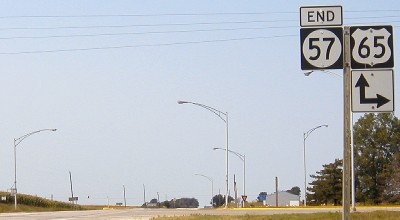
Facing west on 57 (August 2003)
This photo was taken the day 57's route was extended, August 22, 2003. At the time other 57 shields had not been placed on the route (see empty bracket at far left). The extension restores 57 to near the length and glory it had between 1932 and 1969, and also means that all of 20's old route between US 65 and US 63 is or was marked as 57.
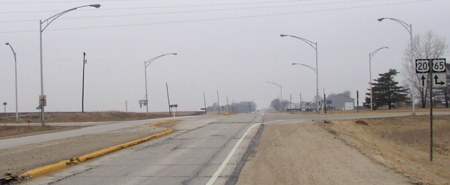
Facing west on 20 (March 2003)
This picture was taken five months before the top at the same intersection. After half a century of planning (see IA 402), multiple instances of being designated a high priority, and coming to a complete standstill for problems of routing through the Greenbelt, US 20 finally goes from Waterloo "straight west to Webster City."
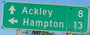
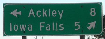
The road going to the left is now S45, which was a very old alignment of 20 as it joined 65 at this intersection and headed south before heading west into Iowa Falls (instead of west-then-south). The mileage sign before this intersection, "^Iowa Falls 5 / Hampton 13 ->", is so faded as to be nearly unreadable.
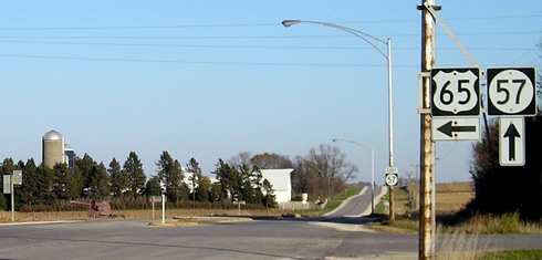
Facing east, but heading north, on 65
The mileage signs had not changed since 57 took 20's route. In other words, neither Waterloo nor Cedar Falls were ever signed at this intersection when it was the only way to get there from 65.
Facing east, but heading north, on 65
Facing south on 65
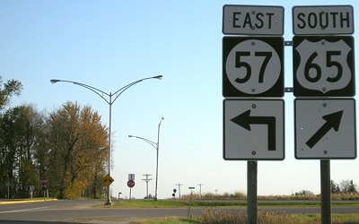
Facing south on 65
I don't know what the setup was for the arrows when a 20 shield was here. It might have been an "East 20 [ahead and left]" instead of a "20 <->".
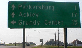
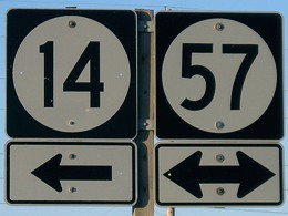
Old WEST End (June 14, 1986-August 22, 2003): Intersection, US 20/IA 14, Parkersburg, Butler County
(photos June 2002 unless noted)
Facing west on 57 leaving Cedar Falls (July 2007)
Before 1985, 57 still ran along most of the eastern half of its original (1920) route. The 20 or so miles between IA 14 and the University Avenue/Hudson Road intersection had been 57 ever since the roads were numbered in 1920. (At one point or another in the 1920s, highways 57, 58, and 59 all ran somewhere in Black Hawk County.) After various extensions and truncations, almost all of 57 in the early 1980s (outside of Waterloo-Cedar Falls) was still part of the original. On June 14, 1986, the final portion of the US 20 freeway in Black Hawk County opened, and 57 lost its original route in exchange for US 20's old route between Parkersburg and US 63. According to the June 16, 1986, Waterloo Courier, it took 600 man-hours to swap the signs, including 200 on the 14th. The east-west portion of 57 through Dike became part of 20 (until 2000), and the diagonal portion - called University Avenue even outside of Cedar Falls - became D18. That straight Grundy County portion was temporarily IA 263 and is now D19.
None of the shield setups below are identical today; the 20 shields are gone with 57 shields added.
Facing west on 57
LGS in above picture (since replaced, but same)
Last signs on 57 (2002)

Facing west on 57 (2007)
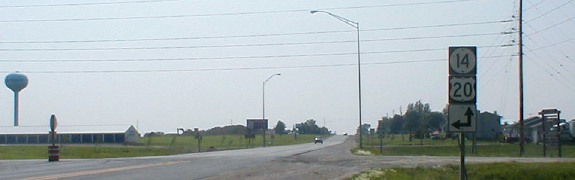
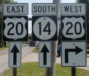
Facing north on 20/14 (2002 / 2002 / 2007)
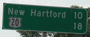
Mile markers on the north-south segment are for IA 14, since 20 was moved onto it later. West of here through Parkersburg, there are mile markers for 20 - in fact, the last one is right before this intersection. The new freeway shaves off about 14 miles from 20's route; MMs 195 and 209 are near each other at the IA 14 interchange. IMHO, that gap and others call for a re-mile-marking of 20's route across the state, but because of the cost involved and associated problems with renumbering exits it most likely will not happen. (But then, southern states recently renumbered their interstate exits to a mile-marker system, so it's not without precedent.)
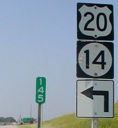
Facing north on 14 (June 2004 / October 2007)
Can you ee the mipelling in one LG?
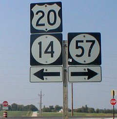
Facing east on 20/14
Northbound traffic stops and east-west traffic continues, like the east end of IA 96. Unlike 96, a gravel road goes north.
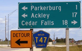
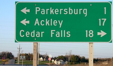
Surrounding area information: Parkersburg
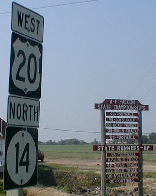
These assemblies are visible at the far right of the "last signs on 57" picture above, at the intersection. The Aplington and Parkersburg school districts merged in the early 1990s and immediately became an athletic force to be reckoned with. A-P is probably most known for four football players that then played for the University of Iowa or UNI and then the NFL - numbers that the Associated Press once said, given the size of the school, "stretch credulity."
In case you can't make out the sign at right, the state championships are 1993 (football), 1994 (boys golf), 1994 (boys tennis), 2001 (girls track) and 2001 (football). Runners-up are for 1996 (football), 1997 (girls track), 1999 (girls track), 2000 (girls track), 2000 (volleyball), and 2000 (football). In a strange coincidence, that 2000 football championship game was a loss to Southern Cal of Lake City, which had lost the title game 10 years before to...Parkersburg. Since that picture was taken, A-P has added a volleyball runner-up (2004) and championship (2005) and taken down this sign due to new construction.
Facing south on 14
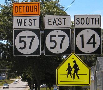
The 20 shields were replaced with 57 shields, but the arrows were changed while 57 was detoured for a bridge to be rebuilt. (Better to do it after 20 was moved off the route.)
Facing south on 14
This slightly strange situation was in place through town in the summer of 2004. Traveling south from Allison on 14, to go west to Ackley, you had to go on eastbound 57 to the east side of town, and then south.
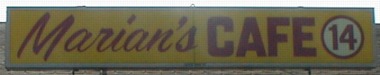
Just north of the west 20/14 junction (a four-way stop) was this cafe.
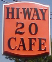
Not to be outdone, these were on the shared portion east of a half-mile north-south jog. The street is now Highway 57, but the cafe is still the same. Or was...
"Is there an F5? What would that be like?"
"The finger of God."
On May 25, 2008, a tornado ranking EF5 on the new Enhanced Fujita Scale mowed down the southern half of Parkersburg, right along the east-west part of 14. Hundreds of homes, businesses and A-P High School were destroyed. Those houses you see at 57's old end in the photos above vanished from the face of the earth in seconds.
To original IA 57 (before 1986) / To the IA 57 East historic ends / To the current IA 57 East end
All pictures by me: First, 8/22/03; second, 3/20/03; third-sixth, 11th, 14th, and 16th, 10/31/07; seventh, 7/15/07; eighth-tenth, 12th, 13th, 17th-19th and 21st-23rd, 6/24/02; 15th and 20th, 6/26/04
Page created 12/1/01; last updated 8/17/08