
(October 26, 1937-July 1, 2003)
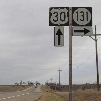
NORTH End: Stop sign, US 30, Benton County
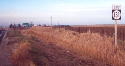
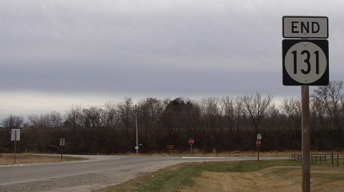
Facing north on 131 (12/2/01)
Photo by Jason Hancock
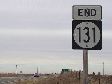
Facing north on 131 (11/29/02 and 7/6/13)
Facing north on 131 (11/29/02)
The curve of the farm field fence just to the right may mean that, since the road to the west was built later, the original alignment had a curve here.
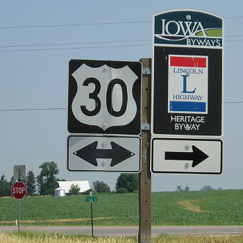
Facing east on 30 (3/26/10)
Facing east on 30 (11/29/02)
Facing east on 30, post-decommissioning (3/26/10)
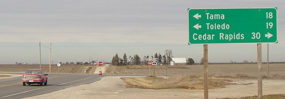
Facing west on 30 (7/6/13)
Facing west on 30 (7/6/13)
When they finished blasting through the "Bohemian Alps" for a straight US 30 through Tama and western Benton counties in the mid-1930s, some renumbering took place. In fact, the official alignment changed the same week the King Tower Cafe opened in Tama! Both announcements are on the same front page of the Tama News-Herald, a copy of which is in the cafe. On October 26, 1937, the original Lincoln Highway west of Belle Plaine became IA 212 (which had other major reroutings in the '30s), and east of Belle Plaine it became 131. Former IA 131 was the only piece of the Lincoln in Benton County that isn't still 30 or parallels 30 closely.
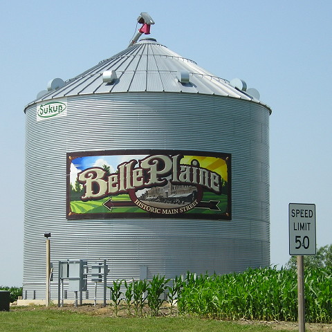
This bin and special sign for Belle Plaine were erected in the early 2010s. (7/6/13)
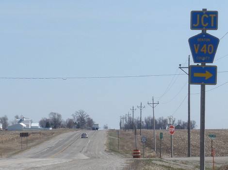
SOUTH End (2001-03): Stop sign/T intersection, E66, Benton County
Facing south on 131 (11/29/02)
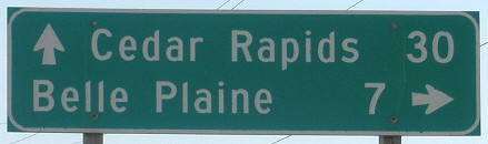
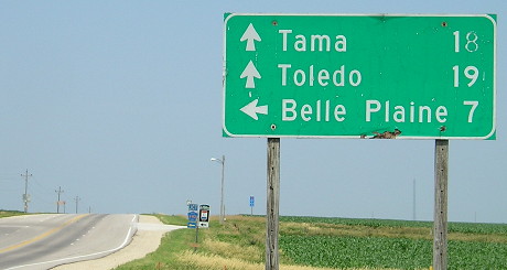
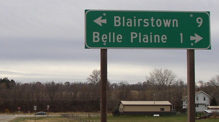
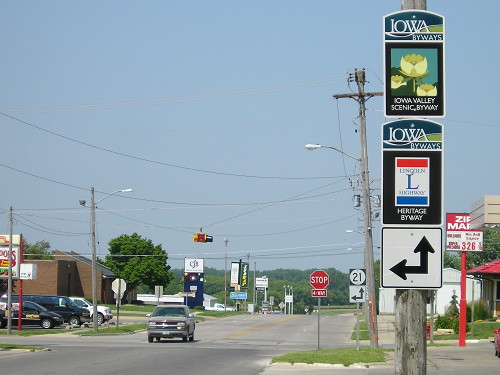
In 2000 and 2001, 131 was completely detoured along IA 21 and US 30 for rehabilitaion. The result of said rehab is that the east-west segment of 131 was turned over to the county and Belle Plaine, and 131 came to an abrupt and undignified end at E66. Before then, 131 continued to the right into Belle Plaine. Mile markers were not changed; MM 3 is about one mile north.
Facing south on 131 (11/29/02)
Facing west on E66 (11/29/02)
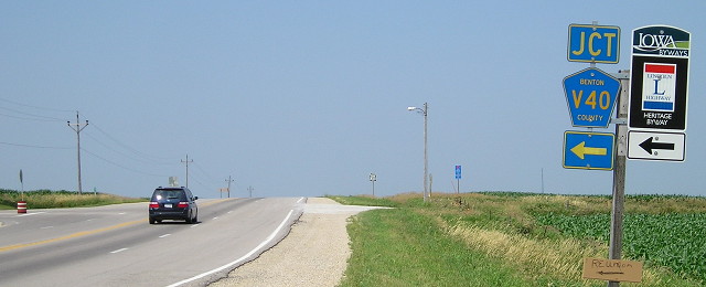
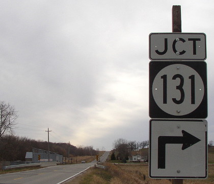
An identical arrangement except without the "Jct" appeared on old 131 eastbound. The separate assemblies on the county road (one is at the intersection) and the up-and-right arrow aren't usual signage. The Belle Plaine city limits are actually just over the hill.
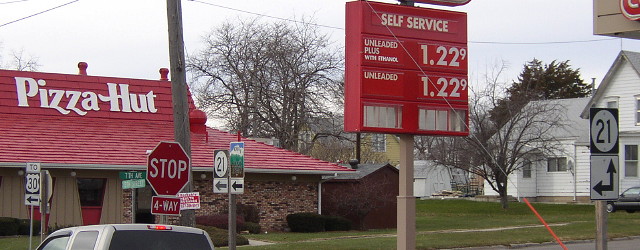
In Belle Plaine
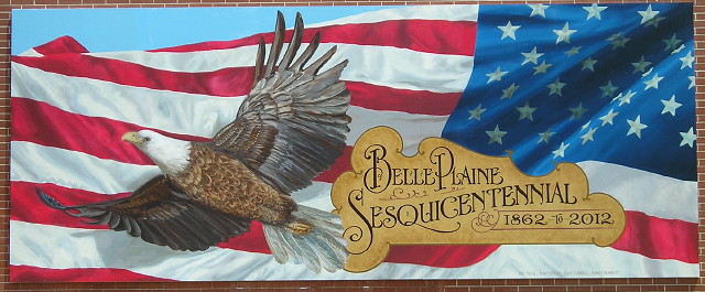
This beautiful mural is at the corner of 12th Street and 8th Avenue, one block east and south of the 21/131 junction. The Lincoln Highway, in its very very early days, ran on 12th Street through the business district, and then 13th Avenue and 15th Street on the east side of town, but was straightened out fast. (7/7/13)
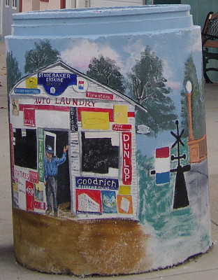
This concrete marker at the Lincoln Cafe commemorates George Preston and his famous gas station. Tama's Lincoln Highway bridge is also on it. The colors were notably faded a decade later. (11/29/02) Photos of the station can be seen in my 2002 Lincoln Highway photo gallery.
Special banner at Preston station (7/6/13)
Old SOUTH End (1937-2001): 4-way stop, IA 21 N/13th St. and IA 21 S/7th Ave., Belle Plaine, Benton County
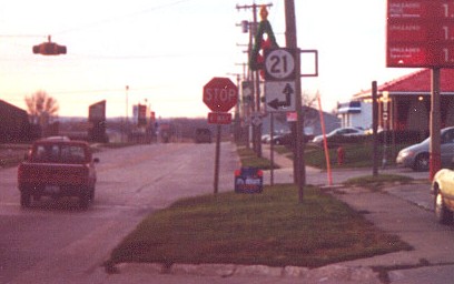
Facing west, but heading south, on 131 (12/2/01)
Photo by Jason Hancock
The red pickup has just passed the end of 131. The 21 signs and bracket still stood when Jason took this picture (see below).
Facing northwest-ish (11/29/02)
The highway signs, right to left, are the one that still had brackets when Jason took the picture, the assembly for northbound 21 (compare to below as well), and a "To 30" that could instead have a double arrow or be broken into "To West 30 <- / To East 30 ->".
DOLLAR-22 GAS *sighs wistfully*
Facing west, but heading south, on 131 (7/6/13)
Facing west, but heading south, on 131 (11/29/02)
This LGS and the city limits sign remain. From the city limits sign to about halfway to here the road was newly reconstructed, complete with curbs. That's probably why Belle Plaine took over the road, to do improvements.
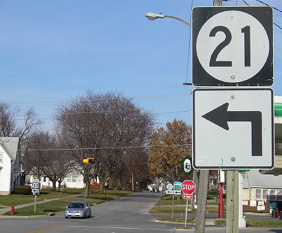
Facing north on 21 (11/22/06)
Facing north on 21 (12/2/01)
Photo by Jason Hancock
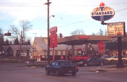
A "131" with a right arrow sat aside the 21 sign, thus the non-centering. By November 2002 an Iowa Scenic Byway sign had been placed on the right (see above). Notice the old Standard sign; the red portion at the top has fallen off here but is still on the other side. The station has since been BP-ified.

Facing east, but heading south, on 21 (11/29/02 and 11/22/06)
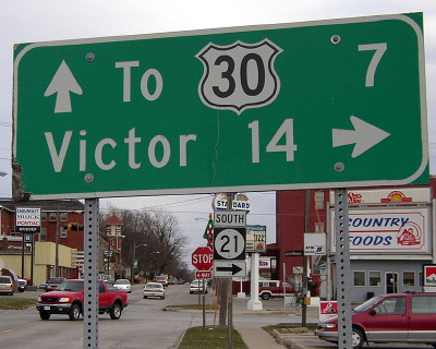
Comparatively, northbound 21 traffic is told to come this way for 30, or was until after 2003. Highway 21 LGSs include Elberon and Victor, although it never entered the former and has bypassed the latter. (Did you notice that on this page, it's always Christmas in Belle Plaine?)
Last seen: 2003
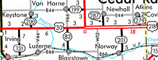
The 2003 map was the only one to note a truncated 131, still showing 7 miles to Belle Plaine.
Page created 2/3/02; last updated 1/31/14