
| IA 141 endpoint history | |||
| FROM | TO | WEST (Sioux City until 1961) | EAST |
| 10/16/26 | 6/24/29 | South Dakota line (Military Rd bridge) | US 30 (7th St at US 30, Denison) This route replaced IA 34. |
| 6/24/29 | 7/23/34 | US 75 (Morningside Ave at Lakeport Rd) | |
| 7/23/34 |
2/5/36 | US 75 (1st St at Westcott St) | |
| 2/5/36 | 6/21/39 | US 20 (Fairmount St at Correctionville Rd) | |
| 6/21/39 | 4/1/41 | US 20 (Linn St at Correctionville Rd, one block west of above) |
|
| 4/1/41 |
1956 |
US 75 (Gordon Drive at Westcott St, with 20 on Gordon) |
US 6 (Merle Hay Rd at Douglas Ave, Des
Moines) |
| 1956 |
11/9/58 | US 20 (Fairmount St at Gordon Dr) |
|
| 11/9/58 | 6/1/61 |
I-35/80 |
|
| 6/1/61 | Present | I-29 (Sloan) | |
| All the Sioux City endpoints 1929-61 are in an
extremely small area bounded by 1st Street, Fairmount Street,
Gordon Drive, and Westcott Street. I've done the best I could with
what I have. |
|||
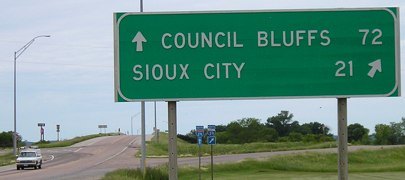
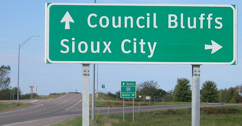
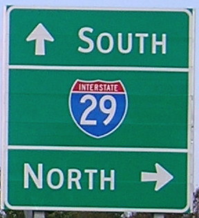
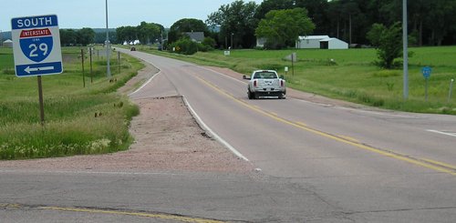
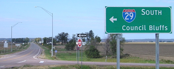
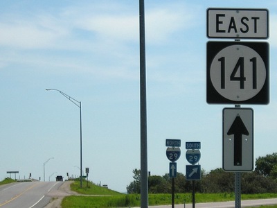
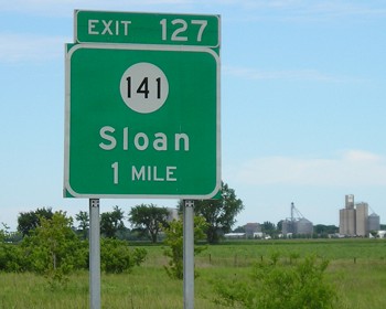
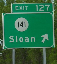
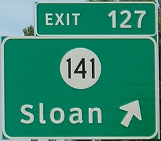
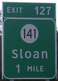
WEST End: I-29 exit 127, near Sloan, Woodbury County
Facing west on 141 (6/12/05)
Facing west on 141 (10/1/15)
Facing west on 141 (10/1/15)
Facing west on 141 (6/12/05)
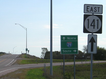
The official end for 141 is probably nearing the background of this picture where the pavement changes from a reddish tone to gray, near the ramp for eastbound traffic to southbound I-29. On the right side of the photo is a K42 shield, a north-south number that turns south in the distance. This type of I-29 sign is very rare and potentially original to the interchange, which was the south end of IA 140 for about three years (between I-29's completion and the rerouting of IA 141 from Sioux City).
Facing west on 141 (10/1/15)
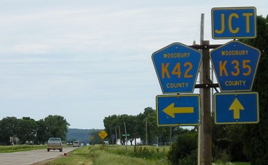
Facing west on K42 (6/12/05)
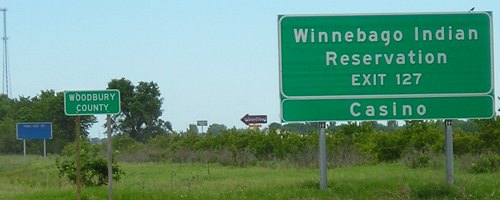
This pavement, which was K42 immediately after the interchange but quickly becomes K35, goes west along a "rough road" (the yellow sign) to the Winnebago Indian Reservation's WinnaVegas casino. "But the Winnebago reservation is in Nebraska," you say. And it is...except where it isn't. If you look at a topographic map of the area, the Iowa-Nebraska border along the Missouri River at that point is indefinite, and somehow, the official reservation boundary extends a mile inland through land completely in Iowa. On the linked map, the casino is at the intersection of the east-west road extending west from 141 and the dashed "Res Bdy" line. As casino gambling is currently against Nebraska law, the tribe built a casino on the tiny piece of Iowa land. The nearest bridges across the river are I-129 in Sioux City and IA 175 west of Onawa, both more than 15 miles away. No state map or atlas colors those two (or so) square miles of Iowa land as part of the reservation, so the situation is a bit curious. (I would be interested in seeing a Woodbury plat/landowner's map of the area.)
Facing east on 141 (6/12/05)
Facing east on 141 (2/23/02 and 7/23/09)
Left photo by Neil Bratney
This is the first sign for 141 east.
Facing east on 141 (10/1/15)
This sign and one visible near the bridge after the ramp are the only signs to survive the genericization of the interchange signs.
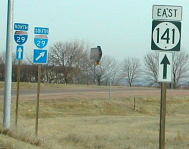
Facing north on 29 (6/12/05)
Like every other interchange on I-29 except for the north end of IA 192, the state highway exit sign includes no direction.
Facing north on 29 (6/12/05)
Facing north on 29 (6/12/05 and 7/23/09)
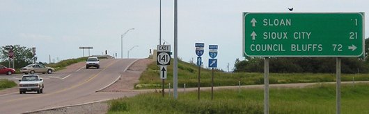
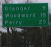
Looking at the route for 141 between its west end and US 59, you might notice that it actually goes southwest a bit between Charter Oak and Ute instead of following its general northwesterly route. This small anomaly has been around since 141 was christened as such; the Smithland-US 59 stretch is 141's oldest part. The original route to Sioux City became IA 982, but the DOT neglected to tell anybody until the 1980s (it was an unsigned "No-Name Highway").

Facing south on 29 (10/1/15)
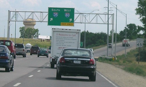
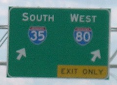
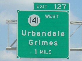
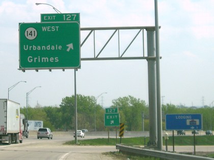
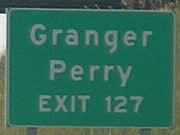
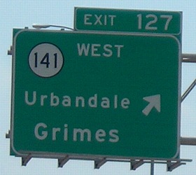
EAST End: I-80/I-35 exit 127, Urbandale, Polk County
Exit 127 to Exit 127(!)
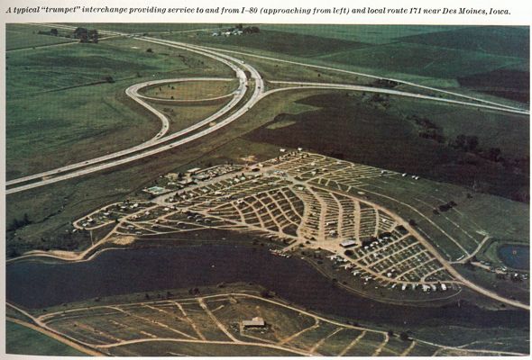
View facing southwest
This photograph is in America's Highways 1776-1976, a U.S. Department of Transportation publication. The road crossing the freeway at upper left is Meredith Drive. The lake at bottom is at upper right in the 2002 aerial photo below, which shows roughly the same area but with north on top. The trumpet was reworked in the late 1990s to provide a road into Urbandale. The caption above the photo contains a typo, as IA 171 was a tiny spur to tiny Elberon at the time.
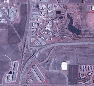
Everything on the north side of the interchange is within Grimes city limits. Everything to the south is Urbandale's. In 1975, when the DOT's photo was taken, this was the northwestern corner of Urbandale.
Facing south, but heading east, on 141 (3/31/02) (sign now removed)
Photo by Neil Bratney
As you can see above, the trumpet interchange 141 ended at was reworked so a road continued into Urbandale. However, the sign on the left, originally over a lane only going to the freeway, was not changed...until the entire thing was taken out in 2005.
Facing south, but heading east, on 141 (6/23/06)
Extra lanes have been added at the intersection near the interstate, resulting in new signage.
Facing south, but heading east, on 141 (6/23/06)
Facing south, but heading east, on 141 (6/23/06)
Closeup of last signs (6/23/06)
The sign at left is in Iowa, but its shade of green and letters make it look like a fugitive from the Nebraska Department of Roads.
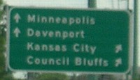
Facing north, but heading west, on 141 (February 2003 and 3/31/02)
Photo by Jason Hancock / Photo by Neil Bratney
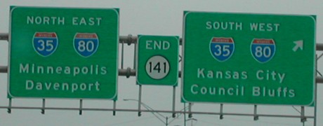
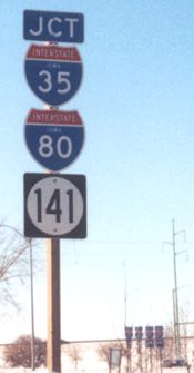
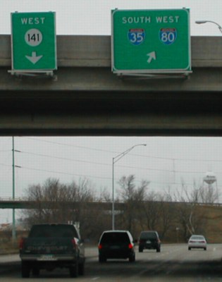
Facing north on 35, but heading east on 80 (5/7/06)
Facing northeast on 35/80 (5/7/06)
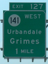
Notice that "Urbandale" is in a smaller font than is normally used. Neil says that before the trumpet was modified that space was occupied by "Perry".
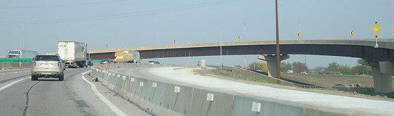
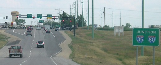
Facing northeast on 35/80 (10/9/20)
A long new flyover ramp for 35/80 to 141, negating the exit shown above, opened a week after I took this picture.
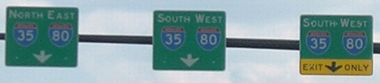
Facing west on 80, but heading south on 35 (8/1/07)
"Urbandale" is also smaller on this overhead sign. The exit for 141 is right where the interstate is in the middle of its big curve.
Facing north, but heading west, on 141 (3/31/02)
Photo by Neil Bratney
In a strange oddity, a major east-west road (IA 141) is predominantly north-south in the Des Moines area, and a major north-south road (5) is predominantly east-west.
Page created 1/27/02; last updated 2/8/21