 NORTH
NORTH
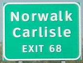
NORTH End (1969-2002): Diamond interchange, I-35 exit 68, Polk County
NORTH End (2002-present): Flyover ramp interchange, I-35 exit 68, West Des Moines, Polk County
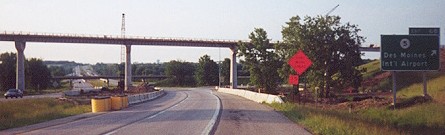
Pictures below chart the transformation (and remnants) of IA 5 from a two-lane on Army Post Road to part of a new beltway around Des Moines. The new interchange is not a triangle, but more like a T with flyover ramps. Only recently did West Des Moines annex land south of the Raccoon River and Walnut Woods Drive. Pictures work west on Army Post and then west on the freeway.
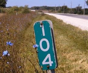
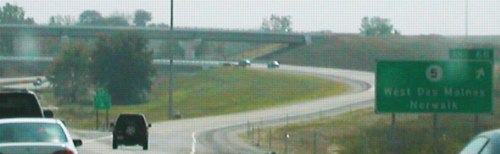
Facing west, but heading north, on 5 (Army Post Road) (8/6/04)
This is the only mile marker left on Army Post Road west of US 69. West Des Moines has resurfaced the entire route west of 63rd/1st Street. This is west of the 42nd Street bridge. (Unlike the other western suburbs, West Des Moines does not follow the Des Moines/Polk County system, so you have to add about 62 to the number. In other words, WDM's 42nd Street is Des Moines' 104th Street.) I-35 is in the deep background.
The new interchange can be seen at the left of this picture. The hill/bridge at top left is the ramp to southbound I-35. (8/6/04)
Facing west, but heading north, on 5 (Army Post) (8/6/04)
There was a little bit of median separation on old 5 at the interchange. I believe the road at right is the very beginning of the on-ramp to northbound I-35 because 5 angled slightly southwest here. The interstate runs across the photo at the top of the hill.
Facing west, but heading north, on 5 (Army Post) (8/13/18)
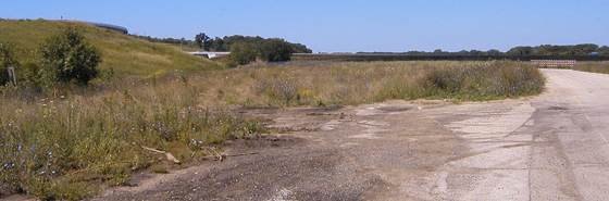
West of SW 105th Street (Des Moines)/SW 42nd Street (West Des Moines), the road is now "inside" a recreational area. What remains of the section-line road between here and Fleur Drive has been chopped up into pieces.
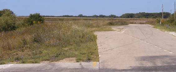
Facing west, but heading north, on 5 (Army Post) (8/13/18)
The end of the pavement I was able to get to in 2004 has been further cordoned off. It was not like this in 2011, according to Google Maps Street View.
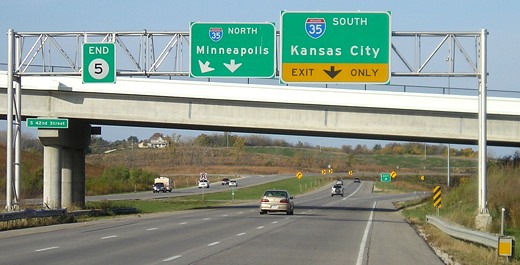
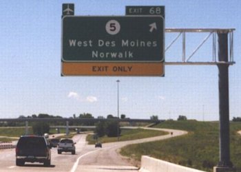
Facing west, but heading north, on 5 (10/21/07)
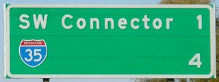
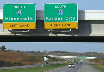
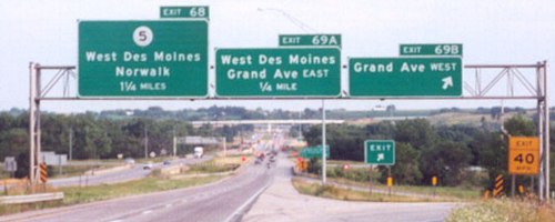
The right picture is at the South 35th Street bridge, which was Southwest 96th Court before West Des Moines annexed the land. The sign on the left migrated from the gantry in the background, and you can see it there below. I think this is the southernmost mention of Minneapolis on BGSs in Iowa.
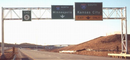
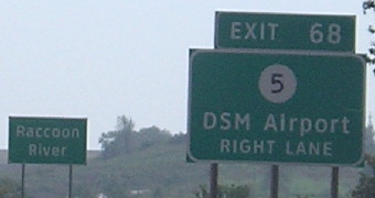
Facing west, but heading north, on 5 (10/13/02)
Photo by Jason Hancock
The middle sign is now on the bridge to the east (see above picture).
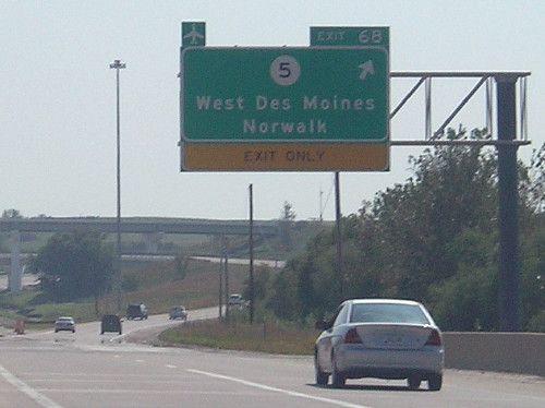
Facing west, but heading north, on 5 (pre-42nd Street bridge) (December 2002)
Photo by Jason Hancock
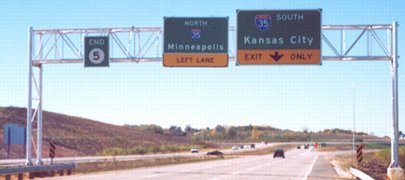
The sign got replaced, yet the new one wasn't made to match up in size. Go figure. This picture shows the bridges in the background better than the one below, which includes a different bridge.
Facing west, but heading north, on 5 (10/21/07)
You might have noticed that although facing west, the north exit is on the south side and the south exit leaves first. That's due to the design of the interchange. Notice how the bridge angles down a lot as it crosses 5.
Facing west, but heading north, on 5 (August 2001)
Photo by Jason Hancock
Taken before the freeway was finished and this gantry was moved back.
On-ramp onto northbound 35 (8/6/04)
Once the freeway was completed Iowa 5 was removed completely from Army Post and its duplex with IA 28. The 2002 state map (Des Moines inset) splits this interchange into two parts. As an interesting side note, 5's first county entries are like this now: Polk, Warren, Polk, Warren. The second trip into Polk County is part of a wrong-way multiplex with US 65.
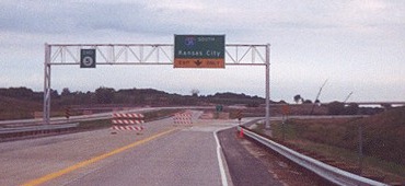
Facing north on 35 (May 2001)
Photo by Jason Hancock
By the bridges, you can tell this is not the same place as below.
Facing north on 35 (August 2001)
Photo by Jason Hancock
By January 2003 there was a little square airplane sign on the left side of the sign across from the exit tab.
Facing north on 35 (9/19/14)
The offset of the word "seven" is because it said "six" before the Mills Civic Parkway exit was built.
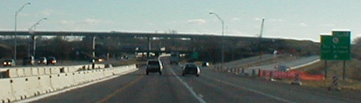
Facing north on 35 (10/9/20)
I-35 was six-laned from IA 5 to near the Cumming exit in 2014.
Facing north on 35 (10/9/20)
Facing north on 35 (10/9/20)
Facing south on 35 (7/20/02)
Photo by Jason Hancock
This interchange was the east end of the last version of IA 90.
Facing south on 35 (12/24/01)
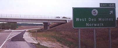
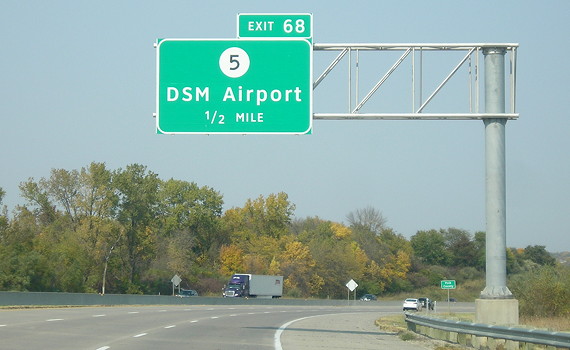
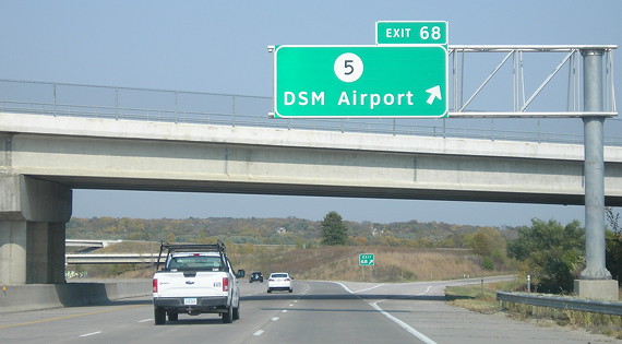
BGS reads "Des Moines Intl Airport", just like the NB sign read earlier. The new off-ramp with new BGS is now in use, while the then-current one has been removed (see below).
Facing south on 35 (9/2/02)
Photo by Neil Bratney
Facing south on 35 (5/31/04)
Photo by Jason Hancock
Today, the southbound on-ramp from Mills Civic Parkway becomes a dedicated exit lane for IA 5.
Facing south on 35 (9/19/14)
Facing south on 35 (9/19/14)
 ?
?
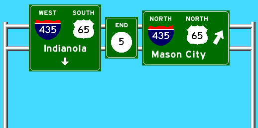
Suggested gantry at the IA 5/US 65 interchange near Carlisle
Proposals for a "beltway" around the east and south sides of Des Moines date back to the 1960s. It was in the February 1968 freeway plan, aka "Iowa's Proposed Network of Freeways and Expressways," a guide that would be the template for the next four decades of construction. That plan divided the beltway into two segments: "Freeway 500," the eastern bypass that later became US 65, and "Freeway 592", the southern bypass and the westernmost segment of a four-lane from Des Moines to Ottumwa via Knoxville. This would be the working strategy for at least the next decade and a half; it was much later that "Relocated US 65" was applied to Freeway 500 rather than a 1973 plan that routed US 65 onto I-235 and I-80 from East 14th Street (US 69) to Altoona. Freeway 592 eventually became the IA 163 corridor instead, but the beltway extension of the route continued to be on the back burner.
Perhaps because of the historic separation of the names, as construction on the Des Moines beltway progressed in the 1990s and early 2000s, it seems to have gone unnoticed that while it may be referred to as "the bypass" or "the beltway" in passing, the whole route doesn't have a uniform number. Not only that, but because of the routes involved, the mileage counts up in different directions and we have a wrong-way multiplex, going north and south on two routes at the same time. Occasionally, this results in incorrect naming of various parts of the four-lane around Des Moines.
To my knowledge, there was never any pursuit of an interstate designation for the beltway. This may be the result of a combination of things: 1) Keeping the bridge across the Des Moines River accessible to vehicles traveling less than 40 MPH - such vehicles are banned west of US 69; 2) Piecemeal relocations of the routes anyway as old segments (of IA 5) were taken off the rolls; 3) Differences in construction guidelines of an interstate as opposed to a four-lane freeway, although the entire beltway has paved shoulders.
So we can't have an Interstate 435. Why can't the DOT commission a state route with that number?? After all, until 2003 we had an IA 428. This could solve many of the mistakes made when trying to refer to this route, and provide continuity to boot. The interstate-based number would provide a smooth transition should it ever happen, much like metro St. Louis' MO 370. (And Wichita seems to do just fine with 135/235, ditto Omaha with 480/680.) Also after all, given that IA 27 was concurrently slapped onto long, long stretches of US 218 and I-380, the real question is, why not? Truncate IA 5 at the Carlisle exit and commission an IA 435 that starts (with Exit Zero, please, or at least don't call it Exit 1) at I-35, heads east to US 65, and continues north to I-80. With this, it's also possible that US 65 could be put back on Hubbell Avenue with US 6 from that exit and remove the somewhat awkward duplex with I-80 (65 crossing a diagonal that it later rejoins/leaving a diagonal that it then crosses over). The mile markers and exit numbers along the south part of the beltway would have to be redone, but since that's the newest piece of the road, and no one's really using those numbers anyway right now, it's the PERFECT time to do it!
Page created 1/5/02; split 11/6/05; last updated 1/28/10 10/30/20