 SOUTH
SOUTH
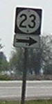
Old SOUTH End (October 16, 1926-July 16, 1997): Stop sign/T intersection, US 63 (now IA 23), Mahaska/Keokuk county line
Before the pictures, this map may help:
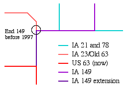
You might say that 149 doesn't end where it should - twice. First is the T intersection with 78 near Martinsburg, where 149 turns to go on the east-west road. "Shouldn't 78 continue west?" you ask. Well, logically, it probably would - until you learn that 149 was there first. The Martinsburg-to-63 stretch was part of 149 since its christening in 1926. Highway 78, on the other hand, did not show up in Keokuk County until the early 1940s. (21 didn't come down until even later.)
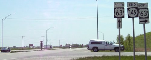
Facing west, but heading south, on 149 (1/20/02)
Photo by Neil Bratney
Old photo: Signage has been fixed (see below)
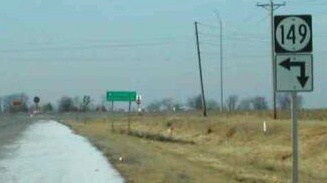
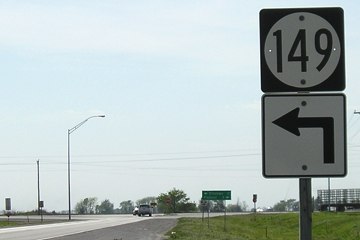
Until 1997, 149 stopped here, at what (again, until 1997) was US 63. While technically correct, this sign is misleading and strange. The arrows imply that 149 runs left and directly behind you - in other words, it's signing the road you're already on! Kyle Johnson e-mailed me to say the sign had been fixed by May 2003 (below).
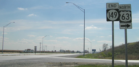
Facing west, but heading south, on 149 (5/10/05)
Instead of 23 replacing the entire old route of 63, 149 was extended southward from its intersection. When 63 was rerouted, it took most of IA 23's old route. A "new" 23 was created, taking over 63's old route from IA 92 south. Instead of finishing the job to rejoin 63, though, the DOT ended 23 here and sent 149 to the south. More on this below.
Facing west, but heading south, on 149 (5/10/05)
Facing south on 63, now 23 (5/10/05)
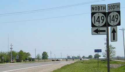
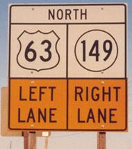
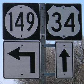
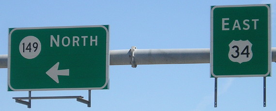
Prior to 1997, the right 149 shield would be 63. That is probably why this assembly includes north and south.
Facing north on 63, now 149 (5/10/05)
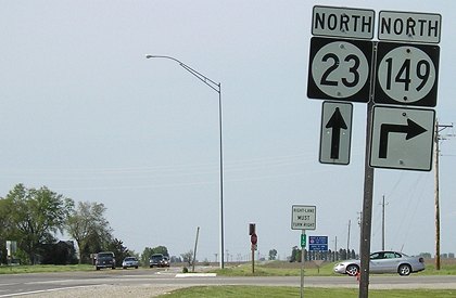
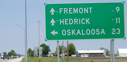
Besides the ahead-and-right that should be a plain arrow, there's a more interesting part of this picture. Despite being approximately 7 miles north of the 63/149 interchange, mile marker 12 is at the intersection, under the "Right Lane Must Turn Right" sign. Kyle Johnson noticed this first. This would track back to about the west intersection of US 63 and US 34 in Ottumwa, indicating that the DOT already planned to extend 149 southward once the 63 bypass to the east of the city was finished, something that happened ten years later.
SOUTH End (July 16, 1997-November 19, 2007): Partial interchange, US 63, Wapello County
More strange signing abounded where the four-lane 63 rejoined the route into Ottumwa. These are pre-bypass pictures. For post-bypass pictures, please see the Business 63 page.
Facing south on 149 (5/10/05)
The hill at right is the rise for future 63 bridges to be built across the road. Were this done already, this would be the spot for a "North 63 <ahead and right>."
Facing south on 149 (5/10/05)
When the roads changed, 149 inherited a fraction of a mile of four-lane running north from this point to old IA 389. Between May and October 2005, the "South 63 ^" sign and pole were removed, leaving only the right two (below).
Facing south on 149 (10/21/05)
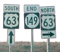
Closeup of end signage (1/20/02)
Photo by Neil Bratney
Present setup replacing the above three photos (7/15/19)
Facing north on 63 (4/4/04)
Photo by Jason Hancock
Facing north on 63 (5/10/05)
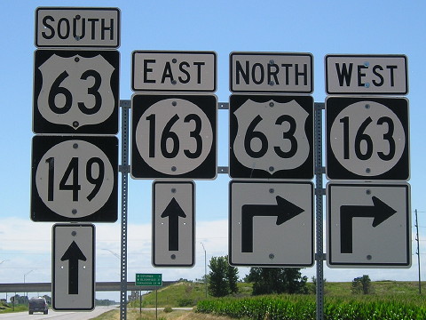
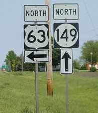
Very unorthodox signage here. First, the LGS is all-caps like an interchange LGS, but on a wood background instead of metal and has metal poles. Then it gets really weird: Those "NORTH" signs sure have a lot of space around them, and the shields themselves are very big. This 63 sign and its counterpart on the left side of the road constitute two of the four shields with 63 in the wider Series D font; the other ones are at the interchange with US 20 (one NB at the WB onramp; a second one has been removed) and at the east US 6 junction (last sign NB).
Facing east, but heading south, on 63 (5/10/05)

Facing east, but heading south, on 63 (1/31/04)
Since this picture was taken, the power poles have been shifted to the north side of the future bridges.

Left: Closeup of BGS; Right: Signs on offramp during sunrise (5/10/05 and 1/31/04)
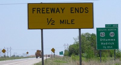
Wait a second... Highway 63 is exiting from itself! This exit tab is numbered for the highway that is also exiting (63). Traffic barrels divert all traffic to the exit (like US 20 used to at IA 263), because new 63 was built to head east from this point and then go south for a bypass. But if that's the case, the exit tab shouldn't be there. When the DOT signed the Mount Pleasant bypass, they left blank areas where those roads didn't exist yet. Similarly, it would have made sense to hold off on the tab here, too. As it turns out, the DOT replaced these signs four months before the bypass actually opened, marking Business 63 before it actually existed.
So...
My completely uncorroborated hypothesis: With 63's reroute, the DOT may have seen an opportunity to have a single number run from Ottumwa northeast to I-80 and perhaps Cedar Rapids (see below). Thus, 149 was extended south. My numbering idea: When you look at the map, 149's general southwesterly direction is about that of US 151. Why not extend 151 along 149's route to Ottumwa? (With a 5-mile duplex with I-80, of course.) This road's number could be extended south of 149's present end into Ottumwa and end at US 34. A single number to Cedar Rapids, and all the way to Lake Michigan. Of course, this would require a major renumbering of 151's mile markers, and since the DOT still uses mileage of the pre-Interstate 29 routing of US 75, that probably is unlikely to happen and this is probably a pipe dream. (Not to mention issues with the quality of the road, etc.) Another argument against it is that the extension would only touch two county seats (Sigourney and Ottumwa), one of which is already served by two US routes, and the only other town above 1000 on the route is Williamsburg.
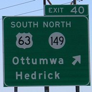
SOUTH End: Stoplight, US 34, Ottumwa, Wapello County
Facing south on 63, pre-bypass (1/31/04)
The signs at this intersection may have been originals from the 1964 relocations of 34 and 63 in this area.
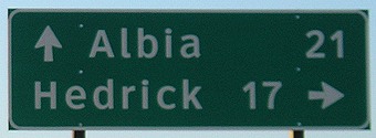
Facing south on 149 (4/13/16)
Closeup of sign on right (4/13/16)
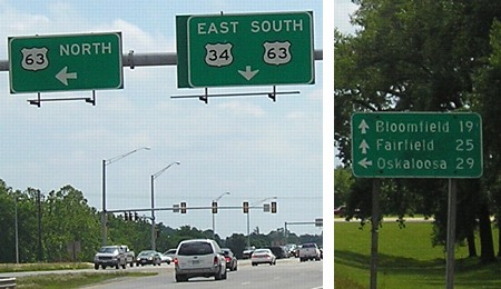
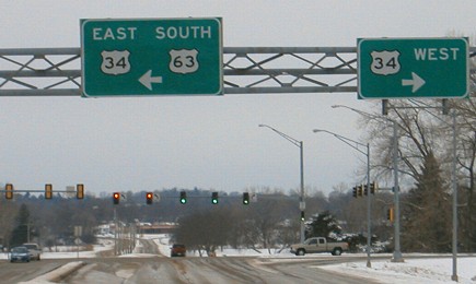
Facing east on 34, pre-bypass (6/11/07)
Facing east on 34, post-bypass (4/13/16)
Facing east on 34 (4/13/16)
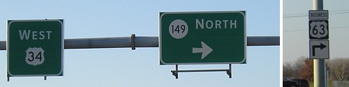
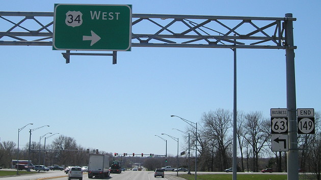
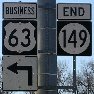
Facing west on 34, post-bypass (11/19/07)
Facing west on 34 (11/19/07)
Map at top created 3/3/02
Page created 3/3/02; split 11/6/05; last updated 3/18/20