
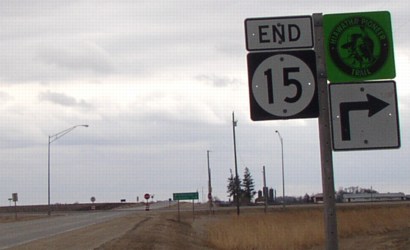
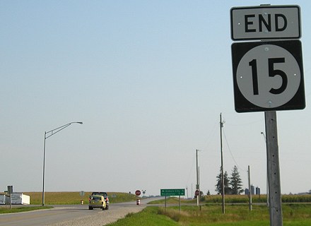
NORTH End of MN 15: Direct merge into US 10, St. Cloud MN, Benton County MN
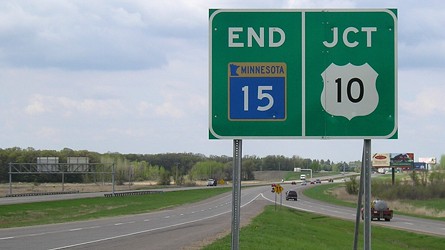
Facing north on 15 (5/8/07)
This is the second-northernmost end of a state highway that carries its number from Iowa into Minnesota; MN 4's north end at I-94 is slightly north of this point.
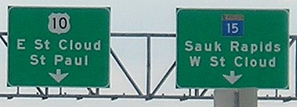
Facing south, but heading east, on 10 (5/8/07)
Almost all of US 10 in Minnesota is a four-lane road. This is about 2/5 of the way between Iowa and Canada, but we're already north of the Twin Cities.
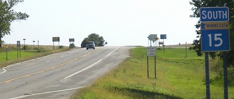
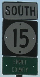
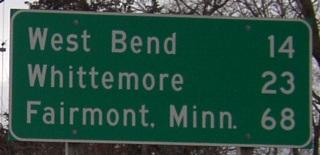
NORTH End: Minnesota state line, Emmet County IA/Martin County MN
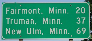
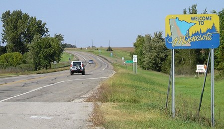
Facing north on 15, 9 miles south of the state line (9/16/07)
On the north side of Armstrong, after 15's two-block duplex with IA 9, is this all-Minnesota sign. New Ulm is on US 14.
Facing north on 15 (6/18/02)
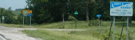
Photo by Neil Bratney
The blue street sign is an Emmet County sign, meaning the Minnesota Adopt-A-Highway sign is actually on the Iowa side of the border!
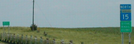
Facing north on 15, with Martin Co. Hwy. 41 in background (9/16/07)
The first MN 15 shield and county sign, seen below, don't come until after the first intersection.
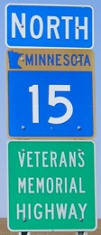
Facing north on 15, 3/8 mile north of state line / Closeup (6/18/02 and 9/16/07)
Left photo by Neil Bratney
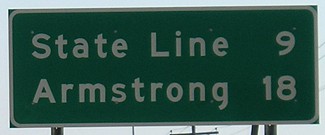
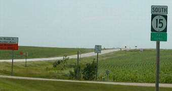
Facing south on 15 (9/16/07)
This is Fairmont's counterpart to Armstrong's sign; the mileage difference is because this is about two miles south of downtown.
Facing south on 15 (9/16/07)
Facing south on 15 (9/16/07)
Facing south on 15 (6/18/02)
Photo by Neil Bratney
Facing south on 15 / Closeup (6/18/02 and 9/16/07)
Left photo by Neil Bratney
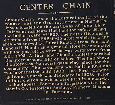
The road across the photo is access to Iowa Lake which, naturally, is mostly in Minnesota.
Facing west (9/16/07)
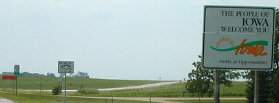
The pole and path on the left side of this building indicates the approximate location of the state line. The building is built as far south in Minnesota as you can get; the open area on the left is Iowa. A closeup of the text on the sign can be seen here.
Iowa historical marker (9/16/07)
Facing north (8/17/19)
The gravel expanse on the west side of present Highway 15 as it crosses the state line was the road until the 1960s. Thus, this is closer to the actual 1920 endpoint of IA 43.

(July 1, 1920-January 1, 1969)
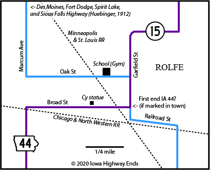
- In 1920, they knew it as: Nothing. Rolfe was on the Des Moines, Fort Dodge, Spirit Lake, and Sioux Falls Highway, but that auto trail was mega-stairstepping its way from Gilmore City to Rolfe to Plover to Mallard.
- We know it as: The southernmost part of IA 15
- Related route: IA 358, created when the extended 44 was rerouted around Whittemore
1920 NORTH End of IA 44: Rolfe, Pocahontas County
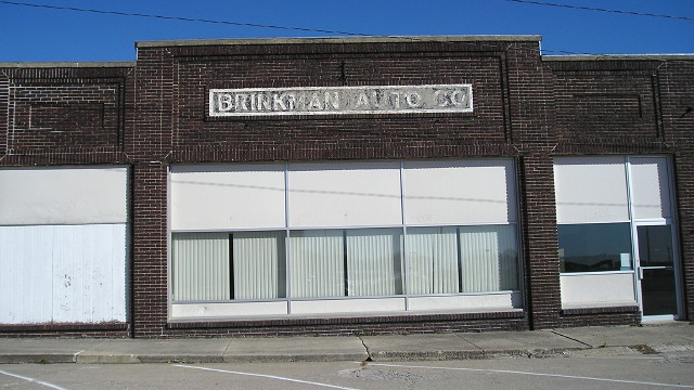
This building at the corner of Broad and Garfield streets in Rolfe (1920 pop. 1031, 2010 pop. 584) appears to be of vintage close to the time IA 44 ended in this town. The sign could have been preserved by a series of other businesses covering it up. Google Street view from 2013 shows this building housing Chris Cakes Pancakes and Wild Faces Gallery & Frame. (10/20/18)
"The Rolfe Commercial Club,
an organization that includes in its membership all the prominent
business men of the city and many of the farmers of the surrounding
community, is responsible to a great extent for the prosperity enjoyed
by the city. The commercial organization is always alive to the best
interests of the city and continually on the lookout for live business
and industrial concerns, for which the city presents unusual
opportunities. The physical conditions of the surrounding country, the
railroad facilities and the enterprising spirit of the citizenship in
general make Rolfe an ideal city in which to live and give it
unexcelled advantages for investments."
— Huebinger's
Map and Guide for Des Moines, Fort Dodge, Spirit Lake, and Sioux Falls
Highway (1912)
Hi, Cy!
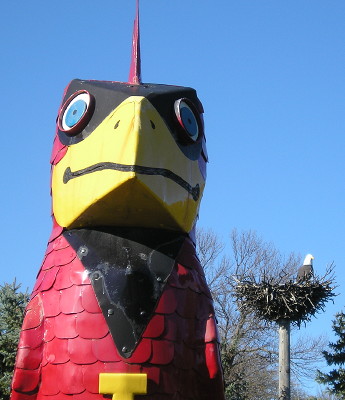
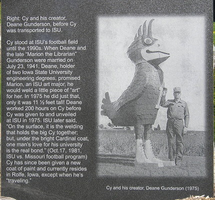
Look, I can't NOT put this here. (10/20/18)
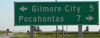
Facing east, but heading north, on 15 (3/21/03)
In the Rolfe area, 15 makes four turns, and makes four more before straddling the Kossuth/Palo Alto line. This, the first leaving-town LGS on northbound 15, is on a short east-west portion just north of town. Fairmont is on Interstate 90, which is closer to Rolfe than I-80. In fact, west of Allison, any town along IA 3 is closer to I-90 than I-80.
1920 SOUTH End of IA 44: IA 10,
Pocahontas County
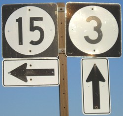
SOUTH End of IA 15: Stop sign, IA 3 and N65,
Pocahontas County
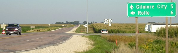
Facing south on 15 (3/21/03)
Facing south on 15 (9/2/08)
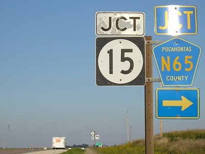
This intersection was one of the first noticed to lose its Hiawatha Pioneer Trail signs. See also the background of the "Jct 15" below.
Facing south on 15 (9/2/08)
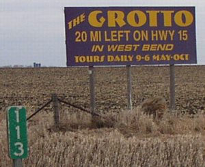
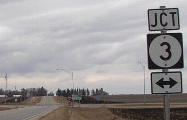
<Grotto plug> Facing east on 3 (3/21/03) </Grotto plug>
Facing east on 3 (9/2/08)
Facing east on 3 (9/2/08)
Facing east on 3 (9/2/08)
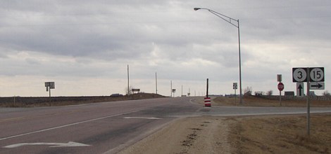
Facing north on N65 (3/21/03)
As often (but not always) happens, the road going straight ahead is not noted.
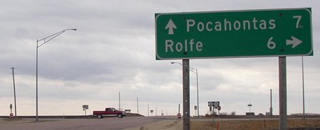
Facing west on 3 (3/21/03)
Facing west on 3 (3/21/03)
Between 1969 and 2003 there was another IA 15, in Van Buren County.
Page created 4/2/04; last updated 12/29/08 3/20/20