 EAST
EAST
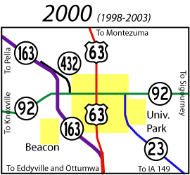
Oskaloosa has had a lot of route and number changes. A series of maps showing routes in 1920, 1930, 1935, and 1950, including old state numbers and US 163, is available here. A map of the routes at the turn of the century is also down this page.
Old EAST End (1969-97): Stop sign/T intersection, IA 92, Oskaloosa, Mahaska County
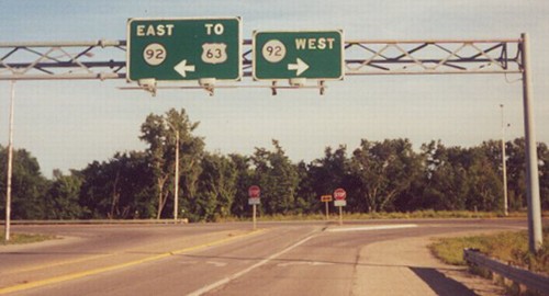
Facing south, but heading east, on 163 (June 2000)
Photo by Jason Hancock
No longer the end of a marked highway (indeed, any highway), but the signs stood for years. All of the signs at this intersection were taken down, and 92 was re-asphalted, in 2004.
This is not where US 163 originally split from what is now IA 92; this intersection didn't exist at that time. When US 63 was rerouted along IA 59 through Waterloo and into Minnesota and Wisconsin, the old Oskaloosa-Des Moines stretch was US 163 between 1934 and 1938. As 163 came into Oskaloosa, it used Pella Avenue (the name is a hint) and North L Street. This entire intersection was built in 1957, when IA 92 was moved off Suffolk Road/High Avenue.
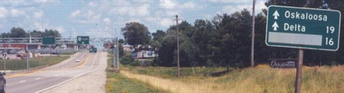
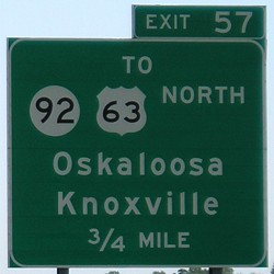
From the L Street/A Avenue intersection, a block north of High, US 163 continued east with 92 just over a mile to end at US 63 in central Oskaloosa. This is additionally confirmed in a 1968 Des Moines Register article about the Great Renumbering, which mentioned 163 would be taken off 92. The east end of US 163 is the same intersection the north end of IA 137 was at before 1997. You can see photos of that intersection on 137's page.
Facing east on 92 (6/28/03)
Photo by Jason Hancock
Pella is in the blacked-out (grayed-out?) space on this LGS.
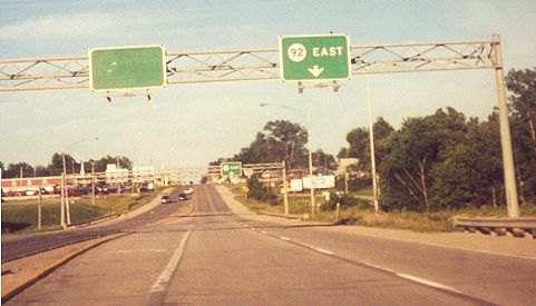
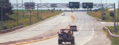
Facing east on 92 (June 2000)
Photo by Jason Hancock
Jason Hancock writes: "This overhead gantry on the west edge of Oskaloosa features a blank green sign. It used to mark the lane for turning onto westbound IA 163 until the freeway bypass was built in 1997. The text on the signs approaching old IA 163 were taken down, but the signs themselves were still up when this photo was taken in June 2000. (If you look closely at the blank sign, you can make out a faint circular outline, the word "WEST", and a downward-pointing arrow.)" These signs were up in June 2003 and gone by October 2004, and could be seen from the expressway when looking east at the interchange with 92.
Facing west on 92 (6/28/03)
Photo by Jason Hancock
Closeup of above picture
Notice the difference in arrow size under the "92 west" and "163 west" signs. Unlike eastbound 92, the 163 shield remained here, with its accompanying arrow turned 90 degrees to face down. The bridges of the 163 bypass are visible just over the top of the hill.
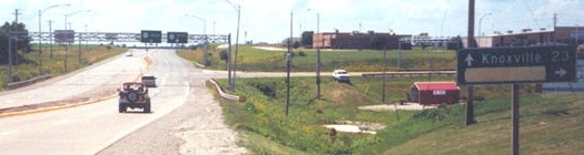
Surrounding area information: 163-92 interchange
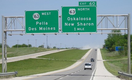
Facing southeast, but heading east, on 163 (5/10/05)
Although you CAN exit from 163 to northbound 63 to the south, this is obviously the better option. (Actually, it's a bit surprising that an exit to northbound 63 is an option at 163's end.)
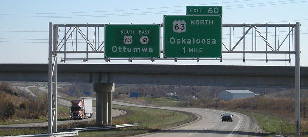
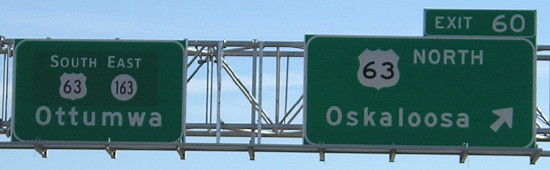
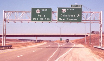
Old EAST End (1997-2009): Direct merge into US 63, near Oskaloosa, Mahaska County
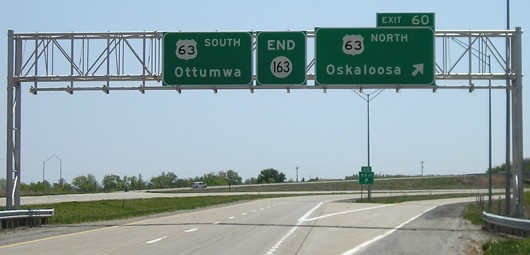
Facing southeast, but heading east, on 163 (5/10/05)
The $64,000 question with this interchange: Is 63 exiting from itself? Not really, though the numbers could make it so. The following is true: A) Each route has its own MM 60 in the area. B) There is only one MM 61, in the middle of the interchange. C) The interchange is spread out over a wide area. Below is the 2002 aerial photo with miles or mile fractions marked. The table goes into more specifics.
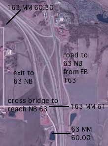
| Place | DOT marker |
| Last before NB 63 exit | 60.35 |
| SB 63 crosses over 163 | 60.85 |
| Last marker for 163, near bridge | 61.10 |
| First marker for 63, a bit farther south | 60.35 |
The numbers in the table are from the little white markers along the side of the road. My car's odometer, however, read differently. According to it, the 60th mile of 163 did not begin until where the road for southbound 63 crosses over the four lanes of 163 - a difference of a little more than four-fifths mile. So even with all the changes in alignment, 163's current markers are very close and the distance between US 69 and US 63 was slightly shortened. (A caveat: I was generally driving in the right lane of the eastbound lanes, which could be thought of as an inner radius. Going in the right lane of the westbound lanes may yield different results.)
In other words: The exit for northbound 63 is 163's Exit 60. Before merging, 163 reaches Mile 61. The point at which northbound 63 leaves the four-lane on the south side of the interchange is inside 163's Mile 61 but 63's Mile 60. When 63's mileage is picked up on the mainline, it's three-fourths of a mile away from an even split. If the "middle" of the interchange is considered the southbound bridge crossing, the exits are 163's. It just so happens that 63 is in Mile 60 at that point too.
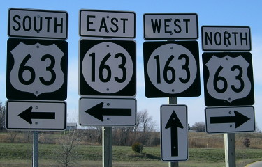
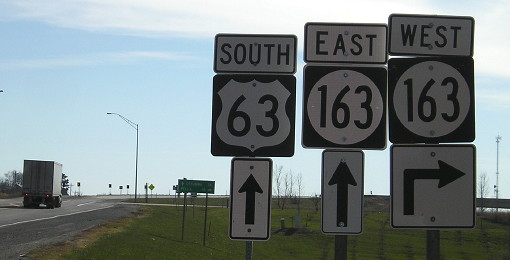
Facing south, but heading east, on 163 (12/15/13)
The left sign in both the above and below pictures used to say "63 South".
Gantry two pictures up, changed after extension of IA 163 (12/15/13)
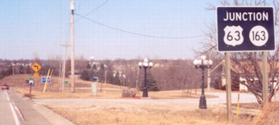
On the access road, facing north (3/10/02 / 12/15/13)
Left photo by Jason Hancock
Jason says, "This black 'junction' sign is approaching northbound US 63 from the off-ramp from eastbound IA 163 (after exiting, the ramp runs over IA 163 and then turns northward to this point)." The sign took a beating over a decade, and we still don't know why it's black.
Facing west (3/10/02)
Photo by Jason Hancock
Facing west, same location (12/15/13)
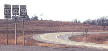
Facing north on 63 (5/10/05)
The "163 West" is a bit premature, even post-extension, since the road is still also 63 for a mile. A "Straight Ahead" at the bottom could work. At this point there are still surface-road intersections.
Facing north on 63 (3/10/02)
Photo by Jason Hancock
Because of the structure of the Des Moines-Burlington expressway plans, the 63-163 change is the dominant road. The confusion between the two sets of mile markers, partially sparked by the nature of the interchange, would be better resolved if the exit tabs were simply removed from the interchange entirely.
Facing south on 63 (12/15/13)
Facing south on 63 (3/10/02)
Photo by Jason Hancock
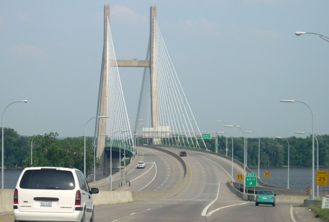
EAST End: Illinois state line (w/US 34), Burlington IA/Gulfport IL, Des Moines County IA/Henderson County IL
<rant>
As I have noted elsewhere, many of the four-lane corridors built since 1990 include multiple routes. Unlike other states, Iowa has been reserved in redundantly extending numbers along routes - or had. But IA 27 defied this convention, going north with I-35 to the Minnesota line when it could have ended at the Clear Lake interchange. And now, with multiple corridors as theoretical candidates for numerical extension (and one desperately in need of unification *cough*Des Moines beltway*cough*) the DOT picked...this one?
Extending IA 163 to Burlington makes little sense. Unlike, say, taking IA 60 down US 75* or IA 330 down US 65, which would have much shorter distances duplicated**, this is a redundant multiplex of around 75 miles with US 34 - and then doesn't end at an interchange at all, but rather in the middle of a bridge. Unlike IA 27, there isn't a place in the middle where it leaves one route and joins others in places that are not immediately obvious. In fact, the only place this four-lane corridor is NOT the through route between Des Moines and Burlington is around the Mount Pleasant bypass, and even then the BGSs say "Burlington" in one direction and "Ottumwa" in the other.
One of the best arguments in favor, that such an extension allows the placement of additional cities on signs at major interchanges, is a nonstarter because these less-than-decade-old signs are only having certain shield identifiers retrofitted. Instead, lots of needless shields have been placed, and the 21st-century IA 163 ironically has become longer and more important than US 163 ever was.
</rant>
Facing east on 34/163 (6/16/06)
Facing east on 34, entering Illinois (5/26/12)
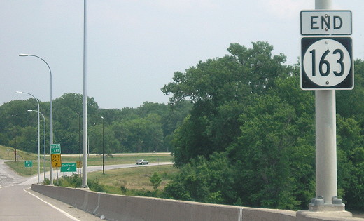
The left picture is approximately where the "End 163" sign has been placed, which is on the Illinois side of the bridge.
Additional pictures of the crossing can be seen on the US 34 page. These are all before the extension.
*Extending 60 along 75 to the state line with I-129/US 20/US 75 might make sense if and only if it resulted in the re-mile-marking and renumbering of interchanges along the Sioux City bypass and all the way up the 60 corridor. That way, "miles" that are in reality shorter or longer can be corrected to reflect the current four-lane mileage, and US 75 finally can be corrected too, at least for the four-lane portion.
**Extension of IA 330 down US 65 has since happened.
Pictures by Jason Hancock: First and third, June 2000; second, fourth, and fifth, 6/28/03; eighth, ninth, eleventh, and twelfth, 3/10/02
Pictures by me: Sixth, seventh, and tenth, 5/10/05
Page created 2/17/02; last updated 12/22/14