
(September 14, 1931-July 1, 2003)
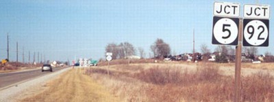
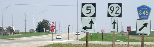
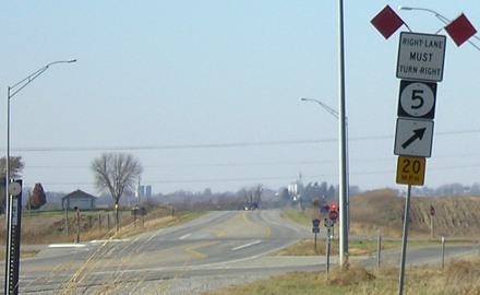
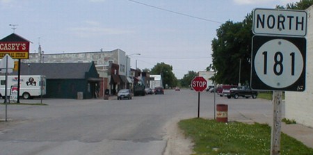
NORTH End: 4-way stop, IA 5 and 92, Marion County
Facing north on 181 (12/14/02)
Photos by Jason Hancock
Facing north on 181 (12/14/02)
Photo by Jason Hancock
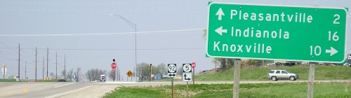
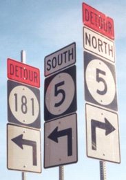
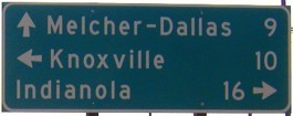
All the signs are on metal poles because they've been in various setups due to construction on IA 5. During the summer of 2002, while upgrading 5 to four lanes between Des Moines and Knoxville, 181 was completely detoured off its route. The LGS below can be seen behind the shields in the foreground.
Facing north on 181 (12/14/02)
Photo by Jason Hancock
This intersection is identical to the east ends of IA 252 and 349 in a sense. All end where a pair of highways split/join and one continues on in the same direction as the ended spur.
Facing north on 181 (4/17/05)
This post-decommissioning picture is one of the first with my new digital camera; just look at the purple skies below to see why.
Facing north on 181 (10/8/04)
Facing north on 181 (8/24/19)
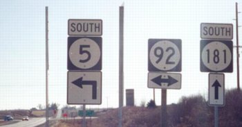
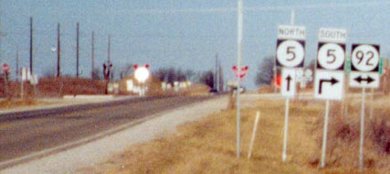
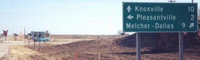
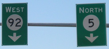
Facing south on 5 (12/14/02)
Photos by Jason Hancock
The 5 shield in the left picture is in the center of the right picture.
Facing south on 5 (12/14/02)
Photo by Jason Hancock
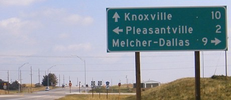
Facing south on 5 (10/8/04)
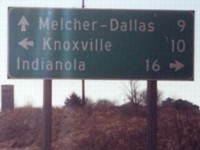
A close examination of the LGSs (mainly spacing) makes it appear Jason's picture and the right one show two different signs. (The same may be true for the LGS facing north, above.)
Facing south on 5 (4/17/05)
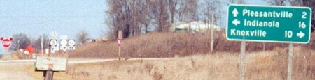
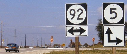
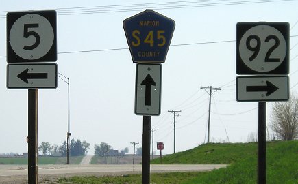
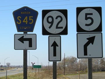
Facing east on 92 (12/14/02)
Photo by Jason Hancock
Facing east on 92
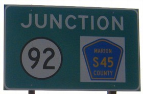
Ironically, while the replacement LGS on IA 92 removes the diagonal southbound arrow...
Facing east on 92 (4/17/05)
... the shields at the intersection add a diagonal. Observe the three separate poles being used instead of the bracketed shields on two poles like they used to be. And after this overconsumption of wooden poles, metal ones keep popping up.
Facing west on 92, but heading north on 5 (overhead sign) (11/19/07)
Facing west on 92, but heading north on 5 (11/19/07)
Facing west on 92, but heading north on 5 (11/19/07)
Facing west on 92, but heading north on 5 (11/19/07)
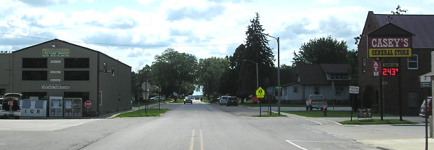
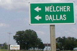
SOUTH End: (Near the) stop sign, just south of the intersection of A St. SW and Main St., Melcher-Dallas, Marion County
Facing east on B Street N, north of the end (10/8/04)
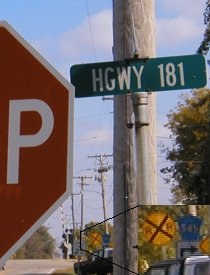
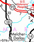
In Dallas, the north half of the town that merged in the late 1980s, the north-south portion is (still) named Highway 181, but as "Hgwy" instead of either "Hwy" or spelled out. One block of 181 goes east-west and then south again, as seen in the zoomed-in part of the image.
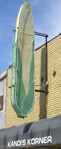
This is the second-biggest ear of corn I've ever seen. No, really. (8/24/19)
Facing south on 181 (8/24/19)
This is a wider view of the area in the two pictures below.
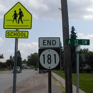
Facing south on 181 (6/1/02)
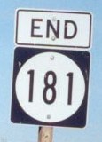
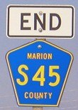
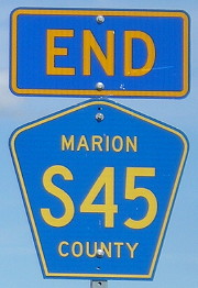
Unlike nearly all spurs that end at intersections (for example, IA 229), the "End" sign is on the far end of the intersection. I have no idea why this particular road includes the intersection while others do not. County Road S45 continues south to an intersection with G76, where S45 goes a mile west and then continues south again.
Facing south on 181 (8/24/19)
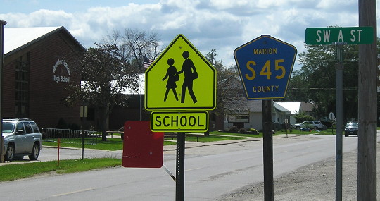
The high school is in the Melcher part and the elementary is in the Dallas part.
Facing north on 181 (6/1/02)
The school zone sign on the far left is the same one in the above picture.
If you're wondering about the hypenated name, the separate but bordering towns of Melcher and Dallas merged in the late 1980s; the Rand McNally 1990 Atlas (I think) features it on the back as one of the many changes made to this edition of the atlas.
Facing east on G76/S45 (6/1/02)
...although this county sign south of town doesn't know it yet. (The billboard in the background does.)
Last seen: 2003
Page created 9/18/02; last updated 1/27/08 5/8/20