
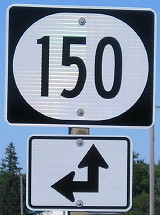
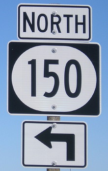
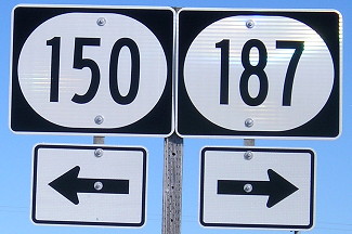
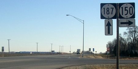
NORTH End: Intersection, IA 150, Fayette County
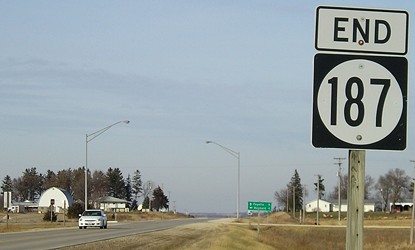
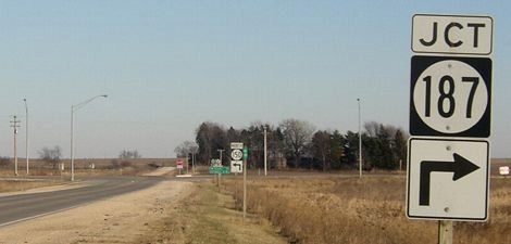
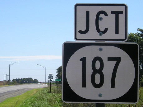
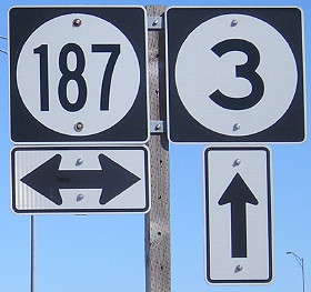
Facing north on 187 (11/20/06)
Until 1981, this was the end of IA 154, and then 187 superseded its entire route. The 1981 state map, with a notation that routes are correct as of October 1980, shows 154 still on its route and ending at 3 but 187 coming north to the same intersection instead of going to Backbone State Park like it had before. This sign was replaced between my trips in December 2004 (sign with smaller digits; see SB 150 below) and November 2006 (above).
Pictures alternate between the previously-standard signs in Iowa and the mid-2010s redesign.
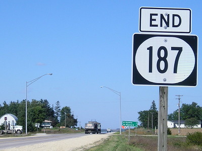
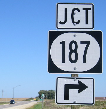
Facing north on 187 (9/26/16)
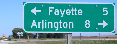
LGS in background of above picture (12/14/04)
Facing north on 187 (9/26/16)
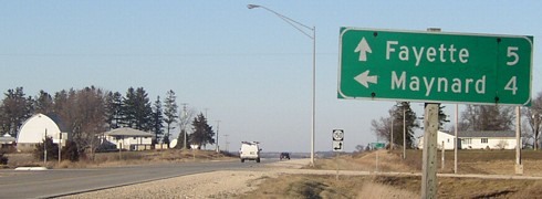
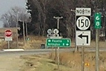
Facing east, but heading north, on 150 (12/14/04)
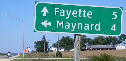
Facing east, but heading north, on 150 (9/26/16)
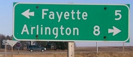
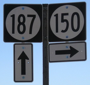
Closeup of signs and LGS in background (11/20/06 and 12/14/04)
Facing east, but heading north, on 150 (9/26/16)
Facing east, but heading north, on 150 (12/14/04)
Facing east, but heading north, on 150 (9/26/16)
Facing south on 150 (9/26/16)
Facing south on 150 (12/14/04)
Facing south on 150 (9/26/16)
Facing south on 150 (12/14/04 and 9/26/16)
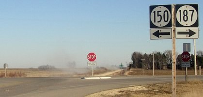
This is the only sign set at the intersection that wasn't replaced with wide shields.
Old NORTH End (June 30-November 25, 1980): Stop sign, IA 3 and IA 154, Fayette County
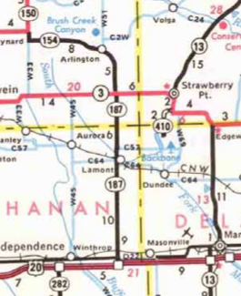
The 1981 state map shows IA 154 and IA 187 meeting at Starmont corner (more on that below). DOT files put online in the mid-2010s show this situation did happen, but for only a matter of months. On July 1, 1980, the extension of 187 into Backbone State Park (C52) was removed and the highway rerouted north - but it wasn't until Thanksgiving week that IA 154 was eliminated. The state map was printed with October 1980 designations - and no 1982 version came out.
Pre-roundabout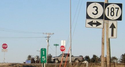
Facing north on 187 (12/14/04)
For more than 40 years, the shield at right would be a 154 (with the same up arrow) - that is, if it was signed from this direction. "End 187" would probably have been a little farther behind. Mile marker 15 is here, but further up the road is MM 15A, most likely to reconcile 187's markers with 154's so the numbers could just be replaced but the poles themselves not moved. This theory is borne out by the fact the mile markers between Arlington and IA 150 are on the right side of the road (signifying a count from IA 150). On the one hand it's an inelegant way to do things; on the other hand, it appears the mile markers were close enough that it made sense.
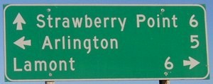
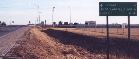
Facing east on 3 (12/14/04)
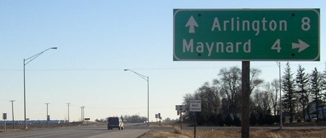
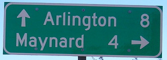
This LGS has the three communities (in order) that make up the Starmont school district - a conglomeration of town names Strawberry Point, Arlington, and Lamont. The school in Arlington is abandoned and was targeted with an EPA brownfields grant for demolition.
Facing east on 3 (12/14/04)
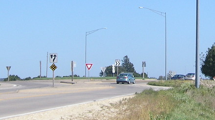
This standard, run-of-the-mill intersection was replaced with (ick) a roundabout in 2009.
Facing west on 3 (9/2/08)
Facing south, but heading east, on 154 (now heading south on 187) (12/14/04)
This is the most likely candidate for an "End 154" pole.�
Facing south, but heading east, on 154 (now heading south on 187) (1/26/02)
Photo by Jason Hancock
The school building is here, at the northwest corner of the intersection. At least this one is at the intersection of two state highways unlike Wapsie Valley, which is all by itself on a county road in the middle of the district.
Post-roundabout
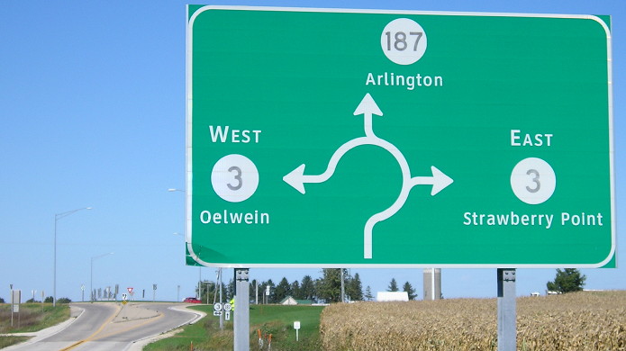
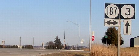
Facing north on 187 (9/26/16)
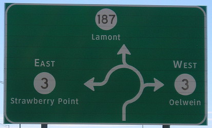
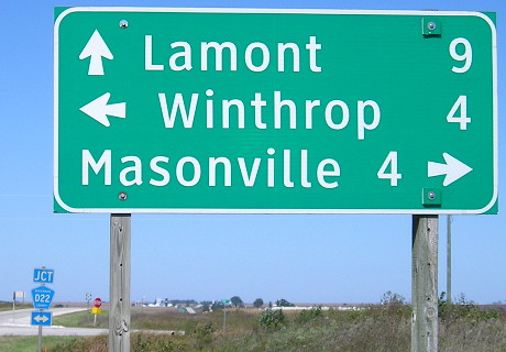
There are no mileages on these roundabout signs, but distances to the noted towns appear after the intersection.
Facing north on 187 (9/26/16)
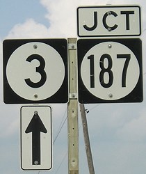
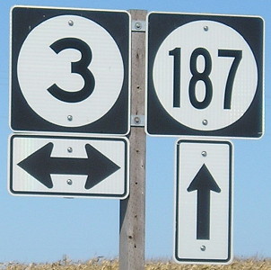
Facing east on 3 (9/26/16)
Facing east on 3 (9/26/16)
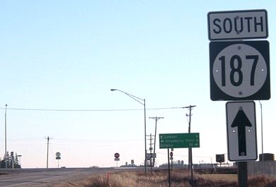
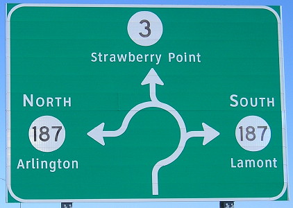
Facing south on 187 (9/26/16)
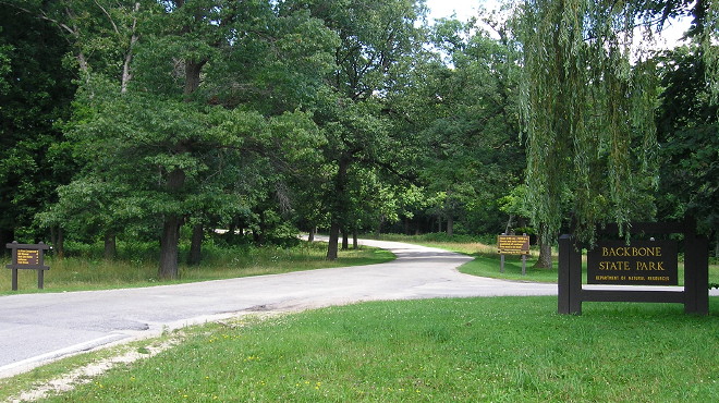
Old NORTH End (1931-80): Backbone State Park (west entrance), Delaware County
Facing east, but heading north, on 187 (1/26/02)
Photo by Jason Hancock
Jason writes that there is still a stray mile marker (11) on C57, 187's old route. Backbone State Park was the only state park to be served by two state highways: IA 187, for the park's west gate, and IA 19/410, for the park's north gate. (IA 19 inexplicably became 410 in 1957.)
Facing east, but heading north, on 187 (7/29/17)
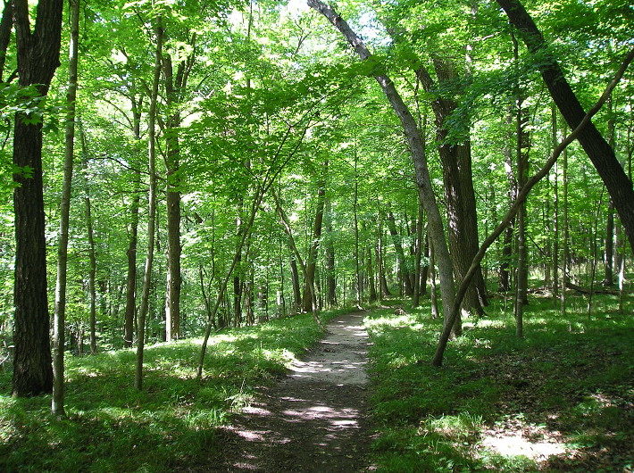
Just a photo from one of the trails in Backbone State Park. (7/29/17)
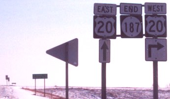
SOUTH End: Interchange, US 20, Buchanan County
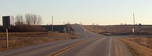
Facing south on 187 (12/14/04)
The upcoming intersection was the end of 187 prior to 1976, when the four-lane 20 opened west of here. After the four-lane was built, IA 939, which was the 'secret' designation for old 20 until 2003, went to the right. The extension also created a Mile 1A on 187. The 'hill', 3/10 mile south of the intersection, is the bridge over 20.
Facing south on 187 (1/26/02)
Photo by Jason Hancock
Facing south on 187 (12/14/04)
This sign set is about halfway between the bridge and the intersection in the above picture. (The 187 shields are different.)
Facing north on gravel Washburn Avenue (12/14/04)
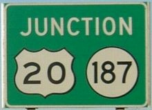
Heading south, 187 becomes a gravel road right after the eastbound (south-side) ramps, and then that road becomes a T intersection half a mile south of the interchange. These signs are on the gravel road. Notice that the 20 shield on the green sign seems like a 3-digit-wide one.
Facing north on gravel (12/14/04)
The "No Passing Zone" sign marks the start of pavement, and presumably 187.
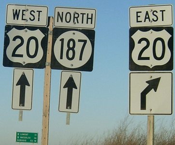
Facing north on 187 (9/26/16)
In the bottom background you can see the intersection with D22 (old 20).
Facing north on 187 (9/26/16)
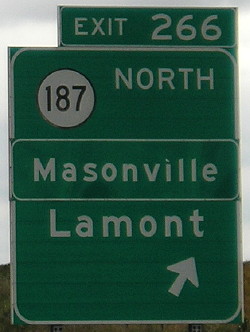
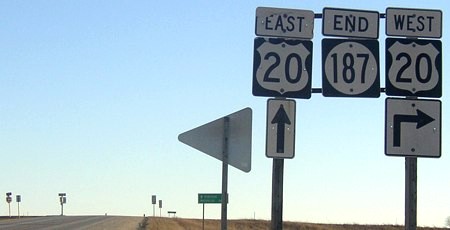
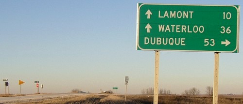
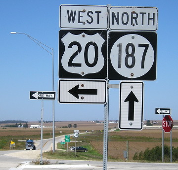
Facing east on 20 (9/23/11)
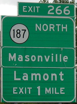
Notice "Next Right" in the middle picture instead of an exit number, because 20 did not have exit tabs until less than 20 years ago. The "Masonville" is in a smaller font most likely because it was added later, but why does it have a frame? What was in that spot before?
Page created 5/7/02; last updated 1/3/18