 WEST
WEST
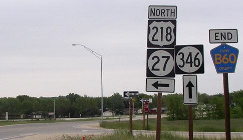
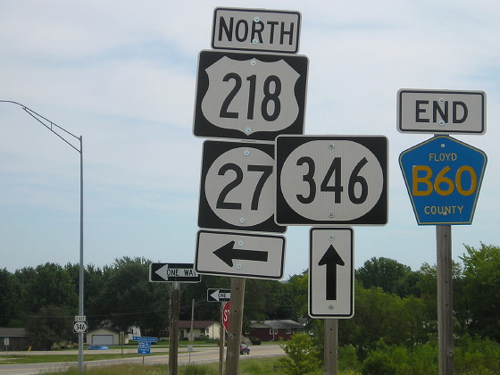
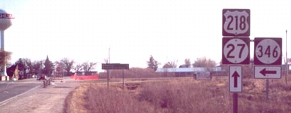
WEST End: Interchange, US 218/IA 27 and B60, Nashua, Chickasaw County (barely)
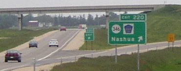
Facing west on 346 (5/19/04)
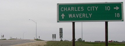
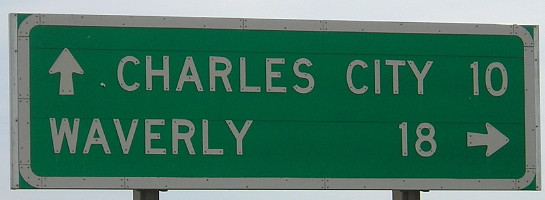
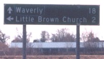
Let's start off this page with a game of "What's wrong here?". Aside from the white border being thicker than usual (a problem plaguing all signs along the Nashua bypass), cities accompanied by an ahead arrow are listed on top.
Facing west on 346 (5/19/04)
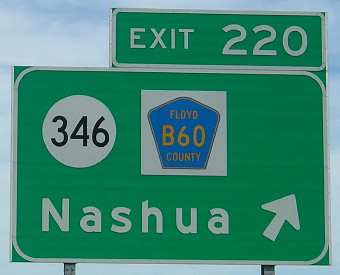
Traveling south, the Avenue of the Saints only barely makes it into Chickasaw County. The pre-freeway route ran for about four miles only half a mile away from the county line. From this perspective, the county line is in the background, but all the blue B60 markers at this interchange - including the BGSs - say Floyd County.
Facing west on 346 (8/4/15)
...My goodness, those wide shields are hideous. If you're going to use a wide shield, use the wide numbers, too! Instead, the shields use the same Series B lettering as the square ones, as seen below.
Facing east on B60
The westernmost signs at this interchange, on the county road approaching 218, were not replaced with wide ones.
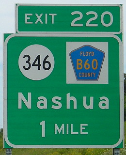
Facing east on 346 (8/4/15)
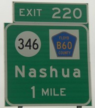
This is what the mileage sign at the top should look like, with the arrows in the correct position (but the cities reversed in this case).
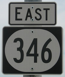
Facing east on 346 (7/31/05)
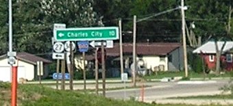
This photo from 2005 makes cause for further study. This LGS wasn't the focus, but when working on the photo I noticed that the sign was in lowercase whereas its counterpart a year earlier was in all-caps (top photo). Maybe they switched - or there's even more inconsistency going on than usual.
Facing east on 346 (5/19/04)
In a time when the call is for larger, more-easily-legible signs, which may be part of the reason the larger-initial-letter "Butt-Ugly Kansas-Style Signage" visible here has now been deemed the signing standard, it's ironic that regular black arrows on newer signs have visibly shrunk. At least the county road's end is signed, even if this photo is in Chickasaw and not Floyd.
Facing east on 346 (8/4/15)
The tilted left pole becomes even more obvious.
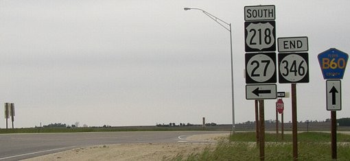
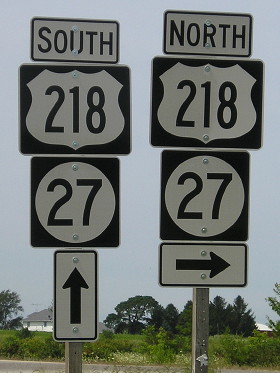
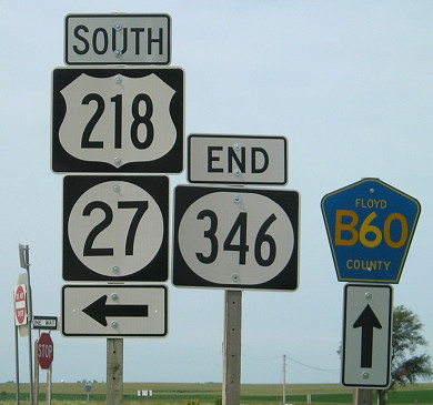
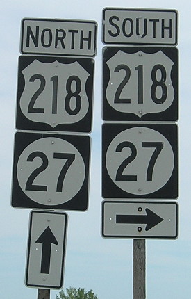
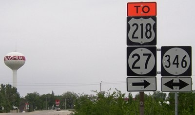
Facing south on 218/27 (5/19/04)
Fredericksburg and/or West Union would be worthy additions to the left BGS, as would cardinal directions. Additional note: The exit numbers are (I think) 3 inches taller than in the past, something you can't tell unless comparing this exit tab to older ones and noticing more green space around the word "Exit".
Facing south on 218/27 (5/19/04)
They're not the tiny until-recent standard county signs, but they're not the all-caps new style either. Signs like this one also exist for Bremer County going south and for Chickasaw and Floyd going north, all part of the Nashua bypass construction.
Closeup of the exit signs (5/19/04)
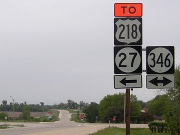
Facing north on 218/27 (8/4/15)
Here, very clearly, we can see Floyd County on the pentagons, although the interchange is in Chickasaw County. But as noted above, the county line is so close that it makes some sense.
Facing north on 218/27 (5/19/04 and 8/4/15)
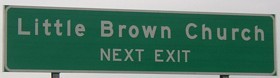
When I put up my pictures, I remarked that it was weird to say "Next Exit" when the exit already had a number. As you can see, that was changed in the new version of the sign.
Old WEST End: Stop sign, US 218, Nashua, Chickasaw County
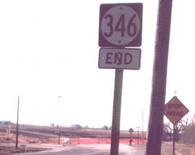
Facing west on 346 (11/17/02)
Photo by Jason Hancock
The grading for the extension of 346 to the Avenue of the Saints is in the background. In the summer of 2002, when the detour for US 218/IA 27 ran due south from Charles City on T64, 346 was 'extended' west six miles into Floyd County to meet it. (If you have a picture of the south junction of T64 and B60 please e-mail me so it can be included as a temporary end.)
Facing west on 346 (5/19/04)
The car is crossing 346 at approximately its old west end. Jason's picture was taken between this one and the one below, which is just to the west. The orange of the "To" arrows may be from construction or it may be a new rule.

Facing west on 346 (5/19/04)
The red and white cars are on old 218, which now has the stop signs. Note the Chickasaw B60 shield. The LGS at the top of this page is to the upper right of the blue pickup.
Facing south on 218/27 (11/17/02)
Photo by Jason Hancock
During construction, this intersection became a three-way stop.
LGS in above picture
Photo by Jason Hancock
Facing south on 218 (5/19/04)
Facing north on 218 (5/19/04)
Surrounding area information: 346's ends/Nashua bypass
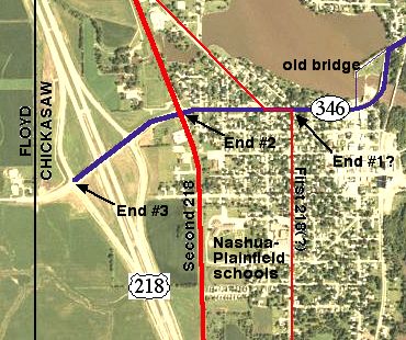
Base map from USDA
The four-lane is the third alignment of 218 in the Nashua area; the first used current Greeley Street and Charles City Road (natch). This was 3/10 of a mile east of the pre-four-lane alignment, and was changed circa 1960. It's possible that the very earliest alignment used the diagonal street east of the school to go through the business district, and then back west, making End #1 the intersection of 346 and the thin line marked "old bridge" (which has been removed). This also means that IA 346 joins IA 117 as a route to have both of its ends physically moved but the changes can't really be seen on the map.
Facing north on 218/27 (11/17/02)
Photo by Jason Hancock
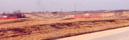
This, on the south side of Nashua, is where the freeway would split from the current road. The part of 218 just north of here would later be blocked off (see below).
Facing north, looking from B60 (11/17/02)
Photo by Jason Hancock
This is B60 at the new alignment of 218 and 27. This area is where 346's west end was moved.
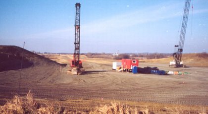
Facing south, looking from B60 (11/17/02)
Photo by Jason Hancock
This shows the future alignment a little better. The grade runs up to near B60 (pavement in the foreground).
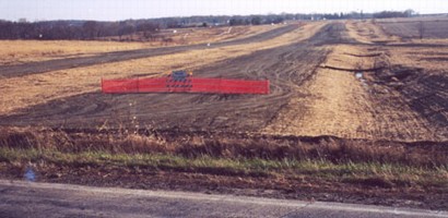
Facing south on 218, south of 346 (5/19/04)
You can see the old route run to a dead end and the four-lane pick up the old road. The old B60, to the right, dead-ends before the freeway.
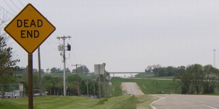
Facing northwest (5/19/04)
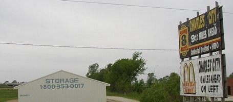
At far left behind the building is the bridge for 346/B60. The road crosses the back of the picture. The billboards aren't very valuable now given the only people to see them are coming from a dead end in Nashua, and they may be from before the Charles City bypass.
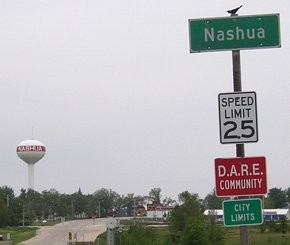
Facing south on 218 (5/19/04)
The intersection with 346 is in the distance. Nashua is among the towns with a round water tower with the town name in a center stripe, as opposed to the "classic" five-pole cylinder.
The Church in the Wildwood
Facing east on 146 (7/31/05)
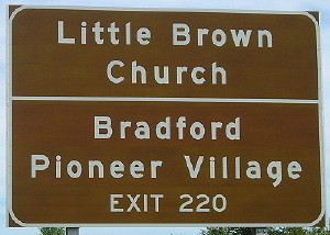
A bit east of this sign - which noticeably ignores US 18 - is the Little Brown Church.
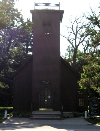
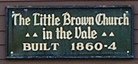
Instead of typing a history here about this famous church - which was built after a song describing it was written - here's a link to the church's website. (7/31/05)
The original 346 was nominally a spur to the village of Bradford, northeast of Nashua. In reality, its designation was in order for the state to be in charge of a connection to the Little Brown Church.
Bradford was dropped from the map in 1972 as a result of disincorporation. Bradford is currently the only town to serve as the end of a spur that has been removed from the official map entirely.
After 346 leaves the Little Brown Church, it enters its straight post-1953 alignment to US 63. It's only by fortune and location that 346 lives; all the numbers around it were spurs (except, arguably, for IA 347). Between the decommissioning of IA 412 in 1983 and the Second Great Decommissioning it was the seventh-highest non-spur number in Iowa; it has now moved up to third.
My plans for a Second Great Renumbering, bringing all highways down to a lower number and, as a bonus, restoring the original 1-107 program, would renumber 346 as a new IA 90. I know it's a pipe dream, but I'd be happy if they just knocked the numbers above 200 down to double digits.
Page created 2/28/03; split 6/9/04; last updated 8/27/16