
(1960-1983)
WEST End: ?, US 63/Sergeant Rd., Waterloo, Black Hawk County
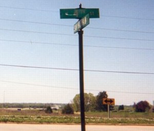
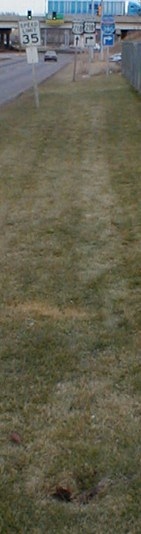
This intersection no longer exists due to the construction of four-lane US 20 on top of where it was. San Marnan Drive (412) now ends at 4th Street, which once, incidentally, was 63. In fact, before 63's relocation onto Sergeant Road, San Marnan ended at 4th then as well! Mile marker 2 still stands half a mile west of Kimball Avenue; if I remember correctly MM 4 may have survived into the late 1990s. Here's what the area looked like in the first decade of the 21st century. All of these signs were removed and replaced in 2009.
The original signs have a special significance I would discover more than a decade after I started this website: The official contract letting date for "Signing, Relocated U.S. 20 from Ia. 57 to U.S. 63" was my birthday.
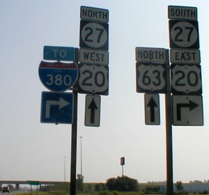
Facing north on 63 (June 2002 / July 2007)
Documents from the Iowa DOT construction document archive for the US 20 freeway show that the current intersection of 63 and the eastbound ramps sits right on top of where San Marnan Drive intersected Sergeant Road for 15-ish years (between construction of Sergeant and the four-lane). Initial surveying for 20 between 63 and 21 was done way back in 1969.
Facing north on 63
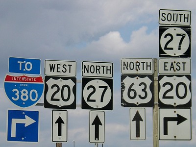
Compare the sign on the right to the bridge two pictures down.
Facing north on 63
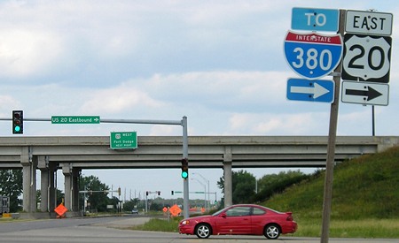
The interchange of 20 and 63 is a folded diamond; EB 20's exit ends at the right of this photo, and the onramp is a right turn here. The eastbound exit has its own bridge across 63 (see below). The car is at the end of the eastbound offramp.
Facing north on 63
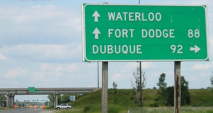
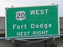
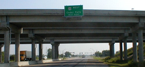
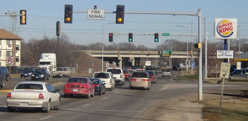
There are three bridges over 63. The one in the foreground is a separate bridge for the eastbound exit ramp, then the eastbound lanes, then westbound. The LGS reads "20 West / Cedar Falls / Next Right". After new 20 opened in Hardin and Grundy counties in 2003 nearly ALL instances of "Cedar Falls" on signs, including this one, were changed to "Fort Dodge."
Facing north on 63
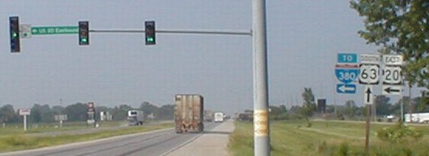
According to the Oct. 4, 1983 Waterloo Courier, 412's final months were spent ending on the north side of the bridges, here at a stoplight shared with Greyhound Drive. "Highway 412 traffic between 4th Street and Highway 63 is being rerouted onto the Freeway 520 westbound offramp ... for construction of the embankment for mainline 520 across existing 412." (Either the Courier was referring to San Marnan as 412 for convenience because it was recently decommissioned, or it was decommissioned within 90 days of that article. Or 412 was actually turned over the same time the new four-lane opened in 1984 and our date is wrong.) The double-left-turn lane is an artifact from this interchange being built shortly before the opening of Waterloo Greyhound Park; this is what used to be on the now-completely-blank BGSs on 20. As far as I know, not much if anything is going on there now - and an application to put a casino there was turned down in spring 2005. (A different one was approved, southwest of the I-380/20/218 interchange.)
During construction and before relocation of 20, the number for the four-lane road was 520. I don't think it was signed as such, though, although the segment between 63 and 297 opened in 1984, but the 20 numbering wasn't actually rerouted to it until the rest of the road south of Cedar Falls opened in 1986. Other freeway projects given the "520" designation include the current 20 freeway around Sioux City and at least the 3-mile portion between US 69 and I-35 before full rerouting.
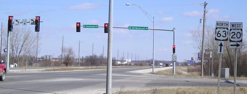
Facing south on 63, same intersection as the fourth picture
The shield here and the corresponding northbound shield at 20 WB are two of the very few Series D shields for 63 I have seen in Iowa; the only other ones I know of are at the IA 149 intersection, which is strangely signed anyway, and at the east junction of US 6. In the second half of 2004 these 63 and 20 shields were replaced, leaving only the northbound shield of this interchange in C (above).
The tree at right is part of a clump on the west side of the intersection. Aerial photos and topographical maps seem to indicate that there is a very old piece of Ranchero Road that followed the section line directly (before 1974 if not earlier), while current Ranchero angles to meet 63 farther south, and the old part has a bunch of trees on it.
Surrounding area information: End of San Marnan Drive
Facing west
You can see the freeway in the background. San Marnan continued on the south side of a cemetery to meet 63 between 1962 and 1983. Between 1962 and 1967, 63 came here from its current alignment (Sergeant Road) to 4th Street to resume its old route until construction was finished to the north. The bridge over US 20 is immediately to the left of this picture.
EAST End: Stoplight, Old US 218/La Porte Rd., Waterloo, Black Hawk County
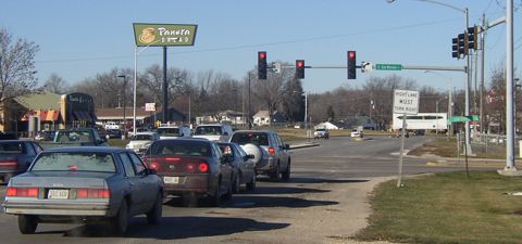
Facing east on 412
Fire station is to the left (and in below picture). Does anyone stop there on red? Pretty much no, although that's where a 218 double-arrow or "End 412" may have been. The Burger King on the right got a facelift in the early 2000s. Look below for some strange occurrences with the I-380 interchange.
Facing northwest, at the Burger King
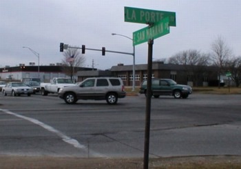
Traffic is stopped at the end of 412. The blue-green SUV is turning from 412 to old 218 north. Street signs in the foreground and background both show La Porte Road and San Marnan Drive. In 2003, street signs were placed on the stoplights but they are in a weird font set.
Facing west on San Marnan
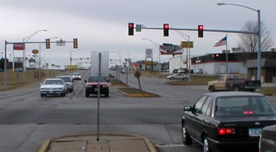
The red pickup in this picture is in the same place as the white pickup in the above picture. The old pickup on the right is turning from old 218 south to 412 west.
Facing north on 218
This is about the spot for a "412 <- 218 ^" assembly. The Panera was built in 2003.
Surrounding area information: La Porte Road at 218
Facing mostly south
If you're curious, La Porte Road (old 218) is now an 'exit' from current 218 southbound shortly before the Mitchell Avenue stoplight and the beginning of I-380. It actually picks up again on the northbound side, except there's no access to it from 218 and at this point 218 would have turned northwest onto Washington anyway. You can drive the two pieces heading south by crossing 218 on Hawthorne Ave. and taking this turn immediately after. The red car has just turned on to La Porte Rd. A sign shortly before this (behind the photograph) says "La Porte Rd. to Mitchell Ave. WESTBOUND" because at the Mitchell stoplight there is no right turn allowed (well, theoretically anyway). A close glance at the sign shows it once said "La Porte Ave." and the "Ave." had been pasted over with "Rd." As of 2007 that sign has disappeared.
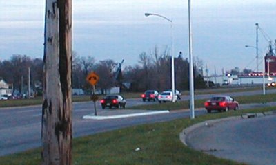
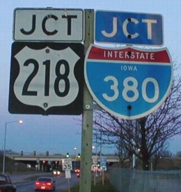
Almost an EAST End: I-380 exit 72, Waterloo, Black Hawk County
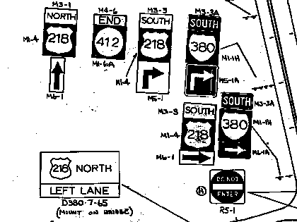
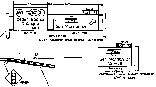
This image from the Iowa DOT archives shows that signage for IA 412 extending the short distance from La Porte Road to I-380 was planned at the time of the initial sign letting date, March 17, 1983. However, the documents also show the plan was revised, removing all mention of IA 412 from the interchange in the finished product. The rest of the signs in this diagram, however, were placed, as seen below (and may have escaped genericization so far).
These would have been on southbound 380/218 as the interstate began. The "412" has been lined out. Because the BGSs in use prior to 2006 (see bottom of this page) did not have open space, it is safe to say that the designation was removed before the signs were created.
There's another easter egg of sorts in this diagram as well: When the northernmost part of I-380 initially opened, US 20 was not signed on the east-west freeway. Notice that it says TO 20 and 21, and omits Cedar Falls. That pegs these signs' actual erection date to the summer of 1984, because 380/Freeway 520 opened west of Raymond to 21 Aug. 9. That would be the case until June 14, 1986, when Freeway 520 opened all the way to the Grundy County line and the 20 designation was placed. The left BGS also, like the modern version, has an I-380 shield as if the traveler wasn't already on I-380.
(All pictures facing northeast)
This is the only I-380 interchange not involving IA 27. In November 2001, you got to see this sign (above), which had been around for a while ... but in January 2002 (left) there's a big hole. (Notice that the below assembly is visible in the background of both pictures.) Someone e-mailed me a while back saying the sign had been wiped out in an accident; as of 2007 it has yet to reappear.
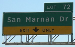
I-380 technically ends about half a mile north of the south side of this bridge, but is only signed for southbound here, because northbound runs into the Mitchell Avenue stoplight. A gantry for Exit 72 appears just south of the light, and side mile marker 73.05 appears right after it. On the northbound side, there is a 73.10 marker just south of the intersection; I think the corresponding south one has fallen off because there is a pole there. (New median tenth-mile markers stop at 73.0.) Between November 2001 and June 2002, the "Eisenhower Interstate System" sign that was on the first exit gantry disappeared.
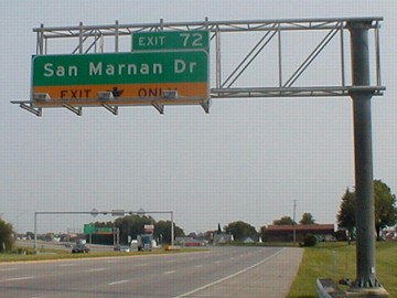
Facing northeast, but heading east, on San Marnan Drive
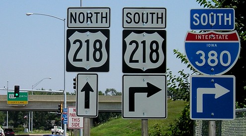
South of this intersection, traffic on the onramp has to almost immediately merge left or take the 380/20 combined exit; the interchange is a modified cloverleaf, with one of the inner loops replaced by a sweeping southbound-to-eastbound arc above the rest of the traffic (as the 20 WB ramp splits off before the bridge crosses 20). The SB BGSs at this interchange do not have IA 27.
Pieces of La Porte Road (old 218) appear in the northeast corner of the interchange and south of the interchange, both labeled as Texas Street. Mile marker 178 remains on the latter. The pavement in the former, coupled with looking at aerial photos, implies that a very small portion is still there and used. The road that goes past the Burger King here, though, curves around to become north-south Hess Road.
Facing west on San Marnan Drive
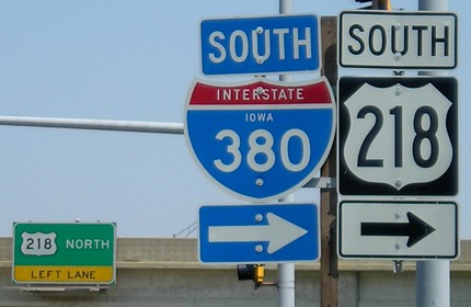
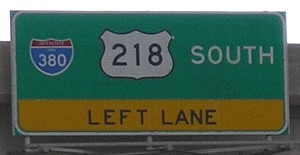
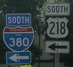
Facing south on 380 (2002 / 2007)
The San Marnan Drive exit is the first BGS for southbound I-380. Many more pictures from the interstate can be seen on the I-380 page.
Last seen: 1983 (1981, 1983 maps)

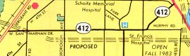
At left is IA 412 as it appeared on the regular state map in 1981. At right is the last Waterloo-Cedar Falls map with 412 on it, in 1983, from Jason Hancock. How can a road be proposed yet scheduled to open?
*Inaugural Highway End*
All pictures by me: First, sixth, and eighth, 6/25/02; second-fifth, 19th, and 20th, 7/15/07; seventh, 3/15/05; ninth, early June 2002; tenth and thirteenth, 12/14/04; eleventh, twelfth and 15th (left), 1/9/02; 14th and 16th, 11/21/01; 17th and 18th, 7/25/07; 21st, 6/27/02; 22nd, 7/25/07
Page created 12/1/01; last updated 3/13/14