
(September 28, 1938-July 1, 2003)
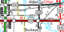
NORTH End: Stop sign, IA 941/Old US 20 (now D20) and S25, Alden, Hardin County
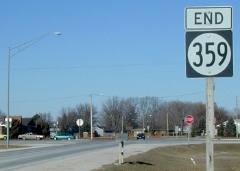
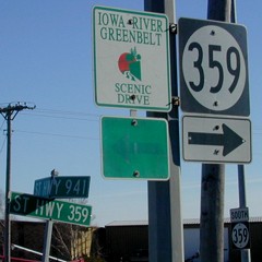
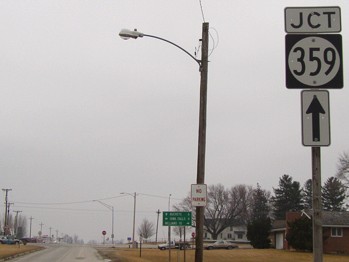
Facing north on 359 (December 2002)
From when US 20 was rerouted in 1991 to 2003, 359 was a double spur, with neither end at a signed highway. If the town of Alden did not exist, it's possible that 359 north of new 20 would have been assigned another secret 900 designation with the intention of turning it over. There was no signage for S25 before or after decommissioning. The first sign on 359 is at the left, although there is a "Jct 359 ^" on the north-south street; it is just to the above right of the black car (see below).
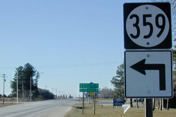
Facing north on 359 (August 2003)
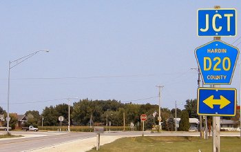
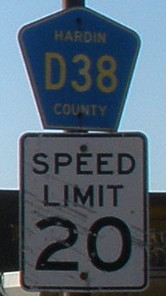
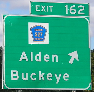
Both 359 and 941 have been assimilated into the Hardin County road system. Notice S27 shield on light at left (the new designation for 359 except its last mile into Buckeye, which is D38).
LGS before the sign above
Facing east on 941
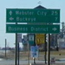
The westbound LGS heading out of Alden, about directly across from here, says "Williams 11; Webster City 25; Fort Dodge 46." The road coming south to this intersection comes at an angle; Alden's roads are built to parallel the Iowa River. It's possible an early alignment of 20 went left here and came out of Alden on what is now D15, angling southwest toward the current road, probably with the same possibility that D15 west of Iowa Falls was the same. Maps indicate what is now old 20 got its 1970s alignment west of town in 1932, with the segment between Alden and Iowa Falls paved in 1933.
Facing southeast-ish
At left is the only signage of 941; it doesn't even have its own mile markers. In the middle is the same Iowa River Greenbelt road seen at highways 118 and 215 (with the same faded arrow...hmm...). At lower right is the first sign southbound.
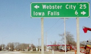
Facing west on 941 (December 2002)
While eastbound signage is conventional, this is the first westbound one. This should be"Jct 359" since there is a second assembly directly under the LGS, as seen below, under the picture that indicates what this pole holds now.
Facing west on D20 (August 2003)
Closeup of LGS in background
Facing south
Facing south
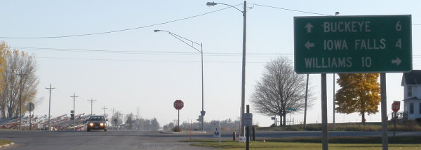
Notice the discrepancy between county and state in saying how far it is to Buckeye (7 vs. 6).
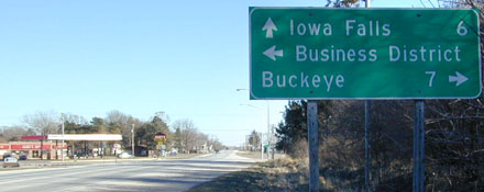
Facing east on 941
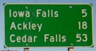
This is farther away from the intersection than its westbound counterpart is. According to the map it is 53 miles to the east end of IA 57 at US 218, which is actually on the east side of Cedar Falls.
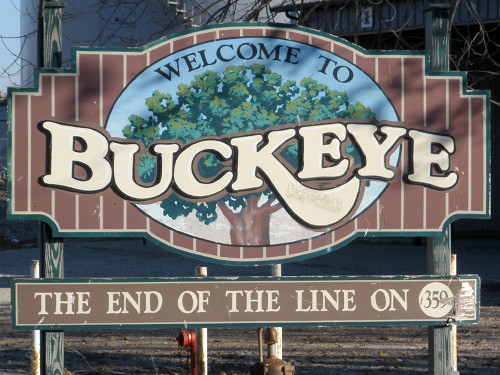
SOUTH End: Stop sign/T intersection, East St., Buckeye, Hardin County
Highway 359 does what 383 doesn't but should: Go into downtown logically, going south at the first street and then resuming an easterly direction.
Facing east (2011)
Facing north on 359
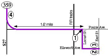
1) At the first intersection east of the railroad tracks, 359 goes south. Neither direction of 359 stops.
Facing east on 359 / Closeup
2) A better picture was prohibited by a parked semi. An enlargement of the street sign shows the intersection of Ellsworth and East.
Facing west on 359, same spot as above / Modern version of pole at right
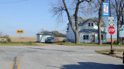
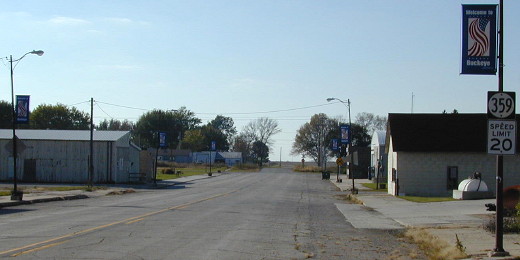
3) This Saturday picture removes all the cars from an already sparse business district. The northbound turn is at the grass in the background. The D38 shield shows that the county did extend the designation along the entire southernmost segment of the route.
Facing north on 359
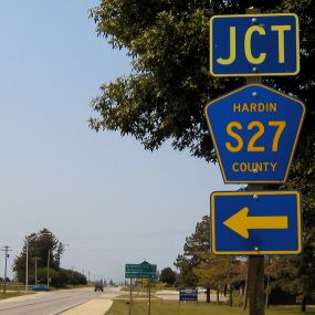
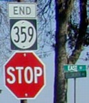
4) This is right after the curve north. There is no signage for S27 going south from here. You can see the bridge for the US 20 interchange and the first mile marker.
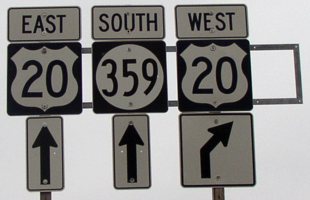
Surrounding area information: Junction US 20
Facing south on 359
The blank space at the end of the pole intrigued me. I'm not sure what it was for.
Facing east on 20 / Facing west on 20
The shield was popped off in summer 2003 but it took years for a county road shield to replace it.
Last seen: 2003
All pictures by me: First, third, fourth-sixth, eighth, and eleventh, 12/8/02; ninth and 19th, 3/20/03; tenth, twelfth, and 17th, 10/31/11; 13th-16th and 18th (includes zoom), 10/19/02; 19th, 10/31/03; 20th, 10/3/16; graphic 1/10/03
Page created 1/10/03; last updated 1/29/17