
(March 6, 1946-July 1, 2003)
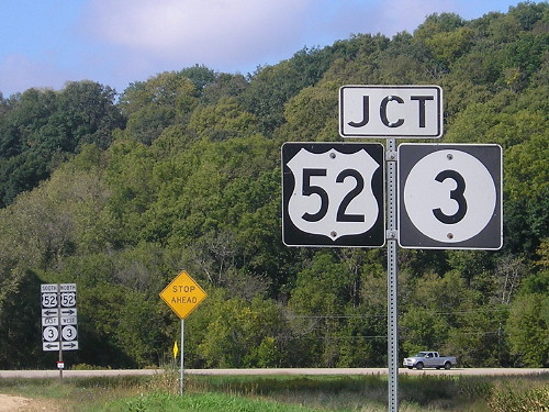
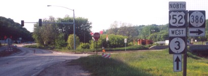
NORTH End: Stop sign, US 52/IA 3, Dubuque County
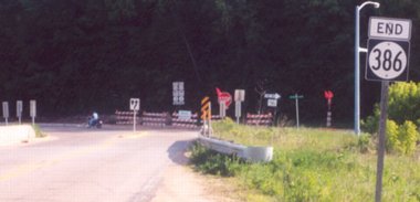
Facing southwest on 386
Facing southwest on 386
Right photo by Jason Hancock
Jason Hancock says "IA 386 has no directional markers on its entire route, mostly because of the change of direction it takes midway through the route. From the northern terminus it runs northeastward to the John Deere Dubuque Works, and from there it turns due southward to the other junction with US 52/IA 3." The roads that first made up 386 were not in their current pattern; four roads formed a semicircle in the area, and the "tip" of 386 was a bit to the south of its later point. The farthest-north part of 386, as laid out at decommissioning, was actually farther north than its northern terminus.
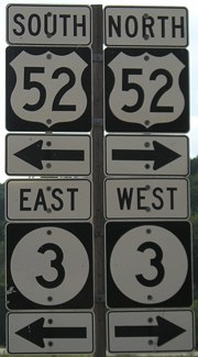
Exactly like the west end of IA 927, the signs at the end were installed by the Department of Redundancy Department. (One 52 shield, one 3 shield, and one double arrow are all you need.)
Facing southeast on 52/3
Photo by Jason Hancock
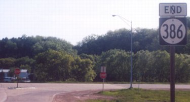
Old SOUTH End (1945-2002): Stop sign/light, US 52/IA 3, Dubuque County
Facing southwest (again) on 386
Photo by Jason Hancock
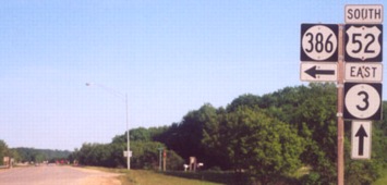
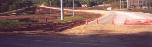
Here's a first: redundant assemblies on both ends. This view is no longer possible due to realignment with IA 32.
Facing northwest on 52/3
Photo by Jason Hancock
When these pictures were taken, the south end of 386 was as it had been since its commissioning. During 2002, 386 was realigned to meet the north end of IA 32 at the same stoplight. (This intersection had a stoplight until construction here.)
Facing northeast
To the left is the road above. Jason has reported that the road on which the south "End" sign was placed has been removed, and now ends just to the south. Since that is now also 32's north end, I will put them together on the same page.
Last seen: 2003 (2002 map)
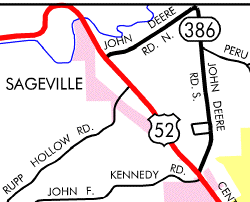
The entire route of 386 fit on the Dubuque inset.
Pictures by Jason Hancock: All but first and second, 5/26/02
Pictures by me: First, 9/28/15; second, 9/2/08
Page created 12/3/01; last updated 12/13/16