
(November 9, 1958-July 1, 1990)
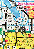
NORTH End: Camp Dodge, NW 78th Ave., Johnston, Polk County
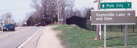
Facing north on 401 (April 2002)
Photo by Jason Hancock
The north end of 401 was hard to find, Jason says. Maps from that time don't extend to the suburbs, so it wasn't visible. Jason took a picture of the last LGS, which if you look at it makes plenty of sense if it was at the end of a state highway. (See also IA 301.) Years later, when route descriptions were posted online, NW 78th was marked as the north end of 401.
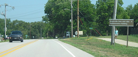
Same view (7/18/20)
Camp Dodge is the headquarters of the Iowa National Guard.
Surrounding area information: Mile marker 4
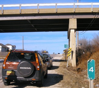
Facing north on 401 (1/19/04)
This intersection, Merle Hay Road and NW 70th Avenue, isn't an intersection at all. It's a two-lane to two-lane interchange that predates many segments of Iowa's interstates. The LGS in the background is city-standard. This is just south of where Merle Hay runs into NW Beaver Drive. Turning left at the onramp will eventually lead to IA 44 at IA 141. Update: Steven Witmer, planning assistant for the city of Johnston, tells me that the bridge was likely constructed in 1960-61, and in 2005-06, was removed to make a four-lane Merle Hay Road and at-grade intersection.
The mile marker isn't the only piece of 401 that stuck around into the 21st century. The highway has amazing staying power, popping up in phone book maps and newspaper graphics years after decommissioning.
North Des Moines beltway?
A document from the DOT's archives shows there was a preliminary interest ca. 1971-72 in building a road that curved from the above Merle Hay Road "interchange" northeast, running across the Saylorville Dam, and then east on Oralabor Road. Its project number indicates it would have been an extension of 401. However, nothing progressed past that study.
SOUTH End: Stoplight, US 6 E/Douglas Ave. and US 6 W/Merle Hay Rd., Des Moines, Polk County
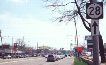
Facing south on 401 (April 2002)
Photo by Jason Hancock
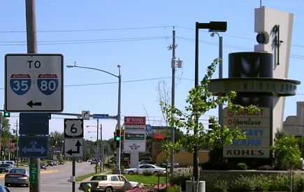
The "MHM" behind the 28 sign is for Merle Hay Mall. Both the mall and the north-south street here are named after Merle Hay of Glidden, one of the first Americans to die in World War I.
Facing south on 401 (8/14/06)
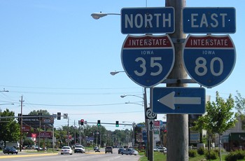
These signs are missing a "To" above them - 35 and 80 aren't here, but they can be reached by going either way on 6, really, or turning around for that matter. Another sign for 35/80 is after this one.
Facing south on 401 (8/14/06)
In late 2002, the Merle Hay Mall logo was redesigned (with a corner marker that looks like something out of Tomorrowland at Disney World).
Facing north, but heading east, on 6 (8/14/06)
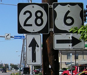
When 401 was decommissioned, 28 was extended north, duplexing with 6 until it split to go north to I-35/80 and end there. The east-west part of 6 is on Douglas; the north-south part here is Merle Hay, which 28 continues to follow.
Facing west on 6 (September 2002)
Photo by Jason Hancock
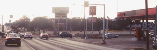
Differences between Jason's picture and mine below: 1) The mall sign; 2) The Younkers is now a Target; 3) The far right turn-sign poles and "West 6" marker have been removed (and other poles replaced); 4) The Texaco is now a BP; 5) Gas prices doubled.
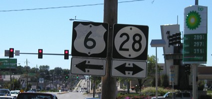
Facing west on 6 (8/14/06)
Last seen: 1990 (1991 map)
Page created 1/17/03; last updated 10/28/20