
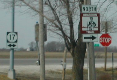
Old NORTH End (July 1, 1982-August 11, 2003): Stop sign, IA 17, Polk/Dallas county line
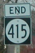
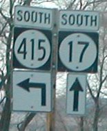
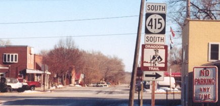
Facing west, but heading north, on 415 / Facing south on 17 / At the intersection (3/26/02)
Photos by Neil Bratney (415 shields were removed in August 2003)
The arrow under the 415 should just be a left arrow. The streets are based on Des Moines' street numbering system, with the streets working down to the confluence of the Des Moines and Raccoon rivers at Sec Taylor Stadium. The avenues work down to that spot theoretically, too, but peter out around 44th Avenue as east-west streets are named and not numbered in Des Moines.
(In a strange contradiction, north-south 2nd, 5th, and 6th are marked as avenues, while ALL the rest of them are streets. The exit sign on I-235 in downtown says "3rd St./5th Ave", and indeed near 415's south end the BGS on I-35/80 says "2nd Ave". I honestly have no idea why these three go against the grain, so to speak.)
Facing west, but heading north, on 415 (5/17/05)
Facing west, but heading north, on 415 (3/26/02)
Photo by Neil Bratney
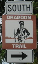
The Dragoon Trail runs along 415, and leaves 17 north of Madrid to follow some gravel roads.
Facing north on 17 (7/29/09)
Usually state parks are on special state park poles or at least in brown (see photo facing NE in Polk City, below). Under the left side of the sign is a 17 shield still in a bracket with a blank right side.
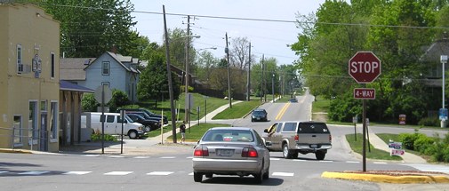
Old NORTH End (June 13, 1959-February 11, 1975): Broadway at 3rd St., Polk City, Polk County
Old NORTH End (February 11, 1975-July 1, 1982): 3rd St. at Broadway, Polk City, Polk County
(same intersection, two different directions)
The topographic map below is circa 1972. As you can see from the map and the 2002 aerial photo below it, the route into Polk City was abandoned when a new segment was built. A dam created an additional arm of Saylorville Lake. According to DOT route logs, 415 was rerouted on the barrier dam road in 1975 and the old segment was blocked off at the city limits. Other changes in 415's alignment are shown at the bottom of this page.
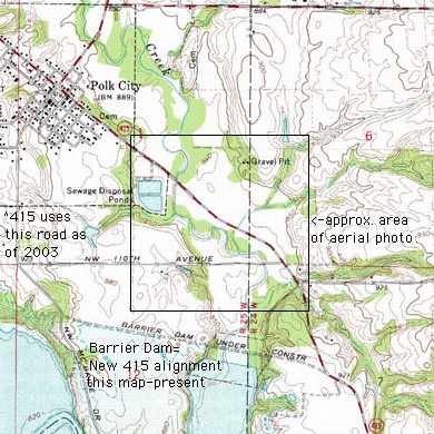
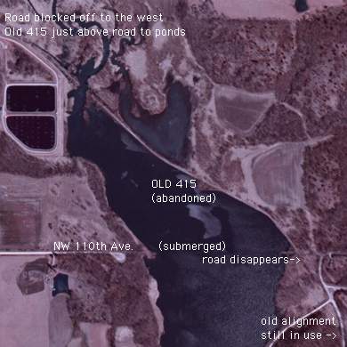
Topo map/photo from USDA/NRCS via ortho.gis.iastate.edu
Traveling southeast from Polk City, the road is completely blocked off at the entrance to the sewage disposal ponds (which parallels the old road for a while). Driving along present 415, you can kind of see pieces of concrete and asphalt littering the far side of the lake, leaving aerial photos as the only way to view this road. The entire area is in a wildlife refuge.
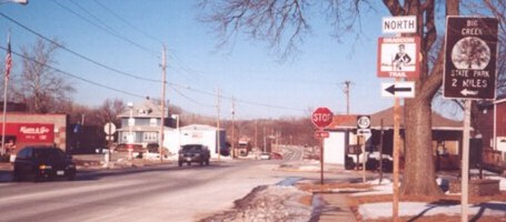
Facing northwest, but heading north, on Broadway (5/17/05)
The stopped car is at what was the end of 415 from its creation until the 1975 realignment.
Facing northeast, but heading north, on 415 (February 2003)
Photo by Jason Hancock
From 1975 to 1982, IA 415 ended here. Although Polk County gave County Road R6F to the state at the beginning of 1981, Polk City did not have an agreement until mid-1982, explaining why the extension was not shown on the 1981 state map.
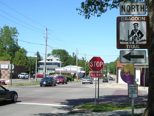
Updated view of intersection (5/31/17)
Now there are no state highways here.
Facing southeast, but heading south, on 415 (February 2003)
Photo by Jason Hancock
The first alignment of 415 began as you crossed the intersection. Today, that alignment is a narrower road that ends outside of town (see above).
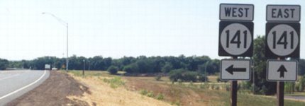
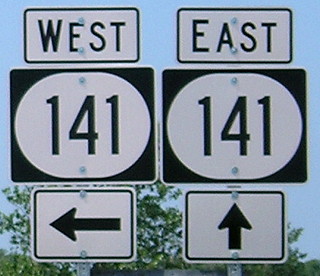
NORTH End: Interchange, IA 141, Polk County
Facing southwest, but heading north(!) on 415 (9/1/03)
Photo by Jason Hancock
In 2003, Polk County agreed to take over large chunks of state highways. Included in the deal were all of IA 931 and 945 (which the DOT had taken over in 1980), IA 316 north of Runnells, and 415 north of a point south of Polk City. But instead of 415 coming to an abrupt end, it was rerouted to cross the other "Mile-Long Bridge" in Iowa (see also IA 14 over Lake Red Rock), and take a new road to end at a new interchange with IA 141 southeast of IA 17. Why the funny font? Most likely, these signs were put up by Polk County because the county built the road and turned it over to the state afterward.
Shields in background of above picture (9/1/03)
Photo by Jason Hancock
The arrows below the shields are most likely also Polk County's. Note that the "141" is in Series D, a font usually reserved for 1-digit and sometimes 2-digit shields, and it looks better here.
Facing southwest, but heading north, on 415 (7/18/20)
The square shields got the wide font, the wide shields got the narrow font. *sigh*
Facing southwest, but heading north(!) on 415 (9/1/03 and 7/18/20)
Left photo by Jason Hancock
Maybe about one-quarter of the IA 415 shields along the route remained square as of summer 2020.
Facing north, but heading west, on 141 (7/29/09)
Facing north, but heading west, on 141 (7/29/09)
Boy, the directions around here sure are screwed up, aren't they? :-)
Facing southeast, but heading east, on 141 (1/18/04)
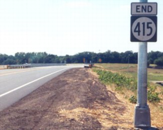
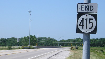
As with the now-decommissioned IA 386, the new 415's north end is farther south (in this case, about three miles farther south) than its northernmost point. In August 2003, this was the only indication of 415 along the new alignment.
SOUTH End: Stoplight, US 6/Euclid Ave., Des Moines, Polk County
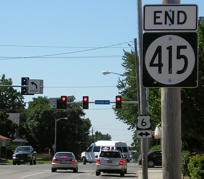
Facing south on 415 (7/23/08)
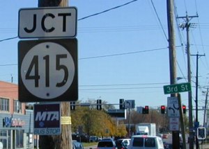
Facing east on 6 (11/1/02)
Again, why is it 2nd Avenue when the others are streets?
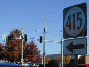
Facing (north)east (11/1/02)
You can see the first northbound sign on the pole under the stoplight.
Facing west on 6 (11/1/02)
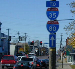
The green sign is for the truck permit station. You could turn right to get to I-35/80, so the straight arrow is a bit odd.
From mid-2003 to mid-2016, 415 was Iowa's only signed 4xx state route. That distinction was lost when IA 471 was created. Only 12 other active, signed routes are higher than 200. As such, I seriously think at least 415 should be renumbered to a 2-digit, possibly 46, a number with a history in the Des Moines area, or 47, sharing a "kinship" with 46 but avoiding historic confusion. In conjunction with this, the new designation should incorporate present IA 160, making a northern "beltway" between IA 141 and I-35, and giving the 2nd Avenue portion of 415 a different number entirely, maybe 87, another number with a history in Polk County. (This will not happen, but I can dream, can't I?)
Point of interest:
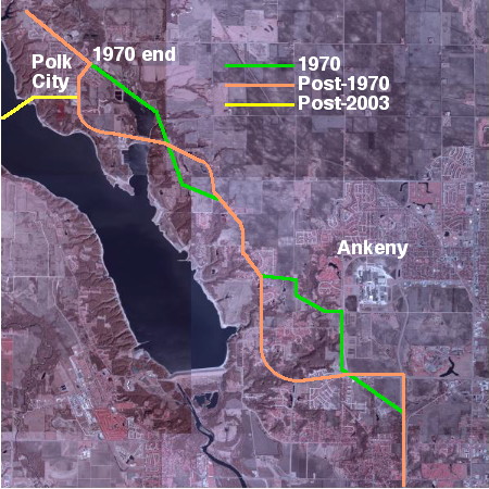
Because of realignments in the Polk City area and west of Ankeny, the ONLY portions of 415 used today that were part of the original 1959 route are the section between the south end and the former Y intersection with IA 160, and about 1.2 miles between Polk City and Ankeny, directly west of Ankeny's 1st Street.
Page created 1/24/02; last updated 10/29/20