
(October 1, 1980-July 1, 2003)
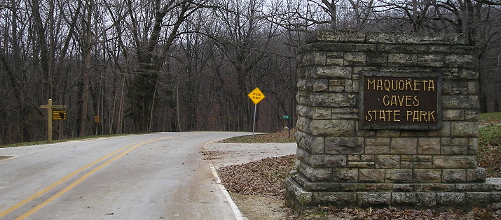
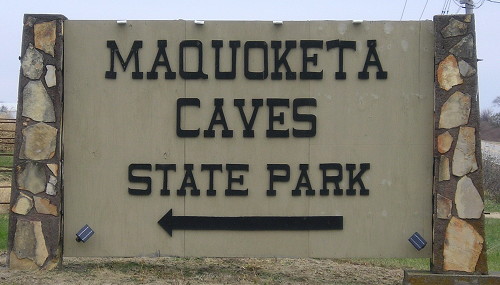
WEST End: Maquoketa Caves State Park, Jackson County
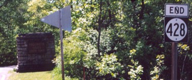
Facing west on 428 (5/26/02)
Photo by Jason Hancock
Highway 428 is an anomaly of a number. It has been a numbering quirk since the first 428 was commissioned in 1965. For reasons unknown, the last odd number given out was 419, to Victor. The numbers 416, 418, and 420 were all given to old pieces of US 20, but that sequence skipped 419 because they were designated in 1960 and 419 two years later. In 1963, the DOT gave out only even numbers in the 420s: 422, 424, and 426. In 2000, 421 was given as a secret number to old chunks of US 61, and then a completely arbitrary skip was made to 431, old US 218 northwest of Waverly in 1998, and 432, old IA 163 west of Oskaloosa in 1997.
In 1965, two years after the previous even-only designations, IA 428 was given to a piece of IA 64 into Anamosa after US 151 and 64 were rerouted to the present alignment on the east side. When that spur was decommissioned in 1980, the number migrated east to the road serving Maquoketa Caves park, a road that had once been a state highway (IA 130) but had not been one for 16 years. It's unclear why the redesignation was made.
Facing west on 428 (11/16/18)
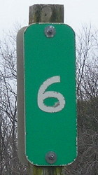
Mile marker 6 on the short east-west segment is the only reminder of the state road here.
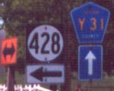
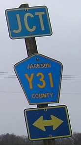
Surrounding area information: Junction Y31
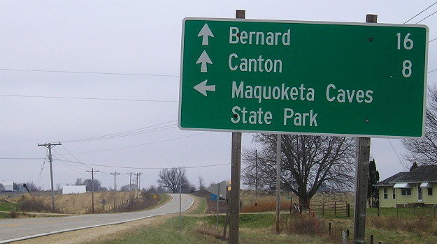
Facing north, but heading west, on 428 (5/26/02)
Photos by Jason Hancock
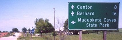
Right before its end, 428 deviates from what was Y31 in 1980 and goes .4 miles west to the park entrance. The replacement sign flips Bernard and Canton for some reason.
Facing north, but heading west, on 428 (11/16/18)
Facing north, but heading west, on 428 (11/16/18)
Facing east on 418 (11/16/18)
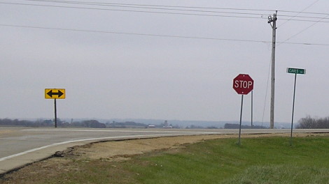
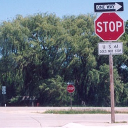
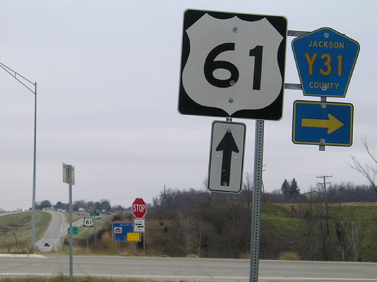
Old EAST End: Stop sign, US 61, near Maquoketa, Jackson County
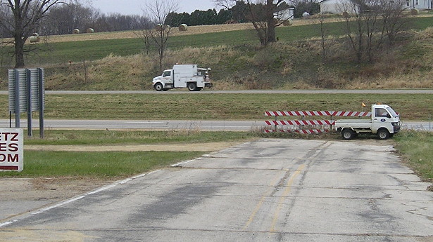
Facing east on 428 (11/16/18)
While IA 428 was designated after US 61 was straightened in Jackson County, the intersection was changed when US 61 was four-laned in 1999. This dead end is a hair north of the current intersection. The sign with the back visible at left is for services at the exit for IA 64.
At least four paved pieces of old 61 exist in Jackson County after straightening: Just south of Zwingle, at the intersection with D61, halfway between D61 and E17, and from Fulton south to IA 136, which no longer has a bridge across the Maquoketa River and intersects current 61 twice, at the northwest corner and south side of Maquoketa. (Street Atlas marks the last entry between the intersections as Business 61, but if it technically exists, it is not signed.)
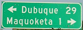
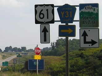
EAST End: Stop sign, US 61, near Maquoketa, Jackson County
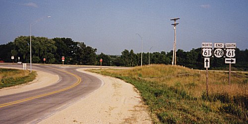
Facing east on 428 (Summer 2002)
Photo by Monte Castleman
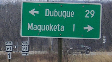
At this point 61 is a divided highway. The up arrow with the "North" just means to cross the southbound lanes. If you look to the left of the light pole, where the car is, there is a "North 61 <-" assembly.
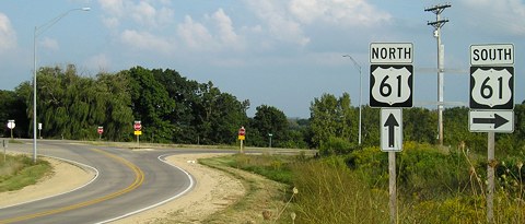
Facing east on 428 (9/2/08)
LGS before above assemblies (9/2/08)
Replaced LGS (11/16/18)
Facing east on 428 (5/26/02)
Photo by Jason Hancock
Facing south on 61 (9/2/08)
The IA 64 interchange can be seen in the background; the 1-mile BGS is behind the camera.
Facing south on 61 (11/16/18)
US 61 is important, but let's not get a swelled head over it.
Last seen: 2003

Page created 11/23/02; last updated 1/7/09 4/17/19