
Why 438? Your guess is as good as mine, since 938 would have better fit the system.
NORTH End: Interchange, US 218/IA 27 Mount Pleasant, Henry County
SOUTH End: Interchange, US 34, Mount Pleasant, Henry County
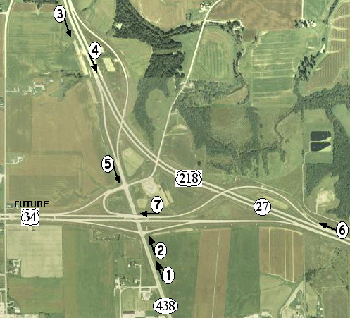
2004 view, USDA photo / 2013 surface map
At left is a score sheet for Jason Hancock's photos below. Instead of "one" interchange, it's actually two partial interchanges and a full. The partials are on 218 and the full at 34. The alignment running between pictures 3 and 1 is the previous route of 218; the three light green parcels mark the old roadbed. The segment between pictures 4 and 2 is the only remaining segment of 438, as seen at right, and is longer than some of the 900s that used to be floating around. Until the 34 bypass opened, though not shown here, the exiting road between pictures 6 and 7 was deemed IA 534, a throwback to the time when bypass plans were given a 5xx designation. Running straight at far left is 218's oldest alignment (Iowa Avenue). Snaking in from top center is a gravel road.
Many of the signs in the below pictures were changed after the bypass opened; see newer pictures on the Business US 218 page.
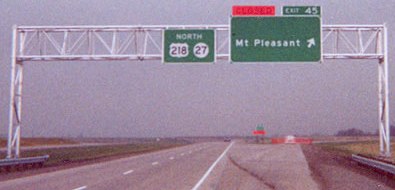
1) Facing north on 438 (5/18/03)
Photo by Jason Hancock
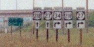
Closeup of signs in background (5/18/03)
Note in both these pictures that eastbound US 34 - but not westbound - is signed though the route had not been officially relocated at the time. Yet again, a new set of signs is one-per-pole instead of using brackets.
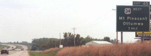
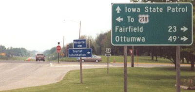
2) Facing north on 438 (5/18/03)
Photo by Jason Hancock
The blank line is most likely for Ottumwa, waiting for the bypass to the north and west of Mount Pleasant to be completed.
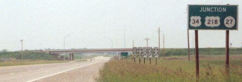
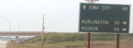
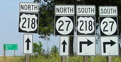
3) Facing south on 218/27 (farther north than the position of the "3" in the aerial photo) (5/18/03)
Photo by Jason Hancock
Accuracy for the future, not the present, as one still needs to go south to present 34. Update: The sign "for the future" ended up needing replacement to include Business 218.
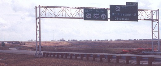
4) Facing south in the northbound lanes (March 2002)
Photo by Jason Hancock
When this photo was taken, the southbound lanes had not yet opened, but 34 was already signed. In some places the signs reflect post-all-bypasses routes, while others simply leave blank spaces. This may be a blessing in disguise if Butt-Ugly Kansas-Style Signage is to be the norm.
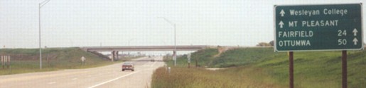
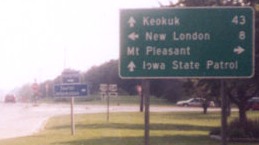
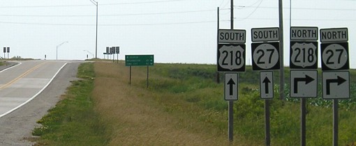
5) Facing south on 438(?), the road connecting US 218 to the 34 bypass (5/18/03)
Photo by Jason Hancock
The up arrows on the right side aren't errors; they'll be changed to right ones when the bypass is done. And holy mixed cases, Batman!
6) Facing northwest, but heading north, on 218/27 (March 2002)
Photo by Jason Hancock
At the time of the photo, the ramp to the future 34 bypass was closed. Spaces are for "34 West" at the top and "Ottumwa" at the bottom. This ramp has opened, so traffic can exit, but currently it will have to exit again.

7) Facing west on IA 534/future US 34 (5/18/03)
Photo by Jason Hancock
Between pictures 6 and 7 is the road temporarily named 534 until the bypass is complete. Exiting traffic curls around and then stops at 438 facing slightly northeast.
Old SOUTH End/Old NORTH End: 4-way stop, US 34, Mount Pleasant, Henry County
Facing south on 438 (March 2002)
Photo by Jason Hancock
This intersection was the north end of 438 for a time (December 2001-March 2002), because the south half of the 218 bypass was done first. On June 11, 2003, the city council agreed to take over old 218 and old 34 when the bypasses were completed; by the end of 2005, this intersection was completely city-maintained.
Facing south on 218 (1998)
Photo by Jason Hancock
Old photo: From 1998, before any bypass work in the area
The four-lane is the second bypass of Mount Pleasant by US 218. If you look at county maps, the route bends eastward and then back west, but there is a long straight road that runs through downtown. Based on topographic and state maps, I believe 218 used what is now Broadway/Jefferson Street to Henry Street, which was probably the original way 34 came into town. The two may have shared four blocks - three on north-south Jefferson, one on east-west Washington - until 218 turned south on Main to head out of town. This takes both routes right through the downtown area, passing City Hall and the Henry County Courthouse. Alternately, east of 218, 34 may have used Monroe Street, one block north of Washington, for a ways because that is where the north-south streets are divided. Regardless of 34's exact route, the Avenue of the Saints is the second time 218 has gone 'around' Mount Pleasant, an assertion backed by the general history of realignments - and Street Atlas marks the road, which is Iowa Avenue outside of town, as "Old 218" too.
Old SOUTH End: Dead end, near US 218/IA 27, Henry County
Facing south on 438 (6/16/06)
This view probably would have been the same in 2004.
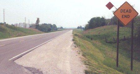
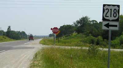
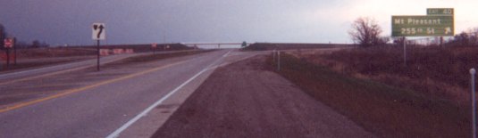
Facing south on 438 at 255th Street (5/18/03)
Photo by Jason Hancock
Jason writes, "IA 438 dead-ends south of 255th Street, which straddles the south city limits of Mount Pleasant (where it's known as Walnut Street)."
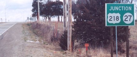
Facing east on 255th/Walnut Street (March 2002)
Photo by Jason Hancock
"This junction LGS can be found immediately after turning onto 255th/Walnut from 438, looking east."
Facing east on 255th/Walnut Street (6/16/06)
Facing west on 255th/Walnut Street (6/16/06)
Facing north on 218/27 (December 2001, shortly after the bypass opened)
Photo by Jason Hancock
Two things with this BGS: If the road straddles the city limits, why not list the city name (Walnut), and why isn't the street name on top? This is one of the few times an E911 county name gets on a BGS.
Jason has additional pictures of the Mount Pleasant bypass on his Avenue of the Saints photo page.
Page created 1/15/05; last updated 12/28/18