

(July 1, 1920-July 1, 2003)
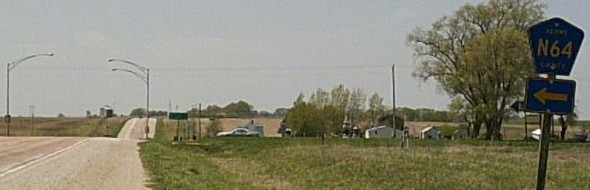
- In 1920, they knew it as: A road connecting Lenox to the Blue Grass Road (2 counties)
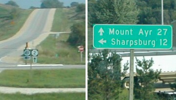
- We know it as: N64, and a road that kept its number until the Second Great Decommissioning
- Related route: IA 344 (I), a spur from Bedford to Lake of Three Fires State Park, that 49 superseded in 1943
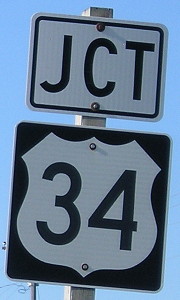
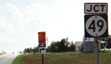
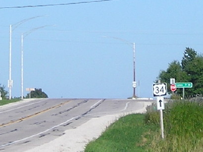
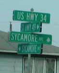
NORTH End: Stop sign, US 34, originally IA 8, Adams County
Facing north on 49 (8/23/19 and 6/15/03)
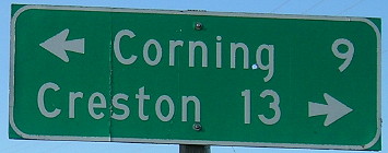
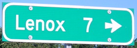
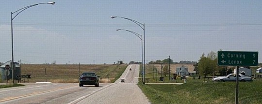
The LGS is for Corning and Creston, towns without any between them on 34 but, maybe surprisingly, three county seats between them in alphabetical order.
Facing north on 49 (8/23/19)
Facing north on 49 (8/23/19)
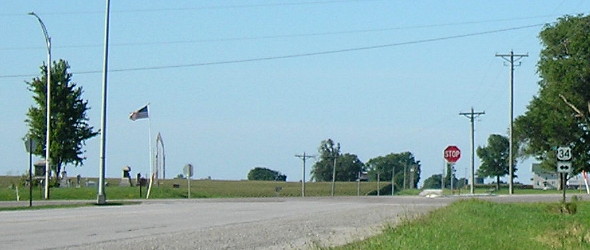
Facing east on 34 (6/15/03)
At the time, a detour was set up for IA 25 using this route (bridge work south of Kent).
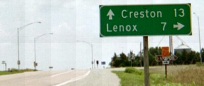
Facing east on 34 (6/15/03)
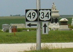
Like IA 107, 49 was an original spur (34 to Lenox) later promoted to a full route. Also like 107, it was deemed unnecessary 83 years later. The replacement for this BGS is below.
Facing east on 34 (8/23/19)
Facing east on 34 (8/23/19)
Facing west on 34 (4/23/06)
Photo by Jason Hancock
Facing west on 34 (4/23/06)
Photo by Jason Hancock
Facing west on 34 (6/15/03)
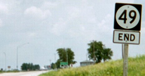
This was the second-to-last of only 19 pictures I took with my digital camera June 15-16 that actually turned out. Thus, this is one of my Miracle Pictures. The 49 shield in this picture was put up sometime after mid-January 2002 to replace an older one Neil had in his picture.
Facing (mostly) north (1/20/02)
Photo by Neil Bratney
*Original Number, Original End*
1920 SOUTH End: Lenox, Taylor County
There's no way to tell if 49, once extended inside city limits, went to the Main Street area before its extension south in 1943.
Choosing the rock over the hard place
The Taylor County Supervisors' minutes printed in the Lenox Time Table on Jan. 8, 2003, indicate the transfer was made in two steps. The motion to sign the transfer for the first portion, the south city limits of Lenox to IA 2 near Bedford (see below), which was added to the route in 1943, was approved Dec. 26, 2002. The motion to sign the transfer for the second portion, the Taylor County portion of the original 1920 spur to Lenox, was approved Dec. 30. The city of Lenox got approximately $458,000 for the transfer. This case is an example of counties agreeing to take jurisdiction (and whatever money the DOT would give them) before Senate File 451 gave them no choice in the matter.
From IA 49's decommissioning in 2003 until new US 20 bypassed Sac City in 2012, Lenox was the largest town in Iowa without a state-maintained road within a mile of city limits.
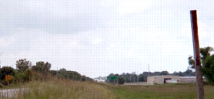
SOUTH End: Stop sign, IA 2, near Bedford, Taylor County
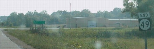
Facing southwest, but heading south, on 49 (9/2/02)
Photo by Neil Bratney
Facing southwest, but heading south, on 49 (6/16/03)
Same pole, but it looked a little naked when I came by in June. In the immediate area of the south end, including what would have been the first sign northbound, all the poles were like this. Despite this advance action, files indicate IA 49 was officially defunct on July 1, 2003.
Facing southwest, but heading south, on 49 (8/21/06)
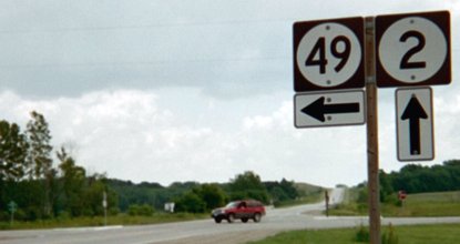
Facing west on 2 (6/16/03)
While the poles on 49 were bare in June 2003, all signs were intact on IA 2 at the time. The brown sign is for Lake of Three Fires State Park.
Facing west on 2 (6/16/03)
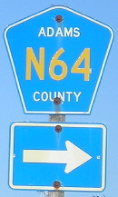
As with Adams County, Taylor also marked 49 as "St Hwy 49". Replacing those signs - and getting everyone to change their addresses - is a bit more complicated than most cases given 49's full assimilation into the county road system (see bottom).
Facing west on 2, post-decommissioning (8/21/06)
Facing east on 2 (9/2/02)
Photo by Neil Bratney
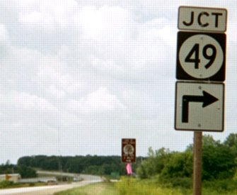
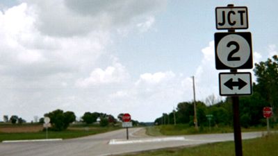
Quite a few state highway junctions have an arrow with the "Jct" when there is none warranted. (In this case, it happenes in both directions.)
Facing east on 2 (9/2/02)
Photos by Neil Bratney
Closeup of signs in left above picture (6/16/03)
Same pole, post-decommissioning (8/21/06)
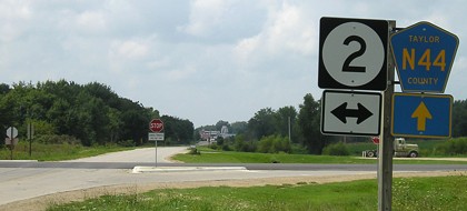
Facing north (6/16/03)
Note, as with many intersections like this, the highway going ahead is not noted. This signage is the county's responsibility (which you can tell by the narrow, separated "Jct" and double arrow).
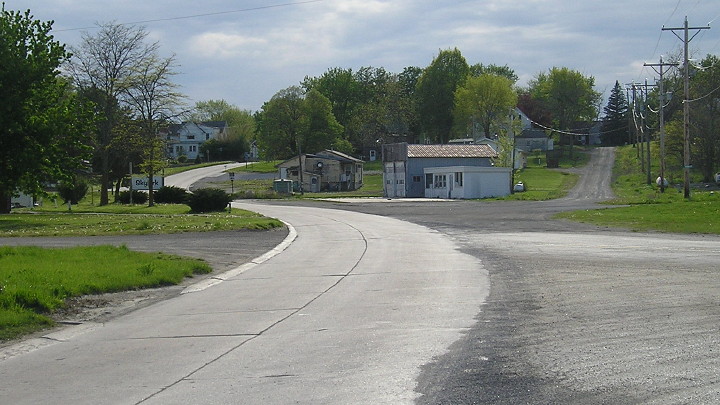
Old SOUTH End: Stop sign, IA 2, Bedford, Taylor County
Facing west on old 2; old 49 is to the right (6/16/03)
IA 49 was truncated from its post-extension south end when the IA 2 Bedford bypass opened May 18, 1979. It did not continue into downtown Bedford, although a 1980s USGS topo map could lead one to think otherwise.
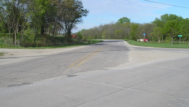
Facing west on old 2 (4/27/17)
The old concrete lip is still on one side of the road.
Facing northeast (4/27/17)
Facing north (4/27/17)
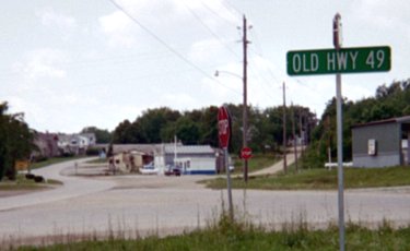
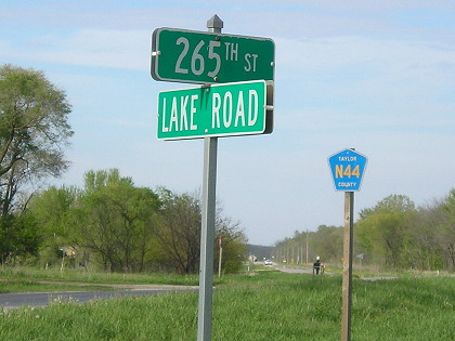
After 49 was decommissioned, Old Highway 49 - a name that was correct and could have been extended - was renamed Lake Road, for going past Lake of Three Fires. The intersection with IA 2 is in the deep center background - you can see a car near the spot.
Last seen: 2003 (2002 map)
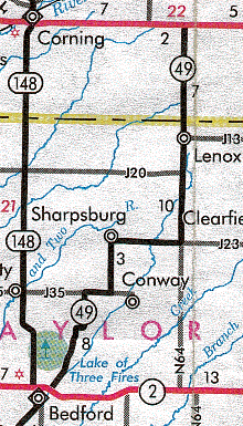
This ties for third-longest route decommissioned in 2003, at 28 miles the same as IA 982; above it were 183 south of 127 (31.2) and 107 (30). (Map mileage around Conway had been separated since at least 1968 even though no spur has gone there since that time.)
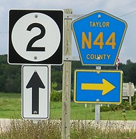
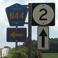
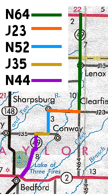
At right is Taylor County's full assimilation of 49 into the county road system; as a diagonal, this one was tricky. Three of them (N64, J23, J35) can be seen continuing from 49 and are therefore logical; for N52, it is a gravel road that extends north past Sharpsburg, and N44 is the road that goes straight south of Bedford. (Credit: Lewis Schrodt gave the new road designations to Jason Hancock.)
Page created 3/22/02; last updated 4/5/20