
(March 29, 1932-April 13, 1981)
| IA 90 (III) endpoint history | |||
| FROM | TO | WEST | EAST |
| 3/29/32 | 1934 | Village of Commerce, now part of WDM (~
Grand Ave at S 35th St) |
US 6/US 65 (EB Grand Ave at 7th St, downtown Des Moines) |
| 1934 | 1935 | Village of Booneville (F90 at R22) |
|
| 1935 | 11/30/37 | US 169 (F90 at US 169) | US 65 (EB Grand Ave at 9th St) |
| 11/30/37 | 1938 | IA 60 (EB Grand Ave at 2nd Ave) | |
| 1938 | 1945 | US 6 (WB abandoned road at F60/F65 intersection east of Dexter) | |
| 1945 | 11/19/58 | IA 60 (NB 2nd Ave at University Ave) | |
| 11/19/58 | 9/5/60 | US 6 (SB F60 at F65, same intersection as above) | IA 64 (NB Merle Hay Rd at Douglas Ave) |
| 9/5/60 | 8/9/61 | US 71 (IA 83 at US 6/71) Swapped routes with US 6 |
|
| 8/9/61 | 12/13/66 | IA 14 (EB old US 6/F48 at IA 14, Lambs Grove/Newton) | |
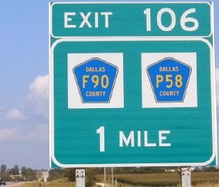
| 12/13/66 | 4/13/81 | I-80 exit 106, Dallas County | I-35 (Grand Ave at I-35) |
| Compiled from Jason Hancock's Highways
of Des Moines, Iowa
Highways Page, and Iowa Highway Commission minutes archives |
|||
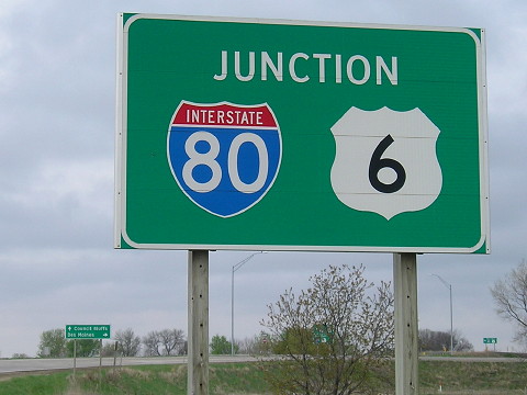
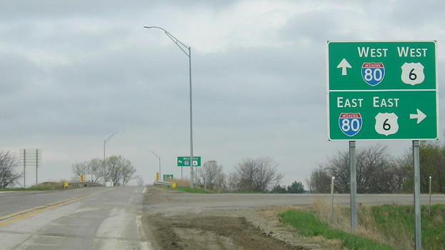
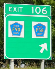
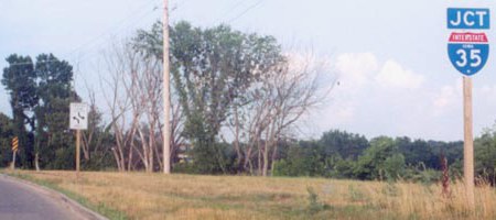
WEST End: I-80/US 6 exit 106, Dallas County
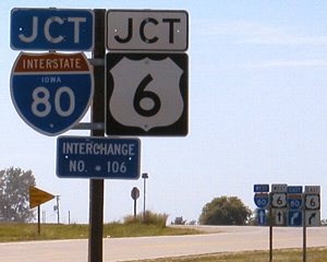
Facing west on 90 (8/6/04)
The stop sign below "Interchange No. 106" is for the old 90 stub.
Facing west on 90 (4/19/17)
The addition of US 6 shields to the interchange came less than a decade before all Iowa interstate interchanges got generic signage.
Facing west on 90 (7/20/02)
Photo by Jason Hancock
To the left of these signs is a pole with a double-arrow sign for an old pre-interstate stub of IA 90. This assembly could have held "End 90". Its (first) replacement is below.
Facing west on 90 (8/6/04)
Facing north (4/19/17)
Facing southeast-ish (8/6/04)
The bridge over the interchange changes the paved road's direction from north-south to east-west.
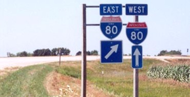
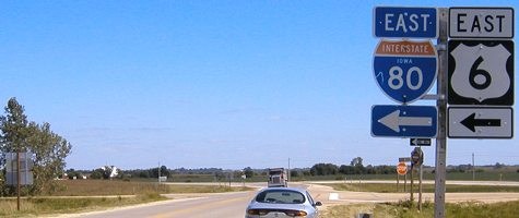
Facing west on 80 (6/4/07)
After the Earlham exit, the westbound mileage sign has the two county road shields...two Pottawattamie County shields. Their presence is a mystery.
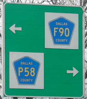
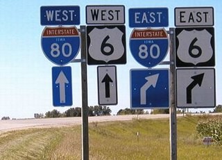
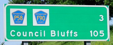
Facing west on 80 / On the offramp (8/21/06 and 4/19/17)
This is the only interchange in Iowa with two signed county roads. No directions, though; "East F90 North P58" would make this a perfect sign. To the west, old US 6 (now F60) and P53 meet but the latter is not signed (see further below).
Facing east on 80 (8/11/03)
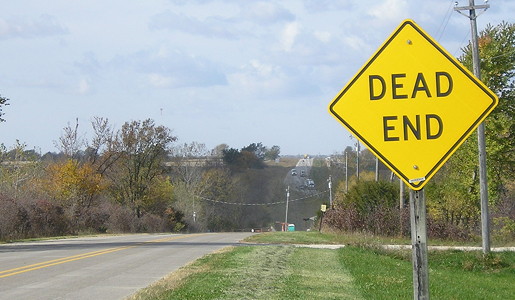
Surrounding area information: Old 90

The F90/P58 interchange is just north of where pre-interstate IA 90 was. The three pictures below are on the stub marked 360th Court.
Facing west (December 2002)
Photo by Neil Bratney
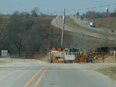
You can see the road matches up perfectly with I-80's eastbound lanes. This is not a coincidence. Construction of 80 took place right on top of 90 between what became the east end of IA 925 and this interchange. US 6 and 90 swapped routes a few times in the late 1950s/early 1960s during construction of the interstate.
Facing west (10/16/20)
Facing west (December 2002)
Photo by Neil Bratney
The dead end is at a construction area. The BGSs on I-80 are for the Earlham exit, which was the north end of IA 232 before and after construction and until 1980.
Facing east (10/16/18)
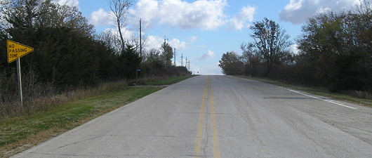
Neil Bratney wrote of this view in 2002, "Looking back up the hill of the stub, you can see that IA 90 was three lanes here, with a passing lane for the uphill eastbound traffic. There are several more three-lane segments between here and Booneville."Surrounding area information: Old 90 stub (the other end)
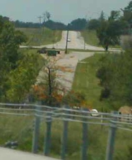
Facing east (December 2002)
Photo by Neil Bratney
This is six miles west of the west end of 90 in 1981. Between 1938 and 1958, before 90 was extended along US 6 (what is now F65 [old IA 925], G30, and IA 83 east of Atlantic), this was 90's west end. The interstate leaves the much older alignment to go on a new route here. In fact, the eastbound lanes of I-80 between here and the Earlham exit originally used pavement laid in 1955 as part of IA 90; the road had been gravel before then. According to paving records, those lanes had the oldest pavement used as part of an interstate in Iowa (the 1955 concrete was repaved in 1966). The interchange for former eastbound 6 (and southbound P53) is to the upper left.
Junction US 169
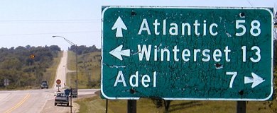
Facing west on 90 (8/19/04)
The camera's flash illuminates the age of this DOT-standard sign, which was still up as of August 2011 according to Google Street View but has since disappeared. Notes Jason, "What's puzzling about the [westbound sign] is that IA 90 hadn't gone anywhere near Atlantic since December of 1966." A similar but newer sign for Des Moines is on eastbound F90. Notice the "F90 ^ / 169 <->" in the background; the arrows were old enough a 90 shield could have been there. Those were replaced by mid-2005.
WEST End of IA 934 (1981-89): Dallas/Polk county line
IA 90 was deleted from the 1981 map, but it was not officially decommissioned by October 1980. It was signed as County Road G30 on that map and only that map. Now, why this is the case, I don't know, and the online route description doesn't help. The G designation in this tier of counties is incorrect, but I suspect an "everyone calls it Highway 90" vibe helped with redesignation.
Between 1981 and 1989, after 90 was decommissioned, the easternmost 1.1 miles between the Dallas/Polk line and I-35 was secret IA 934. That designation would be applied to two more roads before Black Hawk County's 934 in 1998. The entire original route of IA 90 was east of this point, along Grand Avenue.
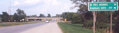
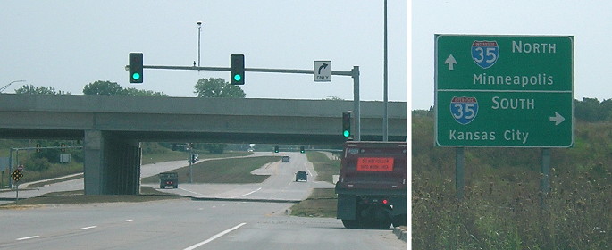
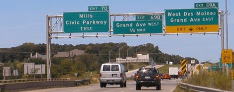
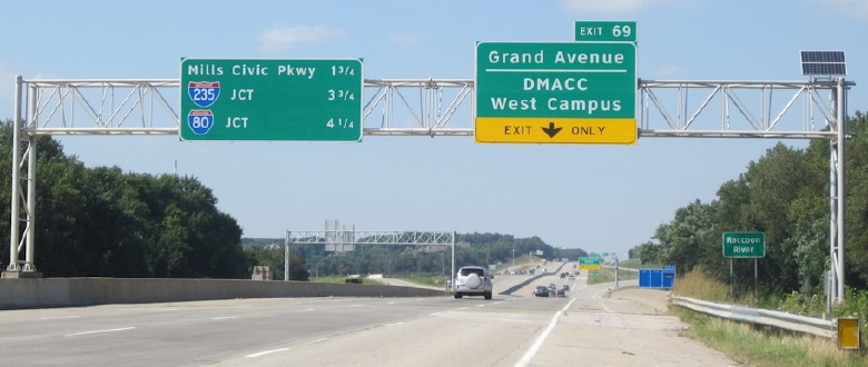
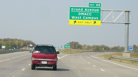
EAST End: I-35 exit 69, West Des Moines, Polk County
Facing east on 90 (7/20/02)
Photo by Jason Hancock
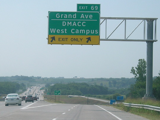
The center-lane-turn sign had moved by summer 2004. West Des Moines has reconfigured the road such that in order to continue west from I-35 on old 90, you have to make a left turn. Otherwise, you end up on a road that goes to a DMACC campus.
Facing east on 90 (7/20/02)
Photo by Jason Hancock
Facing east on 90 (8/19/04)
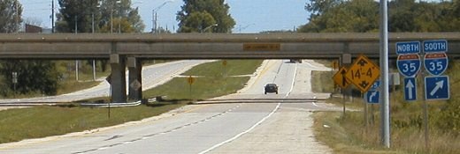
The Grand Avenue interchange was a cloverleaf, perhaps a bit surprising given its relative non-prominence. However, Grand Avenue does go directly to the State Capitol and downtown Des Moines, even though at this point it is far south of where it is through downtown. Original plans for Interstate 80 called for it to intersect I-35 just north of this interchange, following former IA 90 for its entire length much closer than it does today.
Facing east on 90 (8/13/18)
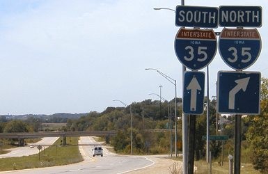
Facing south on 35 (7/20/02)
Photo by Jason Hancock
This vestige of Iowa's earliest interstate plans was removed in the 2010s with the six-laning of I-35 and conversion of this interchange to a diamond instead of a cloverleaf.
Facing south on 35 (8/13/18)
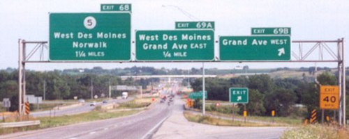
Facing north on 35 (8/19/04)
As with much of the west end, these pictures are also outdated. The new interchanges for IA 5 and the George Mills Civic Parkway have caused signs to change a lot since even 2000. The sign at right, I believe, was a temporary sign before the gantry was put up again, and has now been removed.
Facing north on 35 (8/19/04)
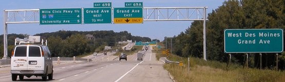
Facing north on 35 (8/15/15)
Photo by Jason Hancock
I don't get why "Jct" is added after the interstate shields. "235 West" on the middle line and the I-80 shield by itself on the bottom would make more sense.
Facing north on 35 (10/9/20)
Facing west on Grand Avenue (8/19/04)
Page created 1/31/02; last updated 2/14/21