 NORTH
NORTH
NORTH End: Interchange, US 218, IA 57, and IA 27, Cedar Falls, Black Hawk County
Because it's also the east end of 57, I've placed pictures from all four directions on this page. With the creation of IA 27, the four-lane portion of 58 is now a redundant multiplex, even more so now that 27's "supremacy" has been asserted via being a lower number (see below). However, I think that it is unlikely to change, in part because everyone calls it "Highway 58" — and has been doing so ever since the project was originally proposed — and making it 27 only would confuse matters.
Old NORTH End (1993-July 21, 1995): Partial interchange, University Avenue, Cedar Falls, Black Hawk County
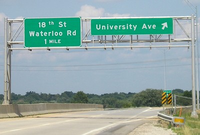
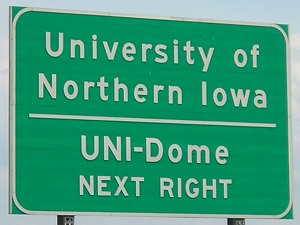
Facing north on 58 (7/15/07)
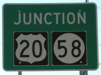
When part of the northern extension was done, traffic came north from 20 to here and took the exit. The right sign was there at that time. South of here are the only three stoplights on IA 27: Greenhill Road, Viking Road, and Ridgeway Avenue. This signage is about 3/10 of a mile directly south of the Main/University intersection.
If exit tabs were added following IA 58's mileage, University Avenue would have been Exit 9. But when the DOT added tenth-mile-markers along the route, the little shield says IA 27. So should numbers be added in the future, University would be Exit 183, followed by 184 (18th Street/Waterloo Road) and 185AB (US 218/IA 57).
Additional note: These tenth-mile-markers around Waterloo display the whole mile horizontally, as opposed to every other similar marker in the state that does it vertically. It makes the sign almost distractingly big, and going every two-tenths of a mile would have been just as useful. And along US 20, there are places the tenth-miles don't match the regular ones!
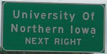
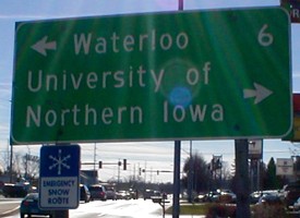
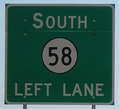
Facing south on 58 (7/2/14)
Notice odd capitalization of "Of" on the left sign.
Old NORTH End (1956-87): Stoplight, US 218 N/Main St. and US 218 S/University Ave., Cedar Falls, Black Hawk County
Facing east on University, but heading north on 58 (6/18/02)
Before the intersection is the "Jct 58/27" sign, and the bridge of current 58 is visible in the background. Until 1989, 218 went north (left) and east (straight ahead) at this intersection. Six years after 58 was pulled from here, it was re-extended on the freeway to end near here again.
Facing south on Main St. (old 218) (11/21/01)
This sign is a remnant from when South Main was part of 218. It lasted 13 years after the highway left, and was replaced by a tiny city-erected sign in May 2002. (You have to really look to see it.)
Old NORTH End (1987-93): Interchange, US 20, Black Hawk County
Between 1935 and 1987, IA 58 continued north on Hudson Road past this point. As early as 1985, at the same time construction on the US 20 freeway was wrapping up, plans were already being made to extend 58 on its present four-lane segment north of 20, using funds from the interstate substitution program. Shortly after the four-lane US 20 was opened, IA 58 was discontinued north of this interchange until that new route was built.
Facing north on 58 (7/15/07)
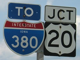
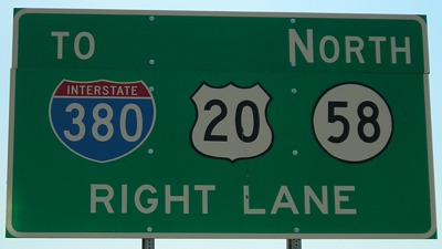
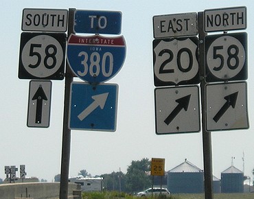
This is the farthest west interchange with "To 380" shields, eight miles west of the 380 interchange.
Facing north on 58 (7/15/07)
Facing north on 58 (3/15/05)
Facing north on 58 (7/15/07)
Facing north on 58 (7/15/07)
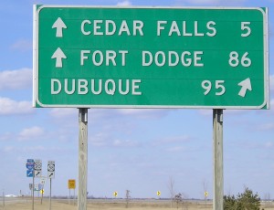
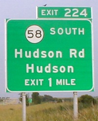
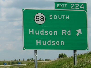
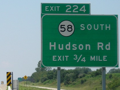
In this closeup, you can see the 5-mile marker past the eastbound ramp, at the south end of the bridge. For some reason, except for a few things at US 63, nothing developed at any interchange on the freeway west of I-380 — though development picked up south of San Marnan Drive near IA 21 in the 2000s. Perhaps it is because the cities aren't very dense at the freeway, or because it's only a US highway instead of an interstate and wasn't seen as profitable. Prior to 2003, the distance to Fort Dodge from here was 108 or 109 miles.
Facing north on the Hudson Road bridge (11/21/01 and 7/15/07)
This is a leftover from 1993, posted north of where northbound 58 now takes the ramp onto 20. Until about spring 2001 right beside it was a "To 57/To 218" sign, which has now been removed. Six years after the left picture was taken, the sign is fading a bit more, plus the lower speed limit has been extended farther south on Hudson Road due to the Target distribution center and some additional development. Since 2001, multiple intersections between here and University Avenue have had stoplights added, too.
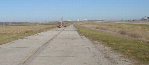
Facing north on old 58 (11/21/01)
This strip of old 58 is in the southwest corner of the interchange (left side of current 58). For half a mile south of the interchange, 58 is four-lane, but traffic is usually light and weeds grow in the concrete islands.
Facing south on Hudson Road (which becomes 58)
This is just south of Ridgeway Avenue (D19). At this point Hudson Road is not a state highway yet.
Facing south (7/25/07)
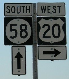
Facing south (6/24/02 and 7/25/07)
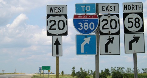
Continuing south, you see this arrangement. Note the two different fonts in the left picture. The left "20" (and for that matter, the 58) is Series D in a wide shield, and the right is the more-prevalent Series C in a narrow shield. (Compare the "58" with the above picture.) Series D numbers show up both on 20 and 30, and occasionally on other highways. US 20 signs were about 95% Series D along the south side of Waterloo/Cedar Falls until sporadic sign replacements over the past few years. For the small portion of 20 freeway the two highways share, IA 58 is not signed on the side, possibly because the other exit's signs show up almost immediately.
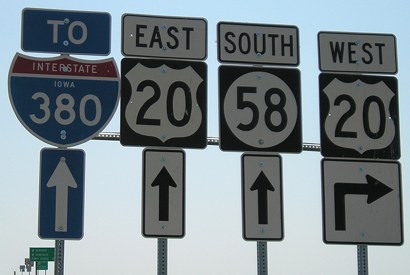
Facing south (7/25/07)
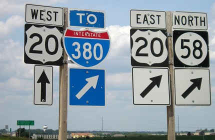
The right assembly is a reversal from 2002, when "West 20" was on the left with a diagonal arrow.
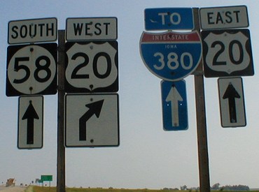
Facing south (7/25/07)
This I-380 shield's font shows up nowhere else in Iowa.
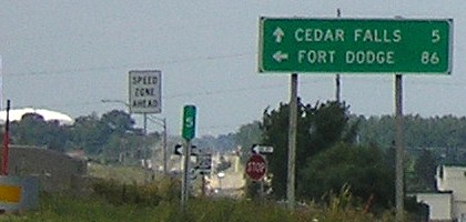
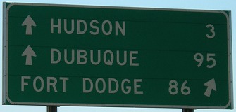
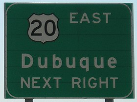
Facing east on 20 (6/21/02 and 7/15/07)
Eastbound, Hudson is signed at IA 58 south. Westbound, Hudson is signed at US 63. Traer is not signed at all.
Facing east on 20 (before the second BGS above) (7/15/07)
Facing west on 20 (7/25/07)
Although 58 joins 20 between the interchanges, there are no shields on 20 except for BGSs. The left sign has a faint shadow of a centered 58 shield, so it's probably original.
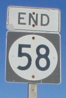
To the IA 58 South end / To IA 58's current north end
*Inaugural Highway End*
Page created 12/1/01; last updated 9/10/07