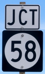
 SOUTH
SOUTH
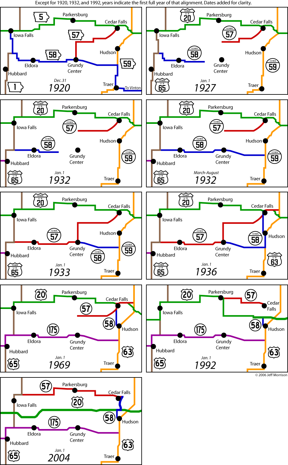
Detailed maps of the historic routes of IA 57 and 58 are here. Detailed maps of the historic routes of IA 57 and 58 in the Waterloo/Cedar Falls area are on this page.
In 2013, the US 63-IA 58 intersection was entirely rebuilt, enough to make the new pictures their own category. New end pictures are 6/3/14 unless noted.
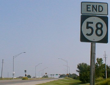
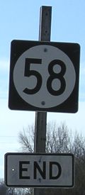
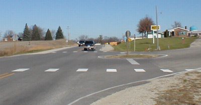
SOUTH End: Stop sign/T intersection, US 63, Hudson, Black Hawk County
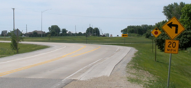
Facing south on 58
At the bottom of this picture is the beginning of the 2013 concrete. Despite seemingly having land to work with, the intersection was engineered for a HARD left to meet 63 (far left). Enough issues apparently cropped up with this setup that during June 2014, chevrons were added to the curve and by the end of the year, "58 End" had moved to the "Jct 63" pole.
Facing south on 58 (7/2/14)
Facing southeast, but heading south, on 58
"58 End" in the text above was not a typo.
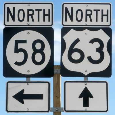
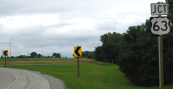
Facing north on 63
I left the photo of the assembly bigger so you can see exactly what is coming to Iowa highway signage in the second half of the 2010s. The shields do not have a thin white border, and the arrows are slightly skinnier than the shields, just enough to be noticed.
Facing north on 63
This curve is where the northbound arc used to be in the intersection. Notice that, as opposed to the original setup, it is now the Hudson arrow that turns while 63 is fully the through route.
Facing north on 58 at Washington Street (pre-1961 US 63) (7/2/14)
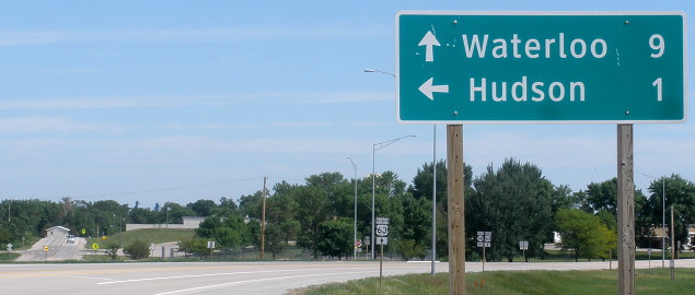
Wait a second, isn't that "Hudson" sign supposed to be white-on-green? Yes it is! At the end of 2013, both this intersection and IA 86 at the Minnesota border had black-on-white signs that were supposed to be different colors (see below). Both projects had the same primary contractor, Cedar Valley Corp. of Waterloo.
The 1950s-era motel that had been north of this intersection was torn down at the same time as the construction in 2013.
Facing north on 63, north of the intersection
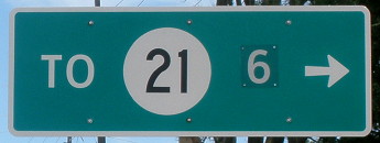
These are brand new signs, yet two things immediately stand out: The wrong colors for signs above and below the route marker and the cover-up of a different numeral for the distance to IA 21. Turns out the LGS was built to spec: The original letting document had a 9 instead of a 6.
Facing south on 63
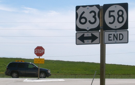
SOUTH End: Direct merge into US 63, Hudson, Black Hawk County
Iowa DOT archives
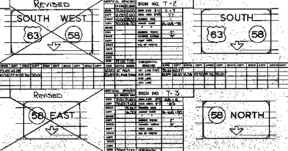
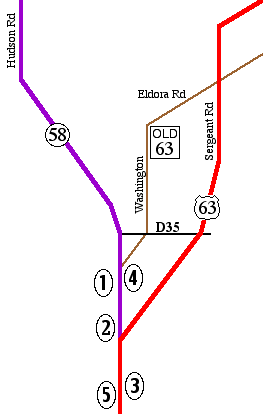
This clip from December 1967 sheds light on both the original construction of the intersection and the pre-1969 signage of IA 58. Until 1961, US 63 went through Hudson on Washington Street and between Hudson and Waterloo on Eldora Road, eventually running into 4th Street in Waterloo. (SEE DIAGRAM BELOW) Later, 63 was put on a new alignment - Sergeant Road outside of Hudson - intersecting only three Hudson streets in its wide path. At some point in the 1940s or '50s, present-day Hudson Road in Hudson was built, moving the split of the roads from 5th Street to the south side of town.
This location was NOT the end of IA 58 because for about 33 years it ran from Grundy Center to Cedar Falls via Hudson. This made signage an interesting situation: Either you're going north and south on a road signed east-west, or you're going northwest when the road is marked south (between Reinbeck and Grundy Center) and vice versa. That's where the signs above come in. They show 58 was signed east-west and while these were being drawn up, that changed, likely in preparation for the truncation of 58 to this intersection a year later.
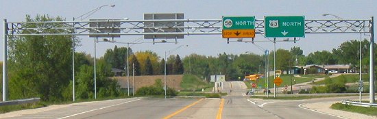
The 63-58 intersection was among a batch receiving interstate-inspired, or at least more complex than T-intersection, intersections and signage in the late 1960s. Many of them still have overhead signs today. Here's a guide to the photos below:
Numbers are for photos below.
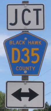
If you wanted to go to 63 north from 58 south, or 63 south to 58 north, you had to use D35 (see bottom).
1) Facing south on 58 (6/24/02 and 3/15/05)
Sometime in 2004 someone must have knocked the "End" off, because later the shield was in place with "End" 6 inches underneath it (right).
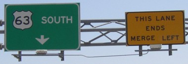
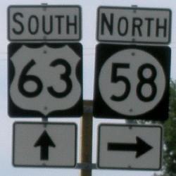
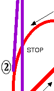
2) 58 and 63 south traffic merge (5/20/03). Until 2000 this was reversed; the yellow sign was on the other side, reading 'This lane ends merge right." (It's actually the same sign with a new direction pasted on it.) The new arrangement makes more sense. This corresponds to the top sign in the 1967 sign design above, which would have had "South 63/58" during 1968.
3) Facing north on 63 at the split. Picture 2 is of the signs on the left. (5/20/03)
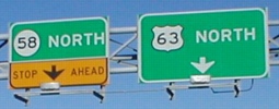
At lower right is the second of two "North 63 [up and diagonal right]" signs, which could have a full diagonal arrow instead. The "58 North" sign corresponds to the bottom sign in the 1967 sign design above.

3a) Closeup of signs at right and LGS before intersection (taken behind location of picture 3) (11/21/01 and 5/20/03)
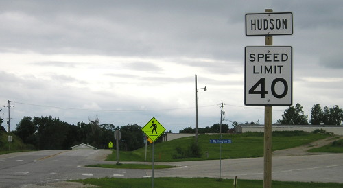
The Hudson city limits are just after the intersection, after the stop sign on 58 and within a short distance on 63. Further north is a leaving-town LGS for Waterloo and New Hampton, which is odd because it's in the middle of town.
4) Historic split of 63 and 58 (11/21/01)
Before the 1961 reroute, this picture would have been taken on 63 just before it went to the right. Prior to some point after the late 1930s, all traffic went right and the road the vehicles are on didn't exist.
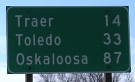
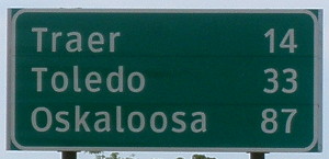
5) Mileage sign heading south on 63 (3/15/05). Hudson's sign gives the distance to Oskaloosa, Traer's is for Ottumwa.
Surrounding area information: Junction D35
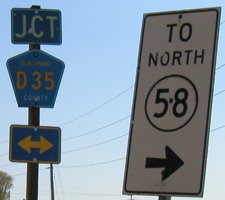
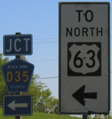
Facing south on 63 / Facing south on 58 (5/20/03)
These two sets of signs are about 1/2 mile apart on the southbound routes at D35 (see map at top). The "To North 58" sign was straighter until a while before the picture was taken.
Surrounding area information: The evolution of a school
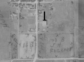
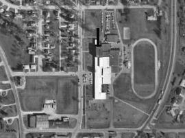
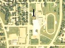
Aerial photos: ca. 1935 / 1994 / 2004 (ortho.gis.iastate.edu) (widen window to see side-by-side)
The bottom of the T-bar in each photo is aligned to the north face of a brick building. Each photo covers precisely the same area, spanning 70 years. At left is the 1930s building for the Hudson school district, on the south side of town; the town itself is only about three blocks wide. The north-south road is Washington Street; in the left photo it had just recently become US 63/IA 58. (Instead of a split at the south side of town, 63 and 58 split at 5th Street.) As the town grew, more buildings were added on the south and east sides of the school. As Hudson's popularity as a bedroom community to Waterloo grew, the decision was made to make an entirely new high school building. That building is the tan-roofed structure on the west (left) side of Washington in the 2004 photo. As you can also see in the 2004 photo, the original building has been torn down.
To the IA 58 North historic ends / To IA 58's current north end
*Inaugural Highway End*
Page created 11/25/01; last updated 1/14/15