
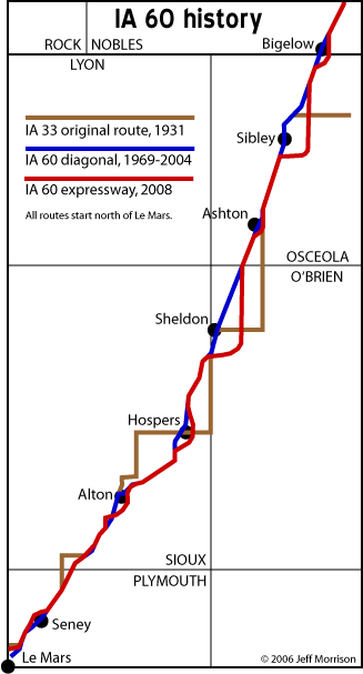
The way past, immediate past, and present of Iowa Highway 60 can be seen in this composite map. (Map created 6/21/06.)
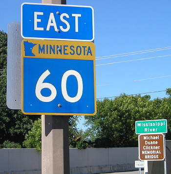
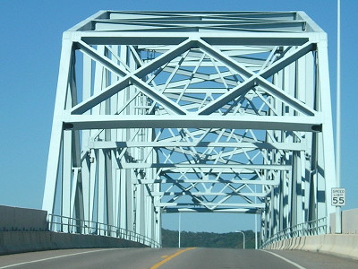
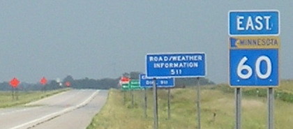
EAST End of MN 60: Mississippi River, Wabasha MN, Wabasha County MN/Buffalo County WI
Facing northeast, but heading east, on 60 (9/13/15)
From the Iowa line, MN 60 heads in an east-northeasterly direction through Mankato, exiting at Wabasha (where it becomes north-south WI 25).
Facing northeast, but heading east, on 60 (9/13/15)
Facing southwest, but heading west, on 60 (9/13/15)
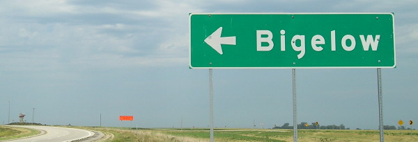
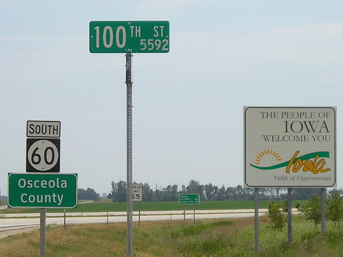
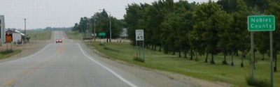
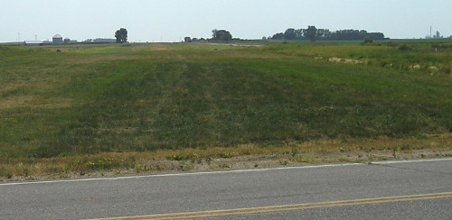
NORTH End: Minnesota state line, Bigelow MN, Osceola County IA/Nobles County MN
Facing north on 60 (7/21/12)
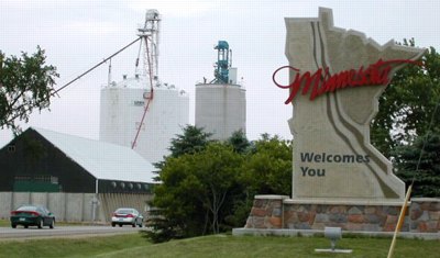
This Minnesota sign is in Iowa.
Unlike the pictures farther down, the end of IA 60 is now at the southeast corner of Bigelow instead of the southwest. In fact, aerial photos show that the northernmost mile in Iowa, seen in the pictures below, has now been removed. (Or, to be more precise, obliterated. Official maps of proposed projects always use the word "obliterate" when talking about segments of existing road that will be removed in construction. Admittedly, that sounds cooler.)

Facing north on 60 (7/21/12)
Facing north, but heading east, on MN 60 (7/21/12)
Facing south on 60 (7/21/12)
Old NORTH End: Minnesota state line, Bigelow MN, Osceola County IA/Nobles County MN
Facing northwest, but heading north, on 60 (6/25/06)
The pavement change in the foreground is the change in jurisdiction though the road to the right is the state line.
Facing north on 60 (6/18/02)
Photo by Neil Bratney
Facing northeast, but heading north, on 60 (6/18/02)
Photo by Neil Bratney
Neil writes, "Here is the Type III Welcome to Minnesota sign. I've only seen this big sign otherwise on interstate entrances." A nice touch, except it had to be moved when the four-lane was finally built.
Facing southwest, but heading south, on 60 (6/18/02)
Photos by Neil Bratney
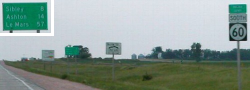
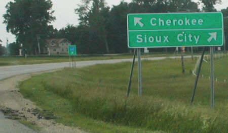
On the state lines in northwest Iowa, the larger county signs were added to the end of the trail of signs normally seen at the state line, taken off the first shield as shown below.
Facing southwest, but heading south, on 60 (6/25/06)
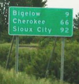
I think the LGS is not for crossing the state line, but for leaving Bigelow; Neil argues Sioux City should be included even though 60 does not touch it.
Facing south (7/21/12)
The old IA 60 two-lane was here.
Although 60 follows the railroad tracks (Chicago and North Western, now Union Pacific), if the road hadn't been around since the 1920s and '30s (when, as IA 33, it was diagonalized to follow the railroad), it's possible it might never have existed given disputes years later about diagonal roads. Ironically, given today's efforts to make it a four-lane, it would have been better if Minnesota had changed its part of MN 60 southwest of Mankato to MN 33 instead of Iowa changing 33 to 60, because that number would fit in the interstate numbering scheme should the route ever become controlled-access.
If not an interstate, what about a US highway? One suggestion has been to extend US 77 from Sioux City northeast on US 75 and then following IA 60 and MN 60 to Mankato. I'm not really in favor of that, since it would extend 77 in a very different direction and cross both 75 and 71. In addition, the segment from Le Mars to Mankato is actually a bit longer east-west in mileage than north-south, though including the distance to Sioux City (I-129) nearly equals it out. At about 153 miles, it would be short, but longer than the current US 73 or 159. It could be US 114 or US 375, though either version would be signed with the wrong polarity in either Iowa or Minnesota.
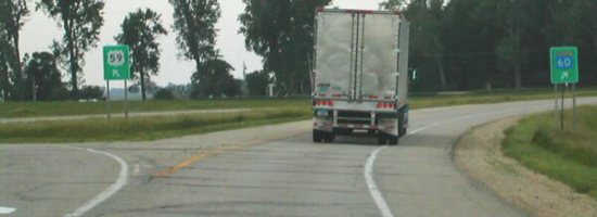
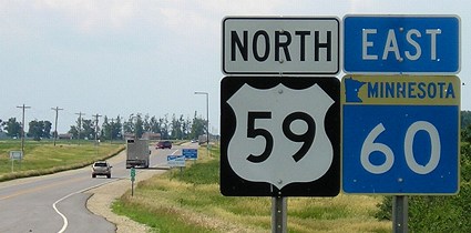
Surrounding area information: Junction US 59
Facing southeast, but heading south, on 59/60 (6/18/02)
Photo by Neil Bratney
In Worthington MN, 59 and 60 join up for a short while, and in either direction 60 leaves on the opposite side. (Its interchange with I-90 is just east of US 59.) Going northeast, 60 is the major connection between southwest Minnesota and Mankato (and from there along US 169 to the Twin Cities), but then the route levels out and becomes a general east-west state highway, ending at the Mississippi River.
Facing south on 59/60 (6/18/02)
Photo by Neil Bratney
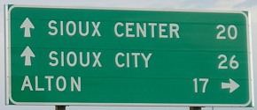
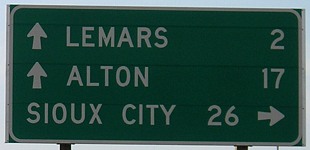
Notice that not only do Minnesota LGSs not include distances (and they're bigger too), the destination for IA 60 is Sioux City instead of Le Mars.
Facing south on 59/60 (6/18/02)
Photo by Neil Bratney
Facing north on 59/60 (6/25/06)
The Minnesota Welcome Center for both 59 and 60 is just ahead. While 59 goes north to the Canadian border, 60 continues eastward in Minnesota to end at US 61 in Minnesota.
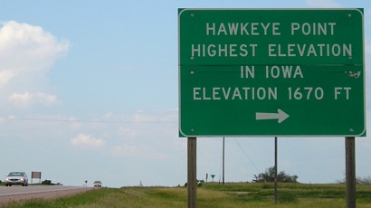
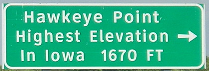
Surrounding area information: The highest point in Iowa
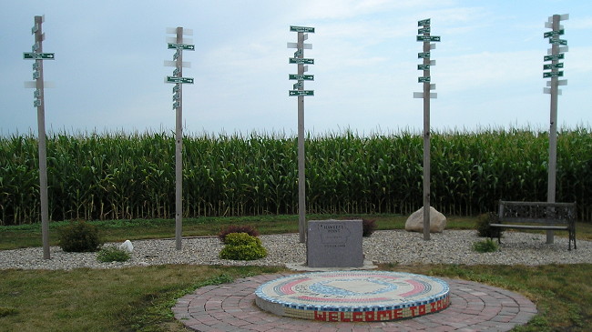
Since I first visited the location in 2006, the site has been taken over by Osceola County Extension, and there have been a lot of changes.
Facing northeast, but heading north, on 60 (6/25/06 and 7/21/12)
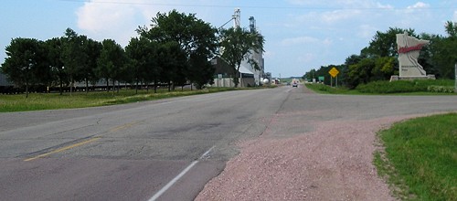
Three miles south of the border, this sign points to the current highest point in Iowa. (Previously, Ocheyedan Mound to the southeast was thought to be higher - see IA 237.) Also just to the right, trees have been taken out for the Sibley bypass, which will joins the railroad diagonal just north of this intersection.
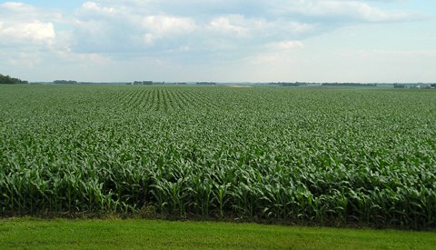
According to America's Roof, Iowa's highest point is ninth-lowest among the 50 states. The increase in elevation from Charles Mound, the highest point in Illinois, is only 435 feet. (6/25/06)
Facing north (6/25/06)
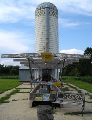
If the foreground is the highest point in Iowa, then this must be the highest silo in Iowa, near the highest water tower and cell phone tower in Iowa.
Facing east-ish (7/21/12)
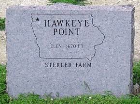
After a few years of county ownership, the site has changed. The granite marker is still there, in the center of this photo, but now there are poles with mileages similar to the one on "M*A*S*H".
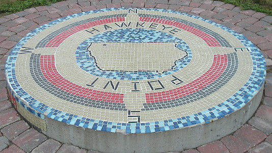
I think this mosaic is on the point itself now. (7/21/12)
Facing southeast (6/25/06)
Admittedly, it's not exactly a snow-covered peak.
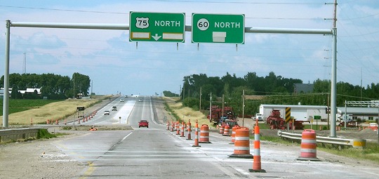
SOUTH End: Interchange, US 75, near Le Mars, Plymouth County
Facing south on 60 (9/17/07)
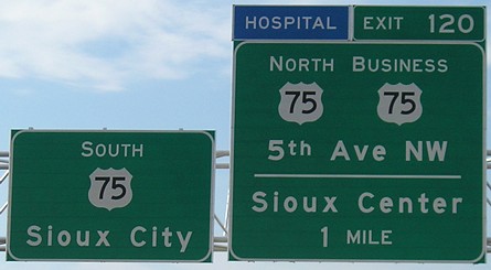
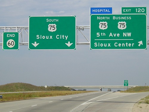
Signs mark the four-lane as US 75 before it actually becomes so. The same thing happens in the other direction (two pictures down).
Facing west, but heading south, on 60 (9/17/07)
It's rare that the business route and a direction of the main route are on the same BGS for the same exit. Though it could/should be IA 60's Exit 0, both directions use 75's exit numbers, meaning 75 exits from itself.
Facing north on 75 (7/1/07)
Photo by Jason Hancock
Facing east, but heading north, on 75 (7/1/07)
Photo by Jason Hancock
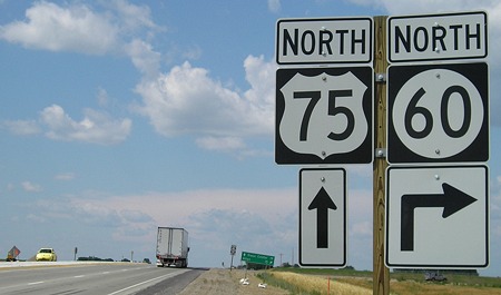
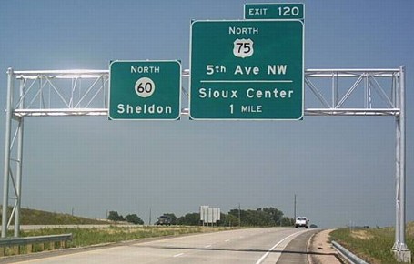
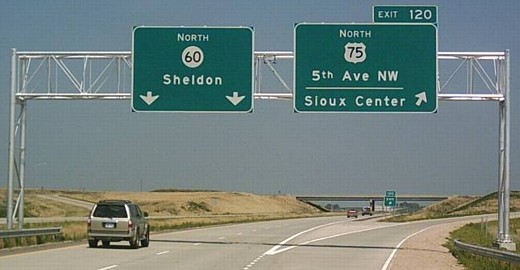
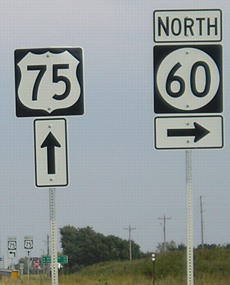
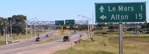
Facing north on 75 (6/25/06)
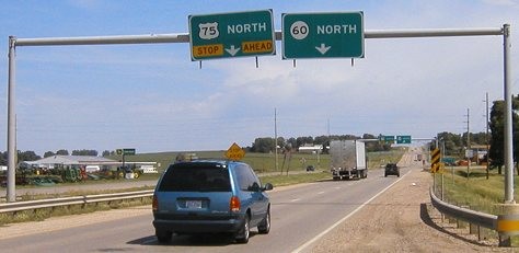
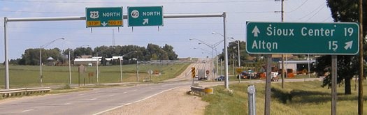
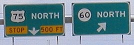
This is the top of the hill seen in the above picture. The Sioux Center/Alton LGS here may be the same one from the old intersection brought north as a temporary sign, replaced with the one seen below. Traffic for 60 takes an onramp onto a new segment of road, which then parallels the old road for a short while until turning northwest of Seney. The old 60 roadbed between Seney and Le Mars has been removed and will not be used. Aerial photos from 2005 show four parallel lines left to right: The future southbound lanes, northbound lanes, the old road (removed in late 2005 or early 2006), and the railroad.
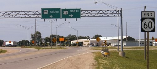
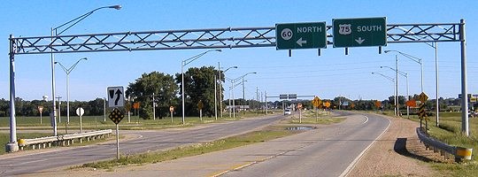
Facing north on Business 75 (widen browser window to see side-by-side) (9/17/07)
This direction is also the north end of Business 75. The omission of any direction above the leftmost 75 shield is technically correct, since both northbound and southbound 75 are ahead until after crossing the bridge (right).
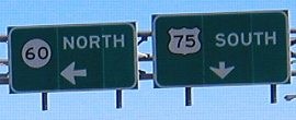
Facing south on 75 (9/17/07)
The old intersection is to the south of here.
Now, with the extension of IA 163 to Burlington, is there a possibility that IA 60 will be extended to Sioux City? Right now, there aren't any indications, but after two such changes elsewhere in the state (IA 330 to Altoona), who knows? One thing working against such an extension is that it would require recalibration and resetting of all mile markers along the route. On the one hand, this actually could be a good idea as the shifting of alignments in the four-lane construction have resulted in "miles" that are shorter or longer than that, and exit numbers might be slightly more accurate. On the other hand, the DOT really doesn't like to do that. The only state highway to have its mile markers reset in the past 30 years is IA 149, extended down to Ottumwa even before the number was, and US 151 did get a reset in 1989. But US 75's markers notably weren't when the road was rerouted into Nebraska in 1984, hence the "Exit 120" above.
Old SOUTH End: Intersection, US 75, near Le Mars, Plymouth County
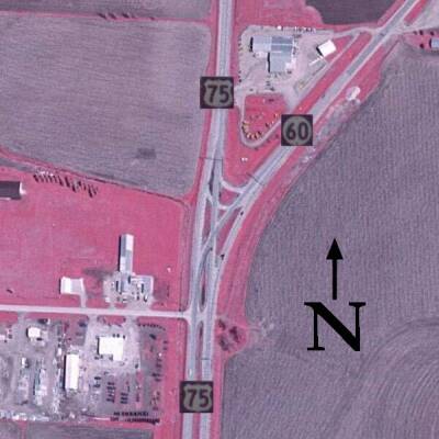
Photo (2002) from USDA/NRCS/MIT; graphic additions by Kurt Berge (summer 2003)
This intersection, shown before construction, has southbound-to-northbound turns available. Most photos below show the area as it was in 2004, before any construction on the Le Mars bypass began. Now that 60 is gone, this intersection has been rebuilt into a regular T intersection with 75, now Business 75, as a three-lane road.
Facing southwest, but heading south, on 60 (6/14/04)
This road was blocked off at the end of 2005, though the gantry wasn't taken down until the second half of 2006.
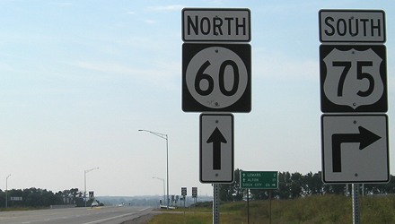
LGS behind above picture (6/14/04)
Facing north on 75 (6/14/04)
To the south is the intersection with IA 3 and Wells Dairy. Wells announced in April 2004 that it would retain its corporate headquarters in Le Mars.
Facing north on 75 (6/14/04)
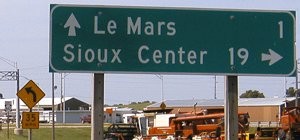
Closeup of signs in above picture (6/14/04)
These signs have changed, as seen below.
Facing north on 75 (6/25/06)
Between the old and new intersections, 75 is four lanes with cement islands in the middle. This road, from the interchange to IA 3, is likely to stay under state control.
Facing south on 75 (6/14/04)
Facing south on 75 (6/14/04)
Closeup of signs in above picture (6/14/04)
Surrounding area information: Misplaced 60 shields
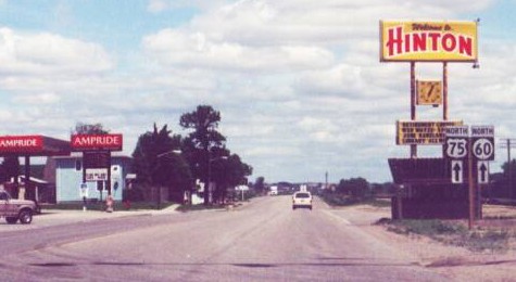
Facing northeast, but heading north, on 75 (summer 2003)
Photo by Kurt Berge
Hinton is 10 miles away from downtown Sioux City but 15 away from IA 60, yet this sign here, because it has a "North" and not a "To", implies that 60 is on this route. Kurt thinks this sign was placed in 1998. A lot of four-lane expressways in Iowa switch numbers at some point, which seems sort of weird until you note that most of those situations involve diagonals. Examples include IA 330-US 65, IA 163-US 63-US 34, and US 18-218.
Page created 5/5/04; last updated 2/24/17