
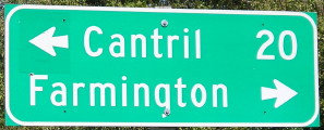
NORTH End: Stop sign/T intersection, IA 2, near Farmington, Van Buren County
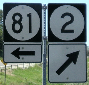
Facing north on 81 (9/8/10)
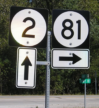
Unlike South IA 15, the mile markers reset, probably because 15 was continuing Missouri's numbers to avoid duplication with the north 15.
Facing north on 81 (9/8/10)
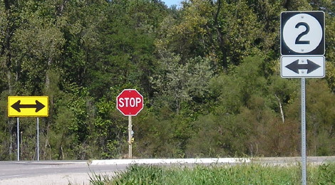
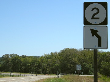
This setup is different from what Jason Hancock saw in 2002, when the IA 2 shield was on top of the double-arrow, which also has changed and isn't the typical style.
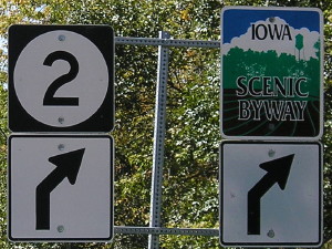
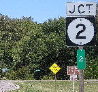
Facing west on 2 (9/8/10)
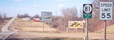
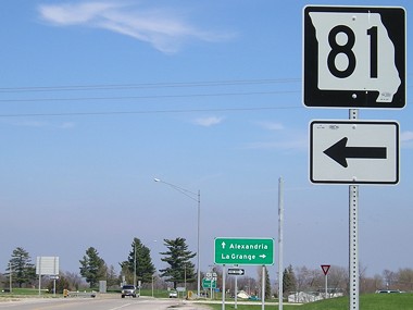
The first town on 81 in Missouri is on US 136, just closer than the next town on 2 (west).
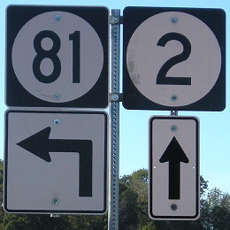
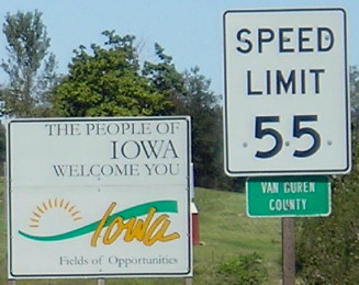
Facing west on 2 (9/8/10)
Facing west on 2 (10/3/15)
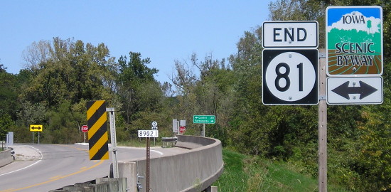
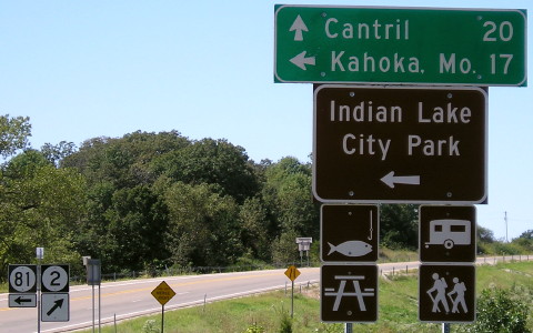
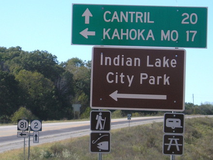
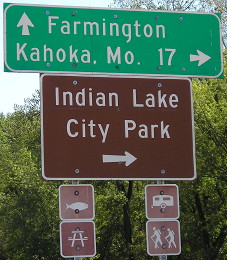
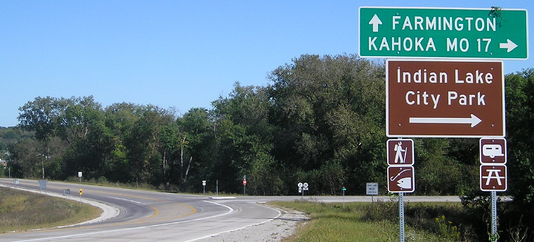
The IA 2 bridge over the Des Moines River was replaced with one alongside it to the south, which required reworking of the IA 81 intersection. All the signs were replaced, and these non-Iowa-standard LGSs came with that.
Facing east on 2 (9/8/10)
The new IA 2 bridge was under construction for a while, delayed by flooding, and locals are worried it isn't high enough above the river.
Facing east on 2 (10/3/15)
Each of the brown activity signs is changed from what was here before. New MUTCD guidelines?
Facing east on 2 (10/3/15)
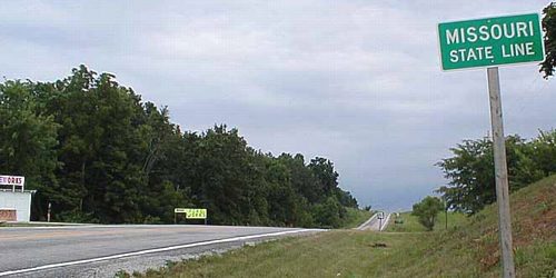
SOUTH End: Missouri state line, 2.7 miles south of Farmington, Van Buren County IA/Clark County MO
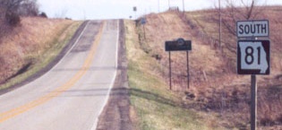
Facing south on 81 (2002)
Photo by Ben Prusia
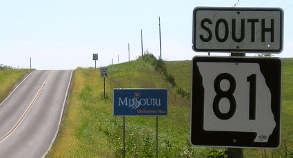
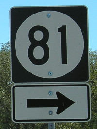
Facing south on 81 (first MO sign) (3/31/02 and 9/8/10)
Left photo by Jason Hancock
Missouri did a widespread update/replacement of its state-line signs in 2010, probably because the old logo had been in use for more than a decade.
Facing north on 81 (3/31/02 and 9/8/10)
Left photo by Jason Hancock
A photo that used to be on Ben Prusia's site shows that sign advertising - what else? - fireworks. That road is for the stand two pictures up.
Had the border between Iowa and Missouri been drawn straight in the early 19th century, the Highway 81 of the 21st century would be two miles longer in Iowa (double its length), south of the intersection with the road that becomes J56 near Mount Sterling. It would have been right near what became the Battle of Athens (but, thanks to surveying errors 40+ years earlier, it was a couple miles north...)
Surrounding area information: Battle of Athens
Sign near Battle of Athens State Park headquarters (9/8/10)
I couldn't get a tour because of Missouri budget cuts to state parks in 2010. I was left to wander what was left of the village of AY-thens.
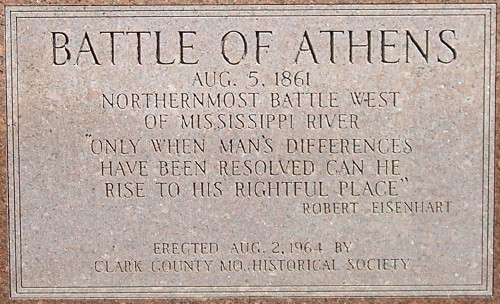
You can see Iowa from the yard of the home that still has a cannonball in it. This was a battle mostly between opposing factions of Missouri militias, though. However, it did have implications for getting the Confederates out of northern Missouri, keeping provisions and ammunition out of their hands and avoiding a possible worst-case scenario of a "sack of Keokuk".
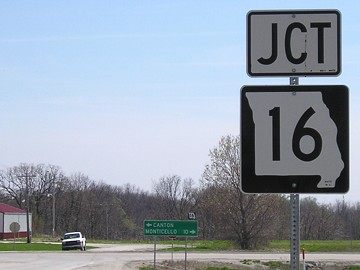
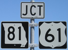
SOUTH End of MO 81: Stop sign/T intersection, MO 16, near Canton MO, Clark County MO
Facing south on 81 (all pictures 4/20/08)
Facing south on 81
Missouri 81 ends at MO 16 within 300 feet of 16's interchange ramps with US 61, and that is reflected in the signs on 16. (81 is not mentioned on 61.)
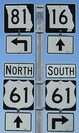
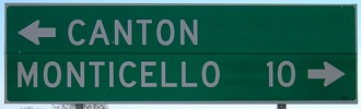
Facing east on 16
Facing east on 16 / Closeup
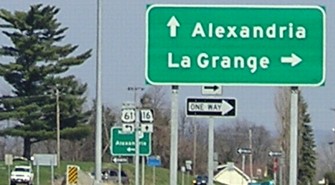
The green sign without mileages is MoDOT standard for an interchange. But, for whatever reason, along 61 northeast of Hannibal, the cities on the signs get smaller and smaller, until we have this one pointing to La Grange (pop. 1000) and Alexandria (pop. 166!) instead of Hannibal and Keokuk. Missouri does seem to be reluctant to list out-of-state cities at interchanges with four-lanes (see the use of Bethany over Des Moines on I-35), but this borders on ridiculous. If the requirement is that the city be on the route - which would rule out Mount Pleasant and Iowa City - Keokuk would do just fine since it's on 61.
Page created 9/14/02; last updated 12/19/16