
(August 14, 1984-July 1, 2003)
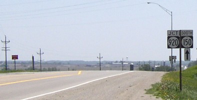
NORTH End: Stop sign, IA 150, Benton County
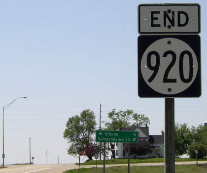
Facing west, but heading north, on 920
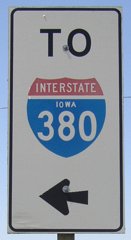
Before 1984, this was 150. Turning right would continue on 150 (hence the additional curve), while turning left would start on 101. Note the LGS mentions Urbana instead of Vinton. That's MM 13 under the stop sign.
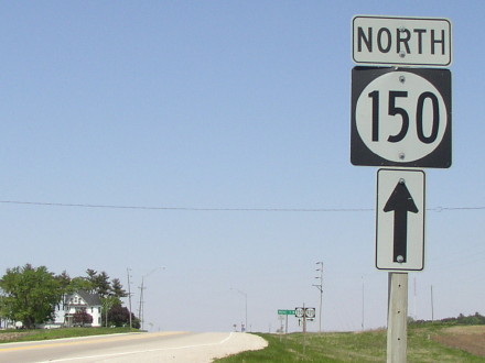
Facing north on 150
A slight deviance from the usual, this assembly has a directional tag. This is probably related to the changeover from 101. This pole is a likely candidate for holding the "End 101" sign.
Facing north on 150
Photo by Jason Hancock
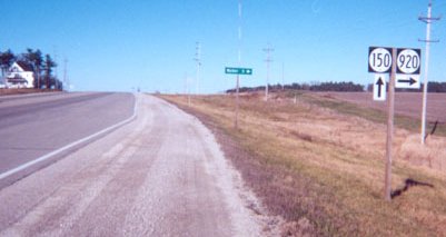
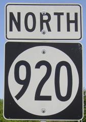
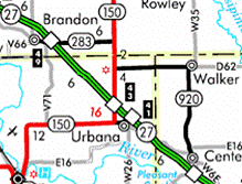
Highway 920 follows the portion of old 150 that does not closely parallel I-380. LGS says "Walker 5->", which is like a county road junction inasmuch the next city ahead is not listed. There probably would have been a 150 with an up-and-right arrow sign (see the east end of IA 96) before 1984.
Facing north on 150
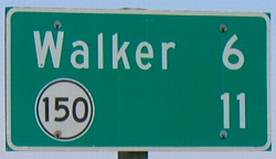
This mile marker is right at the intersection. After 101 was decommissioned 150 simply absorbed 101's mile markers but then did not adjust the rest. It's coincidental that two mile markers sit about equidistant from the intersection, but 150 MM 28 would have been right about where 920 MM 13 is now. The mileage scheme for 150 since 1984, then, has simply omitted mile markers 16 through 27, and Mile 15 is about 3/4 of a mile long with a "BK" (back) tag.
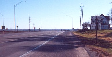
Facing south on 150
Compare this picture to the one below; the arrow under the "Jct" has been taken off. Prior to 1984, the sign in the foreground probably would have read "South 150 [up and left]; South 101 ^" or a variant of that. Which, come to think of it, would provide a perfect explanation for that arrow's existence.
Facing south on 150
Photo by Jason Hancock
Old photo: Arrow under 920 has been removed
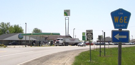
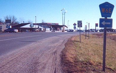
SOUTH End: Intersection, W6E and W36, south side of Center Point, Linn County
Facing south on 920
The picture below shows an Amoco before becoming assimilated by the buzzsaw:
Facing south on 920
Photo by Jason Hancock
Old photo: From 2001, the last year Amocos were unthreatened by encroaching green and white.
Jason Hancock writes, "South end of IA 920, at the junction with County Road W6E in Center Point; it continues southward as County Road W36. I-380 is only about a mile from this intersection, and there is no mention of IA 920 on I-380. But that segment of W36 was never maintained by the state -- IA 150 used to turn onto what is now W6E at this point." (And yes, Street Atlas 4.0 marks the road as 150 co-signed with 920, and "SR 150" tags still hang around all the way down to Collins Road, although not highlighted in any way.)
Since 150, the main route, turned left here, the intersection has most likely been reconstructed since 1984. Note that W36 is not signed as going ahead. It intersects I-380 two miles south and then theoretically continues to near Palo, passing by Pleasant Creek State Recreation Area. However, maps as late as 1996 indicated that W36 was unpaved between I-380 and the park, which would explain the absence of signage anywhere on it as of May 2003.
Facing northwest on W6E / Facing north on 920
The sign on the left is the one with its side to us on the immediate left of the W6E signs above. The other is the first sign facing north, as 920 goes through all of Center Point. County Road E2W to Urbana, which ends at 920, is never marked. Alignments in Center Point may indicate 150 followed a different route a long time ago.
Facing north on 920
Last seen: 2003
Pictures by Jason Hancock: Third, sixth, and eighth, 12/9/01
Pictures by me: First, second, fourth, fifth, seventh, and ninth-eleventh, 5/20/03
Page created 2/25/02; last updated 3/5/04