 (and a history lesson)
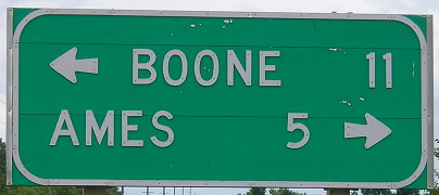
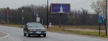
WEST End [current/WEST segment]: Direct merge into US 30, Boone County
Facing west on 930 approaching 30 (12/21/01)
This is an area where "Lincoln Highway", "Old 30" and "US 30" are three separate roads. While this road is marked as Lincoln Way, it is NOT the Lincoln Highway. The Lincoln went along the west side of the Iowa State campus on Sheldon and Hyland, then west on Ontario (which was named from the village of Ontario, since assimilated into Ames) into Boone County on what is now 220th St. (first alignment) or 210th St. (second alignment). In 1930, according to some old maps I have, 30 was changed from its Lincoln route (through Ontario and Jordan, which was flattened by a tornado in the mid-'70s) to a route continuing straight west of Ames and then angled northwest to Boone near what is IA 17 today.
By the mid-'60s, all of the Lincoln between Ogden and Marshalltown (except for between Duff and Sheldon avenues in Ames) was no longer part of 30, as this 1966 map shows. Note the proposed I-35 interchange with E41/Lincoln Way instead of 13th Street (though this might be an error).
(Showing 30 and IA 64 sharing a piece of diagonal road also is probably an error brought on by reconciling the old and new alignments of 30 on the map.)
By the late 1960s, the Lincoln between today's west end of 930 and IA 330 was in 'unnumbered primary' black on the official state maps. All of the route up until 1980 was state-maintained, and then Story County took over E41 (its county road name) from I-35 to the Marshall County line, while Ames took the in-city segment. The portions east and west of that were still state-maintained; see clips at the bottom of the 900s page. By the early 1990s, the only piece of IA 930 left was between R38, which runs on the Story/Boone line, and this interchange. Going west, then turning around and coming back east:
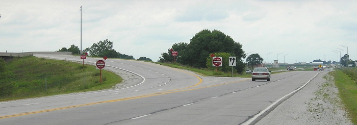
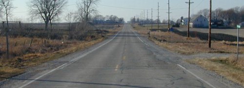
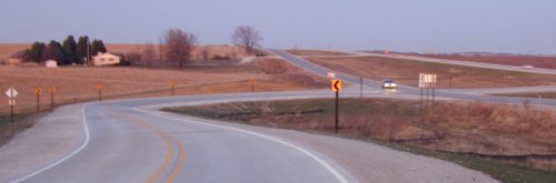
Facing west on 930, about where the car is in the top picture (8/8/16)
A left turn does not put you on the onramp to 30, but the road to Napier, which is the road used for WB 30 to Lincoln Way and the onramp to EB 30. Continuing straight ahead leaves you no choice but 30 WB. The EB exit curves above 30 and becomes the EB part of this road.
Enlargement of above photo (8/8/16)
There's nowhere to go but directly into 30 westbound, a path that reveals the 1930-63 alignment, but that "West 30" is premature since we're not on the mainline.
Facing west on 930 (8/8/16)
Since 2002, a "Keep Right" sign has been added and the two-sets of "Do Not Enter" and "Wrong Way" signs got flags.
Facing east on 30 (8/8/16)
Facing east on 30 (8/8/16)
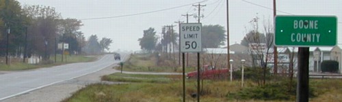
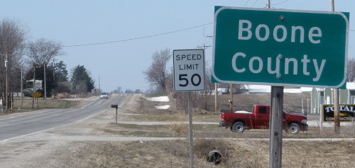
We're still in Boone County; Ames is a good two miles away. The exit and bridge are two lanes. Lighting has been added to the exit.
The four-lane road between here and US 69 was supposed to open in fall 1972, but weather and delays pushed it back. In 2016, Jason Hancock finally pinpointed the date of the bypass opening: December 4, 1972. This interchange remained unfinished over the winter, then the area got clobbered by the infamous blizzard of April 8-10, 1973. Ironically, while that was by far the largest snowfall in April in Ames, it wasn't the most influential. That honor belongs to April 12, 2008, when it snowed on the Veishea parade, and convinced Iowa State officials that attempting to riot-proof the celebration by moving it earlier meant trying to outguess Mother Nature. As a rule of thumb, don't consider winter in Iowa over until after the second weekend of April.
Facing east on 930
Now we're back to the intersection. Turn right to get to the eastbound 30 ramp.
Facing north on X Avenue (unnumbered paved county road to Napier)
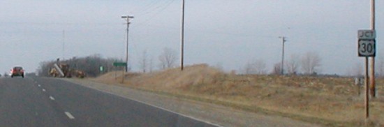
EAST End [current/WEST segment]: Story/Boone county line
The state-maintained portion begins where the tan car is. (12/21/01)
Facing east on 930 (10/25/02)
This was taken about 10 feet to the west of the picture facing southeast. Standalone county signs are also on secret 263 and 928.
Facing east on 930 (3/25/10)
The replacement of the small county sign with the larger (and Clearview!) sign indicates that the state is still involved with this road.
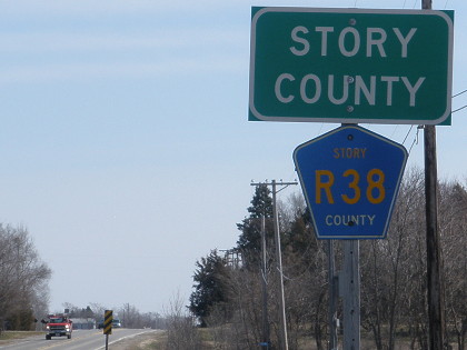
Facing (south)east (10/25/02)
The car is about to start on 930, after it crosses the intersection. The sign at right is R38 with "Story County" underneath it.
Facing east (3/25/10)
The larger county sign with the regular road font, in retrospect, was the interim between the switch to larger signs in the first place and the state's embracing of Clearview. Even after Clearview has been jettisoned, county-line signs are in mixed-case.
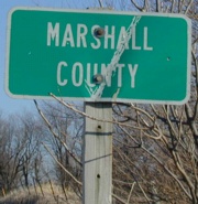
WEST End [old/EAST segment]: Story/Marshall county line

Facing west on 930 (now E41) (12/5/02)
The green sign at right says "Lincoln Highway," since that's what it is. (The Lincoln Highway Map Pack actually indicates the earliest alignment of the Lincoln between State Center and Colo was a mile south at present US 30, but the modern E41 alignment is generally thought of when "the Lincoln" is mentioned.) The road narrows a bit in Story County.
Facing east on 930 (now E41) (12/5/02)
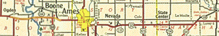
There is no corresponding marker for Story County, possibly meaning that marking secret highways with county-line signs began after 1981. See the map segment at top for the 'east' part of 930. Mile markers were still up into the 2000s, including 2, 3, 5, 7, 10, and an 11 just past where current E41 splits from old 930 - see below. And that leads us to the east end.
EAST End [old/EAST segment]: Stop sign/T intersection, IA 330, Marshall County
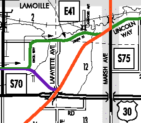
Purple is 930, green is E41, orange is 330 after 1989. Approaching its end, just a bit of old pavement extends straight ahead while the road curves north and then east to meet 330 just north of its interchange with 330. The end 930 had at decommissioning in 1989, though, was obliterated in the early 2000s. (See also map at bottom.)
Facing north, but heading east, on 930 (12/6/02)
This is all new concrete connecting the road to 330 north of where they previously met. Until the four-laning of 330, 930 turned right about here. You can see the new northbound lanes for 330, which merge after the hill. The connection was moved north, away from where US 30 and IA 330 meet, which despite improvements is an underpowered interchange because it's still relying on the standard diamond for eight total lanes.
The pre-construction end was closer, but the east end of 930 is about 1.2 miles northwest of the confluence of 42 degrees north, 93 degrees west, which is nearly on the gravel road that S75 becomes south of 30.
US 30 in Marshall County: Transportation philosophy at work
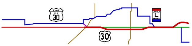
This map goes from one end of Marshall County to the other, with the main iterations of the major east-west route. The BLUE line is more or less the original route of the Lincoln Highway and/or the first paved alignment of US 30 (1913/26 to 1948). The GREEN line, which runs under the red where not seen, is the perfectly straight alignment used for nearly 35 years (1962-96). The small PURPLE connector tied the blue route west of there with the green route east of there from 1948 to 1962. That is the easternmost part of 930. Finally, the RED line is the 2005 route of US 30, wider along the four-lane segment as it was in 2005. All three routes share the segment between Shady Oaks Road (under the Lincoln Highway marker) and a point west of Le Grand - approximately 2 miles. The thin BROWN lines are the present routes of IA 330 and IA 14. (Map created 3/3/05)
The alignment changes of US 30 in Marshall County, I think, exemplify the different eras of road-building philosophies in Iowa:
| Before 1935 | The shortest distance between two points is on whatever roads currently exist, and goes through the business district of nearly every town. (Original Lincoln route) | |
| 1935-1950 | The shortest distance between two points is on the roads that currently exist, but the biggest kinks can be ironed out. (Straightening on the south side of Marshalltown) | |
| 1950-1985 | The shortest distance between two points is a straight line. Anything on that line needs a compelling reason to avoid being torn down. (Final realignments prior to four-laning) | |
| 1985-present | The shortest distance between two points is irrelevant. It's the fastest distance with least impact on presently existing development (or the environment) that matters. If it increases the actual mileage, so be it. Straight lines are merely a bonus. (Marshalltown and Le Grand bypasses) | |
Page created 4/7/02; last updated 1/24/17