
(July 8, 1931-July 1, 2003)
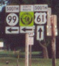
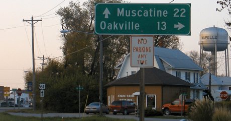
NORTH End: Stop sign/T intersection, US 61, Wapello, Louisa County
(What, you expected Wapello to be in Wapello County?)
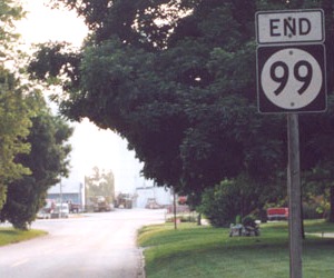
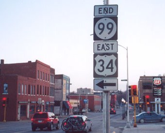
Facing west, but heading north, on 99 (6/22/02)
Photo by Jason Hancock
Facing west, but heading north, on 99 (5/12/08)
Facing south on 61 (6/22/02) (sign replaced - see below)
Photo by Jason Hancock
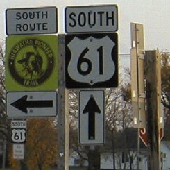
Facing south on 61 (6/22/02 and 10/29/04)
Left photo by Jason Hancock
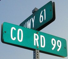
Upon the Second Great Decommissioning, Louisa and Des Moines counties opted to keep the same numbers of the defunct routes, just calling them "County Road" for a couple of years. That has changed now:
Facing south on 61 (5/12/08)
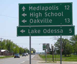
Oakville made headlines in 2008 when it became part of the Iowa River.
Facing north on 61 (10/29/04)
Facing north on 61 (5/12/08)
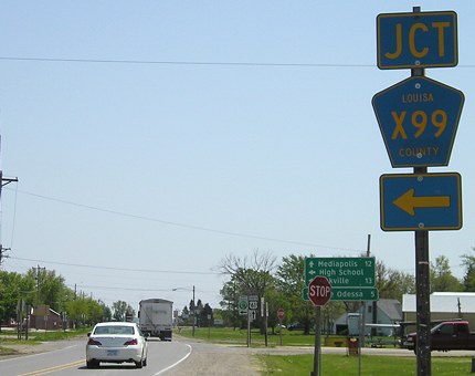
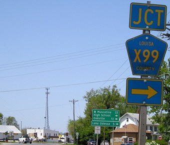
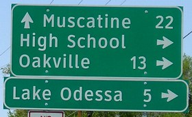
This rural sign is at the intersection of 61 and 99 in Wapello, although I'm not quite sure why. In 2004, this was the only thing with "99" on it at the intersection. I traveled east on 99 hoping to spot a blue pentagon, but upon seeing the first naked pole, I turned around. The county PDF map gave no alphanumeric designation, just "County Rd 99". In 2006, the counties changed the designation to something a little more conventional - it's now County Road X99, and there are blue pentagons along the route. That said, "Highway 99" has a death grip on the locals' vocabulary.
This is not where US 61 originally ran. Prior to 1932, 61 came into Wapello from the south on what is now gravel J Avenue, a legacy evident in the way the roads meet and pronounced curves on the gravel road. It then went east for a mile on what until recently was 99, turning north at the intersection with County Road G62, and following gravel I Avenue north and northwest to Grandview, at one point two miles east of present 61, and then becoming J Avenue again south of Grandview.
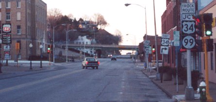
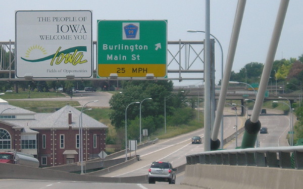
SOUTH End: Interchange, US 34, Burlington, Des Moines County
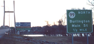
Facing south on 99 (3/31/02)
Photo by Jason Hancock
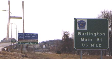
This picture and the two below are near the intersection of Main and Columbia streets, 0.15 miles south of the actual freeway, and changed after 99 was decommissioned.
Facing north on Main Street / Facing west on Columbia Street (3/31/02)
Photo by Jason Hancock
The stoplight in the foreground is the intersection of Washington and Main. Columbia Street is the next one. Jason says the off-ramp from eastbound US 34 follows Front Street for a short distance and turns right onto Columbia before ending here. At left and below left is the Des Moines County Courthouse.
Facing north on Main Street (10/4/15)
One block west of here is the location of Zion Methodist Church, the first legislative house of the Iowa Territory. Burlington was also, temporarily, the capital of Wisconsin Territory! The second session of Wisconsin's first Territorial Legislature in the winter of 1837-38 and a special summer session were both held in Burlington, prior to the Iowa Territory being created on July 3, 1838. The Wisconsin seat of government then moved to the nearly non-existent village of Madison. (Stanley Cravens, "Capitals and Capitols in Early Wisconsin," Wisconsin Blue Book 1983-84) Among the Territorial Legislature's doings in Burlington was creating counties west of the Mississippi River.
Facing east on 34 (1998)
Photo by Mark Roberts
It used to read "Toll Bridge" underneath "Illinois". Note signs for an upcoming hill.
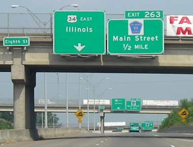
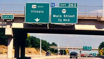
Facing east on 34 (6/16/06 and 5/26/12)
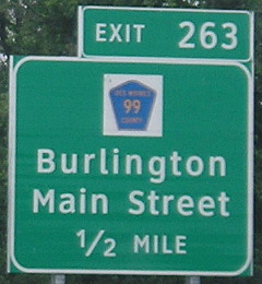
"Toll Bridge" used to be under "Illinois" here as well until the sign was replaced; the 1970s freeway through Burlington fed into the old bridge for 20 years. The BGSs in 2012 still said County Road 99 instead of the newer designation X99 for the former IA 99.
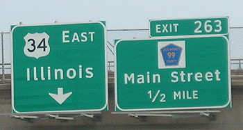
Facing east on 34 (6/16/06)
Although the designation of 99 had changed to X99 by the time of this picture, the BGSs had not changed.
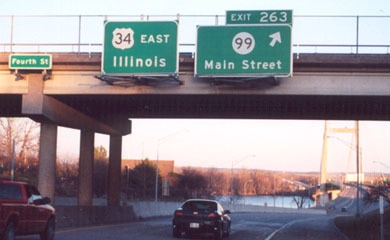
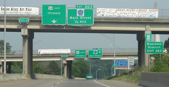
Facing east on 34 (3/31/02)
Photo by Jason Hancock
The bridge into Illinois is visible in the background. Given the circumstances of 99's end, leaving the "North" off may be OK. Often BGSs with county road shields have a white background, though I think they look better without.
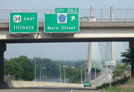
Facing east on 34 (6/16/06)
Facing east on 34 (6/16/06)
The exit is that close to Illinois. Merging traffic gets on the bridge immediately. For photos of the old bridge, see the US 34 page.
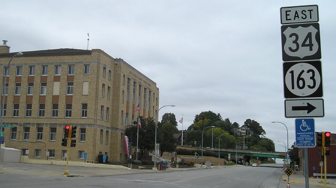
Facing east on Columbia Street at Front Street (5/26/12)
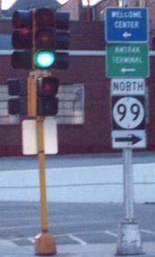
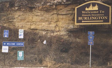
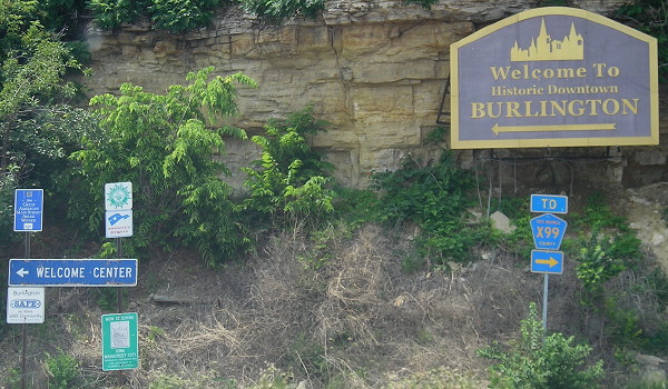
A left turn requires entrance onto the freeway. The Welcome Center is to the right. Signs in the below picture can be seen at left.
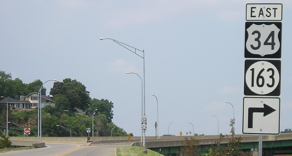
Facing north on Front Street (5/26/12)
These poles show that IA 163 is signed all the way to the state line on the Mississippi River, not just ending "in Burlington".
Facing west on 34 in Illinois (3/31/02)
Photo by Jason Hancock
Jason says this BGS appears to be an Illinois DOT sign, but the Welcome Center sign is Iowa's.
Facing west on 34 in Illinois (12/27/04 and 5/26/12)
Left photo by Jason Hancock
Replaced, yes; centered, no, though the "North" didn't need to be removed at all. Notice the changes to the Welcome Center sign between the 2002 and 2004 pictures, the switch to Clearview between the 2004 and 2012 pictures, and the fact the new BGS still says 99 instead of X99.
Facing west on 34/163 (5/26/12)
These signs are the ones who backs are visible on the bridge in the eastbound bridge picture above.
Facing west with County Road 99 sign (12/27/04)
Photo by Jason Hancock
Facing west with County Road X99 sign (5/26/12)
Last seen: 2003
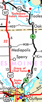
It seems odd that such a long, unparalleled route would be dropped from the state's rolls, but it was, probably becaus Oakville is the only incorporated place on the route. It's a pity, too, as 99 helped define that little "bulge" in Iowa.
Page created 6/23/02; last updated 12/20/16