

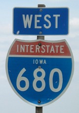
 and
and

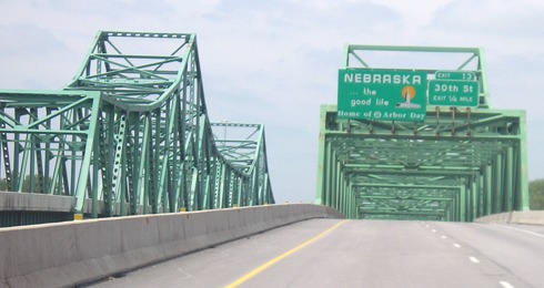
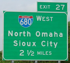
WEST Iowa line: Missouri River (Mormon Bridge), Omaha NE, Pottawattamie County IA/Douglas County NE
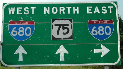
Facing north on 75 in Nebraska
US 75 (old US 73) does not join I-680, but rather parallels it between the first and second interchanges in Nebraska. It turns south again as the road that used to be the easternmost segment of NE 36 went to the Mormon Bridge. When 680 was built in the late 1970s, the bridge became part of the interstate.
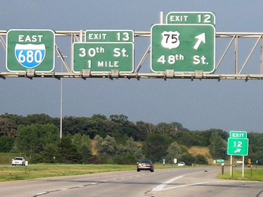
Facing east on 680
This is one of the last gantries in Nebraska. Like most I-680 signs north of US 6, the panels are in an old hunter green instead of a regular green like the exit sign.
Facing west on 680
This, the westbound bridge, is the younger of the pair, built in 1979. The one on the left opened in 1952.
Facing west on 680
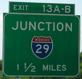
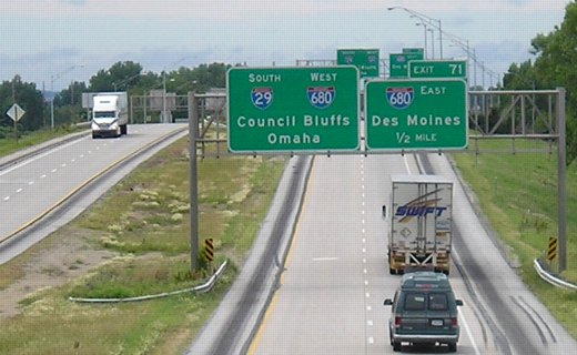
Three miles to the east of the state line, I-680 meets I-29. For a bunch of pictures of the interchange, see the IA 988 page. This shield, a 3-digit interstate in a 2-digit-wide shield, appears between the bridge over I-29 and the ramp from southbound I-29 to westbound I-680. (A traveler following westbound 680 by exiting from I-29 wouldn't see it.)
The western junction of I-680 in Omaha is the first 3-digit interstate not numbered I-180 that I-80 meets east of Salt Lake City (I-215), and the first signed 3-digit x80 not numbered I-180 since a point northeast of San Francisco, where 80 intersects ... I-680. The next I-680 to the east is in far eastern Ohio at Youngstown.
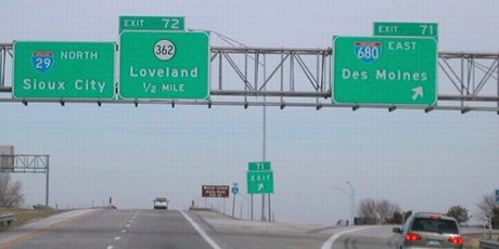
WEST End of I-80N: I-29 exit 71, near Loveland, Pottawattamie County
Facing west on 80N/680
Facing west on 80N/680
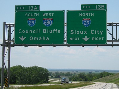
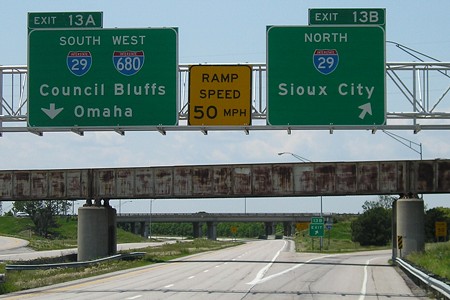
Facing south on 29
This photo was taken before IA 362 was decommissioned. This interchange is close enough to I-29/I-680 that it is a folded diamond.
Facing south on 29 (photo taken from old IA 362 bridge)
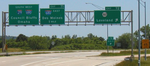
The east-west part of I-680 east of I-29 was constructed before I-80 was built southwest to Council Bluffs. This provided the first four-lane connection from Des Moines to Council Bluffs. For a while, this was called I-80N until AASHTO banned lettered suffixes on interstates (with the notable exceptions of I-35E/I-35W in Minnesota and Texas). In 2003, the signs here were old enough that they may have included US 75 from its pre-1984 alignment. By mid-2007, the second "South 29 West 680" sign (in the background) had been replaced with a Clearview sign.
Facing north on 29
Photo by Neil Bratney
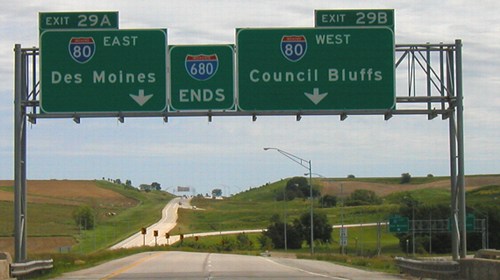
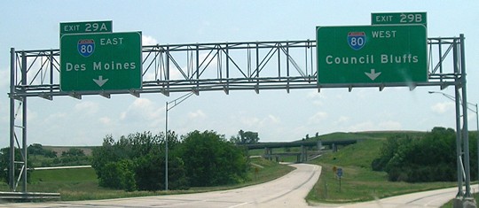
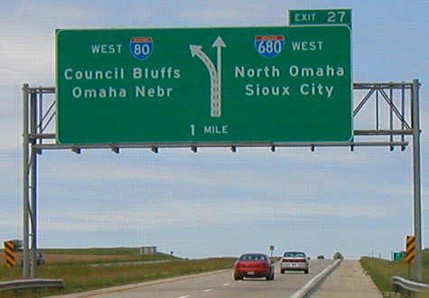
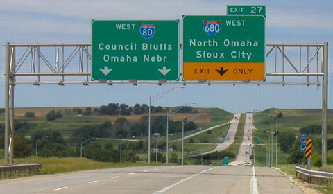
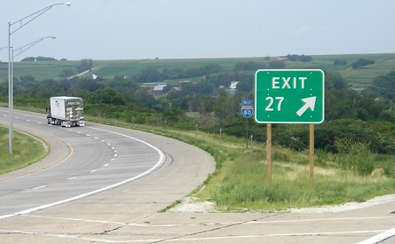
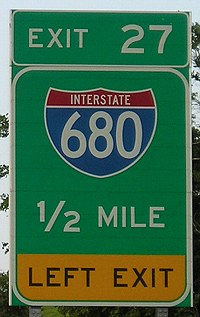
EAST End: I-80 exit 27, near Neola, Pottawattamie County
Facing east on 680
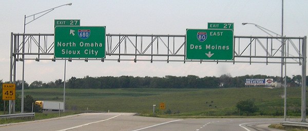
In Iowa, I-680 only has seven interchanges: Two local roads, one county road (L34, Logan/Beebeetown), one state highway (IA 191, now with County Road G8L), and three interstate interchanges (I-29 north and south, and I-80). If you continue east on 80 from 680, you encounter a second Exit 29 - I-80's Exit 29 for US 59.
Facing east on 680
Facing west on 80
Facing west on 80
Even though I-680 is a handy way to bypass Omaha and is the cutoff for Des Moines-Sioux City travelers, three times as much traffic uses I-80 in the area. In fact, I-680 between I-29 and IA 191 is by far the least traveled interstate in Iowa; in 2006, IA 330's four-lane segment averaged 100 more cars per day (5700 vs. 5600). I'm not sure why "Nebr" is added to the Omaha line, since it really isn't needed.
Facing west on 80
Closeup of above picture
Easily seen at the I-80/680 interchange is the exit for IA 191, now IA 191 and County Road G8L. The Neola diagonal - 80 to the southwest of here - was not built at the same time as 80 east of here, so between late 1966 and late 1969 travelers either had to get on two-lane IA 64 (later 191) at the interchange in the background or continue west to meet I-29 at Loveland.
Facing west
Starting in summer 2007, one-piece Clearview exit panels like this started appearing in Iowa. Besides this one, a string of these "gore signs" can be seen on westbound US 20 in the Waterloo area. If this is to become standard Iowa practice, that's a lot of exit signs that will have to be changed. (In my opinion, I prefer having the exit number above on a separate piece.)
Facing northeast, but heading east, on 80
Facing northeast, but heading east, on 80
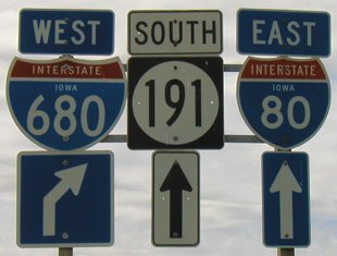
Facing south on 191
The IA 191 interchange is close enough to I-80 that eastbound 680 isn't even signed. Although it's signed as "East 80" here, the ramp merges onto 680 soon enough that you can still go west on 80 if you want to. IA 191 no longer continues south much past this sign assembly, which is near Tri-Center High School. (The school itself is wedged in the half-mile between I-680 and the Pottawattamie/Harrison county line instead of in Neola proper.) This "South 191" has been taken off the poles due to 191's truncation at the 680 interchange.
Tenth picture by Neil Bratney: 2/23/02
Pictures by me: First, second, and 17th, 7/29/07; third and fourth, 6/12/06; fifth-seventh, 12th, 13th, 18th, and 19th, 6/4/07; eighth, eleventh, 14th-16th, 20th, and 21st, 6/9/03; ninth, 6/12/05
Page created 1/8/07; last updated 2/22/08