
Old WEST Iowa line (October 16, 1926-June 29, 1979): Missouri River (Combination Bridge) (with US 77 after 1929), Sioux City IA/South Sioux City NE, Woodbury County IA/Dakota County NE
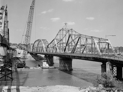
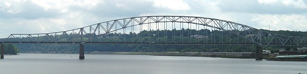
The third connection between Iowa and Nebraska in the area, after a railroad bridge and pontoon bridge, the Combination Bridge opened on January 21, 1896 - meaning the bridge was already 30 years old when 20 came through. It had a span that could pivot to let river traffic through (the prominent one below). It was a toll bridge until February 8, 1951. The pictures below were taken about a year after 20 was routed off the bridge, as construction was beginning on a new bridge for US 77.
Facing north, leaving Nebraska (May 1980)
The Library of Congress photographers got to the Combination Bridge soon before its 85 years of service were up. Think about that: A bridge built 30 years after the Civil War ended would bring traffic right to an interstate highway for more than 20 years.
Facing south (May 1980)
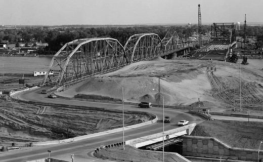
Interstate 29 is running across the bottom of this picture. The new bridge is coming across from Nebraska on the right. About nine months after these photos were taken, the new bridge opened. In the winter and spring of 1981, the Combination Bridge would be demolished to finish a three-year-long project that turned an old bridge and original 1957 "tight cloverleaf" interchange into a new bridge and "Iowa's Most Stupid Intersection." (Work began May 15, 1979, when the west-side ramps were closed. The east ramps were built after the old bridge came down.)
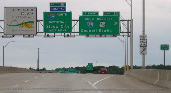
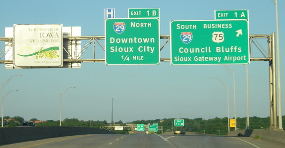
WEST Iowa line: Missouri River (with I-129 and US 75 after 1984), Sioux City IA/South Sioux City NE, Woodbury County IA/Dakota County NE
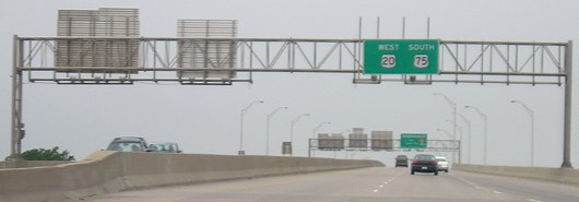
Facing west on 129/20, but heading south on 75 (6/12/05)
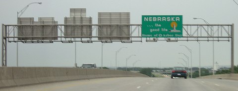
I don't know why I-129 isn't on this sign. This is inside the interchange with I-29.
Facing west on 129/20, but heading south on 75 (6/12/05)
The reverse of this gantry, which is in Iowa, is shown below.
Facing east on 129/20, but heading north on 75 (6/12/05)
Facing east on 129/20, but heading north on 75 (6/4/14)
For more signage of the area, see the I-129 page (east end).
Point of interest:
On October 19, 1958, approximately one month after the first rural segment of interstate highway opened in Iowa, a new alignment of US 20 opened between Moville and western Ida County. Included in this was a 3-mile four-lane segment east of Moville. US 20 would become four lanes west to Sioux City in 1964.
The four-lane has not progressed eastward since. To put this in perspective, imagine being in Moville in 1958 and telling residents that their children's children would still be waiting for a four-lane road to Fort Dodge.
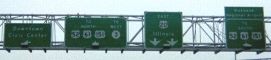
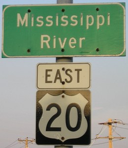
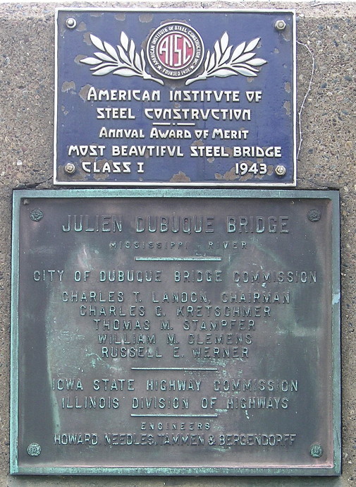
EAST Iowa line: Mississippi River (Julien Dubuque Bridge), Dubuque IA/East Dubuque IL, Dubuque County IA/Jo Daviess County IL
Facing east on 20 (1/31/03)
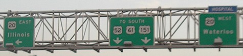
This is last sign assembly in Iowa, at the foot of the bridge. The bridge approach crosses over 52/61/151.
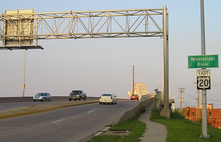
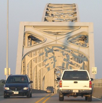
Facing east on 20 (8/10/07)
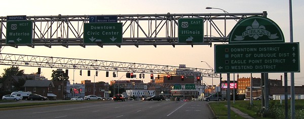
The four-lane US 20 that extends eastward from Fort Dodge drops to two as it crosses the Mississippi. The signs for the connector to US 52/61/151 are seen here; the 1990s expressway goes under the bridge.
Facing east on 20 (8/10/07)
This bridge is the "halfway point" for what is currently the nation's longest US highway. (However, it's not the longest continuous highway, because it technically does not exist inside Yellowstone National Park.)

Facing east on 20 (10/9/15)
Facing east on 20 (10/9/15)
These are all from the same image, encountered in succession starting on the right.
Illinois end of bridge, westbound (10/9/15)
Illinois end of bridge, eastbound (10/9/15)
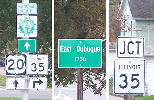
Facing south on 35 (8/10/07)
The very short IL 35 connects East Dubuque to Wisconsin and US 61/151. Between 1969 and 1981, US 61/151 were routed onto IL 35, the only time they were ever in Illinois. The semi is on 20.
Facing south on 35 (8/10/07)
There's a little ramp onto 20 right at the Illinois foot of the bridge.
Facing west on 20 (11/6/16)
Since Locust was original 61, somehow they crammed toll booths in between the position this photo was taken (still on the bridge approach) and the stoplight.
Facing north on 946 (9/28/15)
IA 946 is the designation for a connector between 52/61/151 and 20. This is where US 61/151 travelers can pull off for the Hy-Vee and fast food as well (although southbound drivers have to know to turn at the north end of 946, north of 20).
Facing north on 946 (8/10/07)
Facing south on 946 (8/10/07)
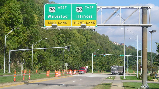
Notice the use of "Illinois" as a control city for 20 - not Galena, Rockford, or Chicago - and the lack of any for 52/61/151, probably because there are so many options (Bellevue, Davenport, Cedar Rapids).
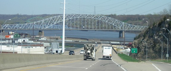
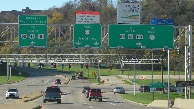
Facing north on 52/61/151 (4/18/06)
This view of the bridge is on US 52/61/151 at the exit for the access road to 20 (IA 946). The green bridge in the background is 61/151 to Wisconsin.
Facing south (8/9/07)
Old EAST Iowa line (October 16, 1926-August 31, 1943): Mississippi River (Wagon Bridge), Dubuque IA/Dubuque County IL, Dubuque County IA/Jo Daviess County IL
Facing east (8/9/07)
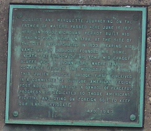
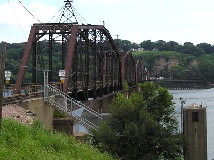
Originally, 20 exited Dubuque on 4th Street, a bit north of Dodge, which connected to a bridge originally built in 1887, beating out the Ak-Sar-Ben bridge by one year as the oldest state-line bridge used for highways in Iowa. Dubuque's new riverwalk has informative panels about the Wagon Bridge and the Shot Tower near the railroad bridge.
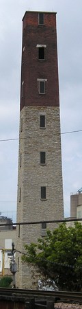
The Shot Tower (8/9/07)
The remnant of 4th Street east of the US 52/61/151 expressway, running parallel to the railroad, was torn up in the 2000s.
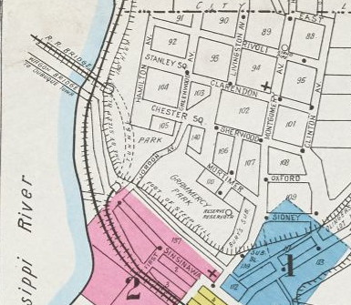
Sanborn Fire Insurance map, East Dubuque, 1921
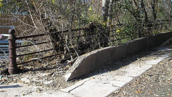
This appears to be a remnant of the old road after coming off the High/Wagon Bridge, where 20 entered East Dubuque, is just off the end of Sinisawa Avenue. These photos are near the south end of the railroad tunnel seen in the above map. (11/6/16)
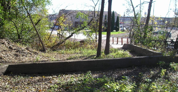
The bridge paralleled the railroad tracks. (11/6/16)
Page created 4/15/07; last updated 4/8/20