
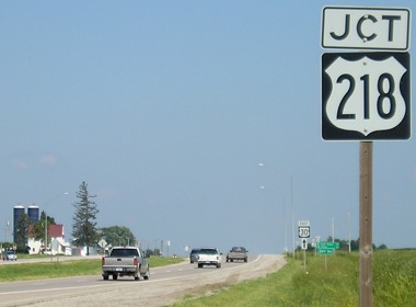
Every state seems to have an oddity in its US highways, and Iowa's is US 218, an original 1926 route. It runs north-south with an even number - glitch number 1. It has always met - and multiplexed with - its "parent" in the middle of its routing, in this case US 18 between Floyd and Charles City - glitch number 2.
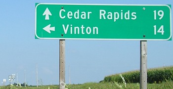
In 1938, there was a chance to rectify this situation. US 161 in Iowa was broken up into a new US 151 northeast of Cedar Rapids and an extension of US 218 south of there. Prior to this change, 218 ended at US 30 in Benton County. But I don't see a reason that 161 could not instead have kept its route south of Cedar Rapids and instead absorbed 218 through Waterloo into Minnesota. (One potential argument against it: confusion of "one-fifty-one" and "one-sixty-one" in the Cedar Rapids area.) Such a change would have solved the peculiarity of 218's existence. As it is, the extension of 218 restored to one number the route between the Minnesota border and southern Iowa, which had originally been numbered IA 40. The other option for 218, since US 65 originally ran through Owatonna MN, would have been to make 218 an x65.

Facing west, but heading north, on 218 (5/28/06)
The pickup truck is on 65; the stopped vehicles are on 218, and US 14 probably took a right turn here to join 65.
Facing east (5/28/06)
This sign is a block west, by the Steele County Courthouse. There's a similar sign southbound on Oak.
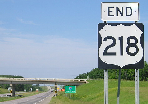
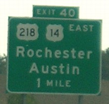
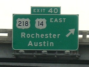
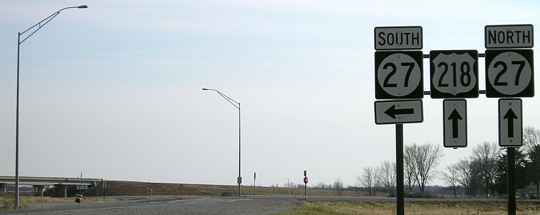
NORTH End: I-35 exit 40 County Road 45, Owatonna MN, Steele County MN
Facing north on 218 (6/19/15)
Facing south (6/19/15)
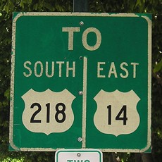
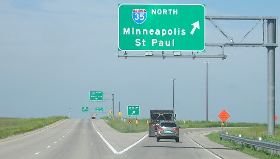
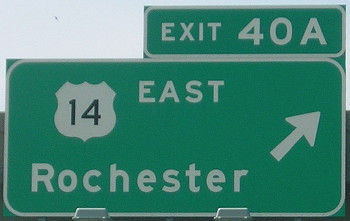
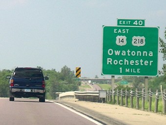
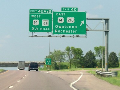
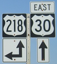
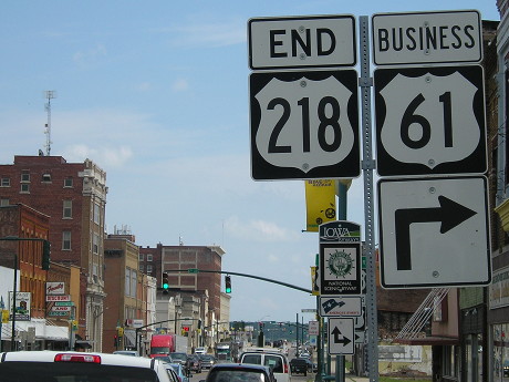
This is where US 218 should end/begin. Instead, the Minnesota Department of Transportation is adamant that 218 joins 14, heading toward I-35.
Facing west on 14, but heading north on 218 (6/19/15)
Facing west on 14, but heading north on 218 (6/19/15)
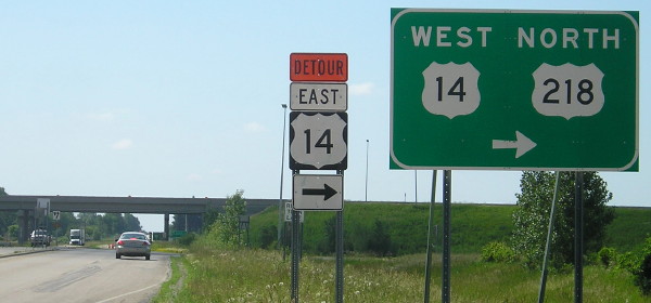
After all the signs routing 218 onto 14, MnDOT now marks "End 218" here, east of I-35, at the only exit on 14 between 218 and 35. This makes no sense. Not only that, but no official truncation has been submitted to the agency that approves changes to the US route system.
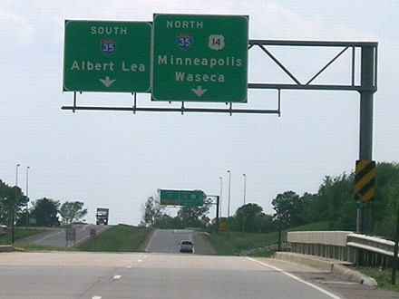
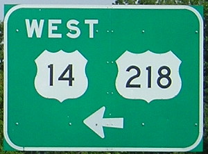
Facing west on 14, but heading north on 218 (5/28/06)
After I-35 and the US 14 bypass of Owatonna were built, 218's north end could have been pulled back to where 14 and 218 split on the southeast side of town, but it wasn't (see above). Construction to extend US 14 west of this interchange was going on in 2009; a four-lane to Waseca opened August 31, 2012. However, a 14-mile two-lane gap remains east of Owatonna on what otherwise is four lanes from Mankato to Rochester.
Facing west on 14, but heading north on 218 (5/28/06)
A comparable Iowa sign probably would have included a "West" above the 14. The left lane becomes the outer part of the trumpet interchange.
Facing west on 14 (6/19/15)
The trumpet is now a cloverleaf.
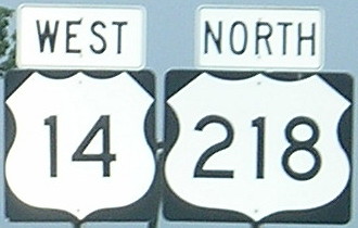
Facing north on 35 (6/19/15)
The I-35 BGSs for the cloverleaf do not show 218.
Facing north on 35 (5/28/06)
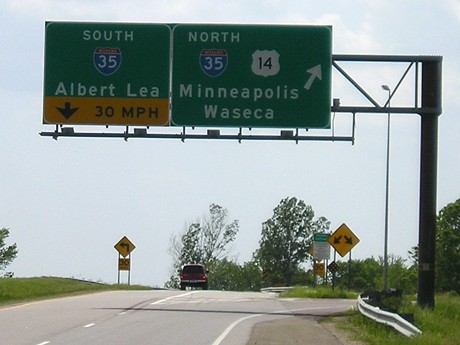
Signs on I-35 before the four-lane to Waseca opened clearly show US 218 is involved in this interchange.
Facing north on 35 (5/28/06)
Facing south on 35 (5/28/06)
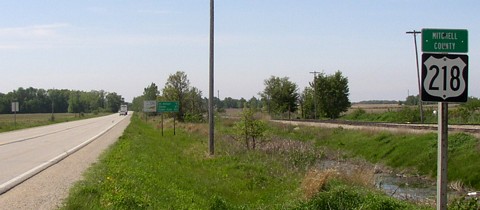
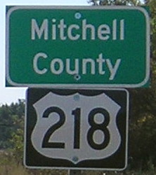
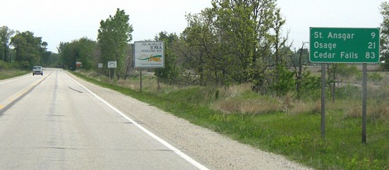
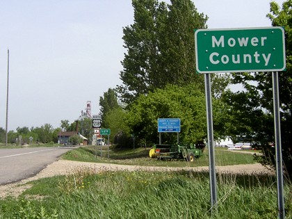
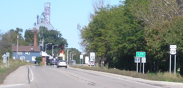
NORTH Iowa line: Near Lyle MN (9 mi. N of St. Ansgar), Mitchell County IA/Mower County MN
Facing south on 218 (5/19/04 and 9/29/15)
This is the only state line for the bi-state US 218.
Facing south on 218 (5/19/04)
Facing north on 218 (5/19/04)
Facing north on 218 (9/29/15)
Old SOUTH End (October 16, 1926-January 1, 1938): Stop sign, US 30, Benton County
Facing south on 218 (8/8/09)
The cross road became the endpoint of the four-lane in 1999.
Facing south on 218 (8/8/09)
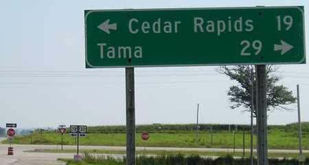
The 48 (official) miles between Tama and Cedar Rapids is a very long distance between towns by Iowa standards.
Facing east on 30 (8/8/09)
At lower left, traffic fully enters the eastbound lanes and the four-lane starts.
Facing west on 30, but heading north on 218 (8/8/09)
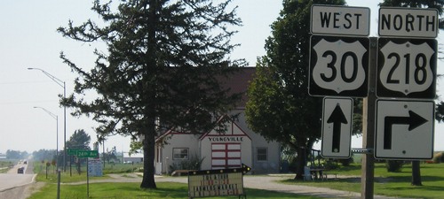
Facing west on 30, but heading north on 218 (8/8/09)
Back when 218 was ending here, the Youngville Cafe was in its first years of operation. The cafe, at the northeast side of the intersection and left of the photo, operated until 1967, but by the early 1990s had severely deteriorated. It has now been restored.
Facing east on 30 (8/8/09)
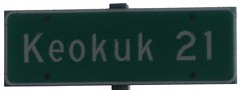
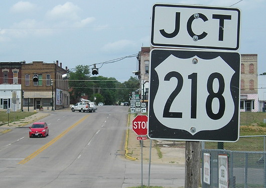
Old SOUTH End: Missouri state line, with US 61, Lee County
The south end of US 218, and US 161 before it, are kind of murky. The Iowa Highway Commission Service Bulletin for the fourth quarter of 1925 specifically notes that the end of US 161 will be US 61 north of Keokuk. Today, this point is slightly northwest of 218's intersection with a four-lane US 61. For pictures, see the US 161 page. However, in the course of research, a map from the DOT seems to indicate that 218's end never would have been there.
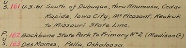
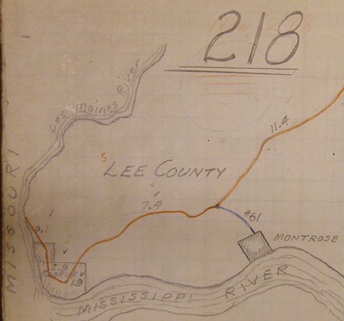
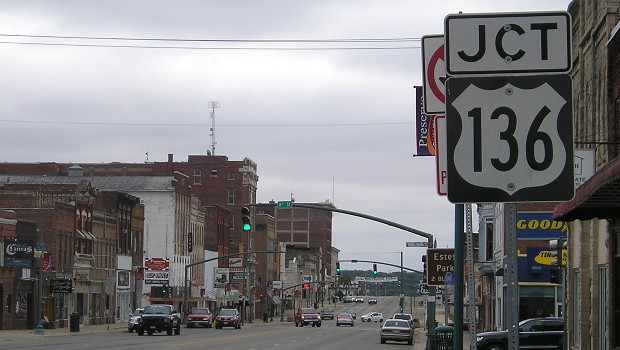
This is from a large, thick book that contains hand-drawn, detailed depictions of every route in Iowa in the 1937-43 time period. The index listing at the beginning of the book, which was most likely created in late 1936 or early 1937, has US 161 distinctly going "to Missouri State Line." The maps for 161 were cut up and placed in their respective positions for the new 151 and 218. If you look at the top of the map clip closely, you might be able to make out an erased circle with "161" inside, and an erased "Now 218" in red above that. After some more research, I found out that 161 was indeed extended through Keokuk to the Missouri River in January 1936. The strange thing with this is that at the time, there was no other US highway to extend the route TO; US 136 wouldn't arrive until 1951. The entire route south of the junction near Montrose is redundantly multiplexed with US 61, which then crossed into Missouri while 161 abruptly stopped. For pictures and history of the river bridge, see the US 136 page.
Facing south on old 218 (12/18/06)
This sign south of Donnellson was the last one for US 218 before the Avenue of the Saints was built. Now, the last such sign on 218 is one leaving Mount Pleasant: "Donnellson 22; Keokuk 43; St Louis 224". (It's also the first sign in Iowa to reference St. Louis.) Old 218 goes through Donnellson to near the intersection of old IA 394.
Facing south on old 218 (12/18/06)
To the right is old 394. To the left is the onramp for southbound 27. Ahead, 218 picks up its old route again, the only two-lane portion of 218 south of US 30. There are only five counties in Iowa - Mitchell, Floyd, Black Hawk, Benton, and Lee - that have two-lane portions of 218. For more pictures of this intersection, see the IA 394 North page.
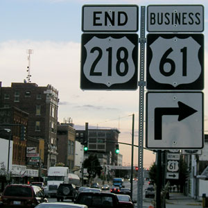
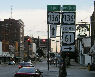
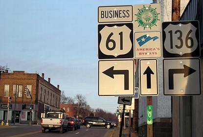
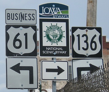
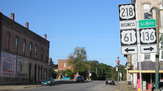
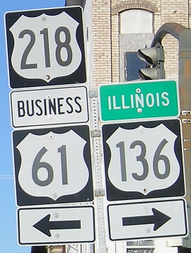
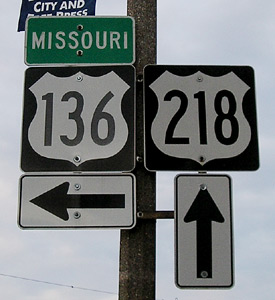
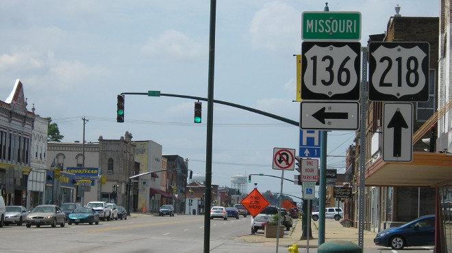
SOUTH End: Stoplight, US 136 E/Main St. and US 136 W/S. 7th St., Keokuk, Lee County
Facing southeast, but heading south, on 218 (10/24/05)
When Jason Hancock was in this area in 1998, many of these signs were different and attached to light poles.
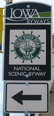
Facing southeast, but heading south, on 218, with Great River Road sign (7/11/17)
Facing southeast, but heading south, on 218 / Closeup (10/24/05 and 10/3/15)
The original layout of Keokuk is based on one bend in the Mississippi River, which is why (or I assume is why) the entire thing is diagonal. In 1998, these signs were side-by-side. The "Illinois" and "Missouri" tags unique to this intersection serve in lieu of "East" and "West" tags. It is seven blocks to the river.
Facing east on 136 (7/11/17)
The building in the next block was demolished sometime recently, because you can see it in some of the photos below.
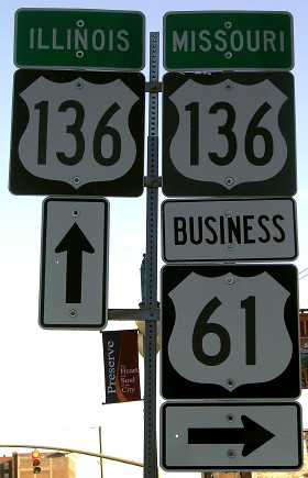
Facing northeast, but heading north, on 136 (12/18/06 and 7/11/17)
That Mile Marker 103 is not a typo. The zero point for US 136 is treated as 100, and miles numbered accordingly, to distinguish it from IA 136, which is slightly under 100 miles. The non-duplication ensures that a reference to "mile 2 on Highway 136" only refers to one location in Iowa. This is also likely why the south IA 15's mile markers did not reset upon entry from Missouri, to separate it from the north IA 15. In Minnesota, US 65 starts at 300, to separate it from MN 65.
Facing northeast, but heading north, on 136 / Closeup (10/3/15)
Facing northwest, but heading west, on 136 (10/24/05)
This was the only remaining assembly on a streetlight - and it was gone by December 2006. Signs have since been restored on a standalone pole (below).
Facing northwest, but heading west, on 136 (7/11/17)
The building on the right appeared to be a computer repair shop abandoned in the middle of the day. It looked like someone had just stepped out...but there was a layer of dust on everything.
Facing southwest, but heading west, on 136 (10/24/05)
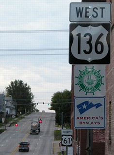
You could count the number of 136 shields in Iowa - I didn't - but this is one of the few on a pole without any other US shields with it. There are seven stoplights and one school-crossing stoplight on 136 in Iowa, most between 218 and the river.

This sign is on a small building at US 136's last intersection before the Mississippi River. It is probably just used as a building for a tower to strengthen the station's signal. But it's a TV station that usually doesn't come to mind when you're thinking about Iowa affiliates. (10/24/05)
Why not Missouri?
After following 218 nonstop through the southern half of Iowa, the four-lane Avenue of the Saints and 218 diverge. The Avenue, also (albeit not very popularly) known as IA 27, continues due southward to Wayland MO while 218 angles southeast to Keokuk. When one considers that the segment of the Avenue from near Donnellson to 136 had been county roads as recently as 1980, that's a big upgrade.
In my opinion, the logical thing to do as construction progressed would have been to announce a realignment of US 218 into Missouri, to end at US 61 south of Wayland. As it stands, 218 suddenly drops in prominence and then gets subsumed into a different four-lane, US 61 north of Keokuk. A glaring omission in the four-lanes of today is a connection between the Avenue and US 61 running along the Mississippi River. The 10 two-lane miles of 218 remaining in Lee County seem almost like a drop in the bucket to upgrade compared to what's been done in the past 15 years, but no such project is in sight.
Page created 11/27/05; last updated 12/19/17