
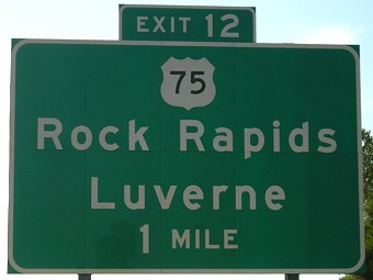
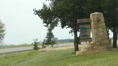
NORTH Iowa line: 6 miles N of Rock Rapids, Lyon County IA/Rock County MN
Facing west on 90
Minnesota BGSs appear to put the left-hand turn on top, so on westbound 90 the Iowa town trumps the Minnesota town that's just to the north on old US 16. At this point I-90 is 9½ miles north of the state line.
Facing east, but heading south, on 75
The section lines in Iowa and Minnesota don't quite match up, so 75 has a short east-west jog on the state line. The pavement change is the jurisdiction change, so each state does half of the segment.
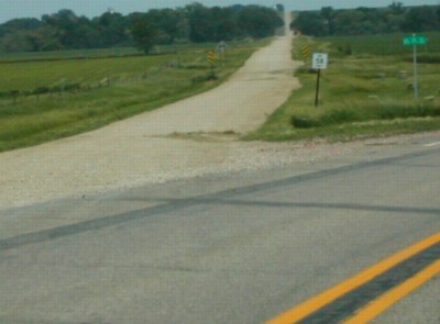
Facing east at the end of the curve
Photo by Neil Bratney
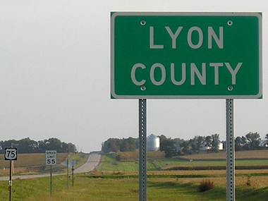
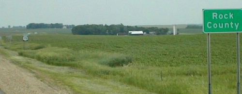
The gravel road has a Rock County sign and a Minnesota-style "Stop Ahead" but the street sign is Lyon County's.
Facing south on 75
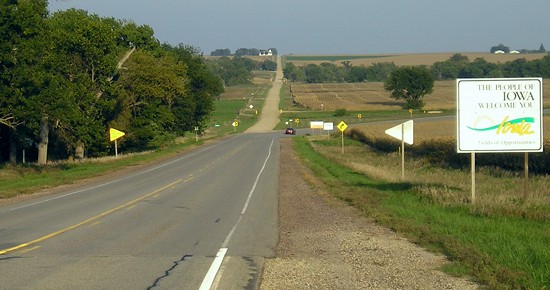
Facing (north)west on 75
Photo by Neil Bratney
Behind this welcome sign, right where the curve starts, is one Iowa US 75 shield facing west.
Facing north on 75
Photo by Neil Bratney
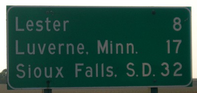
Facing west on 9, but heading north on 75
Because of a one-mile, four-lane duplex with IA 9 on the west side of Rock Rapids, this is one of two three-state (non-BGS) mileage signs in the state. The other is on the US 275/IA 2 duplex at Sidney, even after the new bypass opened.
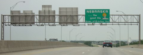
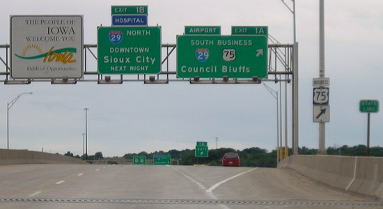
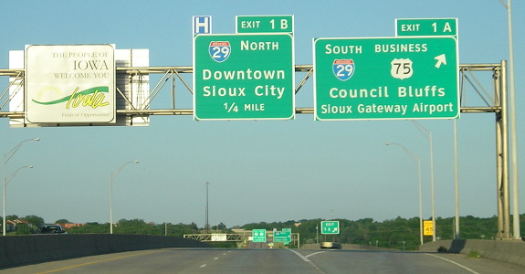
SOUTH Iowa line: Missouri River (with I-129 and US 20), Sioux City, Woodbury County IA/Dakota County NE
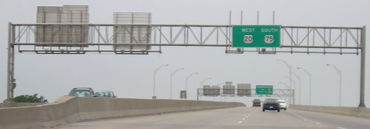
Facing west on 129/20, but heading south on 75
The last fraction of a mile for US 75 is shared with I-129 and US 20. Between 1984 and 2001, southbound 75 came with northbound 29 to this interchange, then took the ramp. Completion of the bypass in northeast Sioux City fixed that. (Why I-129 is not on the current westbound sign, I don't know.)
Facing west on 129/20, but heading south on 75
Facing west on 129/20, but heading south on 75
These are the signs with their backs to us in the above picture. The state line is marked near the bridge joint.
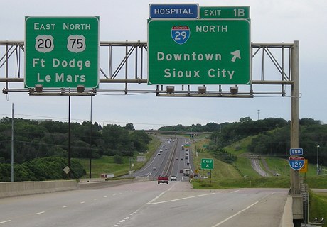
Facing east on 129/20, but heading north on 75
Facing east on 129/20, but heading north on 75
For more pictures of this interchange and 75's approach from Nebraska, see the I-129 page. Because 75 used to enter in Council Bluffs (see below), mileage numbers on 75 jump into the 90s on the Sioux City bypass after US 20 leaves.
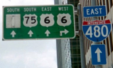
Old SOUTH Iowa line (1966-84): Missouri River (with I-480 and US 6), Council Bluffs IA/Omaha NE, Pottawattamie County IA/Douglas County NE
Facing south on 14th Street in Omaha (old SB US 73) at Dodge Street
This sign, up in 2003 but gone in 2006, still shows the early 1980s configuration of highways in downtown Omaha. The covered-up space at far left is US 73. All the highways were on one-way pairs here, so a right turn would be for westbound 6 on Dodge but eastbound 6 is at the next intersection. (Northbound 73 would be a block to the left.)
Facing south on 14th Street in Omaha (old SB US 73) at Douglas Street
Here is where US 75 would have joined US 73 (second from left shield) going south. A left turn onto Douglas would have been going north on 75 and east on 6 to the bridge, but 75 hasn't been on Douglas or 13th/14th for 20 years.
Facing east on Douglas Street at 13th Street
Reconstruction of I-480 (and thus, closure of the onramp) is probably responsible for the wear and tear on the far left, and the greened-out space probably held "North 73 [up and left]". This sign was still up in 2006.
This is a representation (via Kurumi's SignMaker) of I-480's entrance into Iowa as it appeared in the Council Bluffs Nonpareil on Oct. 24, 1968, as I-29 opened north of I-480. (In reality, the arrows on the far left sign were to either side of the text.) Notice that 75 is BOTH straight ahead and on 29. Since 480 opened first, Broadway is where 75 used to go, but that shield would have been removed the day after the photo was taken. A gap in the middle sign had been reserved for "Kansas City" but I-29 had not yet been finished south of I-480. For pictures of the current I-480 signage see the I-480 page.
Old SOUTH Iowa line (1926-66): Missouri River (Ak-Sar-Ben Bridge) (with US 30A [US 30/30S] and also US 6 after 1931), Council Bluffs IA/Omaha NE, Pottawattamie County IA/Douglas County NE
Highways on the Ak-Sar-Ben (Douglas Street) and I-480 bridges
| 1926-late 1931 |     |
| 1931-34 |     |
| 1934-39 |
 |
| 1939-41 |      |
| 1941-60 | |
| 1960-66 | |
| I-480 bridge opened Oct 21, 1966; Ak-Sar-Ben Bridge torn down 1968 | |
| 1966-69 |    |
| 1969-84 | |
| 1984-present | |
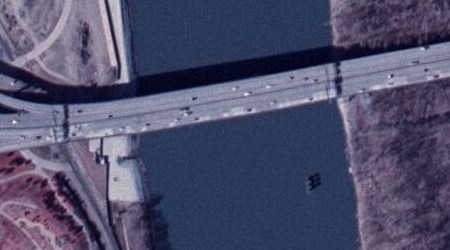
Aerial photo from ortho.gis.iastate.edu
The Ak-Sar-Ben/Douglas Street Bridge, originally built in 1888, was located very near the present I-480 bridge; a pier of the old bridge is still sitting in the river today (lower right).
Pictures by Neil Bratney: Third, fifth, and sixth, 6/18/02
Pictures by me: First, second, fourth, and seventh, 9/16/07; eighth-eleventh, 6/12/05; 12th, 6/4/14; 13th-15th, 6/16/03
Page created 8/7/06; last updated 1/17/15