 BUSINESS
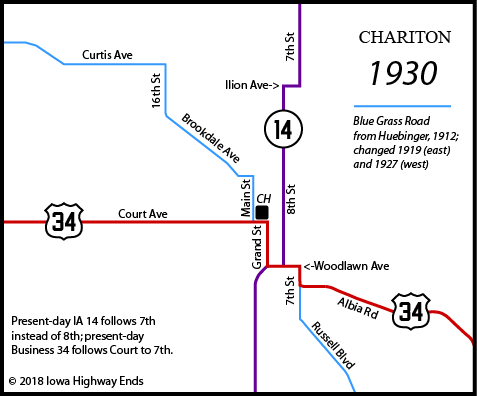
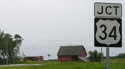
WEST End: Stop sign(s), US 34, Chariton, Lucas County
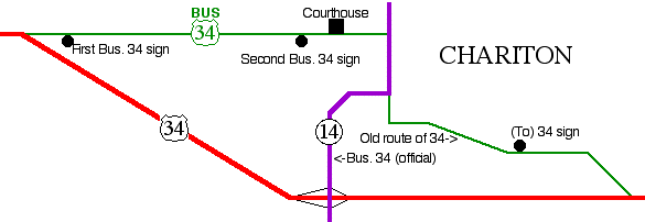
The route of Business 34 in Chariton is barely marked. In fact, its true alignment has eluded just about everyone, including me. On October 4, 1996, the AASHTO Special Committee on Route Numbering approved a multitude of business routes in Iowa that followed old alignments of various highways realigned in the past 30 years. Among these was a Business 34 in Chariton - but the official approved description does not follow 34's entire pre-1961 alignment. Instead, the "east end" is the US 34/IA 14 interchange, seen at the bottom of the map, and then Business 34 follows 14 north to Court Avenue and goes west. However, no true signage exists at all save for "Business 34" marked on both directions of mainline 34 on the west end and two green shields facing east. (Attention Chariton/Lucas County/DOT: If you're going to have a business route, at least sign it well enough for people to follow.)
Facing west on Business 34 (6/10/07)
The business route (or at least part of it) is only one example of the many route changes to 34 since its original commissioning. Highway 34 would be in the running, probably competing with US 30, for the most old pieces that lived long enough to be paved. (And in 34's case, many are pieces.)

Facing east on 34 (6/10/07)
Facing east on 34 (6/10/07)
The BGS for the secret interchange with IA 14 on the south side of Chariton is nearly hidden in the trees, behind the gravel driveway.
Facing west on 34 (6/10/07)
Facing east on Business 34 (6/1/02)
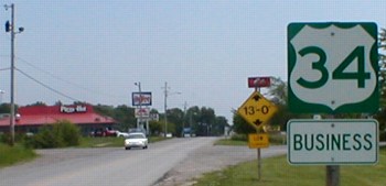
This is the first sign for Business 34, right after you get on it...
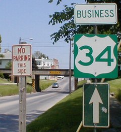
...and this is the second and last(!) sign for it. Both of these are eastbound. (6/1/02)
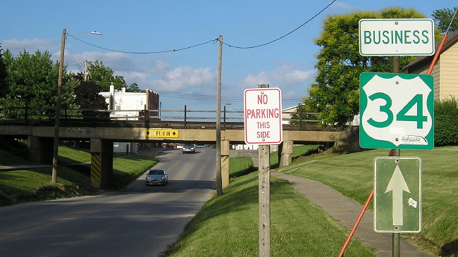
Still there 16 years later (6/18/18)
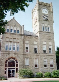
And it passes by the Lucas County Courthouse, hence this shot. (6/16/03)
Now, the map at the top of the page, which marks the courthouse, looked straightforward, right? Well, after a deep dive into both the Iowa DOT highway construction files and the Chariton newspapers (yay digital renderings!), the obvious didn't start out that way.
Chariton paved a lot of its city streets in 1919. That work would have been influenced by already existing auto trails, in this case the Blue Grass Road (or Blue Grass Route) that closely paralleled the Chicago Burlington & Quincy railroad line from Burlington to Council Bluffs. The Lucas County portion of that road east of Chariton was straightened in 1919, and strong objections from Melrose and Russell at the time might be why those two towns got spur highways in the original state system (IA 68 and 97). Russell Boulevard's overpass at the former Chicago and North Western tracks was abandoned for a time in the early 21st century but has been replaced.
A paving project in 1934 changed the routes of US 34 and IA 14 downtown, such that their shared segment was no longer a block of Woodlawn Avenue between Grand Street and 8th Street but three blocks of 7th Street between Woodlawn and Court Avenue. (Chariton's numerical north-south streets are interrupted with Grand instead of 9th and Main instead of 10th.) This kept the US highway running past Chariton's typical Iowa town square with a double ring of parking around the courthouse.
EAST End (official): Interchange, US 34, Chariton, Lucas County
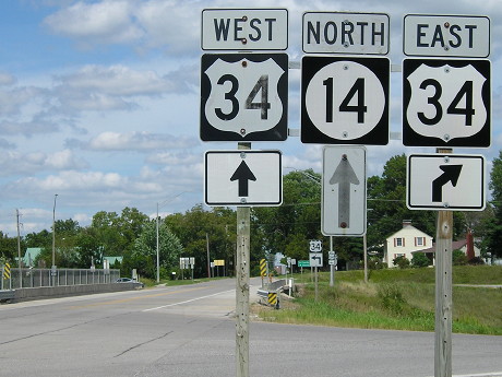
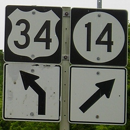
Facing north on 14 (8/24/19)
Officially, Business 34 begins ahead.
Facing east on 34 (6/10/07)
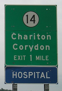
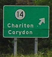
The BGSs for the interchange list Chariton, which is useless because you're already within the city limits. I think Knoxville would be a better option.
Facing east on 34 (6/10/07)
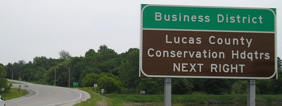
As if putting "Chariton" on the main signs wasn't enough, "Business District" is on the second sign. This may have something to do with the business route officially being on 14. A few businesses are on 34 east of this interchange.
Facing east on 34 (6/10/07)
Eastbound 34 also has regular shields in addition to the BGSs; westbound 34 doesn't.
EAST End (old alignment of 34): Stop sign, US 34, near Chariton, Lucas County
Facing west on old 34 (6/16/03)
In the east segment of old 34 between 34 and 14, you see this sign directing you back to the route. The bypass, while it has an interchange with IA 14, also intersects roads at grade relatively close to the interchange. The railroad underpass in the background may be part of the reason why Business 34 uses 14 instead of this road. The pavement quality may be another issue.
Facing east on old 34 (6/16/03)
Facing east on old 34 (6/10/07)
The pavement had an older look to it, lots of patching in the middle (since re-asphalted). Notice the change from a wooden pole to metal.
Facing west on 34 (6/10/07)
In this direction, there is no signage at all for Business 34, which before my finding out that Business 34 wasn't here seemed very strange. The IA 14 interchange can be seen in the background. Just behind the camera and to the south, there's a snippet of original concrete that dead-ends, left behind when the bypass was built.
Facing east on 34 (8/24/19)
Page created 11/28/02; last updated 8/21/07 5/7/20