|
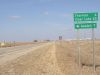
Day 1: Traer to Storm Lake |
 |
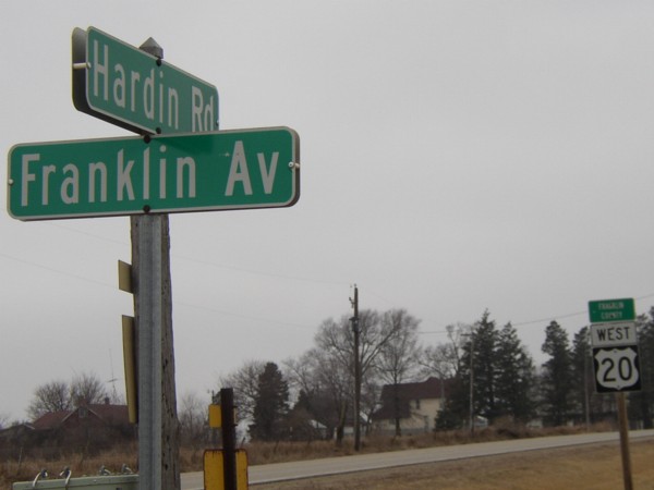
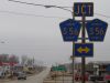
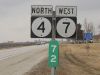
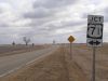
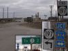
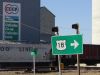
At the corner of Butler, Franklin, Grundy, and Hardin counties,
there are four rural street signs. Here is the northwest corner,
naming the streets by county. In the background is the shield
for the WESTbound lane of US 20 entering Franklin County (eastbound
never does); the days of any part of US 20 in Franklin County
are numbered. |
 |
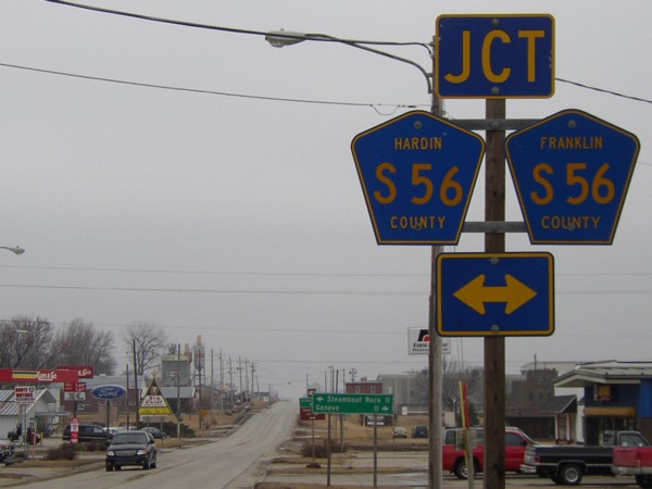
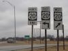
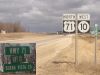
In Ackley the junction with S56 features shields for both
counties. To the left is Hardin County; to the right, Franklin.
Farther east, a sign for S55 on 20 has no county marked at top. |
 |
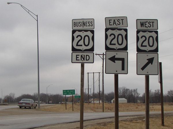
The west end of Business 20 in Fort Dodge. Turning around,
there is the first shield for Business 20 cosigned with P59,
just like Business 71 and C43 (see below). |
 |
I drove around the north interchange of US 169 and Business
169 to see the odd junction with D22 (it meets the ramps!) and
then found myself traveling south on 169. Turning around, I saw
this "Keep Left" sign for joining NB 169. Near this
area, I took a picture of the sign for the north Business 169
exit, and turned around and was able to see the south end of
Business 169 at a stoplight. |
 |
At the west end of IA 124, these mileage signs showed up
on IA 4 after the intersection, instead of being on an LGS at
the intersection. IA 4 meets 124 at an angle, in order to recify
segments north and south of the intersection at the survey correction
line that runs through the state (and the aptly-named Correctionville,
Iowa). |
 |
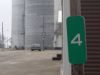
This duplex is the lowest-total Iowa-highway-only duplex
in the state. (US 6 and IA 1 share a piece in Iowa City.) The
mile marker corresponds to IA 4, the lower-numbered highway.
This specific number duplex was created as a result of the Great
Renumbering of 1969; before, the two roads were IA 17 and IA
5, respectively. |
 |
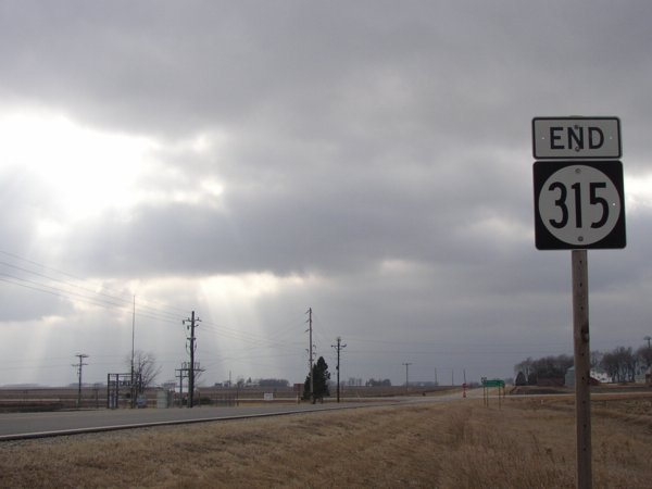
Unfortunately for historical purposes, all the pictures of
IA 315 were taken in overcast skies. (The road should become
C56 in a matter of weeks, if not days.) The sun happened to peek
through right as I took this picture. |
 |
Playing with perspectives. The mile marker is attached to
a stop sign on a two-block north-south part of IA 315, as it
goes south to run through the business district. There is only
one sign in each direction for the turn, both with the ahead-and-left
arrow you see there. |
 |
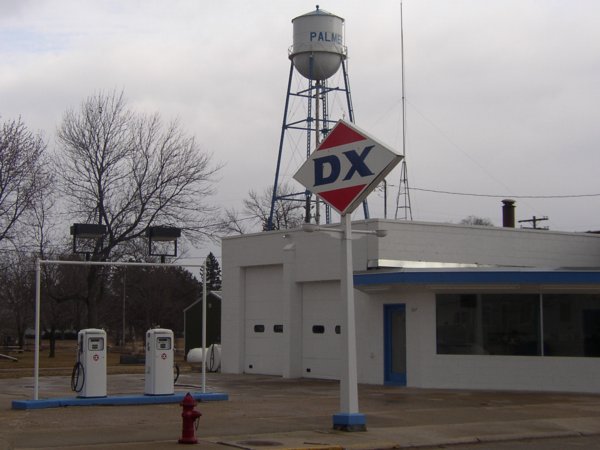
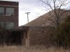
This restored DX station was on the north-south part of 315,
across from the above mile marker. There wasn't anything in the
building, though. The DX brand was bought by what is now Sunoco
on Oct.
25, 1968, and I assume that the DX brand then evaporated
across time. The occasional sign pops up; one I know of is in
Chelsea. |
 |
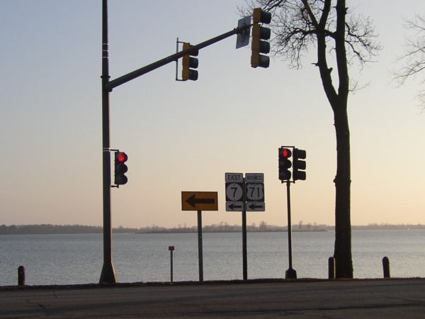
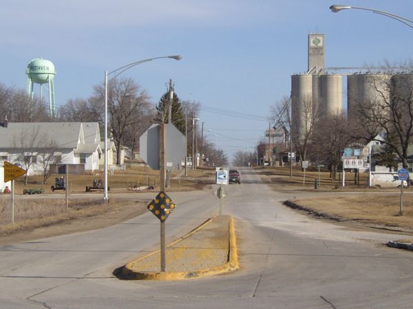
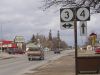
In Storm Lake (the city), Business US 71 and IA 7 make a
northbound turn at the northeast corner of Storm Lake (the lake). |
|
Day 2, Part 1: Storm Lake to Pocahontas |
 |
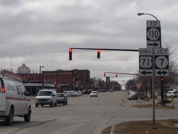
Business US 71 splits from IA 7 at the north end of the original
Storm Lake business district. Ahead is a string of stoplights.
At left you can see the back of a Standard sign. The "To
110" is a helper that sort of dates back to 1920: The original
IA 4 included what is now 110 and US 71 north of Storm Lake.
In 1926, 4 was truncated after 71 was commissioned. At the north
end of IA 110 to the west is a blank pole, perhaps holding a
"To 71" before 71's realignment in the mid-1990s. This
is also the south end of secret IA 914. |
 |
The third-lowest intersection in Iowa (after 1/2, 3/4, and
6/1) is a four-way stop. Eastbound, the signs here are in the
correct order (7 on the south side) without directions; why they're
reversed with direction tags westbound is unknown. |
 |
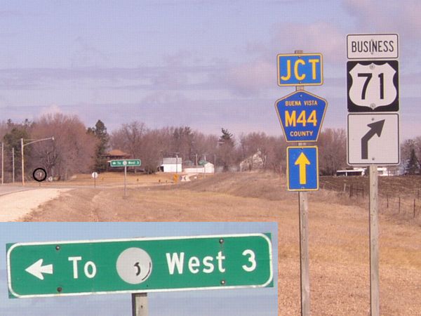
Coming back to Business 71, the "Jct M44" was probably
never changed from before the realignment. To the left you can
see the back of an M44 shield (circled); outside of Storm Lake,
Business 71 is co-signed with M44 and C43, but the state map
only shows them as county roads (something I would like changed).
The LGS is a DOT remainder; you can barely tell what state highway
used to be on the sign. |
 |
This is all of old IA 352 to Truesdale. A rural street sign
even marks it as such, but Business 71 is 550th Street. |
 |
First and last signs at the north end of Business US 71.
The pole on the left is the only place at the entire intersection
with a C43 shield. |
 |
A sad-looking 71 shield at the east end of old IA 351 to
Rembrandt. The LGS closer to the intersection was erected by
the county. Unlike 352 and 390, old 351 is not in the rural street
system. |
 |
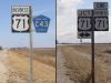
The first pair of signs northbound on US 71/IA 10 has a mile
marker and mini-shield for 71 right beside it. The odd part of
this intersection is the "Buena Vista Co." sign underneath,
because this is in the middle of the county. On the line I can
understand (Greene County does it), but this one's odd. |
 |
A building in Marathon near the north end of old IA 390 reminded
me of the George Preston station in Belle Plaine. |
 |
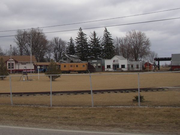
Near the south end of 390 was a railroad museum. I wasn't
sure of where the entrance was to it, though. IA 390 is also
marked in the rural signage system. |
 |
The north end of IA 197 faces east, at the far end of Albert
City's downtown. At lower right is the first sign for 197 southbound,
which is where it turns south; at lower center is the mileage
sign leaving town, including a "To" - the only such
case I am aware of. |
|
Day 2, Part 2: Pocahontas to Spencer |
 |
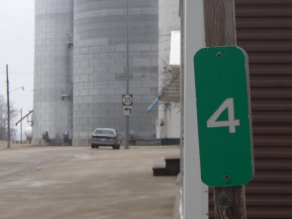
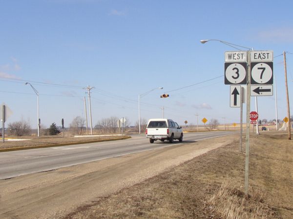
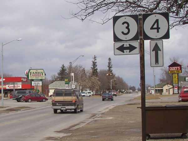
Iowa's "1-2
punch" is in southeast Iowa; the "3-4" is
in Pocahontas. Most of the town is to the east; although 3 and
4 split the county into quadrants, there was no road connecting
Cherokee and Pocahontas until 1936. That might be why the center
is east of here. |
 |
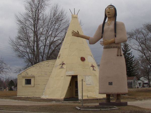
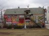
This statue of Pocahontas is on the east end of town, with
a tepee obscuring the front of an otherwise unremarkable quonset
building. |
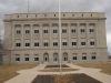 |
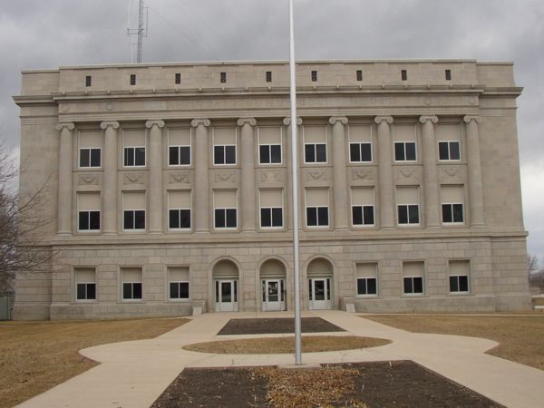
This is the front of the Pocahontas County Courthouse. No
offense, but how boring can you get? |
 |
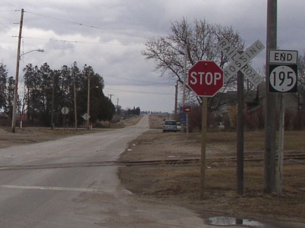
The west end of IA 195 is at railroad tracks in the northeast
part of Plover. The intersection in the background is N57, meaning
195 fell just short of the intersection. Like 315, at the time
these pictures were taken 195 was a "living dead" spur,
decommissioned on paper but not in the field. |
 |
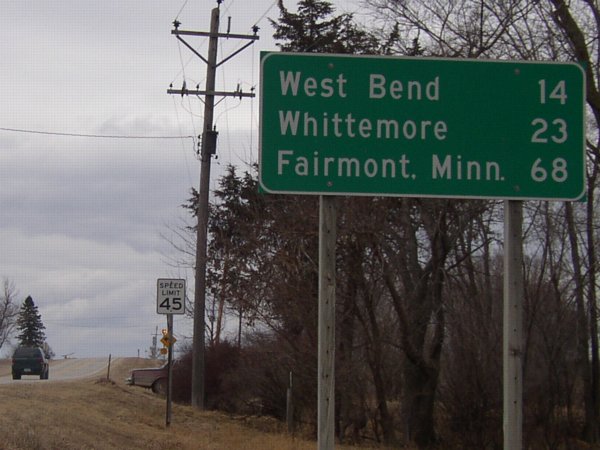
Heading out of Rolfe, you find out about how many miles it
is to I-90 (Fairmont MN is at the interchange of MN 15 and I-90).
All of Pocahontas County is closer to I-90 than I-80. The interesting
thing about it is that this is the first northbound leaving-town
LGS and it gives a distance out of the state; two miles away,
the only destination heading south is IA 3. |
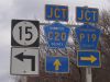 |
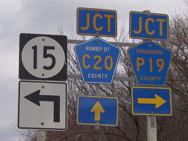
After crossing the Des Moines River right at the county line,
IA 15 hangs around in Humboldt County just long enough to intersect
C20 and P19. Notice that, even though entirely in Humboldt County,
P19 has a Pocahontas label! |
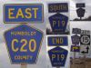 |
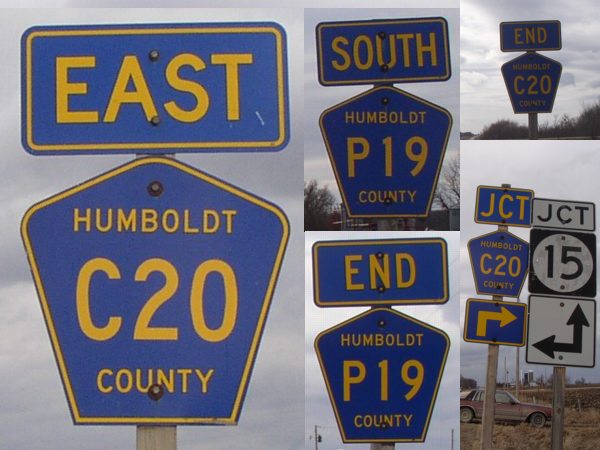
A compilation of what I believe is the best-signed county
road intersection in the state, nitpicks notwithstanding (the
Pocahontas label, the up-and-right arrow in the lower right picture).
Between 1938 and 1980 this was the west end of IA 222. |
 |
The last of the "living dead" on the route, IA
314 faces east when it ends at the railroad tracks. Or, to be
more accurate, where the railroad tracks used to be, as you can
see by the pavement. Behind the picture, after a few blocks,
314 intersects N28 and B53. N28 is redundantly multiplexed one
mile to end the intersection (B53 goes north-south one mile)
and so can be expected to take 314's north-south route. B53 will
take the east-west portion, and you can just see the first B53
shield leaving Ayrshire in the background of this photo. |
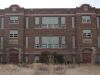 |
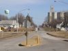
There are two abandoned schools in Ayrshire. This one, a
very regal building marked "Silver Lake Township",
was built in 1920 and features two sets of doors. The other one
is at the end of School Street, making me wonder which one is
older or if both were built in a short time frame. |
 |
At the northeast corner of the 1920 building is this addition.
My limited experience pegs it as being built in the late 1950s
or early 1960s. Those with more knowledge are free to e-mail
me. In the middle of the picture is a pole with lights still
attached, shining on a baseball diamond that might not have seen
action since the Mets won a World Series, if not earlier. |
|
Day 3: Spencer to Traer |
 |
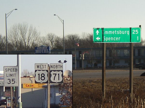
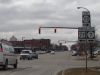
While we are most definitely inside Spencer, the LGS at 18
and 71 still lists it - and, unlike the old
east end of 57 in Cedar Falls, says it's over a mile away!
At a KFC I saw a picture from the early '50s showing no development
here (the DOT signs to city centers). In addition, compare the
two shields side-by-side in the duplex: The one for 71 is the
more prevalent (for now??), while the (uglier) one for 18 has
popped up at recent construction. |
 |
This picture shows the entire route of the post-1988 designation
of IA 341. It goes from old US 18 (right behind the left light
pole) to the foreground intersection. The only signage between
the alignments is an N20 shield on the right and a DOT LGS on
the left. There is still an entrance sign for Ruthven on the
north side. |
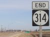 |
Take a good look at IA 314. It won't be around much longer.
Of all the "living dead" highways, the best shots came
Saturday at the north end of 314. |
 |
This is on the side of a building, facing south (heading
west) on 18 in Cylinder. Well, it looks old to me! |
 |
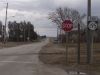
This sign on the south side of Cylinder alerts US 18 traffic
to turn north. |
 |
The westernmost mile of old US 18 west of Wesley has probably
not been paved since it was bypassed in 1961. The concrete is
narrow and has that old look to it. East of here (here being
the intersection of 18 and P64, the south end of old IA 226),
the road is asphalted with modern dimensions. |
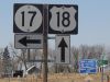 |
Working our way up in sequential intersections, here is IA
17 and US 18. Next is US 20 and IA 21, one I've been to innumerable
times, but this was my first trip to this one. In the background
is the first shield for US 18 in Kossuth County and the rural
street sign for Hancock County - it's Ames Ave., interesting
because IA 17 comes sort of close to Ames. |
 |
Just south of the railroad tracks, and following them to
Britt, is the old alignment of 18. This is where IA 60 ended
prior to 1961. In the background you can see the current end
of IA 17. |
 |
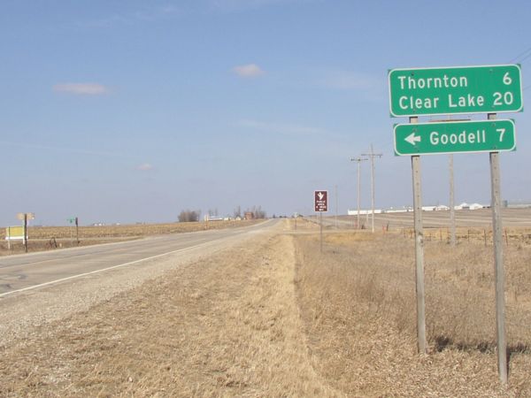
The north city limits of Meservey coincide with the intersection
of IA 107 and B63. Since the portions of IA 107 inside Thornton
and Meservey were not turned over, this will be the north end
of 107 shortly. The isolated piece inside Thornton may get a
900s designation. |
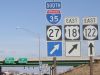 |
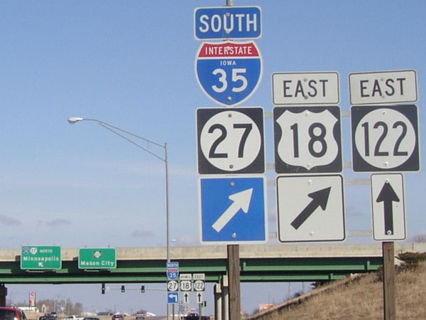
The north end of Business I-35 (but you can't tell), the
west beginning of Business US 18, and the west beginning of IA
122. Compare the BGS in the background to Jason Hancock's photo
on the IA 122
page (second one down); IA 27 shields have been added all over
the place here. |
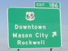 |
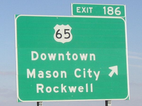
The most outstanding example of odd fonts on recent bypass
signs is evident here. Compare the O and W of "Downtown"
(normal) with "Rockwell" (abnormal - well, it is!).
The difference is because the sign originally had "Federal
Ave." with a bar underneath. Odd fonts also appear on IA
163 around Pella (which also has an assembly with both fonts
on different signs) and on I-35 at the west end of this freeway
segment. But this isn't as strange as on BGSs on US 63 at C50
in Denver (of which a picture still eludes me). |
 |
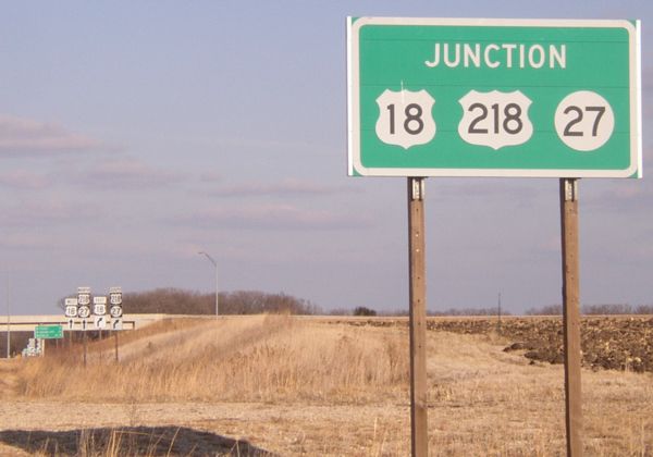
At the north end of Business US 218, and at IA 14 to the
south, the green junction sign features all three highways (with
slightly smaller shields than those used at two-highway intersections). |