|
June 15-16, 2004 |
 |
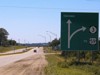
This was the intersection of IA 36, an original 1920 number and the
lowest-numbered spur to survive the Great Decommissioning of 1980. In the early
years, the east-west road here was IA 35, making a 35/36 intersection. US 71
and IA 175 came along later.
|
 |
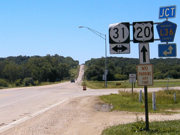
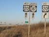
When US 20 was moved to follow the survey line across eastern Woodbury County, it
was, according to the Correctionville News, "the biggest project in the Correctionville
area since the construction of the railroads." This might be part of why the road
is still two lanes today, because adding two more in this hilly area will take a
lot of work. If you take a right here on IA 31, you'll go back east, paralleling 20
for a short distance before going northeast.
|
 |
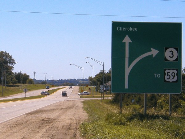
Here's a unique sign on the east side of Cherokee as IA 3 goes northwest. It
used to go straight ahead. The road ahead was IA 977 until 2003.
|
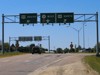 |
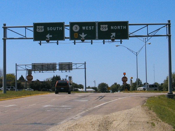
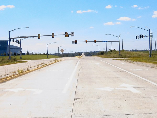
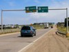
The intersection of US 59 and IA 3 has overhead signs like those seen at
a few other major at-grade intersections in Iowa, including IA 3 and IA 150
(see below).
|
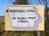 |
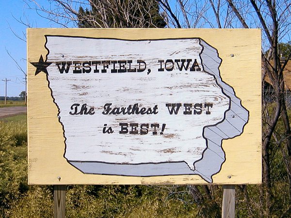
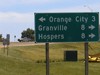
Westfield is the farthest west town in Iowa and nearest IA 3's entry into
South Dakota. The tiny town takes pride in its position, as you can see with
this homemade board on northbound IA 12.
|
 |
This used to be the end of the very short IA
403, which if you
turned left from this spot you could see the entirety of. There was some minor
controversy in the Second Great Decommissioning, because Akron steadfastly
refused to take the road, but had to anyway. This intersection is a bit north
of where IA 3 and IA 12 intersect; 403 was not connected to 3 in any way other
than being a convenient number moved northwest from Cushing in 1980.
|
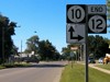 |
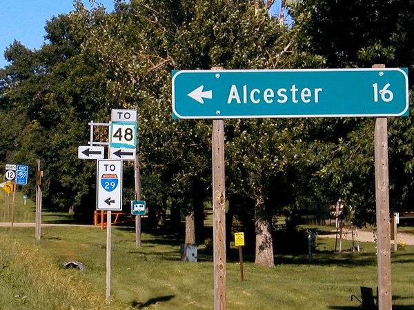
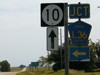
The east-west IA 10 leaves Iowa heading north from this intersection with
IA 12 in Hawarden, the farthest west non-state-line end. At the intersection,
you can also turn left and go into South Dakota (to I-29 exit 42), but that
bridge is not marked on state maps.
|
 |
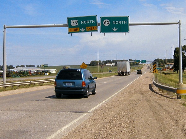
The precusors to these signs on northbound US 75 were put up in 1957. They
were "big black signs" with "silver scotchlite lettering," according to the
news account. At that time, the state highway was IA 33. Fifty years later, there
likely won't be any signs at this intersection as 75 moves to the Le Mars bypass
and an interchange with IA 60 is north of this spot.
|
 |
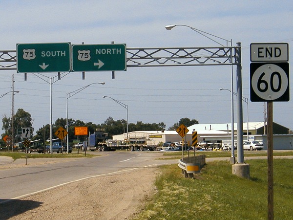
The south end of IA 60 moved north about a year and a half after this picture
was taken. There is a farm implement dealer on the north side of this intersection.
Eventually US 75 will also disappear from this spot; a Business 75 will take over
all of the old route except for a tiny piece near the south end, which could go
from major expressway to abandoned road in an instant when new 75 opens.
|
 |
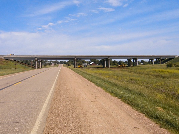
Looong bridges for IA 60 south of Alton as it crosses the old road, railroad
tracks, and some random grass.
|
 |
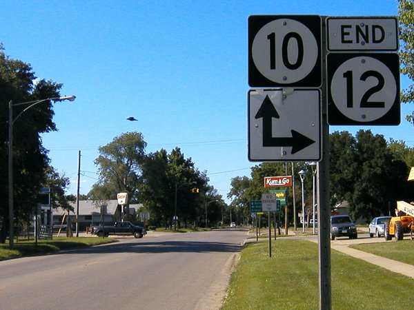
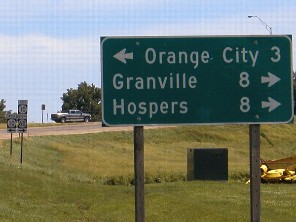
With the new bypass, which opened months after this picture was taken, there
is no longer any direct connection to IA 10. The four-lane crosses over 10 to
the south of an interchange due east of here, but the road under the interchange
is not 10. I am surprised the DOT did not designate a new secret road to maintain
the connection between new 60 and 10. The duplex seen in the background here is now gone.
|
 |
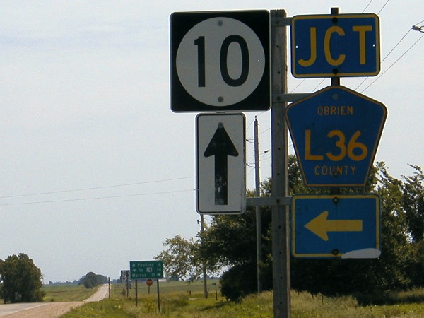
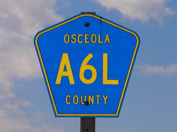
The county road shields for O'Brien County do not have an apostrophe in them.
This is at the north end of IA 143 west of Paullina. Random note: Paullina is the
site of South O'Brien High School, nickname Wolverines, but aka the SOB's.
|
 |
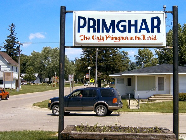
Primghar, the smallest county seat in the state (pop. 891), is smack dab in
the middle of O'Brien County. It is also one of the few county seats without a
high school (part of South O'Brien). This sign proclaims it to be the only
"Primghar" in the world, I guess because M-G-H just usually doesn't occur in words.
|
 |
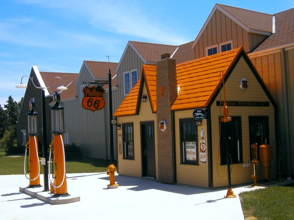
This little gas station is in Sanborn on US 18. I don't know if there is any
story behind it because nothing was open at the time. A lot of old gas stations
looked like this.
|
 |
Semi-rare diagonal county road shield near Melvin (flash on).
|
 |
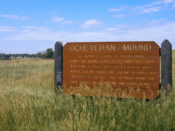
Ocheyedan Mound used to be the highest point in Iowa, until heights were
remeasured. See the IA 237 page for more.
|
 |
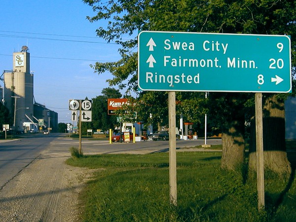
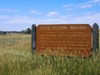
One of the shortest duplexes in Iowa is the two-block pairing of IA 9 and 15
in Armstrong. Fairmont is the county seat of Martin County, Minn., and I-90 is
a mile farther north. |
|
Des Moines vicinity, summer 2004 |
 |
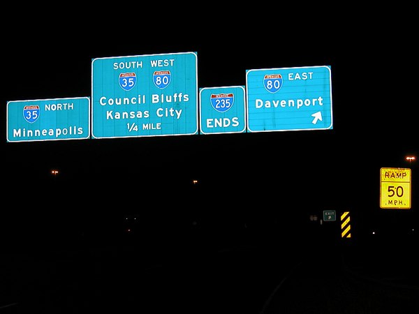
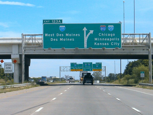
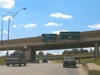
A night view of I-235's east end reveals something weird. Look closely at the
O's in the "North" and "Minneapolis." They look like they're switched around, meaning
that they're the same size.
|
 |
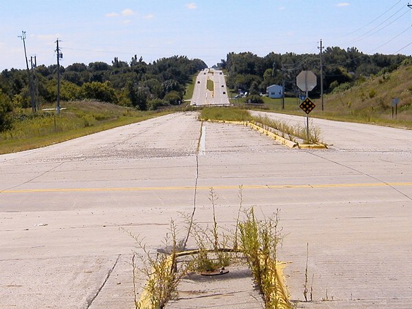
Looking east on Army Post Road, you can just see the gap in the background where
the road was taken out. This photo is near 63rd/1st Street, which was 28 and remains
the border between Des Moines and West Des Moines. The westbound road probably has
the second-most-useless dedicated left turn lane in Polk County (see more below).
|
 |
This is what remains of the Army Post/SW 4nd intersection. This spot figured
prominently in Des Moines highway history, most recently being the place where
IA 28 came north from Norwalk and headed west with IA 5 for a short distance. But
this beginning of a lane separation on the west side of the junction is all that remains.
|
 |
And now, the most useless left-turn-lane and nearly useless stoplight in the
Des Moines area. Behind the camera, the road ends. Ahead of the camera, across
Army Post, the road ends. This little piece of SW 42nd street was cut off by
airport expansion to the north and the IA 5 freeway to the south.
|
 |
Another broken piece of old IA 28/SW 42nd, this time at County Line Road.
This photo is in Polk County looking south at Warren County and where 28 rejoins
the old alignment. Old 28 became IA 296 for a while, but there's nothing here.
|
 |
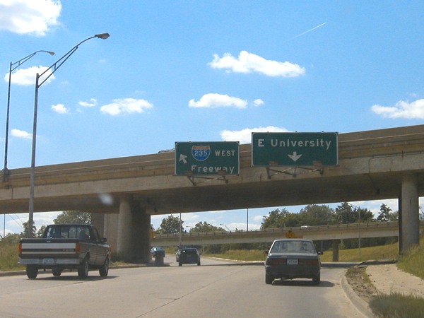
A very 1960s setup at the interchange of University Avenue and I-235 is
being replaced as part of a reconstruction project. Both University and the freeway
split so the two directions were far apart. There was a left-hand ramp from westbound
University that went to a left entrance on 235 - the left sign above - and a ghost
ramp that would have been a left from eastbound University to 235 (in the end,
there was no access from eastbound University to eastbound 235).
|
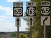 |
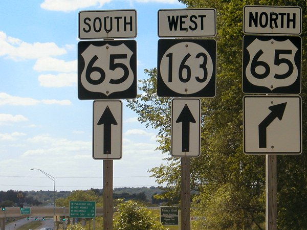
Series D (wide) shields for US 65 are used in the northeastern quarter of
the Des Moines beltway, which opened between IA 163 and I-80 in 1994. For the
next three years, 65 went with IA 163 to US 69 and then southward.
|
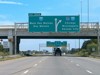 |
This BGS, right on the Polk/Dallas county line (West Des Moines' 60th Street
bridge), is the farthest west BGS on I-80 that mentions Chicago. The farthest
east BGS on I-80 that mentions Des Moines is right before the I-80/90 split
in Gary, Indiana, 22 miles from the state line (for Exit 21).
|
|
Other pictures, later 2004 |
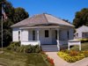 |
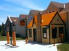
This is John Wayne's birthplace in Winterset, a pretty small house. In the
background is the "store" that sells Wayne memorabilia and movies, and also where
tour groups gather.
|
 |
This mileage sign may be over 40 years old. It is most likely from when US 6
was on this road, between 1958 and 1966. The sign stayed when the road became
IA 90, and then F90. In the background you can see the old (now replaced) black-and-white
up arrow under the F90 shield on the left side of the bracket.
|
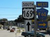 |
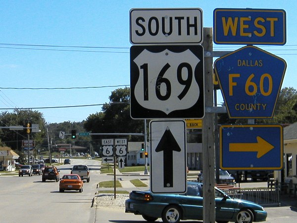
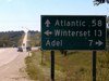
When US 6 west of Adel was turned over to Dallas County, directional tags were
included with the new F60 shields at the 6/169 intersection in Adel.
|
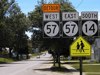 |
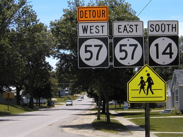
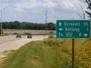
Which way should we go? Because a bridge west of Parkersburg was being replaced
in the summer of 2004, a traveler on southbound IA 14 between the east and west
junctions with 57 was traveling east and west on 57. (The detour then goes south
on 14.) Notice the Butt-Ugly Kansas-Style Signage on the "North".
|
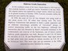 |
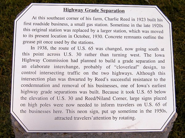
Colo renovated the old motel at the junction of old US 30 (E41) and US 65
with plans to make it a fully functional motel again. Plaques like this are
placed on the grounds. This one has a slight error, as US 65 was not rerouted
to go south from the "interchange" to Collins instead of Ames until 1941.
|
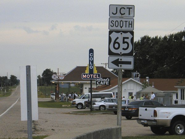
 |
A view of the motel and its relation to the interchange on the day that the
motel was dedicated in July 2004. Running behind the motel (see white van in far
left background) is the original curve for US 65 to join 30.
|
 |
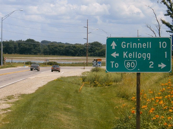
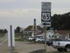
One example of an I-80 shield on a mileage sign; there are a couple variations
of this, but this is the basic one. This intersection was the south end of
IA 224, a short spur to Kellogg before being extended northward and southward.
|
 |
For a short time after the county road system was created, the shields were
green squares. (The old shields, at least at some point, were also green, evidenced
by the Benton County "K" shield north of Keystone.) I don't know how long this
lasted before the blue pentagons were standardized, but a few green squares hang
around, including this one on old IA 181 north of Melcher-Dallas.
|
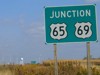 |
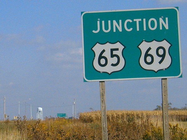
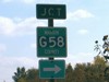
Heading east on old IA 349, approaching the south split of US 65/69, is this
unique sign. Other similar solid-panel green junction signs appear at places
where one road meets two others, usually when the roads on the sign join or split
at that intersection.
|
 |
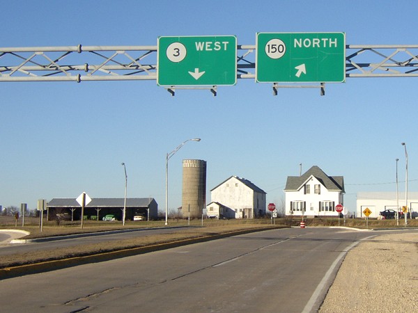
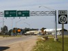
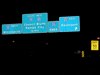
Similar to the US 59 intersection, the IA 3/IA 150 intersection near Oelwein
has some signs on gantries across the roads, in addition to some extra lanes.
The tricky part of this intersection is that westbound 3 traffic must make a
left turn and southbound 150 traffic must also make a left turn.
|
 |
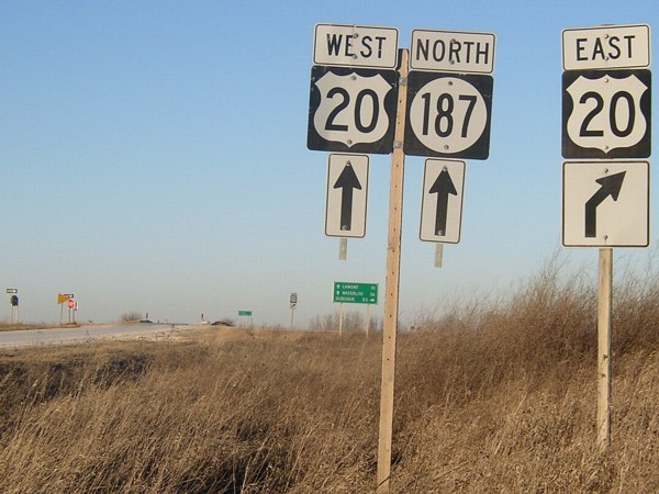
Dead December grass lines the gravel road that becomes IA 187 as it meets
US 20 in eastern Buchanan County. There is a green "Jct 20/187" sign behind the
camera. The road becomes paved at the "No Passing Zone" sign.
|