|
August
6 (Day 1): Traer to Dayton (I-74, I-474, IN 32, I-65, I-865, I-465,
I-470,
I-675)
|
 |
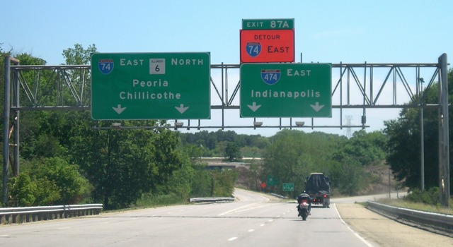
Since previous trips had us exiting the state via I-80,
I suggested taking I-74 this time. Oops. Construction on the bridge
resulted in a 20-minute delay. I then wanted to take I-474 around
Peoria, and found that there was no choice in the matter because of a
major rebuilding project on I-74 in Peoria. I-474 forms a half-loop
around the south side of the city.
|
 |
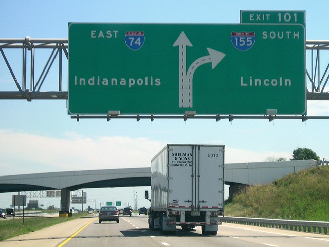
Two miles after the east end of I-474 is the north end
of I-155. This is a graphical BGS on I-74. A logical second destination
on the right side would be Springfield, since I-155 provides that
connection to I-55 from Peoria. |
 |
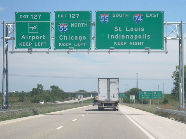
I-74 joins I-55 around the west side of Bloomington.
Continuing east would be merging onto northbound I-55, which encounters
I-39 at its next exit. |
 |
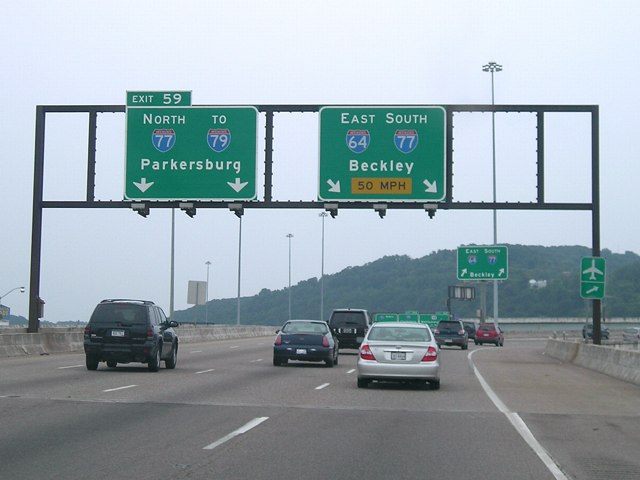
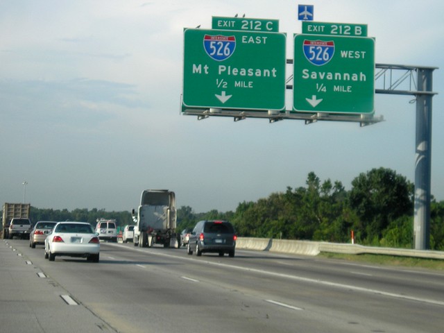
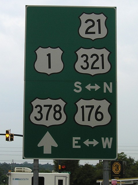
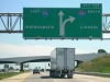
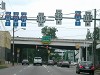
This is what passes for duplex signage in Indiana. We
took IN 32 as a cutoff to I-65 to go around the north side of
Indianapolis. US 52 had joined I-65 just north of there, but this was
the only 52 shield on 65. |
 |
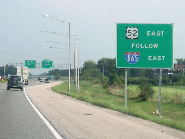
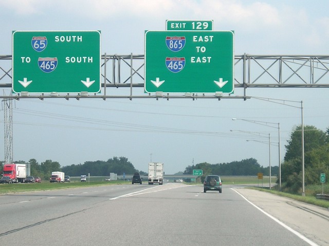
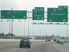
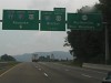
I-865 used to be labeled as a "dogleg" of I-465 but
received its own number earlier in the decade, skipping over 665. There
will be a sign at the east end of I-865 indicating US 52 should follow
eastbound I-465. |
 |
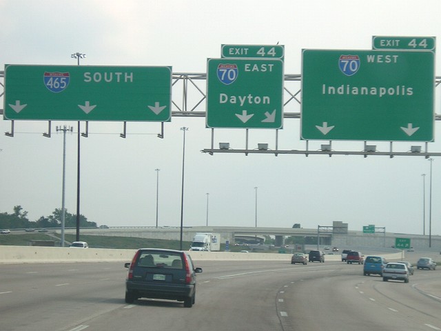
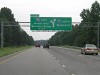
I-465 meets I-70 in a tangle of ramps and lots of
lanes. There's nary a peep of the hidden US routes involved at this
point - US 31, US 36, US 52, and US 421. Every US route that used to
run into downtown Indianapolis has been shunted onto the beltway.
Signage is so minimal that Rand McNally has been confused in the past -
in 2002, its city map showed northbound US 31 running clockwise around
the west side of I-465, and eastbound US 52 running counterclockwise
along the west and south sides of I-465. By the 2007 atlas, those were
switched to the east and north sides to match what was "in the field". |
|
August 7
(Day 2): Dayton to Winston-Salem (US 35, I-64, I-77, I-74, US 52)
|
 |
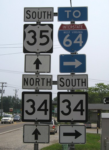
All of US 35 in Ohio east of Dayton is freeway or
expressway. It becomes two lanes in West Virginia through some nice
scenery. I've seen I-35 meet US 34; this is one step below, US 35
meeting a state route 34 in West Virginia. |
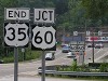 |
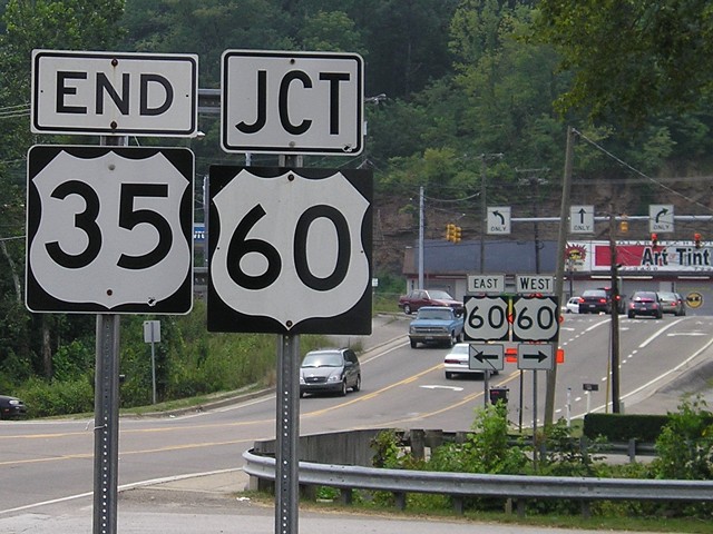
US 35 only goes through three states - Indiana, Ohio,
and West Virginia - ending at US 60 in St. Albans a short distance from
Charleston. For a highway that
runs through Phoenix, US 60 has made a significant trend
northward while going east. |
 |
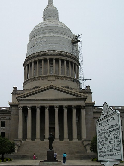
The West Virginia Capitol was undergoing some dome work
when we visited. Since it was a Sunday, there were no tours.
At this angle, the plaque should be readable on the full picture, but
here's what it says: "West Virginia's Capitol first
located in Wheeling, 1863; moved to Charleston, 1870; back to Wheeling,
1875; and finally to Charleston, 1885. It was located two miles west
until destroyed by fire, 1921. Present building was completed in 1931." |
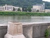 |
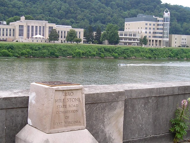
West Virginia has a Zero Milestone across the street
from the Capitol, along US 60 on the banks of the Kanawha River. The
University of Charleston is across the river. |
 |
After stopping at the Capitol, we backtracked to find a
place to eat (surprisingly difficult). We passed back under I-64 in
downtown. |
 |
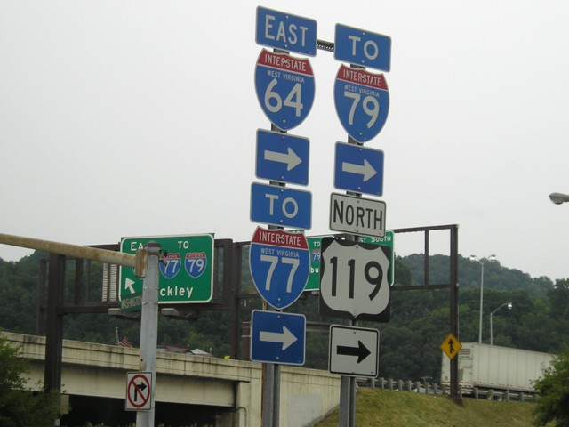
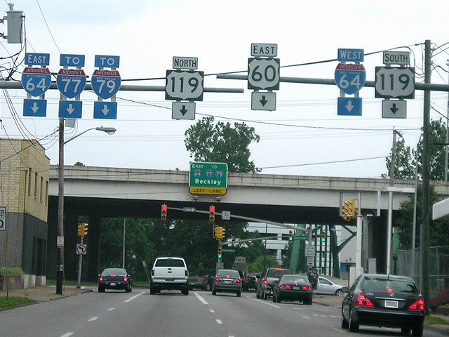
The same interchange from the opposite direction. These
are my only pictures of US 119, a road I've only traveled via a short
interstate duplex just south of here. |
 |
When I-64 joins I-77, signs direct to I-79 a few miles
away. Then, south of here, 64 and 77 become the West Virginia Turnpike,
a road with great scenery but some not-so-great grades and curves plus
moderate traffic. |
 |
This somewhat blurry picture in Virginia shows I-77
entering a wrong-way multiplex with I-81 on a segment that runs mainly
east-west. US 52 makes a cameo appearance. |
 |
Interstate 74 in North Carolina. *shakes head* Wrong on
so many levels. With the flimsy excuse that maybe someday the I-74
diagonal would be extended southeastward from Cincinnati, the potential
diagonal inside North Carolina could/should have been labeled I-38
(since it spends most of its time south of I-40) or even a southern
I-87 (since it may have more north-south than east-west miles in the
state). |
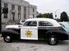 |
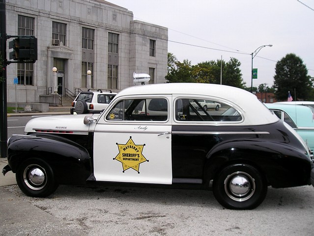
Mount Airy, North Carolina, is considered a model/heavy
inspiration for Mayberry on "The Andy Griffith Show". Downtown is this
police car in Mayberry regalia, with the post office behind it. |
|
August
8-9 (Days 3-4): Winston-Salem to Charleston via Raleigh (I-40, I-95, I-26)
|
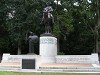 |
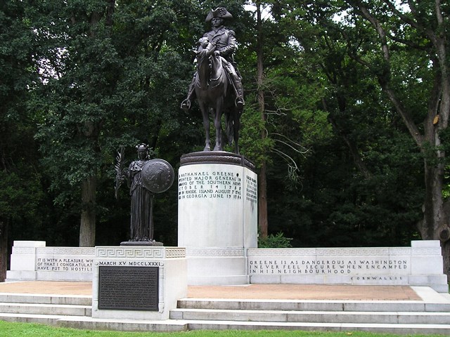
Guilford
Courthouse National Military Park in Greensboro is my first
visited Revolutionary War battlefield. This is a monument to Nathanael
Greene, who led the Continental Army in the battle, an American victory. |
 |
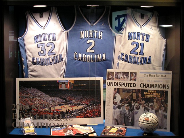
Four months before our trip, the North Carolina men's
basketball team won another national championship (going through Iowa
State to do so). This display was one of many at the "Dean Dome," NC's
home court.
Less than 10 miles north of here is the campus of Duke University; we
saw that basketball court first. |
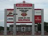 |
Carter-Finley Stadium, football home of the North
Carolina State Wolfpack. With three Division I universities crammed
into such a small area, no wonder the logo of an all-news TV station in the area
has one main color from each. |
 |
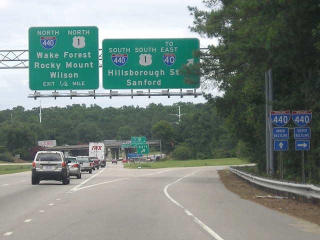
Interstate 40 used to end here, on the west side of
Raleigh. Now, this portion of road carries no number as 40 bypassed
this segment on its extension east and south to Wilmington. Notice the
"Inner" (clockwise) and "Outer" (counterclockwise) designations on the
side signs for the I-440 beltway. |
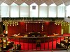 |
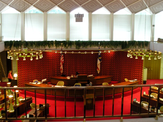
The North Carolina Senate chambers. The Legislature is
in a building constructed in 1963. |
 |
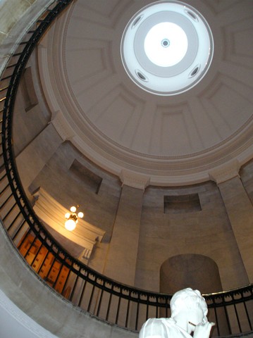
Rotunda of North Carolina's "Old Capitol" with a statue
of George Washington in the middle.
It rained on this day of vacation. Fortunately, our stopping points
were buildings in Raleigh and Fayetteville. The sun came out by the
time we got to the South Carolina line. |
 |
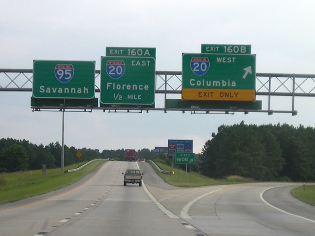
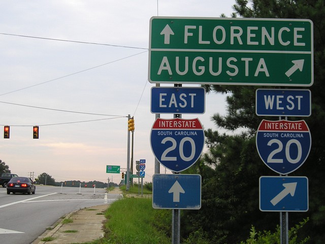
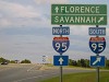
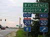
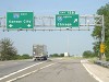
The east end of I-20 is at I-95 in Florence. The middle
sign
should have a green shield for Business Spur 20, but this sign and the
one before it use the wrong shield. |
 |
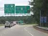
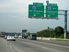
I-95 shields at Exit 108 in South Carolina. This setup
is typical for the state. |
|
August
10 (Day 5): Charleston to Columbia (I-26)
|
 |
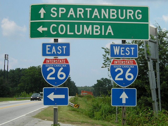
Coming into downtown Charleston, I-26 splits its child,
I-526, in half. |
 |
In summer 2005, a new bridge across the Cooper River
for US
17 also involved changes to the east end of I-26. This is heading into
the oldest part of the city. When I-26 ends, US 52 will also end
nearby, but there will be no signage around. Meeting Street running north from
US 17 is 52. |
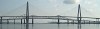 |
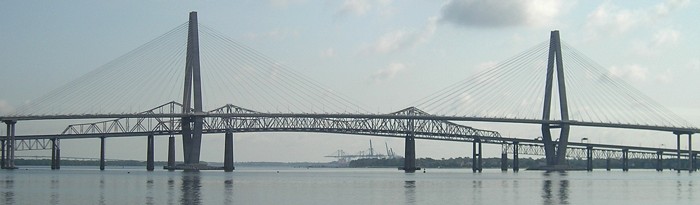
The new and old Cooper River bridges. The old one was
torn down after our trip. |
 |
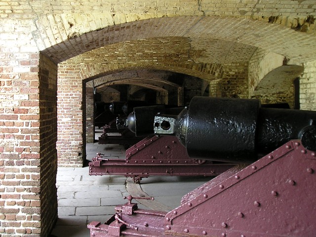
Cannons at Fort Sumter. |
 |
In addition to Fort Sumter, we also took a bus tour of
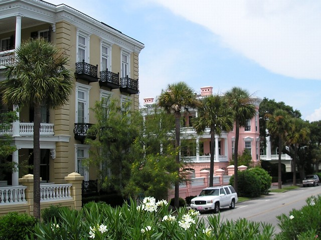
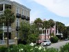
Charleston. Here are some of the houses we saw near the beach, with a
palmetto tree on the left. |
 |
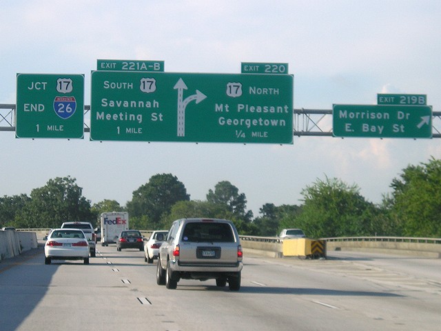
Once again, here's US 52. We could have picked it up at
Joliet - or even Sabula - and followed it all the way down here, but
that would've taken quite a long time. This is the first signage for US
52 on the interstate, in North Charleston. |
|
August
11
(Day 6): Columbia to Cherokee, NC (I-126, I-77, I-26, US 74, US 441)
|
 |
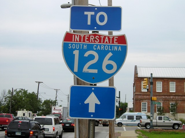
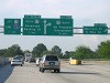
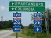
I-20 shields at the Bush River Road exit, one mile west
of
I-26. At that interchange, 26 dips south of 20 on its diagonal
alignment, and then passes the west end of I-126. |
 |
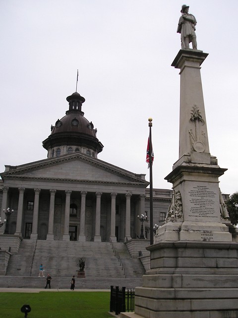
The South Carolina Statehouse with Confederate monument
in
the foreground. Notice the Stars and Bars flag nearby; it stopped
flying over the Capitol in 2000. (News
article) |
 |
Lots of US highways intersect at Huger and Gervais west
of the Capitol by the South Carolina State Museum. |
 |
"To I-126" shield on northbound Huger, aka northbound
US 21/321, aka westbound US 176 based on the panel above. |
 |
I-26 shields at Exit 72, SC 121. South Carolina was the
last
state in the Lower 48 my parents had not visited, and #44 for me. I
would pick up #45, North Dakota, two years later. |
|
August
12
(Day 7): Cherokee, NC to Marion, IL (US 441, TN 66, I-40, I-24, I-57)
|
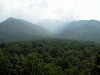 |
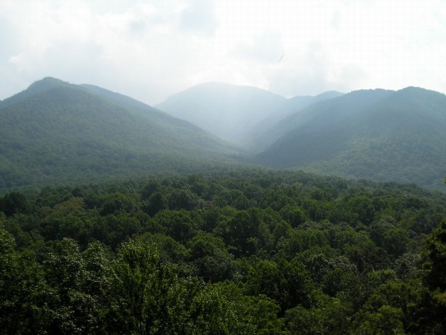
A glorious morning in the Great Smoky Mountains.
It was a perfect day to see this national park. The National Park
Service says it's the most visited park in the country. I have now been
to three of the five most-visited parks: the Smokies, the Grand Canyon,
and Yellowstone. |
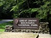 |
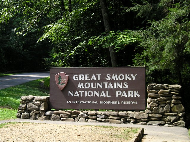
Entrance sign for the park, photo taken on the way out.
Upon
leaving the park we encounted a LOT of traffic in Sevierville and
passed a lot of tourist-trappy areas. Staying on the North Carolina
side the night before was a good thing to do. |
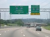 |
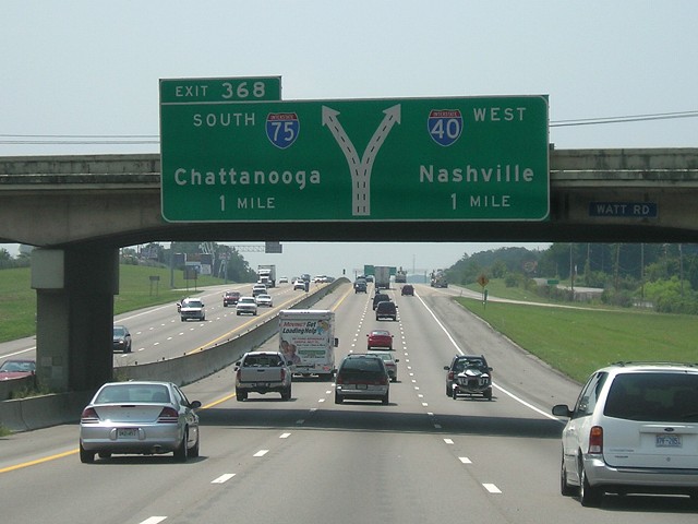
Leaving Knoxville, I-40 joins I-75. Before this point,
we stopped in downtown to see Tennessee's basketball arena. |
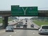 |
Approaching the split of I-40 and I-75. |
 |
It was late afternoon when we got to Nashville, too
late for a tour of the Capitol. We also stopped at the Parthenon. |
 |
When we went through Nashville in 1994, this would have been
the end of I-265. Since then, a reroute of highways in the area has
eliminated that interstate. Leaving Nashville on I-24, we went through
Kentucky and got into Illinois shortly before sunset. Before the night
was over, we had clinched the remaining length of I-24, my second
clinched two-digit interstate and first multi-state one. (The other
half of I-24 was done in 1994.) |
|
August 13-14 (Days 8-9): Marion, IL to Traer, IA via Peoria (I-57, I-64, I-55, I-155, I-74, US 34, US 218)
|
 |
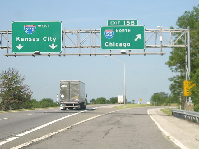
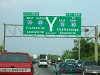
Coming up from Marion, we took a shortcut on IL 4 and I-70.
This is the I-70/55/270 interchange, and the easternmost mention of
Kansas City. (It's also the closest-to-focus picture in the sequence.) |
 |
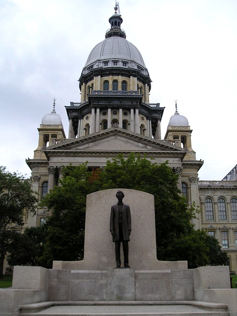
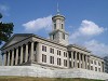
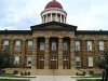
The current Illinois State Capitol and a statue of some local 19th-century lawyer. |
 |
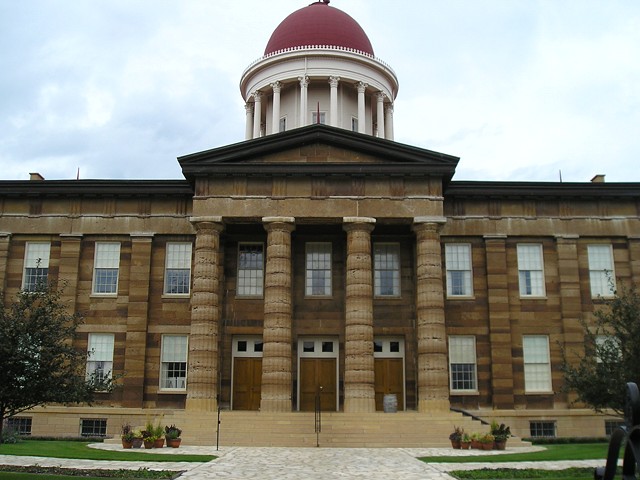
The Old Capitol in Springfield was rebuilt in the 1960s to the style it was in the middle of the 1800s. |
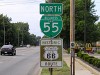 |
Business Loop 55 follows the historic route of US 66 through
the city. Similar signs to the 66 marker line the route in other states.
After Springfield, it started to rain. We found ourselves a day ahead
of schedule, so we decided to stay in Peoria for the night. |
 |
Starting the day in Peoria, we went west to Galesburg to stop
at the Carl Sandburg House and then into Burlington. We stopped to see
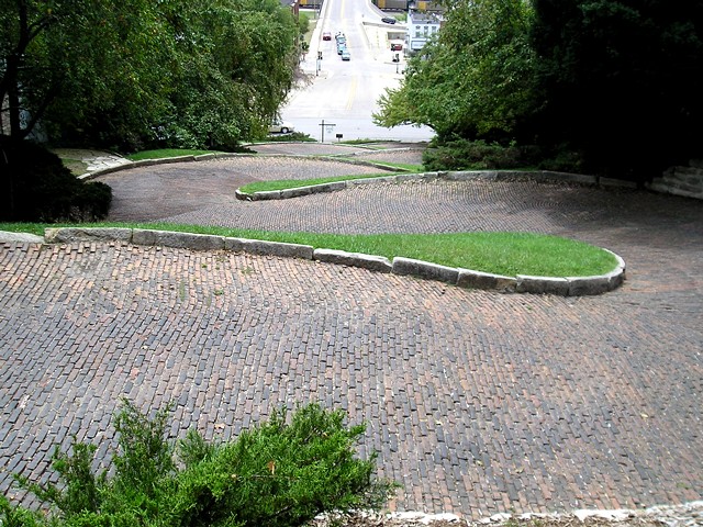
Snake Alley, the crookedest street in the world (or at least one of the
contenders). Ironically, my visit to the famous "crooked street" in
Iowa came four years after I'd been on the famous crooked section of
Lombard Street in San Francisco. |
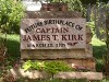 |
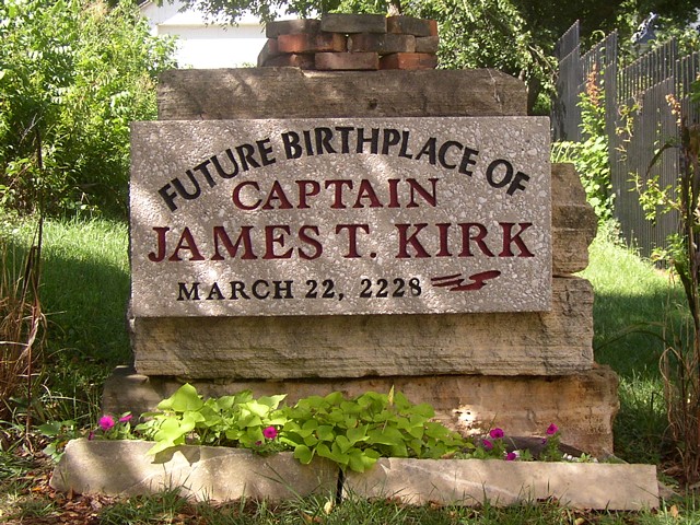
From the 18th Century (Guilford Courthouse) to the 19th (Fort
Sumter) and through the 20th (NC State Capitol), our vacation neared
its end in the 23rd Century in Riverside. That's right - the birthplace
of Captain James T. Kirk of the Starship Enterprise. "I'm from Iowa. I
only work in outer space." |