 WEST
WEST
| IA 24 (II) endpoint history | |||
| FROM | TO | WEST | EAST |
| 12/1/28 | 7/31/63 |
IA 59, later US 63 (Main Street at Pleasant Hill Avenue, New Hampton) | US 52 and IA 11 (later IA 150), Calmar |
| 7/31/63 | 10/5/02 | US 18/63 (Main St at Linn St, New Hampton) | |
| 10/5/02 | Present | US 18/63 interchange |
|
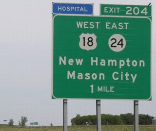
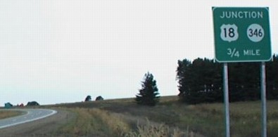
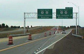
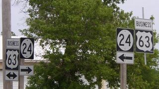
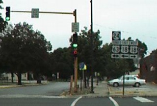
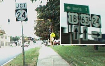
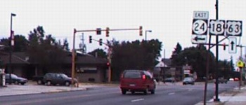
WEST End: Interchange, US 18 and US 63, New Hampton, Chickasaw County
Dennis Swanson drove through New Hampton on Sept. 21, 2002, during the transition of the US 63 bypass. Here's his map of the three ends of IA 24. The first one, at an old alignment of 63, won't be included here. (The old alignment went east along the blue line in town and then north on the road by the red 6, rejoining the present alignment at the top of the graphic.) The freeway shown in blue opened Sept. 11, 2002.
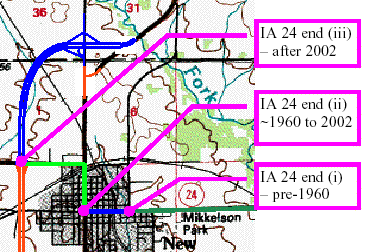
USGS topographic map modified by Dennis Swanson (pre-1960 is pre-1963)
Facing west on 24 (9/21/02)
Photo by Dennis Swanson
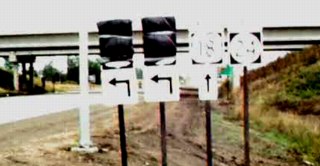
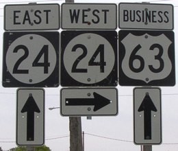
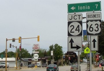
With the completion of the bypass around New Hampton, 24 was extended from its end in central New Hampton north with (now) Business US 63 to where 18 (used to) split from 63 near the Sara Lee plant, and goes west to meet the bypass. Dennis reported that at the time of the photo, there were no other 24 signs between the interchange and downtown (which still had its "END" sign posted as well). The signs covered up are for 63 south and 18 east, as you can see below, because at the time only the stretch north of the interchange was open.
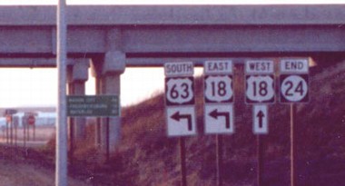
Facing west on 24 (11/17/02)
Photo by Jason Hancock
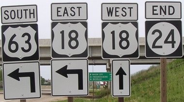
Closeup of above signage (5/18/04)
It appeared to me when taking these pictures that the 18 shields seemed lighter than the 63 shields - the black backgrounds and numbers for 63 were darker.
Facing west on 24 (5/18/04)
Facing east on 18 (5/18/04)
Facing east on 18 (5/18/04)
Facing east on 18 (5/18/04)
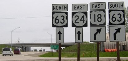
Facing north on 18/63 (5/18/04)
Compare the supplemental sign to the southbound version below. This one has the text on a separate sheet, pasted over whatever was on the original sign.
Facing north on 18/63 (11/17/02)
Photo by Jason Hancock
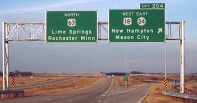
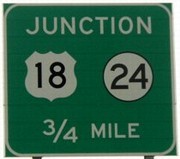
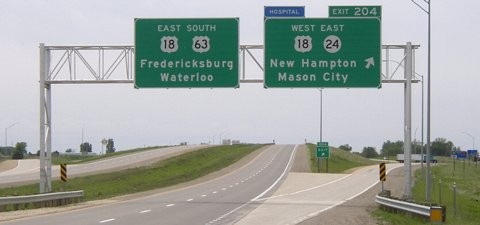
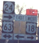
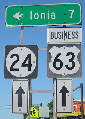
Two things about this gantry: 1) The exit numbers use US 63, even though 18 is the lower number. When US 30 and 61 join, the two exits involved use 30's numbers, even though 30 is entering/exiting the 61 freeway there. That pair of interchanges should use 61's numbers like 63 does here, since 63/61 is dominant. In fact, here along 63, the little white markers every five-hundredths of a mile have 18's mileage, but the exit numbers are 63's, which I think is a good compromise.
2) Lime Springs is the "control city" on 63, even though it is not on 63 proper and in fact had its own spur (IA 157). The only incorporated city in Iowa north of here is Chester (pop. 151), so perhaps Spring Valley MN would have been a better selection. Since southbound signs omit Denver, which is between here and Waterloo on 63, there's no reason to list Lime Springs, although the rules probably mandate it. (And 3) It's not in Butt-Ugly Kansas-Style signage, a little thing to be thankful for.)
Facing north on 18/63 (5/18/04)
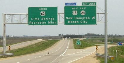
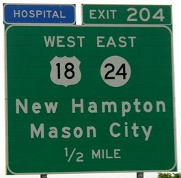
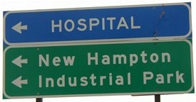
There have been a few instances of blue "Hospital" signs being added to BGSs, including on US 30 for US 69.
Facing south on 63 (9/21/02 and 5/18/04)
Left photo by Dennis Swanson
Oops! Wrong state highway! Dennis wrote later and said it had been replaced by Sept. 30 (right). The real question is, why is this sign here? Given that the Business 63 exit is behind us, there's no reason it shouldn't be a regular freeway sign. A regular BGS appears in the background at the half-mile, though, which should've just been placed here.
Facing south on 63 (5/18/04)
The sign at right is taken with a flash. Compare it to its northbound counterpart above.
Facing south on 63 (9/21/02)
Photo by Dennis Swanson
Facing south on 63 (5/18/04)
Facing south on the offramp (5/18/04)
These signs are both on the offramp, but compare the difference in style and thickness of the fonts. (Contrast has been turned up on these and some above pictures to show the signs better.)
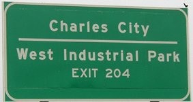
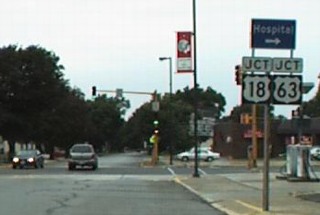
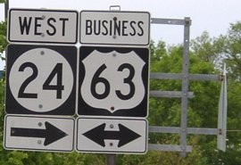
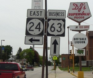
Surrounding area information: North junction Business US 63
Facing northeast (5/18/04)
Facing south on Business 63 (5/18/04)
This basic separate-shield pattern was up back when the intersecting road was US 18.
This intersection made a cameo appearance in the 1999 film The Straight Story, when lawn mower-driving Alvin Straight (Richard Farnsworth) had to deal with semis making the turn from 18 to 63.
Old WEST End (July 31, 1963-Oct. 5, 2002): Stoplight, US 18/US 63 (now Business US 63), New Hampton, Chickasaw County
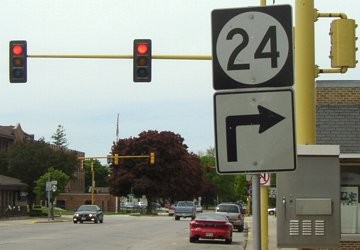
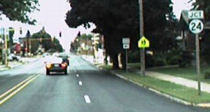
Facing west on 24 (5/18/04)
Facing west on 24 (9/21/02)
Photo by Dennis Swanson
Facing west on 24 (9/21/02 and 11/17/02)
Photos by Dennis Swanson / Photo by Jason Hancock
It may not be evident on the map, but the end of 24 and where 18 split from 63 were not the same intersection. This sign at the end had not changed when Dennis took the picture. The left side reads "24 / End / 63 / <->".
Facing west on 24 (5/18/04 and 7/16/20)
Facing north on 63 (final assembly in inset) (9/21/02)
Photos by Dennis Swanson
The LGS for Ionia is for highway B57, which goes west from the intersection (you can see a blue shield in the above photo). The Ionia sign was and still is the only LGS at the intersection.
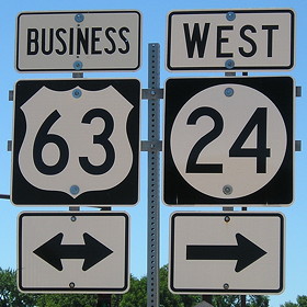
Facing north on Business 63 (5/18/04)
B57, to the left, has a bridge over the new four-lane.
Facing north on Business 63 (7/16/20)
Why did this setup lose the "Jct" and necessary right arrow with 24?
Facing south on 18/63 (9/21/02)
Photo by Dennis Swanson
Facing south on 18/63 (9/21/02)
Photo by Dennis Swanson
The "East" may have been added after the bypass was built. I wonder why there's no arrow under the 18. Notice the "18" is in the wider Series D font.
Facing south on Business 63 (5/18/04)
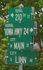
Chickasaw County put up a rural sign in the middle of New Hampton (the 24 sign has been shifted from its perpendicular).
For additional pictures of the New Hampton bypass see the Business US 63 and IA 346 East pages.
EAST End: 4-way stop, US 52 and IA 150, Calmar, Winneshiek County
The mutual end of 24 and 150 has its own page here.
Point of interest
At its creation in 1928 until late 1932, IA 24 followed a markedly different route in the middle. Its original route, before being graded to mostly parallel the Chicago, Minneapolis & St. Paul Railroad, was as follows: IA 24 from its west end at Pleasant Hill Avenue (then IA 59), 205th Street, Ridgeway Avenue, IA 24, McHugh and Grove streets through downtown Lawler with a vacated diagonal northeastward, V56, B33 past the extinct map dot of Little Turkey, V64, 128th Street, 295th Avenue, IA 24 (with a corner at 280th Avenue), vacated diagonal that ran into 273rd Avenue where the road has a 90-degree angle, 273rd Avenue, Main and 1st streets in Fort Atkinson (24 is on 1st today), 271st Avenue, 150th Street (crossing the railroad back to 24 east of 265th Avenue), a jagged routing just north of the present that has totally vanished, a vacated northward extension of 252nd Avenue plus some more vacated segments, and present IA 24 in Calmar.
Page created 12/15/01; last updated 1/30/10 4/12/22