 BUSINESS
NORTH End: Interchange, US 63, Chickasaw County
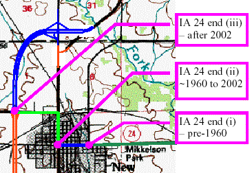
Map by Dennis Swanson
The north end of the business route is not exactly where the old route meets the new. As you can see, the north end of the business route is at the blue interchange, and the stub of black road at the southeast corner is a piece of 63 rebuilt to intersect the new two-lane perpendicularly. The north end of Business 63, like 346, has one inner ramp instead of being a regular diamond. Dennis Swanson's pictures are from during construction of the bypass in 2002; mine are in 2004, about 18 months after completion.
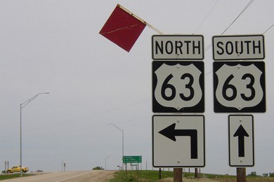
Facing north on Business 63
The red flags are most likely because it is a left turn (the inner loop) rather than a right.
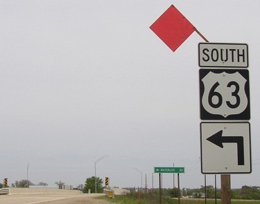
Facing north on Business 63
As for the red arrow here, it may be to alert those unfamiliar with the bypass, or you get so complacent leaving New Hampton that you don't notice the road becomes gravel.
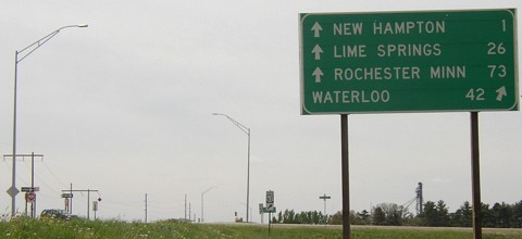
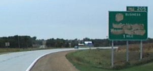
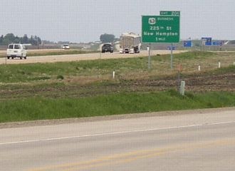
Facing south
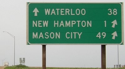
Business 63 starts ahead. Notice that this LGS includes "Minn" on the Rochester line, yet on interstates the Twin Cities don't come with the same note, nor does Kansas City have a state on signs at I-35 interchanges south of Des Moines. Maybe it's because there's a Rochester, Iowa, albeit an unincorporated one east of Iowa City. Lime Springs is the "Iowa" destination for 63 north, although the route technically doesn't go through town, and Spring Valley MN might have been a better choice.
Facing south on 63
Photo by Dennis Swanson
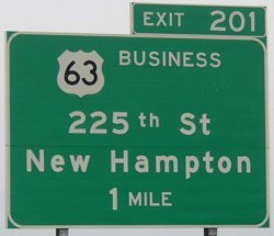
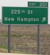
This is at the top of the map at the top of this page. The pre-1960 alignment of 63 can be seen going straight ahead. At the time these pictures were taken the business route was not yet marked as such. The business route will not directly merge into 63 at the south end of the bypass, instead ending at an interchange on a country road (225th Street). A mile or so of current 63 remained on a diagonal reconfigured to end at the north-south road.
Facing south on 63
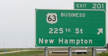
This is the same sign, now open for business. (Ooh, that was a bad pun.)
Facing south(west) on 63
Photo by Dennis Swanson
The new road curves to head directly west and go to four lanes. The old road is now a dead-end stub reconfigured to a stop sign just south of the Business 63 interchange (see below).
Facing west, but heading south, on 63
Facing north on 63
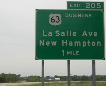
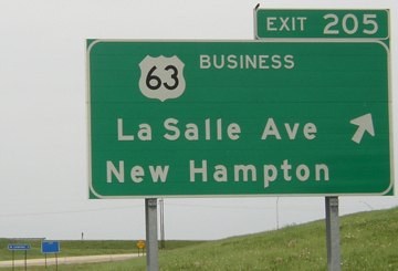
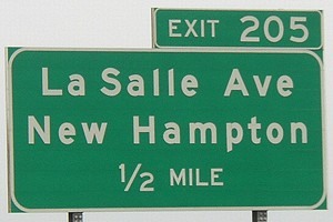
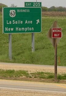
The business route is only signed in one direction - the direction one would normally want to be told about a business route. I can't say I entirely agree with this philosophy. La Salle Avenue is the rural street name; this one, 225th Street at the other end of the business route, and Oaks Avenue on US 30 west of Marshalltown are the only gravel rural roads I know of that get their name on BGSs.
Surrounding area information: Old 63
Facing northeast
This is sort of an interesting visual cue. The road ends, yet it seems to go on. Only a few hundred feet of old 63 were removed between the segment left behind and the route still in use; this stub serves a farm.
Facing northwest
This view from old 63 shows the beginning of the divided highway and how close the business route exit is.
Surrounding area information: South End of IA 478
Facing south on Business 63
A short portion of Business 63 that didn't become 24 remained in DOT hands for a while after the bypass opened in order to refurbish some pavement. For reasons defying all number conventions, this secret route was given the designation IA 478. This number had never been used before, and unlike IA 475 (a derivation of US 75) there was no IA 78 for it to be derived from. Since IA 432 was designated in 1997, a lot of secret highways have been assigned completely random non-900s numbers even though (to our knowledge) plenty of those numbers were available. Now that nearly all the 900s have bitten the dust, perhaps the DOT will go back to that convention.
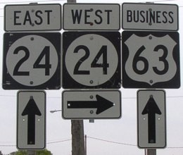
The only change between 2002 and now on this assembly is that the 24 shields used to be 18 shields (and the "Business"). The directions were separated then too.
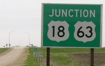
SOUTH End: Interchange, US 63/US 18, Chickasaw County
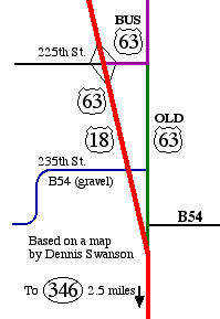
The status (designation) of old 63 south of the business route has no designation other than the E911 street name. Dennis's map indicates (less obvious on mine) that 63 and 18 diverge from the original route approximately where B54 intersects the four-lane. Old 63 stops at B54 and a quick right takes you right to the four-lane. The portion of 225th that became Business 63 was not previously paved. The blue line indicates 235th Street (blocked off at the four-lane), which carries a designation of B54 but is gravel.
Facing northwest
In the foreground is old 63, which ends about 100 feet to the lower left.
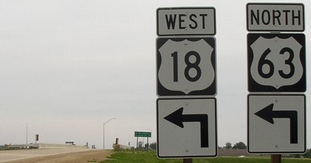
Facing north on 18/63
Although US 18 is the lower number, and does get the little white mileage markers on the side, 63, the main route, gets the exit numbers. This sign is
Facing north on 18/63
Facing south on 18/63
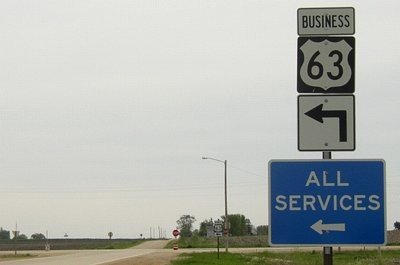
Facing west, but heading south, on Business 63
There is no "End" sign for the business route. Compare the angle of the arrows in the BGS and the LGS.
Facing west, but heading south, on Buiness 63
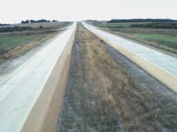
Facing north from the bridge
Photo by Dennis Swanson
Facing south from the bridge
Photo by Dennis Swanson
At the time these pictures were taken this part of the bypass was not open yet.
Facing east on 225th Street
I find it a bit amusing when signs like this end up on gravel roads.
Facing east, but heading north, on Business 63
Facing east, but heading north, on Business 63
This sign and the one in the background are the only Business 63 shields on the east-west portion. The westbound green "Junction 18/63" sign is to the left and back a few dozen feet.
Pictures by Dennis Swanson: Second, sixth, eighteenth, and nineteenth, 9/21/02
Pictures by me: First-third, fifth, seventh-seventeenth, and twentieth-twenty-second, 5/18/04
Second map by me: 2/28/02
Page created 2/28/02; last updated 6/9/04
For additional pictures of the New Hampton bypass see IA 24 West and IA 346.