
(January 4, 1938-July 1, 2003)
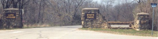
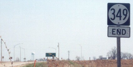
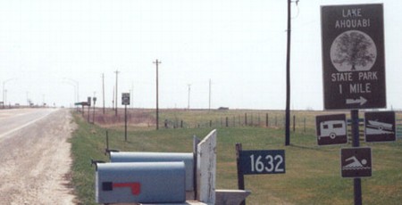
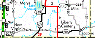
WEST End: Lake Ahquabi State Park, Warren County
Facing west on 349
Photo by Jason Hancock
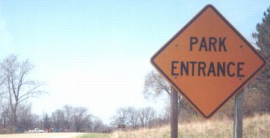
The west end of the highway is not signed, much like many other state highways that ended at state parks.
Facing west on 349
Photo by Jason Hancock
A 1930s-esque stone wall welcomes you to the park, which isn't surprising once you learn the lake was another man-made creation of that decade. The Civilian Conservation Corps (CCC) built many of the structures in use today, according to the park website. The CCC also worked at many other state parks, including Springbrook (IA 384), Lake Keomah (371), Lake MacBride (382), and Backbone (410) (and there they built a lake too!).
The street sign at right indicates the intersection of "Hwy 349" (at the time) and 118th Avenue.
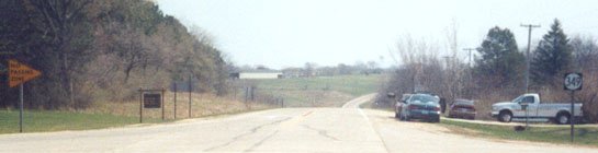
Facing east on 349
Photo by Jason Hancock
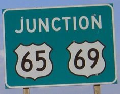
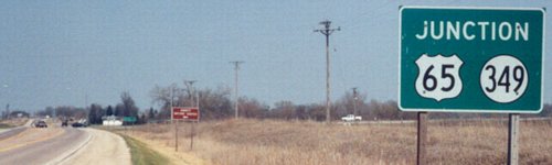
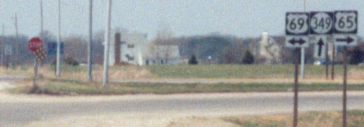
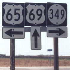
EAST End: Stop sign, US 65 and 69, Warren County
The end of a one-mile-long state highway to a park wouldn't usually be a very interesting intersection, but in this case, two highways split at the same place (see also IA 252). Not only that, but for approximately a year (December 1934 to sometime in 1935), the intersection was also the north end of US 69, which had been extended along what had been US 65 north from Leon. (At that time, 65 assumed its current route between this intersection and IA 2.) Going counterclockwise from 9 o'clock to show the two ends first:
End 349
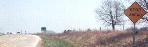
Facing east on 349
Photo by Jason Hancock
Facing east on 349
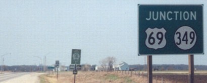
This "Junction 65/69" sign is the only indication on 349 that 69 is involved in the upcoming intersection.
Facing east on 349
Photo by Jason Hancock
LGS in above picture
Photo by Jason Hancock
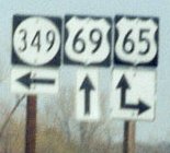
Notice that the last assembly before the intersection only shows 65 going left and ahead, without a 69 and double arrow.
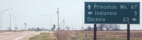
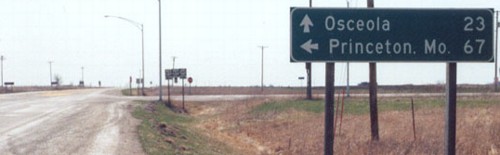
This intersection is the northernmost location of Princeton, Missouri, on LGSs, and because every other route leaving the state hits a county seat or larger town, it's the northernmost location of a Missouri city on any LGS in Iowa. (Kansas City on I-35 doesn't count.) This is slightly less than 100 miles south of the southernmost location of a Minnesota city on an LGS, Rochester on US 63 leaving Waterloo.
69 North (End 69 1934-5)
Facing north on 69
Photo by Jason Hancock
The brown sign is for the Annett Nature Center, which you can get to by turning right on 118th Avenue at 349's west end.
Facing north on 69
Photo by Jason Hancock
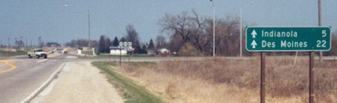
Notice that this LGS does not point to any southern destination on 65 - or, for that matter, Milo, straight east on 65 and former IA 205.
Facing north on 69
Photo by Jason Hancock
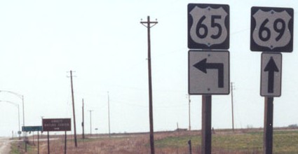
65 North (West)
Facing west, but heading north, on 65
Photo by Jason Hancock
LGS in above picture
Photo by Jason Hancock
In this case, not listing a city in the southern direction is even more surprising.
Facing west, but heading north, on 65
Photo by Jason Hancock
65/69 South
Facing south on 65/69
Photo by Jason Hancock
Facing south on 65/69
Photo by Jason Hancock
Facing south on 65/69
Photo by Jason Hancock
Facing south on 65/69
Photo by Jason Hancock
Last seen: 2003 (2003 map)
All pictures except fifth by Jason Hancock: 4/14/03
Fifth picture by me: 10/8/04
Page created 9/13/03; last updated 11/12/04