 EAST
EAST
(June 14, 1986-present)
Old EAST End (1989-July 21, 1995): Stoplight, Old US 218/Franklin and Center streets, Cedar Falls, Black Hawk County
This intersection has gone through many changes in the past 30 years. First, as with 58, a diagram to get oriented:
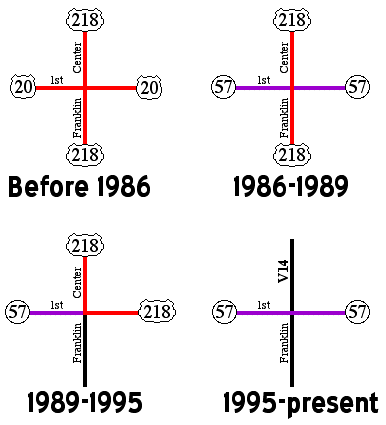
(Between 1935 and 1980 57 also crossed this intersection, intersecting 218 while multiplexed with 20.)
Much more detailed maps of the historic routes of IA 57 and 58 in the Waterloo/Cedar Falls area are on this page.
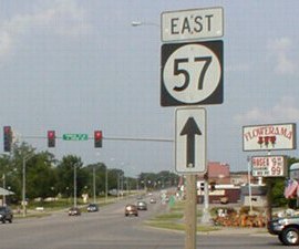
Facing east on 57 (6/3/14)
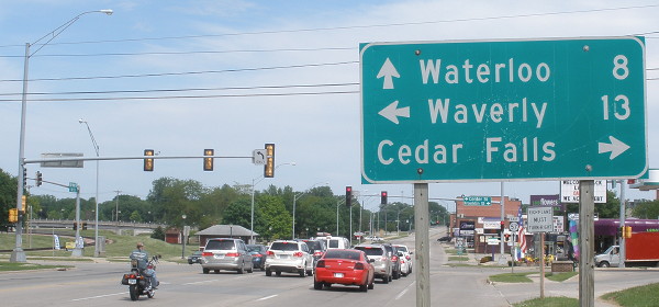
Honestly, if you need directions to Cedar Falls from here, you're extremely lost. It's not like we're IN it or anything...
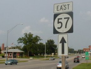
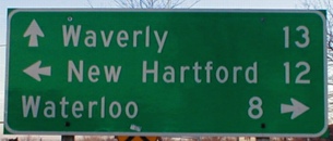
Facing east on 57 (6/21/02)
The left sign is at the intersection. The sign at right is past the intersection, brought to you by the Department of Redundancy Department. The brick building at left is an old gas station-cum-info building; the brown sign is for the Ice House Museum. These signs and the LGS above were the same in 2002 and 2014.
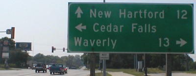
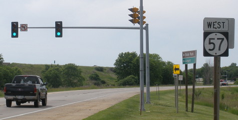
Facing west on 57 (6/24/02)
Before 218 was rerouted to use the present expressway south of the airport (1989), this would have been on 57. In the early 1990s, 218 was on this road and went north at this intersection. (See the diagram at top.) As with eastbound, there is a second "West 57" with a straight arrow after the intersection.
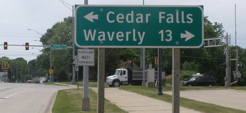
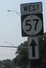
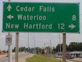
Facing west on 57 (6/3/14)
Of the three destinations on the previous sign, Cedar Falls, not New Hartford, was the one needing to be omitted.
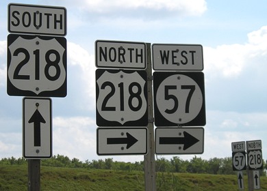
Facing north on old 218 (Franklin Street) (11/21/01)
After this was no longer part of 218, a junction sign was added, but when 218 was removed entirely from the intersection, the bracket was not (until the 21st century). The LGS was dated 1987 and still existed in 2014. From here, V14 goes north on Center Street, taking 218's old route to near Janesville, but there are no markers for it anywhere here.
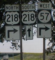
Facing south on 218 (now V14) (6/21/02)
EAST End: Interchange, US 218, IA 58, and IA 27, Cedar Falls, Black Hawk County
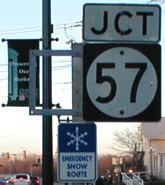
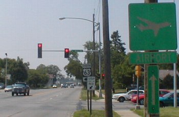
Facing east on 57 (7/15/07)
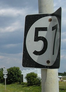
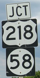
An extremely rare sight in Iowa - a wide 3-digit sign. This is at Roosevelt Road, a gravel road just west of the interchange that was blocked off a few years ago. Jason Hancock also has a picture of this sign. About ten yards in front of these signs is the last eastbound "57" on a street light, but it does not have an "End" with it. For pictures of the intersection, since it's at the same interchange as 58's north end, I have a combined page here.
Surrounding area information: Leftovers
Facing west on Broadway (6/3/14)
This is at the east end of the 218/Broadway interchange. The stoplight is for traffic that took the exit from 218 northbound; the freeway is curving around on the left side of the picture. The brown and green sign points to George Wyth State Park and the airport. Continuing west on this road, it becomes the onramp for 218 north.
Facing south on Airport Road / Facing south (far right: the onramp to 218 NB) (6/24/02 and 7/15/07)
Even though 57 hasn't been near this area since 1989, there are still signs directing drivers to 57 as if it was duplexed with US 218. These are all from when 57 took over 20's route all the way to US 63 along Broadway. Because of the Leo P. Rooff Expressway (present 218), this area is vastly different from when 20 ran through here until the mid-'80s. Northern Waterloo is the only place I have seen this particular font on 218 shields, except for one in La Porte City.
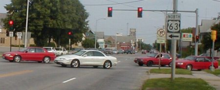
Old EAST End (1986-89): Stoplight(s), US 63 S/Mullan Ave. and US 63 N/1st St., Waterloo, Black Hawk County
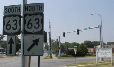
Facing west on Franklin Street (6/24/02)
Just north of here, 63 starts/finishes a one-way split between Mullan Avenue and First Street. Behind this picture, there is a short road for NB 63 traffic to turn right, which is where a 1st/Franklin street sign stands. Although the northbound traffic seems to be at an angle here, it is actually going straight north. Aerial maps from ortho.gis.iastate.edu show that this short "diagonal" portion is in line with true north-south Logan Street, which now ends just north of here and used to carry 63 before a shift in the late 1960s. (The diagonal is also signed as Logan, but it's only a short bit.) Before the freeway, US 20 would be on Franklin all along this portion (turning to Broadway a short bit west). Right after the freeway opened, 57 started heading west from here and the street to the east was turned over to the city.
Facing east on 57/Franklin Street (6/21/02)
This would have been the very end of 57, a block east of 63 south. Directly under the 63 sign is the back of a dark-colored car, which is at the short turnoff of 1st to Franklin eastbound.
Facing west on 57/Franklin Street (6/24/02)
The airport sign is probably a leftover from the US 20 days.
To original IA 57 (before 1986) / To the IA 57 West end / To the current IA 57 East end
*Inaugural Highway End*
Page created 12/1/01; last updated 1/15/15