

(July 1, 1920-June 14, 1986)
- In 1920, they knew it as: The shortest way between Grundy Center and Cedar Falls (2 counties)
- We know it as: IA 14, D19 (US 20 from 1986-2000), and University Avenue, plus assorted streets in Cedar Falls
- Let's get granular: IA 14, 170th Street, T55, Front or State Street and Main Street in Dike, D19, University Avenue, Hudson Road, 27th Street and extension, College Street (then called Normal Street), 18th Street, and Main Street
- See also: Waterloo-Cedar Falls Highway Chronology and this series of maps with an overview of IA 57's and 58's routings
- Note: IA 57 has never been decommissioned. However, given the complete swap of 57's route with a segment of US 20 in 1986, I have made separate pages for 57's post-1986 west and east ends.
- Sort-of-related routes:
- US 20, which 57 supplanted at one point or another between US 65 and US 63
- IA 58, which did a dance with 57 for about three decades
- IA 175, which replaced the westernmost part (US 65 to IA 14) in the Great Renumbering
- IA 263 (II), the old east-west road through Dike that was bypassed in 2000, 14 years after US 20 had taken over the road
| IA 57 endpoint history | |||
| FROM | TO | WEST | EAST |
| 7/1/20 | 11/3/24 | Grundy Center | IA 5, later US 218 (Main St at 13th St, Cedar Falls) |
| 11/3/24 | 9/1/31 |
IA 14 (170th St at IA 14) |
|
| 9/1/31 | Aug 1932 |
IA 14 (D19 at IA 14) | |
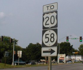
| Aug 1932 | 12/18/34 | US 65 (IA 175 at US 65) | |
| 12/18/34 | 1/1/69 |
US 63 (Airline Hwy at Logan Ave) | |
| 1/1/69 | 7/1/80 | IA 14 (D19 at IA 14) | |
| 7/1/80 | 6/14/86 | US 20 (Hudson Rd at 1st St) | |
| 6/14/86 | 10/2/89 | US 20/IA 14 (Parkersburg) | US 63 (Franklin St at 1st/Mullan) |
| 10/2/89 | 7/21/95 | US 218 (1st St at Franklin St) | |
| 7/21/95 | 8/22/03 | US 218/IA 58 interchange | |
| 8/22/03 | Present | US 65 | |
1920s WEST End (1): IA 58, now IA 14/4th St.
at IA 175/G Ave., Grundy Center, Grundy County
1920s WEST End (2): IA 14, now 170th St. at IA 14, Grundy County
The redundancy with IA 14 was cut in the Great Truncation. Paving in 1931 bypassed downtown Dike and brought the end to the below intersection.
WEST End: Stop sign, IA 14, Grundy County
Facing west on 57, then US 20, later IA 263, now D19 (7/15/07)
Highway 57 has always been in Grundy County in some way, shape, or form. It's just that those forms have changed a bit since 1920. The route 57 followed on June 13, 1986, the day before the final segment of the US 20 freeway opened in Black Hawk County and the routes were swapped, contained the easternmost portion of the original route.
Facing southwest from the same spot above (6/24/02)
As I was taking pictures here, some guys watching me asked what I was doing. After I explained, they offered a new piece of information: Before the route swap, there was a northbound-to-eastbound curve. It would have been much like that of the current west end of IA 212, only turned around.
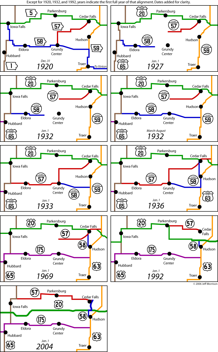
Facing west past the "Jct 14" sign (7/15/07 and 6/3/14)
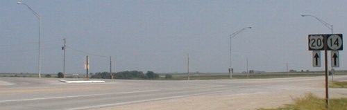
Facing south on 14/20 (6/24/02)
The new interchange with US 20 is in the background. (Of course, when 57 ended here, this was just 14, just like it is now.)
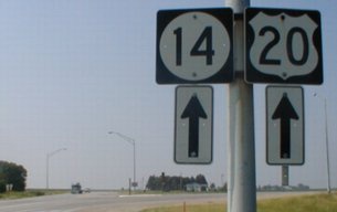
Facing north on 14/20 (6/24/02)
1920 EAST End: IA 5, now Main St. at 13th St., Cedar Falls, Black Hawk County
Originally, 57 went past the south edge of Iowa State Normal School/Iowa Teachers College, but a good part of 27th Street is now a walkway across the University of Northern Iowa campus. It was moved to what's now University Avenue in 1931, but still went north on Main to then-US 218. University remained the south boundary of development in Cedar Falls until the mid-1950s.
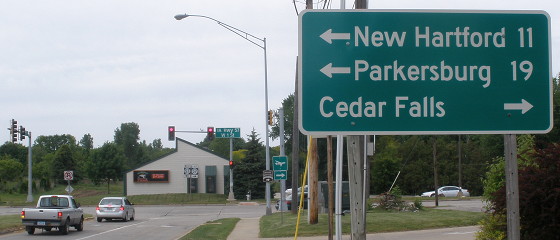
EAST End: Stoplight, Old US 20/First St., Cedar Falls, Black Hawk County
Detailed maps of the historic routes of IA 57 and 58 in the Waterloo/Cedar Falls area are on this page.
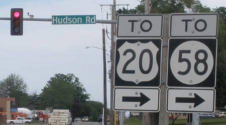
Facing north on Hudson Road, but heading east on 57 (6/24/02)
This LGS was still at the intersection in June 2002, and was probably at least 20 years old. For some odd reason, Cedar Falls keeps getting signed on LGSs even when you're inside the city; in this case, you've driven past UNI and some subdivisions. The sign was replaced by November 2003, and "Jct 57" and "57 <->" signs added, but Cedar Falls is still on the sign. Go figure.
Facing north on Hudson Road (6/3/14)
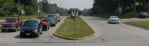
Facing east on old 20 / Facing west on old 20 (both 6/24/02)
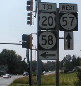
The picture on the right is the shield assembly with its back to us on the left. Both show a redundant "West 57/East 57" assembly under the NB stoplight. Travel south long enough and you will be on 58.
(Written in 2002:) Just west of this intersection, barely visible on the left side of the right picture, is a local (non-chain) motel, a testament to the time when US highways ruled the country and this was 20. Local motels are also on pieces of old US 218/V14 north of Cedar Falls and old 218/La Porte Rd. between Mitchell Ave. and San Marnan Drive in Waterloo. (And there's also a long string of them along old 30 on the south side of Marshalltown.) An Amoco near the motel is now a full BP.
Since I wrote the above paragraph, the motel has been torn down and 57 has been five-laned (center turning lane) west of this point.
Facing west, past the Subway sign in the above left picture (6/24/02)
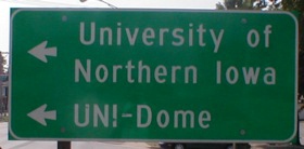
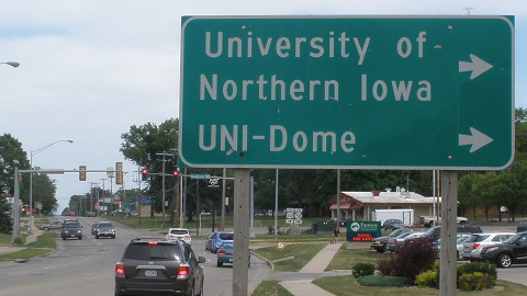
All three state universities are on various LGSs and BGSs in their areas.
Facing east on 1st Street/old 20/present 57 (6/3/14)
Facing east on 1st Street/old 20/present 57 (6/3/14)
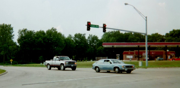
Facing south at the "West 57/East 57" assembly (6/24/02)
Although we are facing south, the white car would be heading west on 57. The manner of extension and truncation for highways 57 and 58 resulted in an odd little "bump" at University Avenue and Hudson Road; each highway turned from one street to the other. It happened first in 1956, for reasons as yet unknown. (Possibly because the DOT wanted to turn over part of Main Street to Cedar Falls because 218 had already been rerouted, and that way it wasn't going back west while heading east.)
Although the swap did not occur until the middle of 1986 because of weather conditions affecting construction, the 1986 map does show the routes swapped, with the Parkersburg-Waterloo route a thinner "unmarked primary" line, probably as either an interim map marking or a mistake.
Old EAST End: Stoplight, US 63/Logan Ave., Waterloo, Black Hawk County
Facing northwest (8/25/02)
The changes to the route in Cedar Falls did not affect its endpoint, since between 1934 and 1980 it had been extended past the Waterloo airport to end at 63. The car and pickup are at the old end of 57.
To the current IA 57 West ends / To the current IA 57 East end / To old IA 57 East ends
Page created 9/28/02; last updated 4/20/20