
(July 1, 1920-January 1, 1969)
| IA 4 (I) endpoint history | |||
| FROM | TO | SOUTH | NORTH |
| 7/1/20 |
10/16/26 |
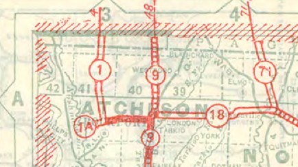
Hamburg/Missouri state line | Minnesota state line |
| 10/16/26 | 7/9/28 | US 20 (M43 at 230th St) |
|
| 7/9/28 | 1/8/31 |
Missouri state line (~US 275) | |
| 1/8/31 | 10/27/31 |
US 71/IA 5 (5th St at Lake Ave, Storm
Lake) |
|
| 10/27/31 | 11/25/31 | IA 3, Shenandoah (likely not signed) | |
| 11/25/31 | 6/25/34 | Missouri state line (US 59) | |
| 6/25/34 | 11/7/34 | IA 73 (II), Denison | US 20 (IA 471 at D36) |
| 11/7/34 | 4/4/35 | US 59/IA 141, Denison (IA 39 at Ave C) | |
| 4/4/35 | ? | US 71 (IA 175 at US 71) | |
| ? | 11/15/67 | IA 175 (IA 39 at IA 175, Odebolt) | |
| 11/15/67 | 1/1/69 | US 59/IA 141, Denison (present) | |
- In 1920, they knew it as: Minor routes in the northwest, but likely nothing south of Denison. There were few north-south auto trails in the western half of the state in the 1910s. (9 counties)
- The portion from Early to Spirit Lake was the northernmost part of the Okoboji Trail, which angled southeast to Des Moines.
- In both a 1915/1923 Highway Commission document and 1912 Huebinger atlas, it's the Storm Lake and Okoboji Air Line between those two locations.
- In the 1912 Huebinger atlas, it's a segment of the Omaha, Denison, and Spirit Lake Air Line from Denison to near Schaller.
- IA 1 and IA 4 were the only single-digit north-south routes in 1920. Conversely, IA 19 was the only east-west route in the teens.
- We know it as: Parts of US 275, US 34, US 59, IA 39, M43, US 20, and US 71
- Because of its angling path that didn't stick to one north-south tier of counties, major chunks of three different US highways can be traced to this primary route.
- But by 1936, all it had left was Denison to Odebolt plus a redundant five miles east to US 71. This last bit was dropped at an unknown date.
- Let's get granular:
- South of today's US 275/IA 333 intersection (Washington and E streets) in Hamburg:
- Washington Street northward from Missouri line, including the part of that street that is IA 333 today
- Or Main and E streets, which would hit the Hamburg business corner, but a 1928 construction document favors the above
- Hamburg to Hastings: US 275, including the old (pre-2006) route through Sidney and Northridge Road at the north end of the bypass; US 34
- Sidney was the intersection of IA 3 and IA 4 in the 1920 system.
- Hastings to Carson: 365th Street, Hews Avenue, M16/370th Street, H12, 395th Street, G66, 400th Street
- Carson: Mildred, Broadway, Dye, and North streets, Carson Avenue, US 59
- The curve between Dye and North, the way both IA 4 and later IA 177 (I) entered/left Carson, wasn't removed until 2013.
- Oakland: Frank Kearney Road, Chautauqua Avenue, Oakland Avenue, Main Street and abandoned extension northeast
- Oakland to Harlan: US 59, Idlewood Road, 425th Street, Magnolia Road, 430th St (straight up to 59), a fragment of G30, US 59, 440th St (including vacated piece), Reflection Lane, US 59, Chestnut Street in Avoca, US 59, 450th Street, Maple Road, F58, vacated stairsteps north of Juniper Road right through airport runway, US 59, 800th Street, Linden Road (old 59)
- Harlan: 12th St, IA 44, 6th St, ??? one block, out on M36
- This is a bit of speculation, because Harlan's downtown is so far away from where the highways are today. By 1930, IA 4 was straight through on 12th Street (which was US 59 until 1972) and the Southwest Avenue diagonal was built along the railroad.
- Harlan to Defiance: M36 (blacktopped), Mulberry Road, a hair of F32, Maple Road (including the vacated line through the middle of Section 6), F24, vacated section line straight north from Linden Road to 2100th Street, then west, then north on what becomes Knotty Pine Road, 2200th Street straight west across the West Fork of the West Nishnabotna River, Linden Road, maybe Railway and 5th streets northward past dead-end of old 59
- All of that, 12 turns (or so?) in all, was replaced in 1930 with the nice, clean line you see today that was bypassed in 1971.
- Defiance to south side of Denison: US 59
- Denison: 25th Avenue, 8th Street, 5th Avenue S, Main Street, Broadway, Avenue C
- IA 4's route in Denison is intertwined with the Lincoln Highway in Denison, something on which I have spent way too much time attempting to research.
- Denison to near Kiron: IA 39 (though part of it did not hew as close to the railroad), Kane and Main streets in Deloit, IA 39
- Sac County: M31, 390th Street, Dean Avenue, 330th Street, 2nd and 1st streets in Odebolt, IA 39, M43, 230th Street, IA 471, US 71
- I have nothing to prove an early (ha) route in downtown Early on Main Street, then probably either 2nd or 4th streets. I have nothing at a good enough scale to disprove it, either.
- Storm Lake: US 71, Business US 71/IA 7, Lakeshore Drive, Lake Avenue
- Storm Lake was the intersection of IA 4 and IA 5 in the 1920 system.
- Huebinger's Map and Guide for Hawkeye Highway (1912) uses Memorial Road and East 3rd Street southeast of downtown. This changed around Labor Day weekend 1917, according to a one-paragraph item in the Storm Lake Pilot Tribune (September 7). However, this change apparently didn't take with the IHC. Five years later, the City Council "expressed dissatisfaction in the way the State Highway commission has marked the road past the churches and schoolhouses of the city," a clear reference to East 3rd. (Storm Lake Register, August 11, 1922) Official change to Lakeshore appears to have happened soon after.
- Storm Lake to Truesdale: Business US 71 (also signed as M44 and C43), 110th Avenue, a road that should be 555th Street but is labeled in multiple places as "County Road", a long-gone road on the quarter-section line between 110th and 115th avenues, 540th Street
- Not directly through Truesdale, as I believed back in 2003 but have since been disproven by a 1923 construction document that also has 1915 date marks. Said document dropped corners west of Truesdale so the route turned directly from 110th Avenue to 540th Street, went one mile east across the railroad, then turned north.
- Truesdale to Sioux Rapids: 120th Avenue, C13, 125th Avenue, 1st Street in Sioux Rapids, a vacated road across the Little Sioux River that ran into North Sioux Road, then a vacated extension northwest from where North Sioux Road abruptly turns east-northeast, joining present US 71 a bit north of the county line and KTFG-FM radio tower
- 480th Street, Railroad Avenue in Rembrandt, 475th Street? No evidence either way, but it's four turns and two RRX's.
- Original IA 4 and present US 71/IA 10 cross each other at the Casey's on the south side of Sioux Rapids.
- Clay County: US 71, but also including E 18th Street/4th Avenue W on the north side of Spencer and the now-frontage road past Fostoria
- The Clay County supervisors voted to pave the road north of Spencer in 1924 (Spencer News-Herald, July 24) including a relocation onto present 71 north of East 18th Street. Supervisor J.J. Scharf "as usual" voted no, although he had a vested interest — he owned part of the farmland that would be needed for the relocation. He led an anti-paved-roads revolt for years, including taking a few whacks at the IHC at a 1926 regional meeting where "practically a solid front was presented in opposition to any state bond issue for the paving of primary highways." (Spencer News-Herald, June 3)
- Things wouldn't be resolved until 1931, when the IHC paid Scharf more money to go away (I mean, paid him more for right-of-way) and make the corner a gentle line. US 71 was paved from the north junction of US 18 northward in 1930, and southward in 1931. Scharf moved to Montana and the land today is the Gateway North mall.
- Fostoria to Spirit Lake: 270th Street, 225th Avenue, 230th Street, US 71, Terrace Park Boulevard, 202nd Street, US 71, Okoboji Grove Road, US 71
- "[F]ive miles of pavement running from 'nowhere to Milford'" (Spencer Reporter, November 2, 1921) would be the only primary highway concrete in the area for nearly a decade. It was bypassed in 1939 and its narrow roadbed was not widened until 2019.
- Spirit Lake area north: 32nd Street, Sumner Avenue, 28th Street, Lincoln Avenue, IA 9, Hill Avenue, 140th Street, M56, A15, 280th Avenue
- One plan that didn't materialize involved a reroute on 175th Street and Hill Avenue. The file is dated 1929 though the map used on the cover looks older. This was ditched a year later for present US 71.
- Related routes:
- US 275 south of US 34, US 59 south of Denison, and US 71 north of Early
- Business US 71 in Buena Vista County
- IA 39 (II), which in the Great Renumbering replaced the only remaining post-1935 independent segment of IA 4
- IA 73 (II), replacing the 1934 version of the route south of Denison that became US 59 by the end of the year
- IA 110 (II), which started as an extension of 4 in 1931 and kept in the system after the road north from Odebolt was cut in 1934
- This means that IA 4 came to Storm Lake two different ways: as future US 71 and as future IA 110.
- IA 177 (I), a spur to Carson created when IA 4 was straightened in 1930
- The part of IA 184 (II) between Imogene and US 59, part of its 1931-34 path through Shenandoah instead of Sidney
- IA 244 (I), a spur to Henderson created because IA 4 just missed it, originally to the junction of H12 and M21, later east to US 59
- The southern part of IA 276, IA 4's original route out of Spirit Lake
- IA 327, another part of IA 4's original route out of Spirit Lake
- IA 351, a spur to Rembrandt created after US 71 was straightened in 1937
- IA 352, a spur to Truesdale created after US 71 was straightened in 1937
- IA 356 (II), old US 71 between Arnolds Park and Milford bypassed in 2000, now Terrace Park Boulevard although there's at least one rural sign that still says "US 71"
- IA 362 (I), a spur to Macedonia created when US 59 was straightened in 1938
- IA 914, Business 71/Lake Avenue between IA 7 and C49
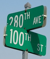
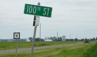
NORTH End: Minnesota state line, Dickinson County IA/Jackson County MN, now 280th Avenue at 100th Street, 2 miles west of US 71
Facing north on 4 (9/8/06)
Before 1934, 71 ran from Spirit Lake (the city) north along Spirit Lake (the lake) on roads that later became IA 276 and 327. Although maps show 71 continuing straight through the line, the county roads don't align. Most likely, 71 went a few dozen feet to the left to another gravel road and then continued north.
Along the route
Air
Line paving contract is let - Job from Milford to Clay County line
awarded at $3.93 a square yard
The contract for paving 4.8 miles of the Air Line from the railroad
crossing at the south edge of Milford to the Clay County line, was
awarded by the Dickinson county supervisors last week to the Koss
Construction Company of Des Moines at $3.93 a square yard for the paving
proper and $1.20 a cubic yard for earth excavation.
Work is to be started by August 1, 1920, and completed by September 1,
1921. The contract calls for an eighteen-foot roadway of reinforced
concrete eight inches thick in the center and seven inches thick at each
edge.
— Spencer Reporter, June 23,
1920. The next significant concrete on any part of IA 4 would not come
until 1928.
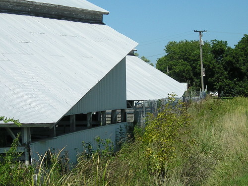
US 59 on Walnut Street in Avoca is a block west of the straight north-south road, Chestnut Street. The highway was moved to Chestnut in 1937, when a railroad overpass was built. According to the Walnut Bureau (get it?), the overpass was dedicated July 31, 1937.
What does that have to do with this picture? These are animal barns for the Pottawattamie County Fairgrounds, on the south side of town, that have had their corners shaved off exactly along the right-of-way line for 59. (8/23/19)
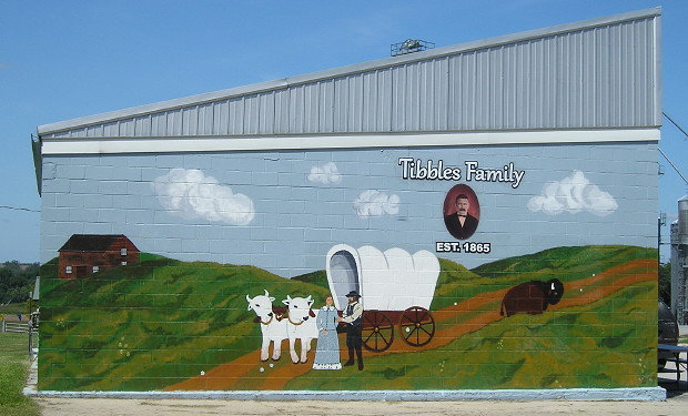
This mural in Macedonia is on the original route of IA 4. (8/23/19)
St. Patrick's Catholic Church, Imogene, a couple blocks off original IA 4 (8/23/19)
IMOGENE, 211 m. (1,044
alt., 303 pop.), on Hunter Branch Creek, was settled by a group of
Irishmen in the early 1880's.
The ROMAN CATHOLIC CHURCH, in the Gothic style on an elaborate scale,
was erected in 1915. Altars and statuary of Carrara marble, massive gold
candlesticks, the Stations of the Cross, and other furnishings were
imported from Italy. Stained glass windows depict Bible scenes.
— Iowa: A Guide to the Hawkeye
State (1938)
SOUTH End: Missouri state line, Hamburg, Fremont County IA/Atchison County MO
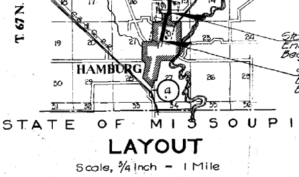
1927 Missouri state map from MoDOT archives / 1928 construction
document, Iowa DOT archives
(1. I am glad Iowa's maps are better detailed. 2. "Missoupi" is likely
an accidentally funny scan artifact.)
Facing south from the state line (6/12/06)
This road is entirely unconnected to any other paved road in Missouri; if you follow it, you will eventually turn back northward into Iowa and enter Hamburg on the road that goes under the I-29 bridge at the "IA 333 1 mile" sign. Route V is on the west side of the Nishnabotna River and residents in that clipped corner have no access to the rest of Missouri without entering Iowa. (But, in a geographical quirk, they do have access to an isolated part of Nebraska!)
A 1927 map from ISU says MO 1 came straight north to L72, 6 miles east of Hamburg. The temporary connection was between that point and Hamburg, likely along J64/old IA 333. MO 1 ran the depth of the west side of Missouri, got cut to Kansas City after the creation of US 71, and today exists as a microscopic route in the Kansas City metro area. Had the road run straight north of Rock Port, the state line crossing would be on L71, nearly seven miles east of Hamburg.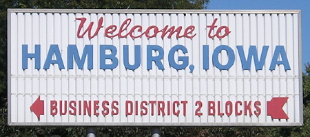
Facing north on 4 (10/2/15)
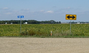
This is on G Street, two blocks north of the present junction of US 275 and IA 333, and has since been replaced with a digital sign.
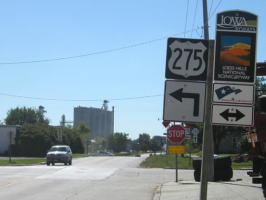
Facing south on 4 (10/2/15)
Downtown Hamburg is two blocks west (right), at Main and E streets; E becomes L44. Ahead is IA 333 and the way to Route V. For about five years, 333 went west here, to the business district, and then south on Main. I think it's logical that original IA 4/12 did the same, exiting Hamburg on Main and taking that to the state line.
Page created 5/6/20; last updated 12/18/20