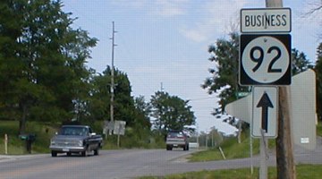
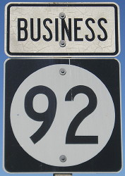
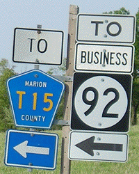
 BUSINESS
and old 92 east of Knoxville
BUSINESS
and old 92 east of Knoxville
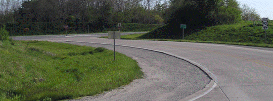
WEST End: Direct merge into IA 5/92 (IA 5/92 exit 64), Marion County
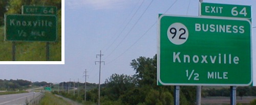
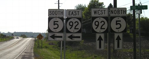
MAIN: Facing east on 92, but heading south on 5 / INSET: Facing west on 92, but heading north on 5 (6/1/02)
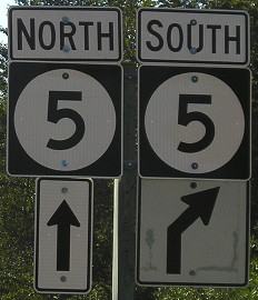
Like most business routes, the "Business" designation is only marked in one direction on each end. IMO, it should be marked both ways for the sake of completeness. The exit numbering follows that of north-south IA 5, since it is the lower number. Again, IMO, the exit numbers should be related to the dominant highway when another one "shares" the route. In this case, 92 is clearly the main road and 5 is a secondary number.
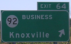
BGS in background of above main picture (7/11/05)
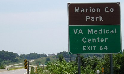
The VA hospital closed in December 2009 and the text on this sign peeled off.
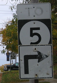
Facing east on 92, but heading south on 5 (10/15/10)
Facing northwest (6/1/02)
This intersection is nearly identical to that near the west end of Business 30/IA 976 in Marshall County. In both these intersections, the eastbound exit (the one marked "Business") curves around, crosses the highway, and rejoins the road that once went straight through the whole thing. The westbound exit ramp actually ends up at a separate north-south road, and traffic goes north for a short while before intersecting the business route. In this case, you go south here to meet SB 5/EB 92 and to your left, on Business 92 itself, to run into NB 5/WB 92. The west end of Business 30, however, is spaced far enough apart that it is more accurately treated as two half-interchanges.
Facing west (5/10/05)
Three years after the above picture, metal poles have replaced two of the wooden ones. It's like Invasion of the Body Snatchers or something. The "End Business 92" sign is beyond the slight hill of the road. In the area of the exit, the old pavement of pre-four-lane 92 runs down into a valley and pops up sporadically for the next half-mile or so.
Facing east on Business 92 (6/1/02)
This is the first sign after the exit, a short distance from the end, right near the set of signs above.
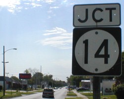
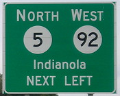
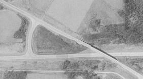
Surrounding area information: Junction IA 14
Facing west / Facing east (6/1/02)
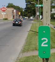
After the bypass was constructed in the late '70s along with the new two-lane to the east, the old route went under two separate secret numbers. The two-lane east of what became the business route was IA 964, and the business route IA 975. The business route includes a mile of what used to be IA 5 as the routes split just east of Knoxville. After a few changes (which are documented on the third and fourth 900s pages), the business route proper was all designated IA 964 for ten years until the route was finally turned over in 1996. Like IA 930 when it was in Marshall County, mile markers were put up and then never taken down. This '2' is near the "Jct 14" sign. The wooden pole behind it holds nothing. Unlike IA 14 at Business 30 in Marshalltown, this intersection does have "Jct Business 92" signs on 14.
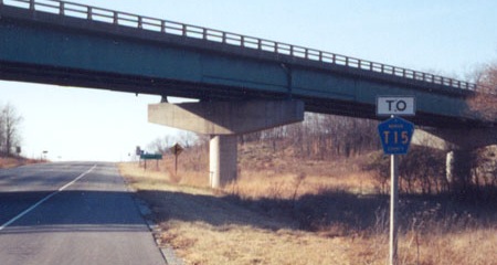
Surrounding area information: Junction T15
Facing east on Main Street (10/18/20)
This sign is posted where Business 92 turns south, but shows To IA 5 instead. This could be a remnant of when it was IA 5 turning south here, but Business 92 signs would be better. To the right is Attica Road, because the road goes to Attica, of course. Ahead is old 92, an east-west road, but signed as T15; see maps below.
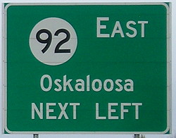
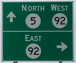
EAST End: Interchange, IA 5 and IA 92, Marion County
Facing southeast, but heading east, on Business 92 (10/15/10)
Facing southeast, but heading east, on Business 92 (12/14/02)
Photo by Jason Hancock
This end of Business 92 is on a piece of road that previously was IA 5. At this interchange, 5 splits off from 92 and heads southeast to Albia.
Facing southeast, but heading east, on Business 92 (12/14/02)
Photo by Jason Hancock
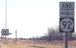
The "End Business 92" sign was gone by October 2010.
Facing southeast, but heading east, on Business 92 (10/18/20)
The genericization of interchange signs has spread to freeways other than interstates.
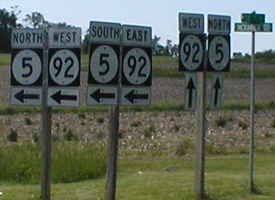
Facing northwest, but heading north, on 5 (10/15/10)
Facing northwest, but heading north, on 5 (10/15/10)
There are no signs for Business 92 heading north until a reassurance sign after the interchange.
Facing northwest, but heading north, on 5 (10/29/04 and 10/15/10)
At far left is the "End Business 92" sign. Above the white car is the first Business 92 sign, the only one at the intersection in this direction, shown at right.
Facing north on 5 (10/18/20)
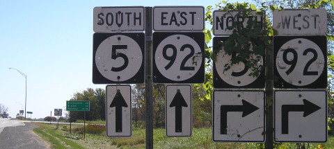
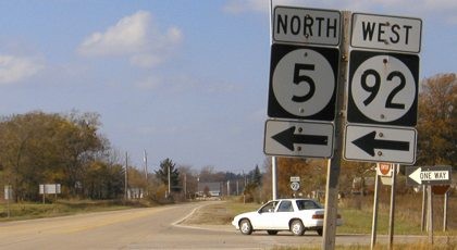
Facing east on 92, but heading south on 5 (10/29/04)
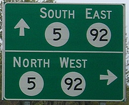
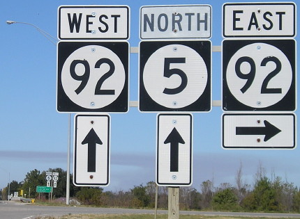
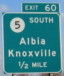
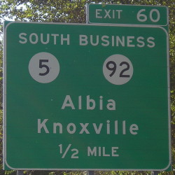
As 5 and 92 join together west of and around Knoxville, exit numbers follow 5 because it's the lower number. Unfortunately, this also means that at this interchange, IA 5 is exiting from itself. The state line is 60 miles south of here on 5. True to general form, Business 92 is not signed in the direction leaving town. With that in mind, perhaps Centerville would have been a better second city than Knoxville.
Facing west on 92 (10/15/10)
There are BGSs and regular shields as the IA 92 four-lane begins/ends a short distance east of the interchange.
Surrounding area information: Old Highway 92/IA 964
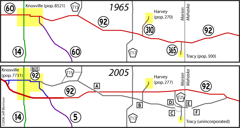
Lettered squares correspond to photos below
(A=all photos from this area; USDA image)
The north-south road on the left is the access road between the routes. In conjunction with the plans for "Freeway 592," the road constructed in the 1970s between Knoxville and west of Ottumwa has few intersections and wide shoulders (see below). Plans to upgrade the route to an expressway were eventually shelved as IA 163 became the desired route of choice. After having traveled this stretch of road myself, I can see a possible reason why: A lot more land would have had to be smoothed out and trees removed, making the environmental impact greater on 92 than the comparatively smoother 163.
Facing west on 92 (12/14/02)
Photo by Jason Hancock
Old 92 crosses over new 92. As you can see, these would have been the eastbound lanes. Also notice the wide, paved shoulder.
Facing west on 92 (12/14/02)
Photos by Jason Hancock
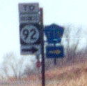
The strange thing with the signage here is that a) T15 is a ways away; and b) so is Business 92. Business 92 is not mentioned eastbound, as seen below.
Facing east on 92 (6/16/06)
Facing north on the access road (12/14/02 and 5/10/05)
Left photo by Jason Hancock
Old Highway 92 has a very rare characteristic: It does NOT have a county road number. In fact, until the E911 system officially named it Old Highway 92 it didn't have a 'real' name at all. Only when old 92 runs into T15 does it get a county road designation, T15, going into Knoxville. (The intersection has been reconfigured to make T15 the dominant road.) Business 92 is farther away from here, about 5 miles.
Facing south from top of access road (5/10/05)
Facing south on the access road (12/14/02)
Photo by Jason Hancock
...and Marion County does not get a perfect score on its sign spelling test.
B) Facing east on old 92 (5/10/05)
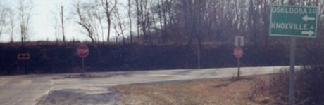
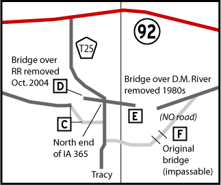
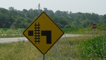
This intersection south of Harvey is the old end of IA 310 and the last connection to 92 before T25. This is a DOT-standard sign, meaning it dates to the early 1980s. In 310's day, an LGS here would have read "^ Oskaloosa 16; <- Harvey 1". Tracy is 4 miles ahead, but now with a twist - it's not reached entirely by old 92 anymore:
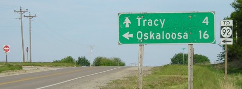
C1) Facing east on old 92 (6/16/06)
C2) Facing south (6/16/06)
How often do you see a sign like this - and stop at an L intersection?
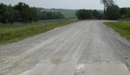
D) Facing west on old 92 (6/16/06)
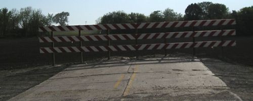
This, to my great surprise, is what I encountered when attempting to follow old 92 in May 2005. It turns out that a month after aerial photos were taken of the area in early September 2004, the bridge over the railroad was removed and the section of old 92 on the other side rerouted to follow the railroad and then intersect T25 closer to Tracy. This isn't a dead-end stub; a gravel road goes north (right) and intersects T25, but this paved road now only serves two farms.
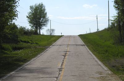
E) Facing west on old 92 (6/16/06)
This IS a dead-end stub, east of T25, and into Mahaska County, but only reachable via Marion County. Surprisingly, the road markings are quite visible and there is a cluster of houses here. The edges of the narrow road look distressed, as if the slanted "Iowa Curbs" used to be here but were shaved off.
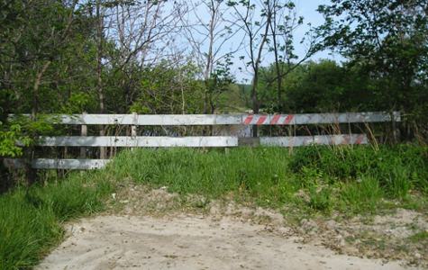
E) Facing east (6/16/06)
Same position, opposite direction. This is what nearly 25 years of blockage does to the end of a road (the bridge across the Des Moines being removed in the early 1980s). The Mahaska County map (see below by next picture) appears to indicate a bridge to the south of this position. The map lies. Well, it sort of lies...

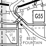
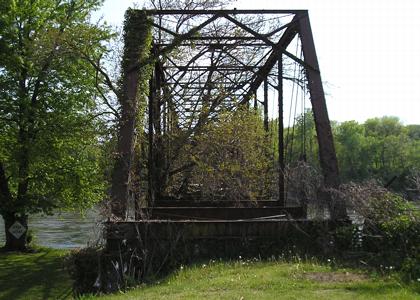
F) Facing west (6/16/06)
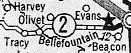
Welcome to the Bellefountain bridge. This early-20th-century structure quietly stands across the river with no roadbed. I think if one were daring enough, had good balance/composure, and didn't mind the possibility of going into the river without a bungee cord, one could cross the bridge. (The "Stop Ahead" posted on the tree is odd but amusing.) This was most likely the original crossing used by the state highway between Knoxville and Oskaloosa (see above shields and map). In the upper right hand corner of the map you can see a stub of gravel road on about the same angle as the bridge; aerial photos do show the trace of a scar running between the two (this is the "NO road" on the Tracy map earlier on this page). I don't see how it can be any other way.
Maps created 5/14/05; updated 9/16/06
Page created 9/29/02; last updated 11/1/20