| Longer than 2 miles | Signed | Active | July 1, 2003 |
| No. | Year(s) | Old/Co. | Length | Proof of life | Other notes |
| 941 | Mid-1970s -1981 |
IA 5 Appanoose |
3 |  2002
PDF
(gray); compare top of map to 1981 below 2002
PDF
(gray); compare top of map to 1981 below |
Old route shown better in recent maps |
| 941 | 1981 -1986 -1987 |
US 30/218 Linn |
6.4 (1981) 0.2 (1986) |
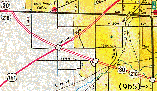 1986 1986 |
6th St. N of 30 was 941; S of 30 was 965 after '85; 941 was 6th, 16th Ave. |
| 941 | 1988-1990 |
US 20 Dubuque |
1.1 | Jason
Hancock's research: "US 20 to Epworth" Jacoby Drive (frontage road) on north side of 20 at interchange |
|
| 941 | 1991 (-1994) -July 1, 2003 |
US 20 Hamilton/ Hardin |
15.7 (1991) 13.97 (now) |
 2001
DeLorme 2001
DeLorme 1995
1995 |
Signed on maps in 1994-95 and 2003; NOT signed on I-35; IA Falls piece gone '94 |
| 942 | 1976-1980 |
IA 5 Monroe |
5.7 |  1981
(blue
in '77 map for unknown reason) 1981
(blue
in '77 map for unknown reason)Also includes short segment to the north (south of Albia) |
Other half of old piece, w/ first 941 |
| 942 | 1980-2003 |
IA 104 Clarke |
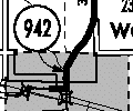
0.47 (2481 ft., ca. 827 yds.) |
|
Last of three leftovers from decom'd spurs |
| 943 | 1974-1980 |
IA 13 Linn |
0.7 | Jason Hancock's research: "Old IA 13 in Central City" - is now Marion Road | Result of IA 13's 4-laning |
| 943 | 1980-1987 |
IA 328 Ida |
0.4 | Jason Hancock's research | In Galva, remainder of spur |
| 943 | 1988-1990 |
IA 12 Woodbury |
0.5 | 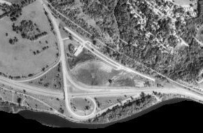 1993
1993Jason Hancock's research: "'Old IA 12 ramp' in Sioux City" |
NE part of trumpet, replaced by smaller ramp; had drive-in theater; removed 1990s |
| 943 | 1994-1995 |
US 63 Bremer |
1.8 | Jason Hancock's research | Old 63 in Denver |
| 944 | 1971-1980 |
IA 13 Delaware |
1 |  1972
1972Jason Hancock found this first but didn't know what it was. Later study of aerial photos shows this was the original route of IA 13 between the present US 20/IA 13 interchange and downtown Manchester. |
Franklin, Marion, 5th Sts. and 220th St. |
| 944 | 1980-2003 |
IA 88 Lee |
0.56 | 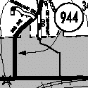
 |
Inside Fort Madison city limits |
| 945 | 1979-1980 |
? Lee |
0.3 | Jason
Hancock's research: "route not specified" Not in 1978 or 1980 traffic books |
Maybe fragment of IA 2 about halfway between Donnellson and Fort Madison? |
| 945 | 1980-2003 |
none (S14) Polk |
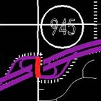
4.61 |  2001
(unmarked; see 931 for marked)
 DOT
archives (8/11/03-12/31/03) DOT
archives (8/11/03-12/31/03) |
Came from nowhere; signs on I-80 Turned over to Polk Co. with 931; slight delay for a piece as bridge was built |
| 946 | 1976-1980 |
US 18/52 Clayton |
2.7 | Jason Hancock's research: "ECL Luana to US 18". It's old 18 between Luana and Monona, plus a short piece south of Monona connecting to present 18. | Luana bypass/ straighten route |
| 946 | 1988-1989 |
US 218 Mitchell |
0.07 (370 ft., ca. 123 yds.) | Jason Hancock's research: "Former US 218 in St. Ansgar" | Old curve at IA 105 intersection |
| 946 | 1992 |
US 52/ 61/151 Dubuque |
0.96 | 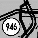
 2001
Dubuque;
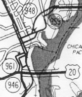
see also maps for 948 (Dbq), 955, 959 2001
Dubuque;
see also maps for 948 (Dbq), 955, 959 |
Access road from 52/61/151 to 20 has its own number N of 20 possibly added post-'92 |
| 947 | 1976-1981 |
US 20 Buchanan/ Delaware/ Dubuque |
24 |  1974 1974
|
Older bypassed segment; W of 187 would be 939 later |
| 947 | 1980-1986 |
IA 317 Story |
0.5 | Jason Hancock's research | In Zearing, remainder of spur |
| 947 | 1989-1992 |
US 218 Black Hawk |
4.7 |  1991
1991Jason Hancock's research: Franklin/6th/Main/University route through Cedar Falls and western Waterloo to Greenhill Road |
Part later became 934 |
| 947 | 1994 (-1997) -2003 |
IA 70 Louisa |
2.5 (1995) 0.7 (2003) |
 2001
DeLorme 2001
DeLorme
|
Post-'97 Col. City to SCL Col. Jct. |
| 948 | 1975-1987 |
US 30 Clinton |
5.1 |  1981
(E-W
road; N-S is 956) not
including section inside De Witt city limits 1981
(E-W
road; N-S is 956) not
including section inside De Witt city limits |
Lincoln Hwy., old 30 |
| 948 | 1992-1993 |
US 61/151 Dubuque |
0.3 |
Jason Hancock's research: "On E. 11th from SB US 61/151 ramps to E. 9th St./IA 959" |
|
| 949 | 1974-Dec. 30, 2002 |
US 34 Mills |
2.27 | 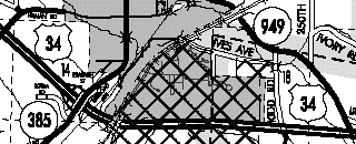 |
Bus. 34 in Glenwood; see 978 for 2001 state map; turned over with 978 and 385 in '02 |
| 950 | 1980-1994 | none
(NE 56th St.) Polk |
3.4 | 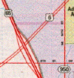
Below: 1995 (although decom'd)
|
Still on phone book map, along with IA 401, into 2000s |
| 951 | 1976-1980 |
US 34 Clarke |
2.7 | 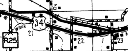 1986
1986 |
H34 W of Osceola |
| 951 | 1983-1993 |
IA 95 Adams |
3.2 | Entire route of IA 95 | |
| 952 | 1976 | US 34 Des Moines |
1.8 | Old US 34 (Mount Pleasant Street) in Burlington; added administratively, but then state realized it was supposed to have been turned over based on agreement made in 1966, before Burlington freeway was constructed. | |
| 952 | 1978-1982 |
US 67 Clinton |
0.17 (898 ft., ca. 299 yds.) | Now-driveway south of Deer Creek Road, created by slight straightening of 67, officially abandoned | |
| 952 | 1992-2003 |
none Dubuque |
0.11 (581 ft., ca. 194 yds.) |
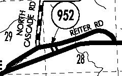  |
Built as connecting road btwn. old and new 151 in 1973 |
| 953 | 1975-1980 |
IA 38 Muscatine |
0.9 |
Jason Hancock's research: "Across NCL of Muscatine, had bridge over Mad Creek" PDF/Street Atlas |
|
| 953 | 1988-1994 |
IA 149 Keokuk |
0.08 (422 ft., ca. 141 yds.) | Jason Hancock's research: "Old IA 149 on NW ramp curve" in South English | |
| 953 | 1995-1996 |
IA 28 Polk |
1 | Jason
Hancock's research: "W Jct. IA 5 to End Prop. Reloc. IA 28" in Des
Moines Date corresponds to new four-lane IA 28 built north of IA 5. Road would be 63rd Street. |
Not on '95 or '96 map |
| 954 | 1967 (bypassed) 1976 (numbered), (-1984) 1996 (-1997) -2003 |
US 61 Jackson (/Clinton) |
0.6 (1984) 1.5 (1996) 0.78 (2003) |
Jason Hancock's research: "Before 1984 it ran from US 61 north of Hurstville to US 61 south of Maquoketa, following Main Street in Maquoketa. Between 1984-96 it was the 0.6-mile segment from the south city limits of Maquoketa to US 61." In 1996-97 it was 1.5 miles, SCL Maquoketa to IA 136, and then the south end was truncated to the Jackson/ Clinton line.
|
|
| 955 | 1971 (bypassed) 1976 (numbered) -2003 |
US 61 Dubuque |
0.73 |
See big map below |
Also see map below; tiny part near 963 not seen on maps (but may be smudge see 963) |
| 956 | 1976, 1982 -2003 |
US 61 Clinton/ Scott |
3 (1976) 16.77 (2002) |
2001 |
Not in De Witt; N of De Witt in 1976; S of 30 in 1982 Agreements with Eldridge, Clinton Co., Scott Co. on Dec. 9, 16, 23, 2002 |
| 957 | 1976-1977 | US 63 Davis |
3.3 | Straightened US 63 by moving it away from Mark between IA 2 and MO line | |
| 957 | 1979-1980 |
IA 2? Taylor? |
0.8 | Jason
Hancock's research: "West of IA 2, not sure where" Extremely likely this is old IA 2 east of Bedford |
|
| 957 | 1988-2003 |
IA 22 Washington |
0.06 (317 ft., ca. 106 yds.!) |
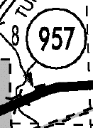
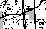 Aerial photos show segment is now driveway/frontage road. |
Another tiny spit of road, "Old IA 22 E of Riverside" Not turned over with 923, 936 |
| 958 | 1965-July 1, 2003 |
US 63 Wapello |
1.61 | 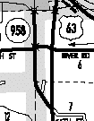
|
Looks like on '77 map not a state road; south of Ottumwa |
| 959 | 1970-1981 |
US 65/69 Polk |
1.3 | Bloomfield Road south of Army Post Road in southeast Des Moines | |
| 959 | 1992-1993 |
US 61/151 Dubuque |
1.3 |
Jason Hancock's research: "E. 9th St./Kerper Blvd. in Dubuque, US 52 to 61/151" 1996 Rand McNally |
See also 948 map |
| 960 | 1973-1982 |
IA 2 Page |
1.6 | Result of Clarinda bypass | |
| 960 | 1982-1986 |
US 61 Scott |
1.1 |  1983
1983 |
Contrary to map, dead ends at both ends, did not cross 61 or touch I-80 |
| 960 | 1993-1994 |
US 61/218 Lee |
4.7 |
DeLorme 2001; "old 61/218 segment north of Keokuk" |
|
| 960 | 2006-2007 | IA 60 Plymouth |
0.98 | According to document from Wisconsin DOT, this was designation for southernmost part of old IA 60 at US 75. Turned over. | |
| 961 | 1971-1980 |
US 71 Montgomery |
0.6 |
DeLorme 2001 Jason Hancock's research: "US 71 to SCL Villisca" Bypass existed before 1976 description in Primary Route Log. Red Oak Express archives point to 1971-72 project. |
|
| 961 | 1991-1993 |
US 61/151 Dubuque |
1.1 | See 948 and 959 maps | |
| 961 | 1994-1996 | US
61 Lee |
0.5 | Jason Hancock's research | In Wever |
| 961 | 2011 (-2013) -2014 |
US 61 Lee |
3.6 | Short-lived designation after opening of Fort Madison bypass, segment not shared with IA 2 | |
| 962 | 1985? -1997? |
US 218 Washington |
0.18 km (~590 feet) |
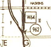 1997
1997Found by Alex Latham in the 1994 and 1996 traffic count books (large PDF, fourth page from bottom), then found in 1997 county atlas. Junction of old/new 218 north of Ainsworth. |
|
| 963 | 1971-2003 |
US 151 Dubuque |
4.15 |
|
See full map below |
Big Maps:
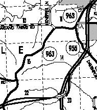
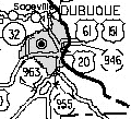 Dubuque area; enlarged 955
and 963


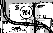
 2001
2001 


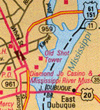


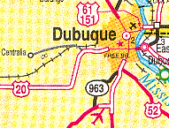 1995
Illinois; also notice
road to Centralia, secret 966
 2001; small red smudge left
of '3' may be 955; see 955