The Census Bureau worked these out. And for 2000, too.
The few that I’ve played with so far are relatively close to the geographic centers of the counties. Tama County’s 2010 population center is about one mile south and half a mile west of the geographic center.
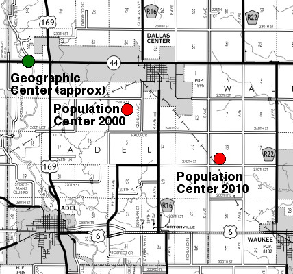
But look at Dallas County. It’s a “4×4” county in regards to townships, with the southern tier shifted eastward, so the geographic center is slightly east of where the center townships meet. IA 44 runs through the geographic middle.
In 2010, with the explosive growth in the suburbs, the population center moved to about 5½ miles west of the eastern edge of the county:
(Here’s a map showing the relative location of Adel Township to the county as a whole.)
Which county’s population center is the most off-center? Well, each river county with a city on the edge is a contender, but Pottawattamie probably wins because of its width:
View Larger Map
Yes, that’s still inside Council Bluffs.
The most amusing, though, has to be in the southeast. Technically, the population center of Lee County, Iowa, is in Illinois. (green arrow)
View Larger Map

