Or: Two counties named Jim
Or: So that’s what 70 mph on a two-lane is like
San Antonio (via Corpus Christi et al.), Texas, Jan. 27 — I started in the Corpus Christi area by driving back across the bay to the USS Lexington and spent two and a half hours there. The tours are all set up so there’s only one way to go.

Superstructure of the USS Lexington
I-69 is signed on the BGSs, and some of those have “Texas” on the shields, but ground-mounted shields are inconsistent. There is a posted end where the freeway turns into a 35-mph curve. There is some beginnings of construction there, presumably to rectify that, but I-69 won’t be going south for a while.
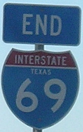
This is wrong. So, so wrong. I-69 does not belong anywhere in Texas. Or Louisiana, Arkansas, or Mississippi.
Filled the tank and ate in Kingsville, near-last outpost of civilization on US 77 for a while. You can tell it counts for civilization in Texas because it has a Whataburger. Iowans only know Whataburger for its trolling of the (former) Big 12 North during basketball games, running advertisements during games like Iowa State-Kansas State when its northernmost locations are in Stillwater and Tulsa.
A ways south, in Riviera, the ominous warning: “Next service station 60 miles.” That’s right, the entire next county has no gas station. Just look at the Rand McNally map. There’s a four-lane US 77 and three dots.
But my goal was not the entire next county, just enough to get into it and set a new personal best for “lowest latitude,” which I did in Sarita.
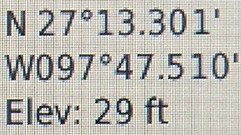
27°13’18” — farther south than the city of Chihuahua, Mexico, and about 6¾ miles farther south than my 2009 mark in Florida
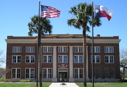
The entire county has 416 people — and it’s part of a micropolitan area! Imagine a courthouse like this in, say, Clutier or Laurel.
I went back north and then drove the length of TX 285, stopping only to pull in and out of a driveway at FM 1538 to be sure I hit Jim Wells County, although I should have been OK since I was heading west and thus on the north side of the road.
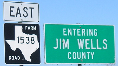
Jim Wells County, about 20 miles away from Jim Hogg County
At Falfurrias, there is construction going on US 281, which has an interchange with 285. If you look at the map, there’s 65 miles of nearly nothing south of there, too, and “No services next 37 miles” to the west. The sagebrush got lower to the ground, the prickly pear cacti a bit more plentiful, and the smooth fast pavement continuing on to forever. Of note unrelated to the road itself: During this time, I was in the National Weather Service’s southernmost territory (Brownsville), so add another “extreme”, sort of.
TX 285 ended without notice and rolled into TX 16 for a couple blocks before I needed TX 359 in Hebbronville. The latter route was US 59 immediately after that route was extended over what had been US 96, but 59 was later moved to a more northerly alignment via Freer.
Traffic picked up in the last 15 miles to Laredo as I neared one of the biggest goals of the trip…which I’ll talk about tomorrow.
