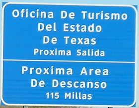
San Antonio, Texas, Jan. 27 — I-35 turns pretty rural just 10 miles from the international border, but has some impressive interchanges at the loop north of the city and the Camino Colombia. The welcome center is at Exit 18, where US 83 splits off. About 25 miles in is a federal inspection point.
And then, a lot of flat land, much like Iowa in winter when there’s no snow and no crops. The semi traffic was heavy, which is obvious given I-35’s key role in NAFTA. I was grateful I had reversed course to be traveling northeast on this segment instead of southwest. The sun behind me was much more calming and made for easier driving. Although it’s still January, this far south I got more time before sunset than in Iowa.
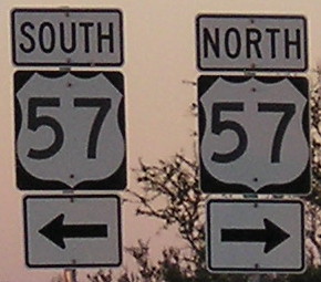
I reached Exit 111, US 57, with minutes of daylight to spare. (But not enough daylight to avoid blurry pictures, it appears now.) I headed west to the only nearby signed intersection on the route, nearly getting blinded by the sun in the process. There was a noticeable amount of traffic for the location and time of day. With that, I got a few miles traveled on one of the shortest, least accessible US routes in the country.

It’s a long hour and a half to Eagle Pass. There are only two other towns on the route.

South is west, and east is north.
US 57 is in the wrong place. It’s an odd number that runs east-west but is signed north-south. It runs west from former US 81. The only reason it has an excuse is to connect to Mexico Federal Highway 57. As Dale Sanderson has pointed out, if the current US 57 and US 96 swapped routes both would fit into the system much better.
Although the sun had set, I was still feeling good about the day and went all the way to downtown San Antonio. My only complaint was the GPS taking me off I-35 an exit earlier than I wanted.
I spent the rest of the night walking down to the Riverwalk (I was close enough I didn’t need to drive) and experiencing what it had to offer in the evening (mostly, lots of meals whose prices started with a 2).

