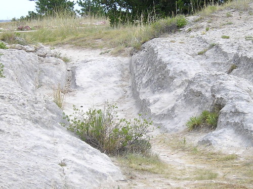
August 4, 2016: Pioneers literally wore down the stone here. Oregon Trail ruts, Guernsey, Wyoming.
Laramie, Wyoming — This would be my first entry into Wyoming in nearly 16 years. But first, some auto work. After that, I stopped at Rebecca Winters’ grave (PDF) on the east side of Scottsbluff, then I was off on 92.

Route: Downtown Scottsbluff, US 26, NE 92, WY 92, US 26, I-25, WY 34, US 30, to end of BL 80 and back, WY 130, I-80
In Lyman, barely on the Nebraska side of the border, I saw an old school and went to photograph it. Then someone pulled up behind me and then it looked like he was writing in a notebook. I was about to leave but then thought, I need to find out what’s going on here. He’s a student at Nebraska-Kearney, and he’s on a mission to visit every incorporated place in Nebraska! He only has 530 cities to see (and only 149 of them are above 800) in a much bigger area. It was a great moment, and if I hadn’t had to wait for the windshield chip I wouldn’t have met him.
I traveled the westernmost part of Highway 92, into Wyoming, and photographed its end in Torrington, clinching (more or less) the entire route of the four-state Highway 92. I then took US 26, at 70 mph, to Fort Laramie, where I figured I needed to eat. There was only open place, a little mom-and-pop diner.
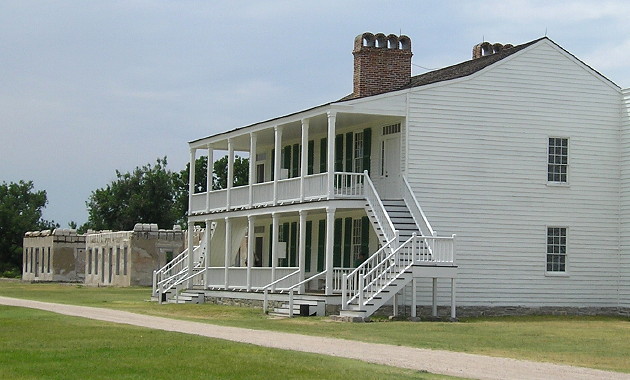
Restored and un-restored buildings at Fort Laramie. For as remote a place as this is (comparatively), quite a few tourists were there that afternoon.
I spent almost two hours at Fort Laramie (and learned, much later, that I had mis-set the date on the camera.) I spent another hour seeing trail ruts and Register Cliff near Guernsey.
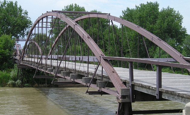
“Old Army Bridge over the Platte River, erected in 1875. This bridge was a vital link between Cheyenne, Fort Laramie and the military outposts, Indian agencies and gold fields of the Black Hills Dakota region. Placed by the Historical Landmark Commission of Wyoming, July 1951”
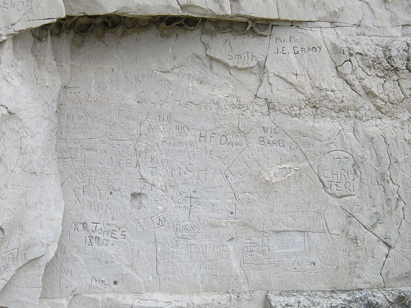
Register Cliff, 15 minutes from the trail ruts. If it’s 160 years old, it’s history; if it’s 50 years old, it’s graffiti.
I-25 is posted at 80 mph and while traffic was sparse it was an experience. “Next fuel 70 miles” after Wheatland. Yes, definitely the West.
At Morton Pass on WY 34, I experienced something that few Americans do today: A cell phone that said No Service. Shortly after that, it started sprinkling. It stopped around the time I reach WY 34’s end at US 30/287 — the westernmost point of this trip, and what I wanted to be the westernmost point of a continuously traveled stretch of US 30 throughout the country.
I followed 30 into Laramie and then went to the Wyoming Territorial Prison. It was ALSO open until 7 (Hooray!) and it was an informational, entertaining visit.
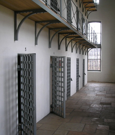
Wyoming Territorial Prison, Laramie.
There were some others touring the prison, including a couple with small dogs. Museum staff caught up to them in the horse building and told them to “vacate the premises” because one of the dogs did what dogs do. Seriously, who is inconsiderate enough to bring dogs inside historic buildings?
After tonight, it would be on to the next historic trail portion of vacation, east on the Lincoln Highway.
